Gill Scar

Valley in Cumberland Copeland

England

Gill Scar

Millom Castle The great tower and the farmhouse wing
Millom Castle Credit: Kevin Waterhouse

Gill Scar is a picturesque valley located in the county of Cumberland, in the northwestern region of England. Nestled amidst the stunning natural beauty of the Lake District National Park, this valley is a popular destination for outdoor enthusiasts and nature lovers alike.

The valley is characterized by its steep sides, formed by the erosion of the surrounding mountains over millions of years. These dramatic cliffs create a sense of seclusion and tranquility, making Gill Scar an ideal spot for those seeking solace in nature.

Gill Scar is home to a diverse range of plant and animal species, thanks to its unique microclimate and rich soil. Visitors can expect to encounter an array of vibrant wildflowers, mosses, and ferns, as well as various bird species that call this valley their home.

The valley is also blessed with a sparkling stream that runs through its heart, adding to its charm and allure. The crystal-clear waters of the stream are a delight to behold and provide a refreshing respite on warm summer days.

Hiking and walking are the primary activities enjoyed in Gill Scar, with numerous trails and footpaths crisscrossing the valley. These paths offer breathtaking views of the surrounding mountains and provide ample opportunities for exploration and adventure.

Overall, Gill Scar is a hidden gem in the Cumberland countryside, offering a serene escape from the hustle and bustle of modern life. Its natural beauty, diverse wildlife, and tranquil atmosphere make it an enchanting destination for nature enthusiasts and a must-visit spot for anyone seeking a truly immersive outdoor experience.

If you have any feedback on the listing, please let us know in the comments section below.
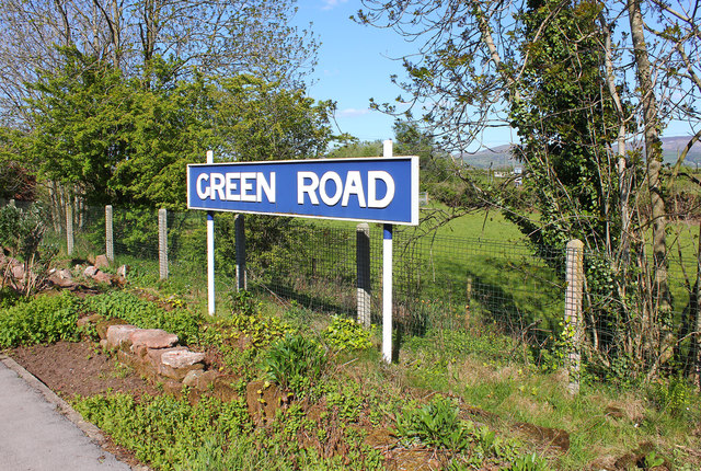
Gill Scar Images

Images are sourced within 2km of 54.236873/-3.2715778 or Grid Reference SD1783. Thanks to Geograph Open Source API. All images are credited.

Millom Castle The great tower and the farmhouse wing
Millom Castle
The great tower and the farmhouse wing
Church Hall Close to Holy Trinity Church and Millom Castle
Church Hall
Close to Holy Trinity Church and Millom Castle
Castle Farm Based around Millom Castle remains
Castle Farm
Based around Millom Castle remains
The Punch Bowl Inn, The Green, Millom
Ordnance Survey Cut Mark This OS cut mark can be found on Briar Dene. It marks a point 19.020m above mean sea level.
Ordnance Survey Cut Mark
This OS cut mark can be found on Briar Dene. It marks a point 19.020m above mean sea level.
SRPS Cumbrian Coast Railtour 2018 : Green Road Station
Ordnance Survey Flush Bracket (G3082) This OS Flush Bracket can be found on the roadside barn at Castle Farm. It marks a point 11.488m above mean sea level.
Ordnance Survey Flush Bracket (G3082)
This OS Flush Bracket can be found on the roadside barn at Castle Farm. It marks a point 11.488m above mean sea level.
Ordnance Survey Cut Mark This OS cut mark can be found on the east face of Holy Trinity Church. It marks a point 11.119m above mean sea level.
Ordnance Survey Cut Mark
This OS cut mark can be found on the east face of Holy Trinity Church. It marks a point 11.119m above mean sea level.
Ordnance Survey Rivet This OS rivet can be found on the wall NE side of the road. It marks a point 84.719m above mean sea level.
Ordnance Survey Rivet
This OS rivet can be found on the wall NE side of the road. It marks a point 84.719m above mean sea level.
Ordnance Survey Rivet This OS rivet can be found on the step of the buried water tank compound. It marks a point 107.189m above mean sea level.
Ordnance Survey Rivet
This OS rivet can be found on the step of the buried water tank compound. It marks a point 107.189m above mean sea level.
Ordnance Survey Rivet This OS rivet can be found on the wall SE side of the road. It marks a point 92.013m above mean sea level.
Ordnance Survey Rivet
This OS rivet can be found on the wall SE side of the road. It marks a point 92.013m above mean sea level.
Ordnance Survey Cut Mark This OS cut mark can be found on the wall south side of the road. It marks a point 54.724m above mean sea level.
Ordnance Survey Cut Mark
This OS cut mark can be found on the wall south side of the road. It marks a point 54.724m above mean sea level.
Ordnance Survey Cut Mark This OS cut mark can be found on the rock face NE side of the road. It marks a point 56.565m above mean sea level.
Ordnance Survey Cut Mark
This OS cut mark can be found on the rock face NE side of the road. It marks a point 56.565m above mean sea level.
Ordnance Survey Cut Mark This OS cut mark can be found on the Village Hall SE side of the road. It marks a point 51.075m above mean sea level.
Ordnance Survey Cut Mark
This OS cut mark can be found on the Village Hall SE side of the road. It marks a point 51.075m above mean sea level.
Ordnance Survey Flush Bracket (G3081) This OS Flush Bracket can be found on Hall Bank. It marks a point 28.226m above mean sea level.
Ordnance Survey Flush Bracket (G3081)
This OS Flush Bracket can be found on Hall Bank. It marks a point 28.226m above mean sea level.
Ordnance Survey Cut Mark This OS cut mark can be found on the brick building at Waltham Nursery. It marks a point 5.925m above mean sea level.
Ordnance Survey Cut Mark
This OS cut mark can be found on the brick building at Waltham Nursery. It marks a point 5.925m above mean sea level.
Ordnance Survey Cut Mark This OS cut mark can be found on a gatepost SE side of the track. It marks a point 6.172m above mean sea level.
Ordnance Survey Cut Mark
This OS cut mark can be found on a gatepost SE side of the track. It marks a point 6.172m above mean sea level.
Green Road Station sign at Green Road, Cumbria.
Green Road
Station sign at Green Road, Cumbria.
Show me another place!

Gill Scar is located at Grid Ref: SD1783 (Lat: 54.236873, Lng: -3.2715778)

Administrative County: Cumbria

District: Copeland

Police Authority: Cumbria

What 3 Words

///natural.arrives.ideals. Near Millom, Cumbria

Nearby Locations

Gill Scar Midlow Hill

Related Wikis

Arnaby

Arnaby is a village in Cumbria, England.

St Peter, Drigg

St Peter, Drigg is in Drigg, Cumbria, England. It is an active Anglican parish church in the deanery of Calder, and the diocese of Carlisle. Its benefice...
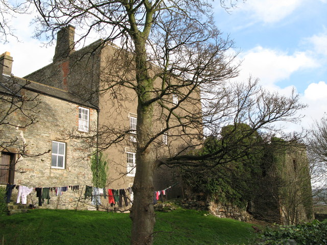
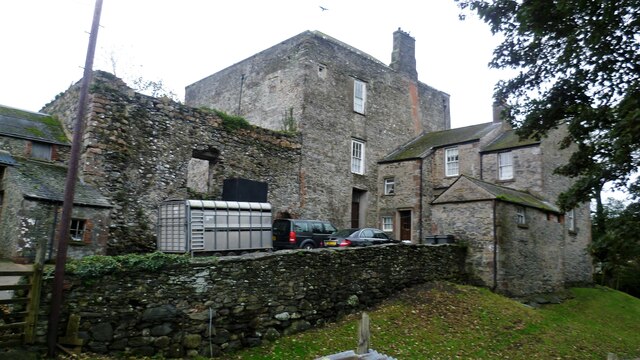
Millom Castle

Millom Castle is an ancient building at Millom in Cumbria. It is a Grade I listed building and scheduled ancient monument. == History == A manor on the...

Holy Trinity Church, Millom

Holy Trinity Church is a medieval building situated next to Millom Castle near the town of Millom, Cumbria, England. It is an active Anglican parish church...

Nearby Amenities

Located within 500m of 54.236873,-3.2715778
Millom Rock Park
Tourism: viewpoint
Lat/Long: 54.2363123/-3.2722492
Barrier: kissing_gate
Lat/Long: 54.238667/-3.2722383
Barrier: stile
Lat/Long: 54.2368628/-3.2659412
Power: pole
Lat/Long: 54.2371218/-3.2657081
Power: pole
Lat/Long: 54.2378563/-3.2660802
Power: pole
Lat/Long: 54.2388055/-3.2665881
Power: pole
Lat/Long: 54.241233/-3.273254
Power: pole
Lat/Long: 54.2405864/-3.2716494
Material: wood
Power: pole
Lat/Long: 54.2364964/-3.2642685
Power: pole
Lat/Long: 54.2368258/-3.265045
Power: pole
Lat/Long: 54.2373707/-3.2661659
Power: pole
Lat/Long: 54.2331859/-3.2711477
Power: pole
Lat/Long: 54.234239/-3.2717828
Barrier: stile
Lat/Long: 54.2408426/-3.2731268
Power: pole
Lat/Long: 54.2395574/-3.2657811
The data included in this document is from www.openstreetmap.org. The data is made available under ODbL.

Have you been to Gill Scar?

Leave your review of Gill Scar below (or comments, questions and feedback).