Ever Cleuch

Valley in Peeblesshire

Scotland

Ever Cleuch

Frozen Track, Broad Law Nearing the summit of Broad Law on a bitter January day. The track is frozen and unlikely to thaw out any time soon. In the distance you can just see the Donald of Cramalt Crag.
Frozen Track, Broad Law Credit: Adam Ward

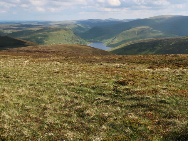
Ever Cleuch is a picturesque valley located in the region of Peeblesshire, Scotland. Situated amidst the rolling hills and serene countryside, this valley is renowned for its natural beauty and tranquil atmosphere. The name "Cleuch" is derived from the Scottish Gaelic word for a narrow, steep-sided valley, which aptly describes the topography of the area.

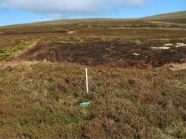
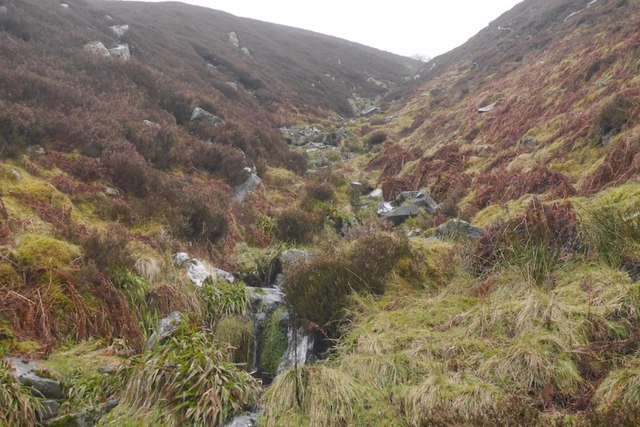
The valley is characterized by its lush green meadows, dotted with scattered trees and bordered by gently flowing streams. It is home to a diverse range of flora and fauna, making it a haven for nature enthusiasts. Visitors can expect to see a variety of wildflowers, including vibrant bluebells and delicate primroses, as well as numerous bird species such as pheasants, buzzards, and owls.

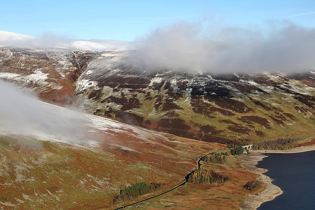
Ever Cleuch is a popular destination for outdoor activities such as hiking and cycling, thanks to its extensive network of well-maintained trails. These paths offer breathtaking views of the surrounding hills and valleys, making it a haven for photographers and nature lovers alike. The valley is also intersected by the scenic River Tweed, which provides opportunities for fishing and boating.

In addition to its natural beauty, Ever Cleuch boasts a rich history. The area has been inhabited for centuries, with evidence of ancient settlements and prehistoric remains found in the vicinity. The valley is also home to several historic landmarks, including old stone bridges and ruins of former dwellings, offering a glimpse into its past.

Overall, Ever Cleuch is a hidden gem in Peeblesshire, offering visitors a chance to immerse themselves in the tranquility of nature and explore the region's rich history.

If you have any feedback on the listing, please let us know in the comments section below.

Ever Cleuch Images

Images are sourced within 2km of 55.501976/-3.3267351 or Grid Reference NT1623. Thanks to Geograph Open Source API. All images are credited.

Frozen Track, Broad Law Nearing the summit of Broad Law on a bitter January day. The track is frozen and unlikely to thaw out any time soon. In the distance you can just see the Donald of Cramalt Crag.
Frozen Track, Broad Law
Nearing the summit of Broad Law on a bitter January day. The track is frozen and unlikely to thaw out any time soon. In the distance you can just see the Donald of Cramalt Crag.
Moorland on Cramalt Craig Looking down to Pykestone Knowe and the Megget Reservoir.
Moorland on Cramalt Craig
Looking down to Pykestone Knowe and the Megget Reservoir.
Track near Cramalt Craig summit Heading to the summit cairn.
Track near Cramalt Craig summit
Heading to the summit cairn.
Start of the Glentinning Burn On the north side of Cramalt Craig.
Start of the Glentinning Burn
On the north side of Cramalt Craig.
Grouse moorland on Sherraside Rig Between Cramalt Craig and Hunt Law.
Grouse moorland on Sherraside Rig
Between Cramalt Craig and Hunt Law.
Col between Cramalt Craig and Dun Law Looking towards Dun Law.
Col between Cramalt Craig and Dun Law
Looking towards Dun Law.
Cotton grass and heather moorland On the east side of Cramalt Craig near the Cramalt Burn.
Cotton grass and heather moorland
On the east side of Cramalt Craig near the Cramalt Burn.
Cramalt Craig This telephoto shot of the east side of the hill was taken from the A708 in late January.
Cramalt Craig
This telephoto shot of the east side of the hill was taken from the A708 in late January.
Broad Law from Dollar Law The bulky round top of Broad Law (840m) seen from the trig point on Dollar Law (817m), about 5km away.
Broad Law from Dollar Law
The bulky round top of Broad Law (840m) seen from the trig point on Dollar Law (817m), about 5km away.
Cramalt Craig This telephoto shot of a snow-capped Cramalt Craig was taken from the northwest slopes of Bowerhope Law.
Cramalt Craig
This telephoto shot of a snow-capped Cramalt Craig was taken from the northwest slopes of Bowerhope Law.
Ling Hope This view of Ling Hope on the northwest side of Megget Reservoir was taken from Dead for Cauld.
Ling Hope
This view of Ling Hope on the northwest side of Megget Reservoir was taken from Dead for Cauld.
Cleuch, Ling Hope Beneath Pykestone Knowe.
Cleuch, Ling Hope
Beneath Pykestone Knowe.
Pykestone Knowe Steep moorland slopes above Ling Hope.  The glen is aptly named, expect to keep tying your laces, the heather is very persistent.

A pretty grim day with rain and high winds.
Pykestone Knowe
Steep moorland slopes above Ling Hope. The glen is aptly named, expect to keep tying your laces, the heather is very persistent. A pretty grim day with rain and high winds.
Linghope Burn The burn is fenced off and young trees planted. This is common in the Tweed catchment and wooded headwaters benefit the wildlife in the river with emphasis on the economically important salmon.
Linghope Burn
The burn is fenced off and young trees planted. This is common in the Tweed catchment and wooded headwaters benefit the wildlife in the river with emphasis on the economically important salmon.
Waterfall, Linghope Burn A step in Ling Hope.  There has been some tree planting on the east side of the burn.
Waterfall, Linghope Burn
A step in Ling Hope. There has been some tree planting on the east side of the burn.
Slopes of Lamb Knowe Sheep on Lamb Knowe, their tracks give excellent going with the west side of Ling Hope being easier to walk along than the east side.
Slopes of Lamb Knowe
Sheep on Lamb Knowe, their tracks give excellent going with the west side of Ling Hope being easier to walk along than the east side.
Tods Cleuch Typical watercourse for these parts, steep and stepped. Some are intermittent with water flowing over the surface only in wet spells, drainage being through the scree beneath the soil.
Tods Cleuch
Typical watercourse for these parts, steep and stepped. Some are intermittent with water flowing over the surface only in wet spells, drainage being through the scree beneath the soil.
West side of Ling Hope Steep grassy slopes which thanks to the sheep are easily traversed.  The east side is a bit tougher with boulders and heather but there is a good sheep trod there too.
West side of Ling Hope
Steep grassy slopes which thanks to the sheep are easily traversed. The east side is a bit tougher with boulders and heather but there is a good sheep trod there too.
Show me another place!

Ever Cleuch is located at Grid Ref: NT1623 (Lat: 55.501976, Lng: -3.3267351)

Unitary Authority: The Scottish Borders

Police Authority: The Lothians and Scottish Borders

What 3 Words

///cookers.computer.obstinate. Near Ettrick, Scottish Borders

Related Wikis

Broad Law

Broad Law is a hill in the Manor Hills range, part of the Southern Uplands of Scotland. The second-highest point in the Southern Uplands and the highest...

Megget Reservoir

Megget Reservoir is an impounding reservoir in the Megget valley in Ettrick Forest, in the Scottish Borders. The 259 hectares (640 acres) reservoir is...

Megget

Megget is a former chapelry or parish containing the valley of Megget Water, now forming the westernmost part of the parish of Yarrow, Selkirkshire in...

Talla Water

Talla Water is a river in the Scottish Borders area of Scotland, near Tweedsmuir. It feeds the Talla Reservoir, and is a tributary of the River Tweed....

Have you been to Ever Cleuch?

Leave your review of Ever Cleuch below (or comments, questions and feedback).