Cat Cleuch

Valley in Peeblesshire

Scotland

Cat Cleuch

View from Ladyurd Hill Ladyurd Hill belongs to an obscure category of hills called Donald Deweys. The Deweys were originally drawn up by a Mr Dewey for England and Wales only, then subsequently adopted in Scotland by various hill-list compilers in the early 2000s. The Donald Deweys  are Lowland hills lower than Donalds (which are Lowland hills starting at 610 metres, or 2000 feet, and follow no other real criteria other than being deemed important enough to be on his list by Percy Donald back in 1935) but at least 500 metres high, with a minimum prominence of 30 metres. There are 247 in total - I have yet to hear of anybody having done a 'round' of them.
Where the actual summit is,  is a matter of some debate. The OS map at the 1:25k scale puts it at the Southern end of the fairly long summit plateau, but confuse matters by showing it as being towards the Northern edge of the plateau on their 1:50k scale map.  Near to the Southern 'summit' are two shallow depressions; an 1850s OS map shows these as being at the site of an old whinstone quarry.
Whether the hill takes its name from the old farm below, or vice-versa is unclear. As is the meaning of 'urd', which also appears in other nearby placenames: Netherurd, Kirkurd and Lochurd. Wikipedia references an 1840s book which suggests it might mean quarter, which presumably would be as in 'living quarters', but other than that there is nothing to go on.
View from Ladyurd Hill Credit: Ian Dodds

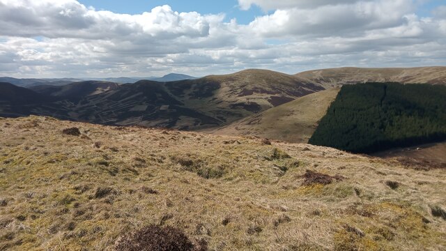
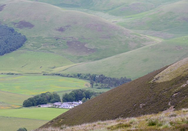
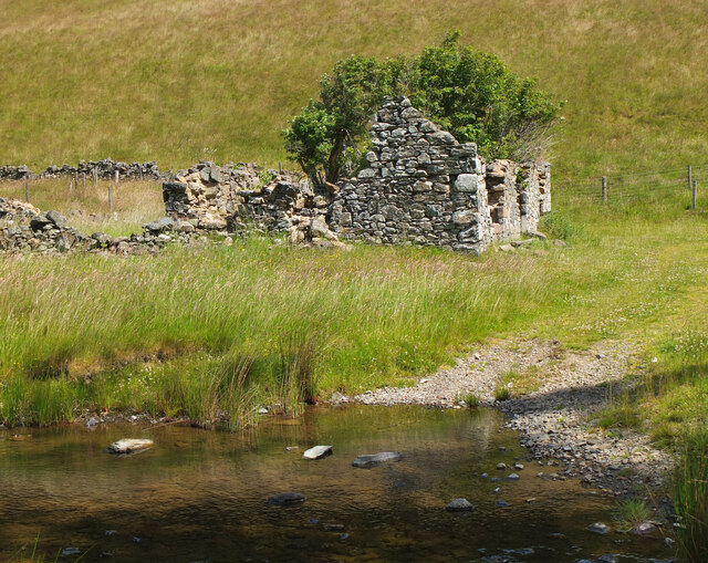
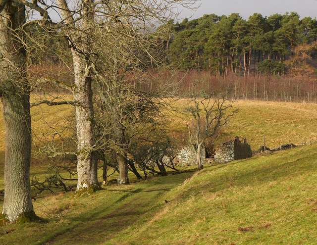
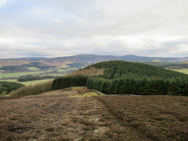
Cat Cleuch is a picturesque valley located in Peeblesshire, Scotland. Situated within the stunning Scottish Borders region, the valley is renowned for its natural beauty and tranquil surroundings. Nestled between rolling hills and verdant landscapes, Cat Cleuch offers visitors a serene escape from the bustling city life.

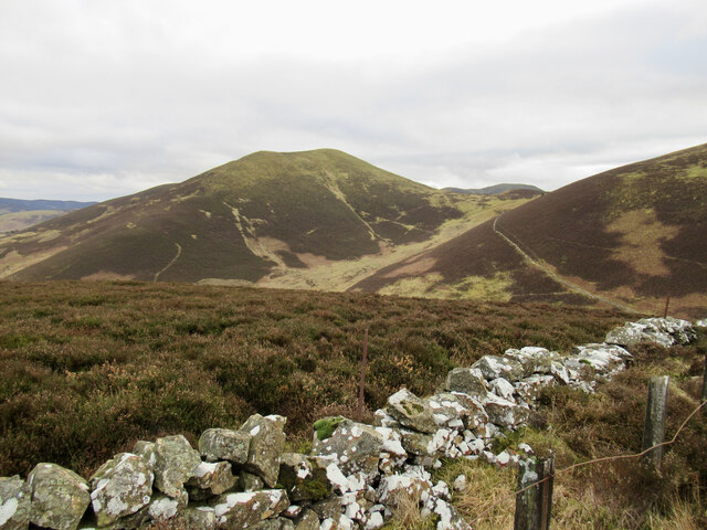
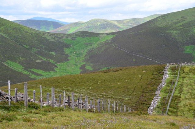
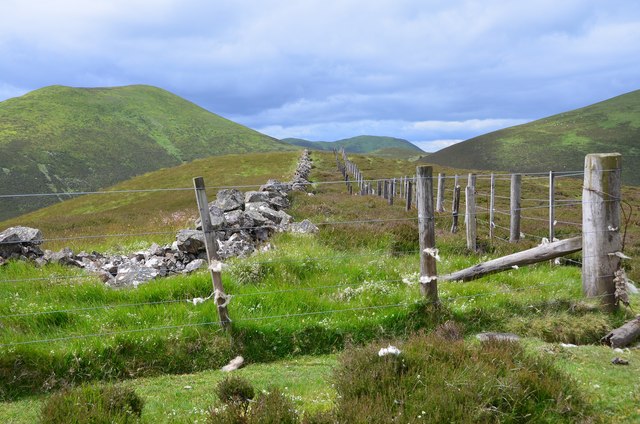
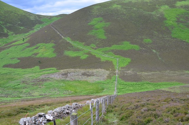
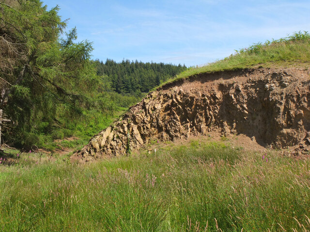
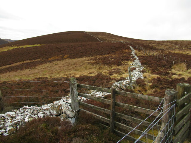
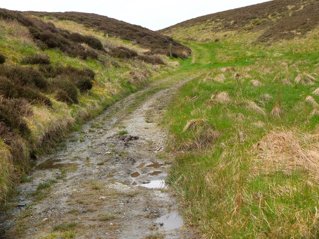
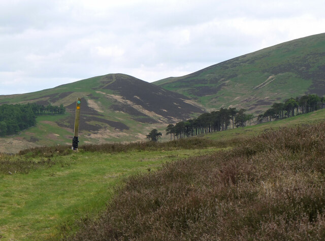
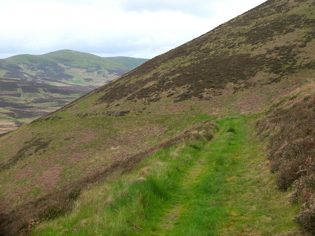
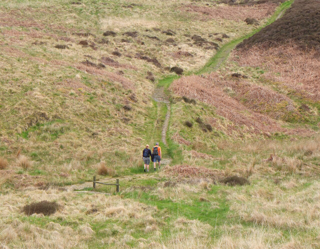
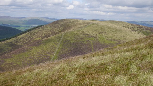
The valley is characterized by its rugged terrain, with steep slopes and rocky outcrops dotting the landscape. As visitors venture into the heart of Cat Cleuch, they are greeted by a meandering river that flows through the valley, adding to its charm and serenity. The river cascades down small waterfalls, creating a soothing soundtrack as it winds its way through the valley.

The flora and fauna in Cat Cleuch are diverse and abundant, with the valley being home to various species of plants and animals. Lush green forests of oak, birch, and pine trees cover the valley, providing a habitat for numerous bird species, small mammals, and insects.

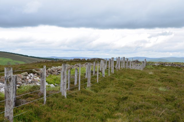
Cat Cleuch is a popular destination for outdoor enthusiasts and nature lovers alike. The valley offers a range of activities, including hiking, birdwatching, and wildlife spotting. There are several well-marked trails that wind through the valley, taking visitors on a journey through its natural wonders.

For those seeking a peaceful retreat in the heart of nature, Cat Cleuch in Peeblesshire is the perfect destination. With its breathtaking scenery, diverse wildlife, and tranquil ambiance, the valley offers an unforgettable experience for visitors of all ages.

If you have any feedback on the listing, please let us know in the comments section below.

Cat Cleuch Images

Images are sourced within 2km of 55.647747/-3.3377944 or Grid Reference NT1540. Thanks to Geograph Open Source API. All images are credited.

View from Ladyurd Hill Ladyurd Hill belongs to an obscure category of hills called Donald Deweys. The Deweys were originally drawn up by a Mr Dewey for England and Wales only, then subsequently adopted in Scotland by various hill-list compilers in the early 2000s. The Donald Deweys  are Lowland hills lower than Donalds (which are Lowland hills starting at 610 metres, or 2000 feet, and follow no other real criteria other than being deemed important enough to be on his list by Percy Donald back in 1935) but at least 500 metres high, with a minimum prominence of 30 metres. There are 247 in total - I have yet to hear of anybody having done a 'round' of them.
Where the actual summit is,  is a matter of some debate. The OS map at the 1:25k scale puts it at the Southern end of the fairly long summit plateau, but confuse matters by showing it as being towards the Northern edge of the plateau on their 1:50k scale map.  Near to the Southern 'summit' are two shallow depressions; an 1850s OS map shows these as being at the site of an old whinstone quarry.
Whether the hill takes its name from the old farm below, or vice-versa is unclear. As is the meaning of 'urd', which also appears in other nearby placenames: Netherurd, Kirkurd and Lochurd. Wikipedia references an 1840s book which suggests it might mean quarter, which presumably would be as in 'living quarters', but other than that there is nothing to go on.
View from Ladyurd Hill
Ladyurd Hill belongs to an obscure category of hills called Donald Deweys. The Deweys were originally drawn up by a Mr Dewey for England and Wales only, then subsequently adopted in Scotland by various hill-list compilers in the early 2000s. The Donald Deweys are Lowland hills lower than Donalds (which are Lowland hills starting at 610 metres, or 2000 feet, and follow no other real criteria other than being deemed important enough to be on his list by Percy Donald back in 1935) but at least 500 metres high, with a minimum prominence of 30 metres. There are 247 in total - I have yet to hear of anybody having done a 'round' of them. Where the actual summit is, is a matter of some debate. The OS map at the 1:25k scale puts it at the Southern end of the fairly long summit plateau, but confuse matters by showing it as being towards the Northern edge of the plateau on their 1:50k scale map. Near to the Southern 'summit' are two shallow depressions; an 1850s OS map shows these as being at the site of an old whinstone quarry. Whether the hill takes its name from the old farm below, or vice-versa is unclear. As is the meaning of 'urd', which also appears in other nearby placenames: Netherurd, Kirkurd and Lochurd. Wikipedia references an 1840s book which suggests it might mean quarter, which presumably would be as in 'living quarters', but other than that there is nothing to go on.
Looking towards Penvalla from Cat Hill Penvalla is a distinctively shaped hill above Harrow Hope.
Looking towards Penvalla from Cat Hill
Penvalla is a distinctively shaped hill above Harrow Hope.
Summit fence, Riding Hill An old wall, an old fence and a newer fence cross the heathery top.
Summit fence, Riding Hill
An old wall, an old fence and a newer fence cross the heathery top.
Westwards from Riding Hill The view to Tinto in the distance across the col between Penvalla and Ladyurd Hill with Broomy Side straight ahead.
Westwards from Riding Hill
The view to Tinto in the distance across the col between Penvalla and Ladyurd Hill with Broomy Side straight ahead.
Wester Happrew from Riding Hill A farm in the Lyne Water valley with the ridge of Stevenson Hill beyond (L).
Wester Happrew from Riding Hill
A farm in the Lyne Water valley with the ridge of Stevenson Hill beyond (L).
Summit fence, Cat Hill Cat Hill is a minor top (437m) on the ridge running NW from Riding Hill. Penvalla is the prominent summit to the left with Hammer Head in view straight ahead.
Summit fence, Cat Hill
Cat Hill is a minor top (437m) on the ridge running NW from Riding Hill. Penvalla is the prominent summit to the left with Hammer Head in view straight ahead.
Descent from Cat Hill Wainwright's maxim 'Watch where you are putting your feet' applies here on a heathery slope with concealed bumps and hollows and the occasional piece of old fence wire. <a href="https://www.geograph.org.uk/photo/1064945">NT1540 : Pass beneath Ladyurd Hill</a> shows this spot in a hard winter frost.
Descent from Cat Hill
Wainwright's maxim 'Watch where you are putting your feet' applies here on a heathery slope with concealed bumps and hollows and the occasional piece of old fence wire. NT1540 : Pass beneath Ladyurd Hill shows this spot in a hard winter frost.
Ruins at Harrowhope The back of the ruined cottage by the Easton Burn.
Ruins at Harrowhope
The back of the ruined cottage by the Easton Burn.
Ruins by the Easton Burn The roofless remains of the cottage. The John Buchan Way passes its front door.
Ruins by the Easton Burn
The roofless remains of the cottage. The John Buchan Way passes its front door.
Small quarry below Hammer Rig An old quarry by the track south of Hammer Rig. Exposed rock is rarely seen in this area.
Small quarry below Hammer Rig
An old quarry by the track south of Hammer Rig. Exposed rock is rarely seen in this area.
Ruined cottage, Harrowhope Only the walls are standing as a reminder of this cottage by the track from Stobo.
Ruined cottage, Harrowhope
Only the walls are standing as a reminder of this cottage by the track from Stobo.
On the slopes of Torbank Hill On a strip of mown heather, with the small forested hill of Penveny in the middle ground and Tweeddale beyond.
On the slopes of Torbank Hill
On a strip of mown heather, with the small forested hill of Penveny in the middle ground and Tweeddale beyond.
Fences and drystane dyke on Riding Hill The stones of the drystane dyke are covered in lichen.
Fences and drystane dyke on Riding Hill
The stones of the drystane dyke are covered in lichen.
Track on Hammer Rig Approaching the summit of the pass between Stobo and the valley of Stobo Hope.
Track on Hammer Rig
Approaching the summit of the pass between Stobo and the valley of Stobo Hope.
The pass on Hammer Rig The highest point of the track between Stobo and Stobo Hope, used by the John Buchan Way.  The small hill to the left is Louden Knowe with Trahenna to the right.
The pass on Hammer Rig
The highest point of the track between Stobo and Stobo Hope, used by the John Buchan Way. The small hill to the left is Louden Knowe with Trahenna to the right.
Track on Hammer Knowe The track traverses the steep west side of the hill with good views towards the Broughton Hills.
Track on Hammer Knowe
The track traverses the steep west side of the hill with good views towards the Broughton Hills.
Walkers on the John Buchan Way Walkers just across the Hopehead Burn on the climb to Hammer Rig.
Walkers on the John Buchan Way
Walkers just across the Hopehead Burn on the climb to Hammer Rig.
Ladyurd Hill View from the flanks of Penvalla.
Ladyurd Hill
View from the flanks of Penvalla.
Show me another place!

Cat Cleuch is located at Grid Ref: NT1540 (Lat: 55.647747, Lng: -3.3377944)

Unitary Authority: The Scottish Borders

Police Authority: The Lothians and Scottish Borders

What 3 Words

///binds.pastime.soak. Near Peebles, Scottish Borders

Related Wikis

Battle of Happrew

The Battle of Happrew was a skirmish which took place around 20 February 1304, during the First War of Scottish Independence. A chevauchée of English knights...

Tarth Water

The Tarth Water is a river in Peebleshire, in the Scottish Borders. It forms part of the River Tweed system. The river with a total length of 7.1 miles...

Lyne Kirk

Lyne Kirk is an ancient and historic kirk or church, of the Church of Scotland. It is situated on top of a mound adjacent to the A72 trunk route 4.5 miles...

Drochil Castle

Drochil Castle is a ruined castle in the Scottish Borders. It is located above the Lyne Water, 10 kilometres (6.2 mi) north-west of Peebles, and 8 kilometres...

Nearby Amenities

Located within 500m of 55.647747,-3.3377944
Ridings Hill
Ele: 478
Munro: no
Natural: peak
Lat/Long: 55.6481699/-3.3300283
The data included in this document is from www.openstreetmap.org. The data is made available under ODbL.

Have you been to Cat Cleuch?

Leave your review of Cat Cleuch below (or comments, questions and feedback).