Allan's Cleuch

Valley in Dumfriesshire

Scotland

Allan's Cleuch

Garro Gill on Romans & Reivers Route Looking WSW towards summit of Scaw'd Fell on skyline. Steep climb up Garro Gill in foreground. On this section, the way is suited to hiking but for off-road cyclists it is a very difficult push (although it's preceded and followed by sections of forestry tracks, suited to riding).
Garro Gill on Romans & Reivers Route Credit: Kim McGillivray

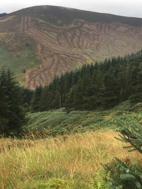
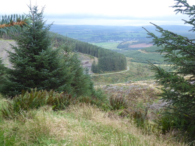
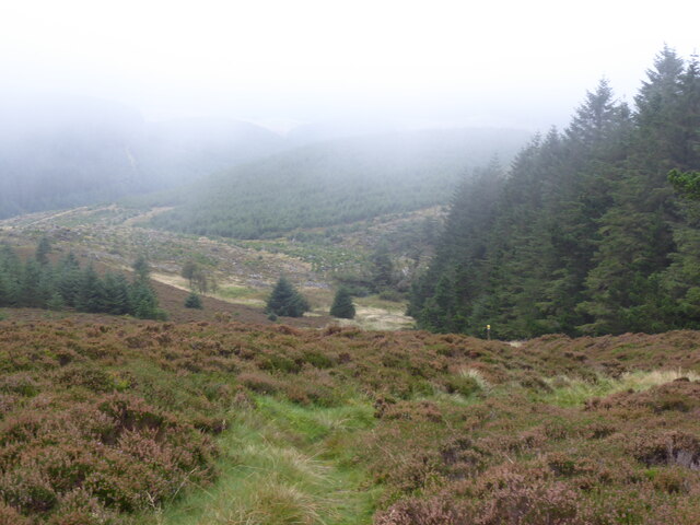
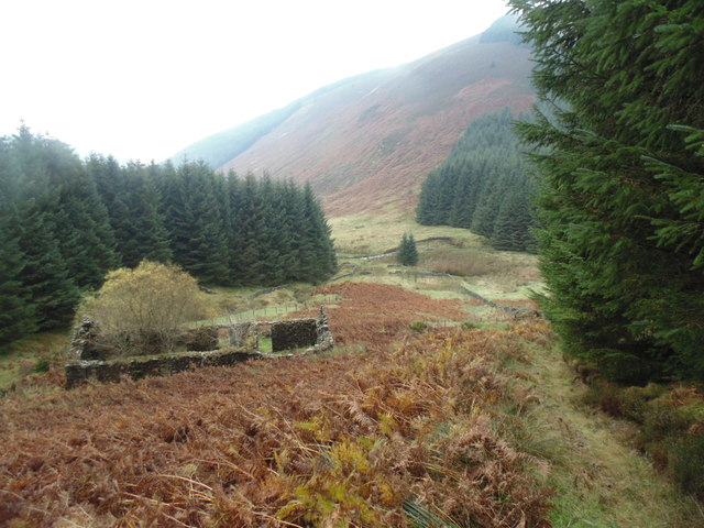
Allan's Cleuch is a picturesque valley located in the region of Dumfriesshire, Scotland. Situated in the southern part of the country, it is renowned for its natural beauty and tranquility. The valley is nestled within the rolling hills and offers breathtaking views of the surrounding landscape.

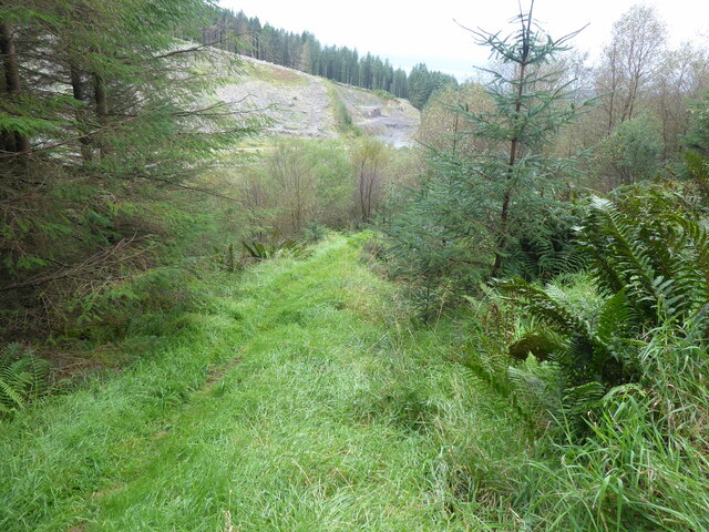
Covered in lush greenery, Allan's Cleuch is home to a diverse range of flora and fauna. Visitors can spot various species of wildflowers, trees, and birds, making it a haven for nature enthusiasts. The tranquil atmosphere of the valley provides a perfect opportunity for relaxation and escape from the hustle and bustle of daily life.

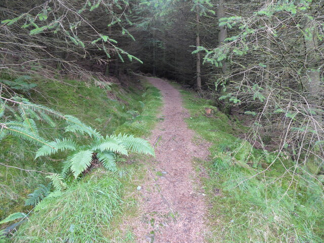
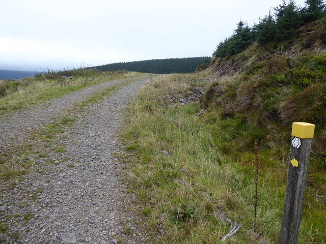
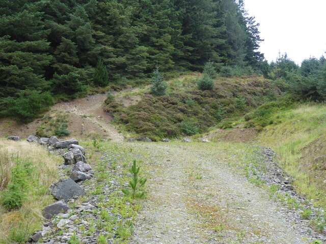
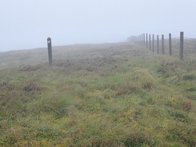
The valley is also a popular destination for outdoor activities such as hiking and walking. There are numerous well-marked trails that wind through the valley, allowing visitors to explore its beauty at their own pace. The trails offer a mix of easy and challenging terrains, catering to both novice and experienced hikers.

One of the highlights of Allan's Cleuch is the Allan Water, a meandering river that flows through the valley. The river adds to the enchanting scenery and provides a soothing soundtrack as it gently cascades over rocks and boulders.

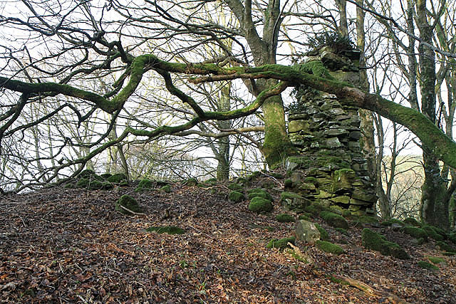
In addition to its natural wonders, Allan's Cleuch has historical significance. There are remnants of ancient settlements and archaeological sites, offering a glimpse into the valley's rich past.

Overall, Allan's Cleuch is a hidden gem in Dumfriesshire, offering a serene and captivating experience for visitors seeking a connection with nature and a touch of history.

If you have any feedback on the listing, please let us know in the comments section below.

Allan's Cleuch Images

Images are sourced within 2km of 55.321654/-3.3522401 or Grid Reference NT1403. Thanks to Geograph Open Source API. All images are credited.

Garro Gill on Romans & Reivers Route Looking WSW towards summit of Scaw'd Fell on skyline. Steep climb up Garro Gill in foreground. On this section, the way is suited to hiking but for off-road cyclists it is a very difficult push (although it's preceded and followed by sections of forestry tracks, suited to riding).
Garro Gill on Romans & Reivers Route
Looking WSW towards summit of Scaw'd Fell on skyline. Steep climb up Garro Gill in foreground. On this section, the way is suited to hiking but for off-road cyclists it is a very difficult push (although it's preceded and followed by sections of forestry tracks, suited to riding).
The Southern Upland Way near Wait Hill
The Southern Upland Way near Craigbeck Rig
View from the Southern Upland Way near Craigbeck Rig
The Southern Upland Way near Craigbeck Rig
The Southern Upland Way near Gateshaw Rig
The Southern Upland Way near Croft Head
Garrogill The ruins of Garrogill - October,2014.
Garrogill
The ruins of Garrogill - October,2014.
The junction of the Cornal Burn and the Littlehope Burn Beside Wait Hill, from the Southern Upland Way, lots of clearfell since my last visit opening up the view.
The junction of the Cornal Burn and the Littlehope Burn
Beside Wait Hill, from the Southern Upland Way, lots of clearfell since my last visit opening up the view.
Looking down Wamphray Burn from Cowan Fell
Gateshaw Rig from Croft Head The Haute Route of the Southern Upland Way, up and over the hills, to amazing views.  This "detour" is a must. Unfortunately there was a haze which didn't lend itself to a decent photo, but the views were still outstanding!
Gateshaw Rig from Croft Head
The Haute Route of the Southern Upland Way, up and over the hills, to amazing views. This "detour" is a must. Unfortunately there was a haze which didn't lend itself to a decent photo, but the views were still outstanding!
Leaflet Boxes On The Southern Upland Way A sign post on the Southern Upland Way directs you north to leave the forest road to head towards Croft Head if you fancy the detour.  Why would you have a leaflet box here and so far away from any car park never mind proper road.  I hope to never have the jog of topping up the leaflets for these 2 boxes.
Leaflet Boxes On The Southern Upland Way
A sign post on the Southern Upland Way directs you north to leave the forest road to head towards Croft Head if you fancy the detour. Why would you have a leaflet box here and so far away from any car park never mind proper road. I hope to never have the jog of topping up the leaflets for these 2 boxes.
Scaw'd Fell Third HuMP and fourth P30 from Southern Upland Way to the west.
Name: Scaw'd Fell
Hill number: 1922
Height: 549m / 1801ft
Area: 28B: The River Tweed to the English Border
Class: Ma,5D
Grid ref: NT 14940 02802
Summit feature: thick fence post
Drop: 154m
Col: 395m  NT150043
Scaw'd Fell
Third HuMP and fourth P30 from Southern Upland Way to the west. Name: Scaw'd Fell Hill number: 1922 Height: 549m / 1801ft Area: 28B: The River Tweed to the English Border Class: Ma,5D Grid ref: NT 14940 02802 Summit feature: thick fence post Drop: 154m Col: 395m NT150043
Coomb Cairn Coomb Cairn summit 504 metres on the way to bag Scaw'd Fell.
Coomb Cairn
Coomb Cairn summit 504 metres on the way to bag Scaw'd Fell.
Southern Uplands Way Looking west and downhill towards Moffat. Perhaps not the most interesting section of the Southern Uplands Way which runs through rather sterile looking spruce forest for several grid squares.
Southern Uplands Way
Looking west and downhill towards Moffat. Perhaps not the most interesting section of the Southern Uplands Way which runs through rather sterile looking spruce forest for several grid squares.
Show me another place!

Allan's Cleuch is located at Grid Ref: NT1403 (Lat: 55.321654, Lng: -3.3522401)

Unitary Authority: Dumfries and Galloway

Police Authority: Dumfries and Galloway

What 3 Words

///encoding.fooling.damage. Near Moffat, Dumfries & Galloway

Nearby Locations

Coomb Cairn Allan's Cleuch

Related Wikis

Croft Head

Croft Head is a hill in the Ettrick Hills range, part of the Southern Uplands of Scotland. It offers unobstructed views to the Solway Firth, the fells...

Cornal Tower

Cornal Tower is the ruins of a tower house located near Moffat, Dumfries-shire, Scotland. Alternative names are Polcornare, Cornal Burn, or Logan. The...

Moffat Academy

Moffat Academy is a school in Moffat, Dumfries and Galloway, Scotland. It educates children from nursery to Secondary 6. == History == Moffat Academy traces...

Moffat

Moffat (Scottish Gaelic: Mofad) is a burgh and parish in Dumfriesshire, now part of the Dumfries and Galloway local authority area in Scotland. It lies...

Have you been to Allan's Cleuch?

Leave your review of Allan's Cleuch below (or comments, questions and feedback).