Forkings Cleuch

Valley in Peeblesshire

Scotland

Forkings Cleuch

Hartfell Rigg Rolling moorland at the head of Black Hope. Centre right is the peak of Saddle Yoke.
Hartfell Rigg Credit: Robert Struthers

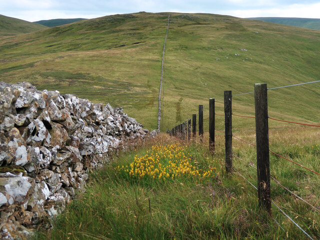
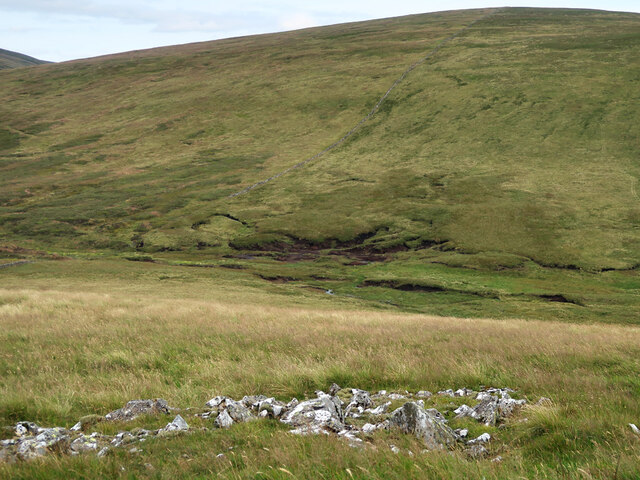
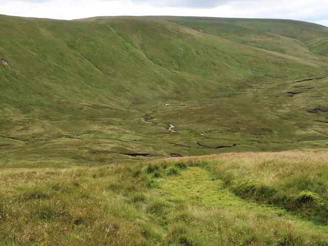
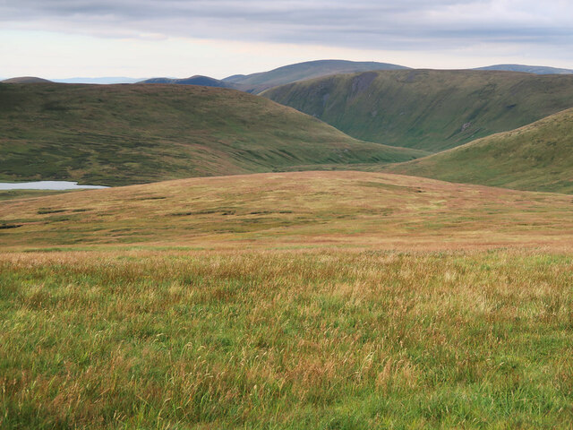
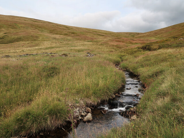
Forkings Cleuch, located in Peeblesshire, Scotland, is a picturesque valley renowned for its natural beauty and rich history. Nestled within the rolling hills of the Scottish Borders, it spans approximately two miles in length and is characterized by its steep sides and lush greenery.

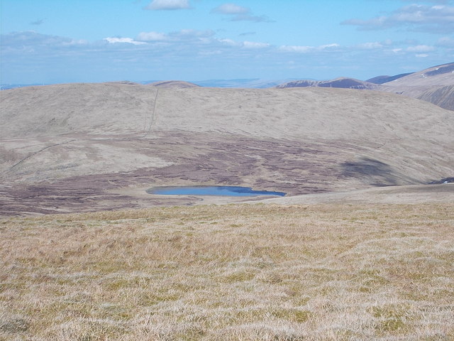
The valley is famous for its scenic views, with the meandering Cademuir Burn running through its center, creating a tranquil and serene atmosphere. The surrounding landscape is adorned with a variety of flora and fauna, including wildflowers, heather, and native Scottish wildlife like deer and birds of prey.

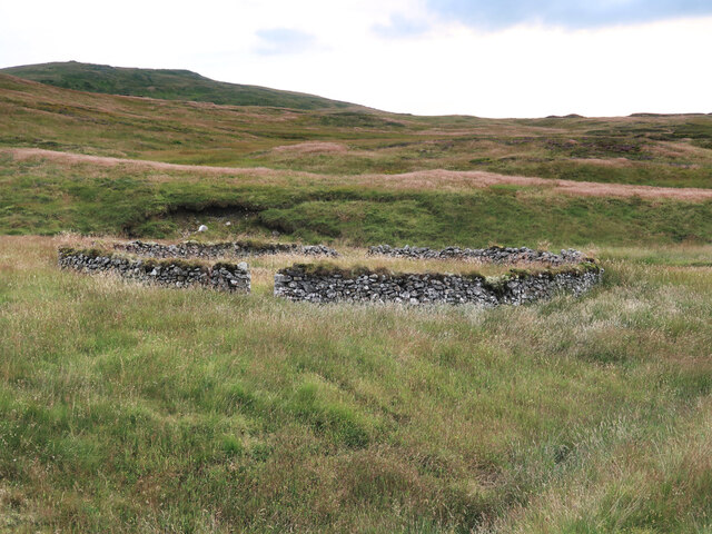
Forkings Cleuch has a long and storied history, with evidence of human settlements dating back to ancient times. The area is dotted with archaeological sites, including Iron Age forts and Roman camps, serving as a testament to its historical significance.

Visitors to Forkings Cleuch can enjoy a range of outdoor activities, such as hiking, birdwatching, and photography. The valley offers numerous walking trails, allowing visitors to explore its natural wonders at their own pace. The nearby town of Peebles provides amenities and accommodations for those looking to stay and explore the area further.

Overall, Forkings Cleuch is a hidden gem in Peeblesshire, offering a tranquil escape from the hustle and bustle of modern life. Its stunning landscapes, rich history, and diverse wildlife make it a must-visit destination for nature lovers and history enthusiasts alike.

If you have any feedback on the listing, please let us know in the comments section below.

Forkings Cleuch Images

Images are sourced within 2km of 55.418239/-3.3701999 or Grid Reference NT1314. Thanks to Geograph Open Source API. All images are credited.

Hartfell Rigg Rolling moorland at the head of Black Hope. Centre right is the peak of Saddle Yoke.
Hartfell Rigg
Rolling moorland at the head of Black Hope. Centre right is the peak of Saddle Yoke.
Redgill Craig A fairly featureless tract of moorland on the slopes above Black Hope.
Redgill Craig
A fairly featureless tract of moorland on the slopes above Black Hope.
Heather Moorland Looking across to Saddle Yoke from the slopes of Hartfell Rig.
Heather Moorland
Looking across to Saddle Yoke from the slopes of Hartfell Rig.
The Head of Whirly Gill On the boggy ground between Raven Craig and Hartfell Rig on a glorious early autumnal day. Hart Fell is the faraway summit in centre of the picture.
The Head of Whirly Gill
On the boggy ground between Raven Craig and Hartfell Rig on a glorious early autumnal day. Hart Fell is the faraway summit in centre of the picture.
Dyke and Fence between Garelet Dod and Din Law On the boundary of the Borders Forest Trust land.
Dyke and Fence between Garelet Dod and Din Law
On the boundary of the Borders Forest Trust land.
Boggy col between Din Law and Cape Law
Back Burn below Hartfell Rig The start of the Fruid Water viewed from Cape Law.
Back Burn below Hartfell Rig
The start of the Fruid Water viewed from Cape Law.
Loch Hill above Gameshope Loch Not looking much like a hill from this viewpoint on Cape Law.
Loch Hill above Gameshope Loch
Not looking much like a hill from this viewpoint on Cape Law.
The unnamed small burn in Ether Cleuch And an old, overgrown sheepfold on the right.
The unnamed small burn in Ether Cleuch
And an old, overgrown sheepfold on the right.
Old sheepfold beside the Games Hope Burn Looking towards Din Law.
Old sheepfold beside the Games Hope Burn
Looking towards Din Law.
Rotten Bottom (bog) Following the dyke/fence to Rotten Bottom and Firthhope Rig.
Rotten Bottom (bog)
Following the dyke/fence to Rotten Bottom and Firthhope Rig.
Cape Law (Donald) Summit of Cape Law (fence corner) NT 13121 15076
Cape Law (Donald)
Summit of Cape Law (fence corner) NT 13121 15076
Brad Moss View of Brad Moss with Gameshope Loch behind.
Brad Moss
View of Brad Moss with Gameshope Loch behind.
Hartfell Craig
Hartfell Craig
Towards Stirk Craig Area of peat hags on the col between Hartfell Rig and Stirk Craig.
Towards Stirk Craig
Area of peat hags on the col between Hartfell Rig and Stirk Craig.
Towards Cape Law Fence and drystane dyke run up and over the Donald.
Towards Cape Law
Fence and drystane dyke run up and over the Donald.
Summit area of Cape Law Featureless grassy area covers the Donald.
Summit area of Cape Law
Featureless grassy area covers the Donald.
Gameshope Loch View of the lochan from the summit of Cape Law.
Gameshope Loch
View of the lochan from the summit of Cape Law.
Show me another place!

Forkings Cleuch is located at Grid Ref: NT1314 (Lat: 55.418239, Lng: -3.3701999)

Unitary Authority: The Scottish Borders

Police Authority: The Lothians and Scottish Borders

What 3 Words

///fine.captures.interviewer. Near Moffat, Dumfries & Galloway

Nearby Locations

Forkings Cleuch

Related Wikis

Moffat Hills

The Moffat Hills are a range of hills in the Southern Uplands of Scotland. They form a roughly triangular shape with a west facing side, a north facing...

Hart Fell

Hart Fell is a hill in the Moffat Hills range, part of the Southern Uplands of Scotland. It lies north of the town of Moffat on the border with the Scottish...

White Coomb

White Coomb is a hill in the Moffat Hills range, part of the Southern Uplands of Scotland. Its broad summit is the highest point in the range and the registration...

Loch Skeen

Loch Skeen or Loch Skene is a loch in Dumfries and Galloway in the south of Scotland. It is located about 10 miles to the north-east of Moffat and feeds...

Nearby Amenities

Located within 500m of 55.418239,-3.3701999
Man Made: cairn
Lat/Long: 55.4218575/-3.3742404
The data included in this document is from www.openstreetmap.org. The data is made available under ODbL.

Have you been to Forkings Cleuch?

Leave your review of Forkings Cleuch below (or comments, questions and feedback).