Ellers Cleuch

Valley in Peeblesshire

Scotland

Ellers Cleuch

Above Fruid Looking down the length of Fruid Reservoir from the lower slopes of Strawberry Hill with Fruid Farm at the bottom of the picture.
Above Fruid Credit: Adam Ward

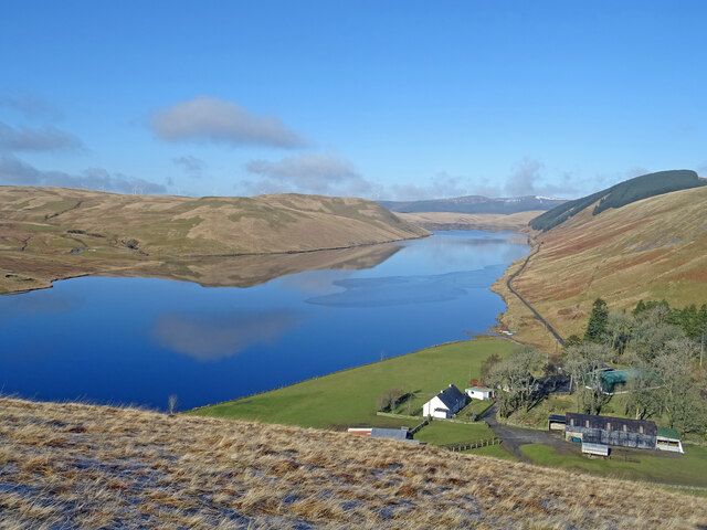
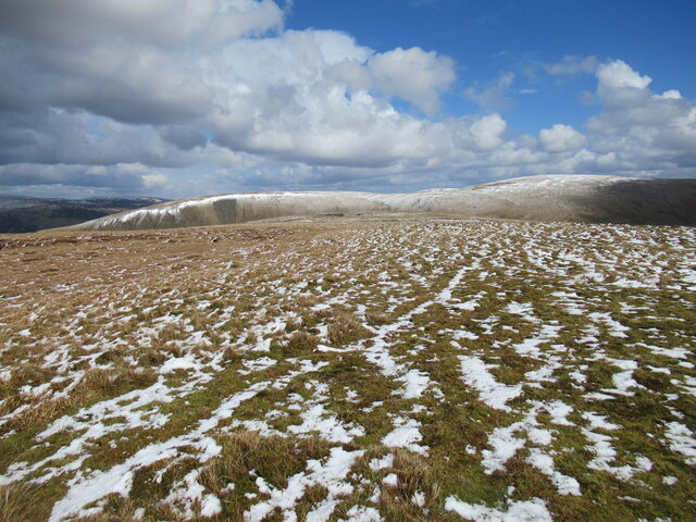
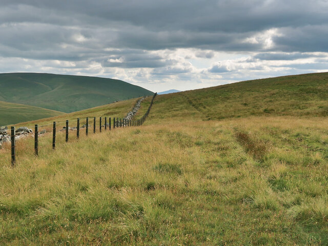
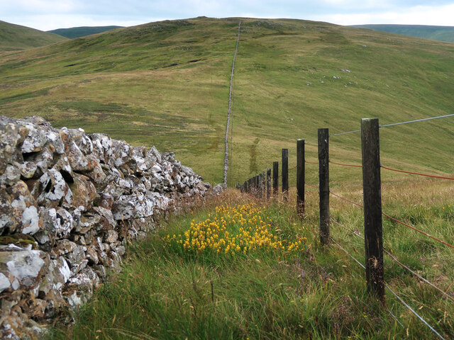
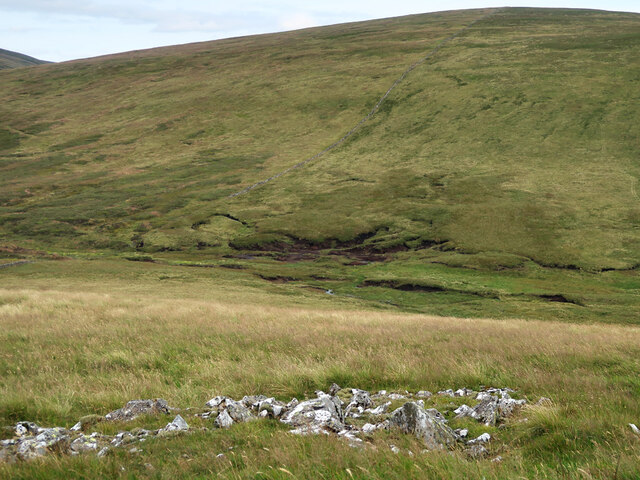
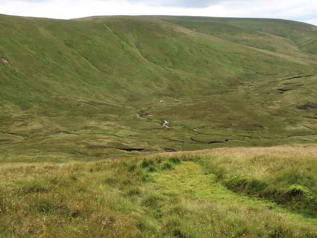
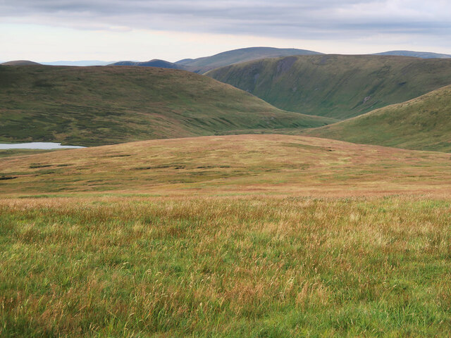
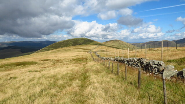
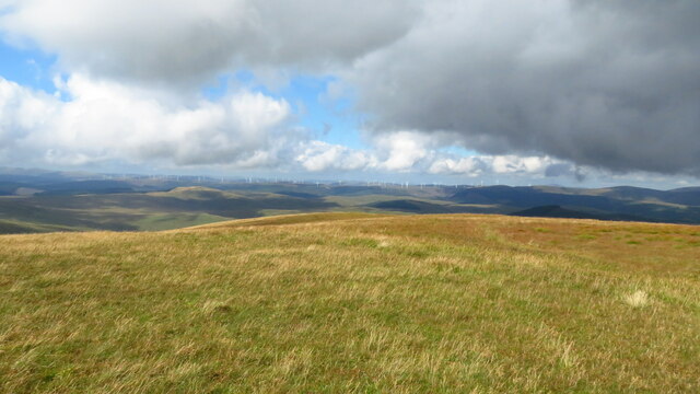
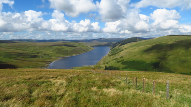
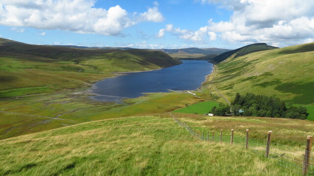
Ellers Cleuch is a picturesque valley located in the region of Peeblesshire, Scotland. Nestled within the rolling hills and lush green landscapes, this valley offers a serene and tranquil escape for nature enthusiasts and outdoor adventurers.

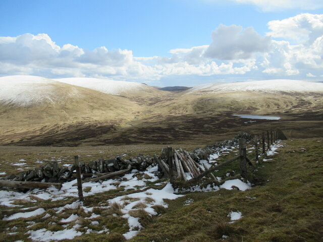
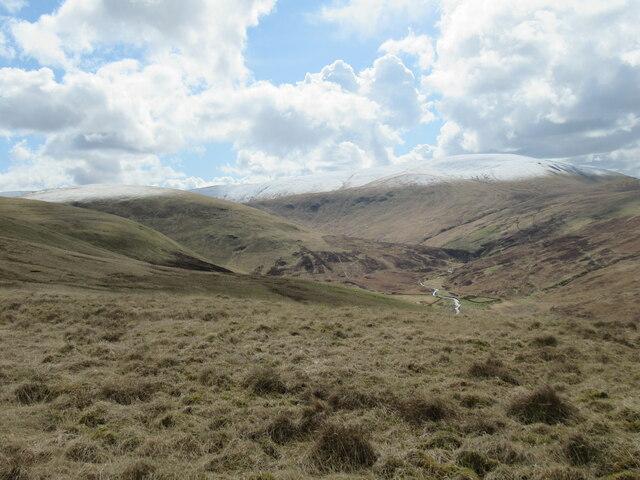
The valley is characterized by its stunning natural beauty, with steep slopes covered in heather and grasses, and a meandering river flowing through the center. Ellers Cleuch is renowned for its diverse wildlife, providing a habitat for various species of birds, mammals, and plant life. It is a haven for birdwatchers, with species such as peregrine falcons, red kites, and buzzards commonly spotted in the area.

For those seeking outdoor activities, Ellers Cleuch offers an array of opportunities. Hiking and walking trails crisscross the valley, allowing visitors to explore the surrounding countryside and take in the breathtaking views. The river provides a perfect setting for fishing enthusiasts, with salmon and trout being the main catches.

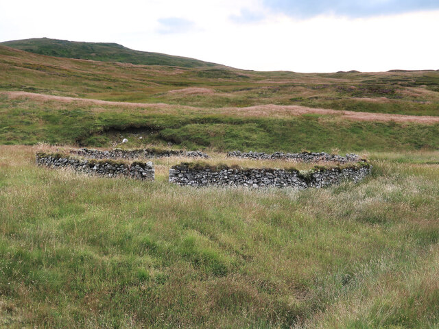
History enthusiasts will find interest in the valley's past, as it was once a significant site for the textile industry during the 18th and 19th centuries. The remains of old mills and buildings can still be found scattered throughout the area, offering glimpses into its industrial past.

Overall, Ellers Cleuch is a hidden gem within Peeblesshire, offering a harmonious blend of natural beauty, wildlife, and historical significance. Whether it's a peaceful walk along the river, birdwatching, or exploring the remnants of its industrial heritage, this valley provides a captivating experience for all who visit.

If you have any feedback on the listing, please let us know in the comments section below.

Ellers Cleuch Images

Images are sourced within 2km of 55.433356/-3.3946676 or Grid Reference NT1116. Thanks to Geograph Open Source API. All images are credited.

Above Fruid Looking down the length of Fruid Reservoir from the lower slopes of Strawberry Hill with Fruid Farm at the bottom of the picture.
Above Fruid
Looking down the length of Fruid Reservoir from the lower slopes of Strawberry Hill with Fruid Farm at the bottom of the picture.
Erie Hill from Strawberry Hill From the summit of the curiously named Strawberry Hill above Fruid Reservoir looking across to the shapely Erie Hill. A glorious early spring day.
Erie Hill from Strawberry Hill
From the summit of the curiously named Strawberry Hill above Fruid Reservoir looking across to the shapely Erie Hill. A glorious early spring day.
Spur leading from Garelet Dod to Strawberry Hill The Fruid Reservoir is visible in the distance.
Spur leading from Garelet Dod to Strawberry Hill
The Fruid Reservoir is visible in the distance.
Wintry showers passing over Fruid Reservoir A cold day of snow and hail flurries and sunny intervals in a northerly airflow.
Wintry showers passing over Fruid Reservoir
A cold day of snow and hail flurries and sunny intervals in a northerly airflow.
Summit plateau on Garelet Dod Carlavin Hill and Molls Cleuch Dod are visible in the distance. As often seems to happen in April, a warm spell has given way to the return of cold northerly winds and wintry showers.
Summit plateau on Garelet Dod
Carlavin Hill and Molls Cleuch Dod are visible in the distance. As often seems to happen in April, a warm spell has given way to the return of cold northerly winds and wintry showers.
Looking into the upper Games Hope Gameshope Loch is visible in the distance, with snow-covered hillsides above 600m. or so, during a spell of  cold spring weather with northerly winds and wintry showers.
Looking into the upper Games Hope
Gameshope Loch is visible in the distance, with snow-covered hillsides above 600m. or so, during a spell of cold spring weather with northerly winds and wintry showers.
The upper Fruid Water from Strawberry Hill Looking towards the Hart Fell group of hills, where a spell of cold northerly winds with snow showers has left decent snow cover above 600m. or so.
The upper Fruid Water from Strawberry Hill
Looking towards the Hart Fell group of hills, where a spell of cold northerly winds with snow showers has left decent snow cover above 600m. or so.
Fence and Dyke on Garelet Dod On the boundary of the Borders Forest Trust land.
Fence and Dyke on Garelet Dod
On the boundary of the Borders Forest Trust land.
Dyke and Fence between Garelet Dod and Din Law On the boundary of the Borders Forest Trust land.
Dyke and Fence between Garelet Dod and Din Law
On the boundary of the Borders Forest Trust land.
Boggy col between Din Law and Cape Law
Back Burn below Hartfell Rig The start of the Fruid Water viewed from Cape Law.
Back Burn below Hartfell Rig
The start of the Fruid Water viewed from Cape Law.
Loch Hill above Gameshope Loch Not looking much like a hill from this viewpoint on Cape Law.
Loch Hill above Gameshope Loch
Not looking much like a hill from this viewpoint on Cape Law.
Old sheepfold beside the Games Hope Burn Looking towards Din Law.
Old sheepfold beside the Games Hope Burn
Looking towards Din Law.
Broad ridge and fence running N from Speir Gairs towards Common Law
Featureless summit of Garelet Dod - view towards Clyde Wind Farm There is no cairn to mark this summit.
Featureless summit of Garelet Dod - view towards Clyde Wind Farm
There is no cairn to mark this summit.
On Garelet Dod - slope leading down to Strawberry Hill & Fruid Reservoir Featureless western slope but the terrain is easy to walk.
On Garelet Dod - slope leading down to Strawberry Hill & Fruid Reservoir
Featureless western slope but the terrain is easy to walk.
On Strawberry Hill - view to Fruid Reservoir
Show me another place!

Ellers Cleuch is located at Grid Ref: NT1116 (Lat: 55.433356, Lng: -3.3946676)

Unitary Authority: The Scottish Borders

Police Authority: The Lothians and Scottish Borders

What 3 Words

///tree.snapping.sidelined. Near Moffat, Dumfries & Galloway

Related Wikis

Moffat Hills

The Moffat Hills are a range of hills in the Southern Uplands of Scotland. They form a roughly triangular shape with a west facing side, a north facing...

Hart Fell

Hart Fell is a hill in the Moffat Hills range, part of the Southern Uplands of Scotland. It lies north of the town of Moffat on the border with the Scottish...
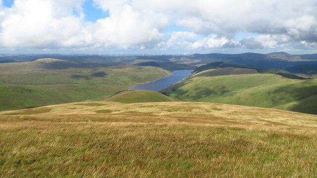
Fruid Reservoir

Fruid is a small reservoir in the Scottish Borders area of Scotland, UK, near Menzion. It is formed by damming the Fruid Water, and supplements the contents...

Talla Water

Talla Water is a river in the Scottish Borders area of Scotland, near Tweedsmuir. It feeds the Talla Reservoir, and is a tributary of the River Tweed....

Have you been to Ellers Cleuch?

Leave your review of Ellers Cleuch below (or comments, questions and feedback).