Glen Quoich

Valley in Aberdeenshire

Scotland

Glen Quoich

Cairn on the path There are not many geographical features in this square, it's a continuous slope of heather, for the most part. But there are paths, some not documented very well. This cairn is on a single track path running almost straight down the hill.
Cairn on the path Credit: Aleks Scholz

Glen Quoich is a picturesque valley located in Aberdeenshire, Scotland. Nestled in the eastern part of the Cairngorms National Park, it is renowned for its stunning natural beauty and diverse wildlife. The valley stretches for approximately 10 kilometers, running from the northern slopes of Ben Avon to the River Dee.

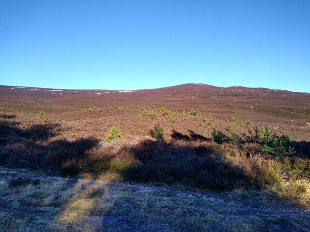
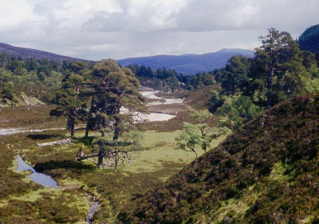
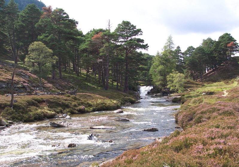
The landscape of Glen Quoich is characterized by rugged mountains, lush greenery, and meandering streams. The towering peaks of Ben Avon and Beinn a' Bhuird dominate the skyline, offering breathtaking views for hikers and mountaineers. The valley is also home to several sparkling lochs, such as Loch Quoich and Loch Builg, which add to its charm.

The flora and fauna of Glen Quoich are incredibly diverse. The valley is blanketed with heather, mosses, and grasses, creating a vibrant tapestry of colors throughout the seasons. It is a haven for wildlife enthusiasts, with sightings of red deer, golden eagles, ptarmigans, and mountain hares being common. The nearby rivers and lochs are teeming with salmon and trout, making it a popular spot for fishing enthusiasts.

Glen Quoich is a paradise for outdoor activities. It offers numerous walking and hiking trails, catering to all levels of fitness and expertise. The valley is intersected by the famous Lairig an Laoigh trail, connecting Glen Quoich to other stunning locations in the Cairngorms National Park. The area is also popular for camping, birdwatching, and photography.

In conclusion, Glen Quoich in Aberdeenshire is a magnificent valley known for its awe-inspiring landscapes, abundant wildlife, and recreational opportunities. It is a must-visit destination for nature lovers and outdoor enthusiasts seeking a tranquil escape in the heart of Scotland.

If you have any feedback on the listing, please let us know in the comments section below.

Glen Quoich Images

Images are sourced within 2km of 57.0137/-3.4884897 or Grid Reference NO0992. Thanks to Geograph Open Source API. All images are credited.

Cairn on the path There are not many geographical features in this square, it's a continuous slope of heather, for the most part. But there are paths, some not documented very well. This cairn is on a single track path running almost straight down the hill.
Cairn on the path
There are not many geographical features in this square, it's a continuous slope of heather, for the most part. But there are paths, some not documented very well. This cairn is on a single track path running almost straight down the hill.
Toddler trees When walking through the slopes above River Quoich, one can see how the woodland is conquering the bare hillside - without fencing, but with deer management in place.
Toddler trees
When walking through the slopes above River Quoich, one can see how the woodland is conquering the bare hillside - without fencing, but with deer management in place.
Quoich Water The Quoich Water has eroded the Landrover track, walkers have cut a boggy path around the side of the Water.
Quoich Water
The Quoich Water has eroded the Landrover track, walkers have cut a boggy path around the side of the Water.
Quoich Water
Quoich Water
Creag Bhalg (summit cairn) The summit cairn on Creag Bhalg.
Creag Bhalg (summit cairn)
The summit cairn on Creag Bhalg.
Glen Quoich Lochnagar on the horizon.
Glen Quoich
Lochnagar on the horizon.
Pines on moorland between Glen Lui and Glen Quoich Looking towards the high Cairngorms, with Cairn Toul amongst the mountains visible in the distance.
Pines on moorland between Glen Lui and Glen Quoich
Looking towards the high Cairngorms, with Cairn Toul amongst the mountains visible in the distance.
Shelter on Creag Bhalg A view of the shelter seen in <a href="https://www.geograph.org.uk/photo/285872">NO0891 : Windshelter, Creag Bhalg</a> with Glen Quoich and Beinn a' Bhuird in the distance.
Shelter on Creag Bhalg
A view of the shelter seen in NO0891 : Windshelter, Creag Bhalg with Glen Quoich and Beinn a' Bhuird in the distance.
Bog pool on Creag Bhalg Looking towards a distant Beinn a' Bhuird and Ben Avon.
Bog pool on Creag Bhalg
Looking towards a distant Beinn a' Bhuird and Ben Avon.
Cairn on Creag Bhalg This is one of two large cairns on the summit area, and appears to be marginally the lower of the two.
Cairn on Creag Bhalg
This is one of two large cairns on the summit area, and appears to be marginally the lower of the two.
Ford, Quoich Water The track has been washed away here and estate vehicles cross the river twice. There is a diversionary bogtrot, err path, but in low water conditions it is easy to walk up the river bed.  A narrow path also follows the bank on the left.
Ford, Quoich Water
The track has been washed away here and estate vehicles cross the river twice. There is a diversionary bogtrot, err path, but in low water conditions it is easy to walk up the river bed. A narrow path also follows the bank on the left.
Eroding terraces, Quoich Water Recently washed out banks after flooding. The exposed gravels provide ideal conditions for pine seedlings.
Eroding terraces, Quoich Water
Recently washed out banks after flooding. The exposed gravels provide ideal conditions for pine seedlings.
Young pines in Glen Quoich Trees growing on stony ground beside the river.  The water course is always changing and it appears to be moving northwards into the terrace. A lot of gravel has been recently exposed, probably during the flooding in December 2015.
Young pines in Glen Quoich
Trees growing on stony ground beside the river. The water course is always changing and it appears to be moving northwards into the terrace. A lot of gravel has been recently exposed, probably during the flooding in December 2015.
Bypass path, Glen Quoich Path around a place where the road was replaced by the river following flooding <a href="https://www.geograph.org.uk/photo/5789773">NO0992 : Ford, Quoich Water</a>.  At times of low water levels, it is better to just walk up the river as this path can be pretty wet and rough further up.  Good to know it's here though for when there is a bit of water coming down the Quoich.
Bypass path, Glen Quoich
Path around a place where the road was replaced by the river following flooding NO0992 : Ford, Quoich Water. At times of low water levels, it is better to just walk up the river as this path can be pretty wet and rough further up. Good to know it's here though for when there is a bit of water coming down the Quoich.
Washed out road, Glen Quoich The river has thrown a new meander, deep into the near bank. This has taken out the road.  Vehicles now go straight up, a couple of easy fords in low water conditions.  There is a diversion path, but it is rough.
Washed out road, Glen Quoich
The river has thrown a new meander, deep into the near bank. This has taken out the road. Vehicles now go straight up, a couple of easy fords in low water conditions. There is a diversion path, but it is rough.
Glen Quoich View upstream towards Meall an Lundain and Beinn Bhreac.  There are still many old pines in the glen and there is now some regeneration.
Glen Quoich
View upstream towards Meall an Lundain and Beinn Bhreac. There are still many old pines in the glen and there is now some regeneration.
Road up Glen Quoich Lots of young pine trees, anywhere with disturbed ground. Heather keeps the seedlings in check elsewhere.
Road up Glen Quoich
Lots of young pine trees, anywhere with disturbed ground. Heather keeps the seedlings in check elsewhere.
Glen Quoich Old pines throughout the glen.
Glen Quoich
Old pines throughout the glen.
Show me another place!

Glen Quoich is located at Grid Ref: NO0992 (Lat: 57.0137, Lng: -3.4884897)

Unitary Authority: Aberdeenshire

Police Authority: North East

What 3 Words

///shackles.defeat.clubbing. Near Inverey, Aberdeenshire

Nearby Locations

Glen Quoich

Related Wikis

Mar Lodge Estate

Mar Lodge Estate is a highland estate in western Aberdeenshire, Scotland, which has been owned and managed by the National Trust for Scotland (NTS) since...

Linn of Quoich

Linn of Quoich is a waterfall of Scotland. == See also == Waterfalls of Scotland == References ==

St Ninian's Chapel, Braemar

St Ninian's Chapel in Braemar, Aberdeenshire, Scotland, is a Grade B listed Anglican chapel located in the grounds of the Mar Lodge Estate. Built from...
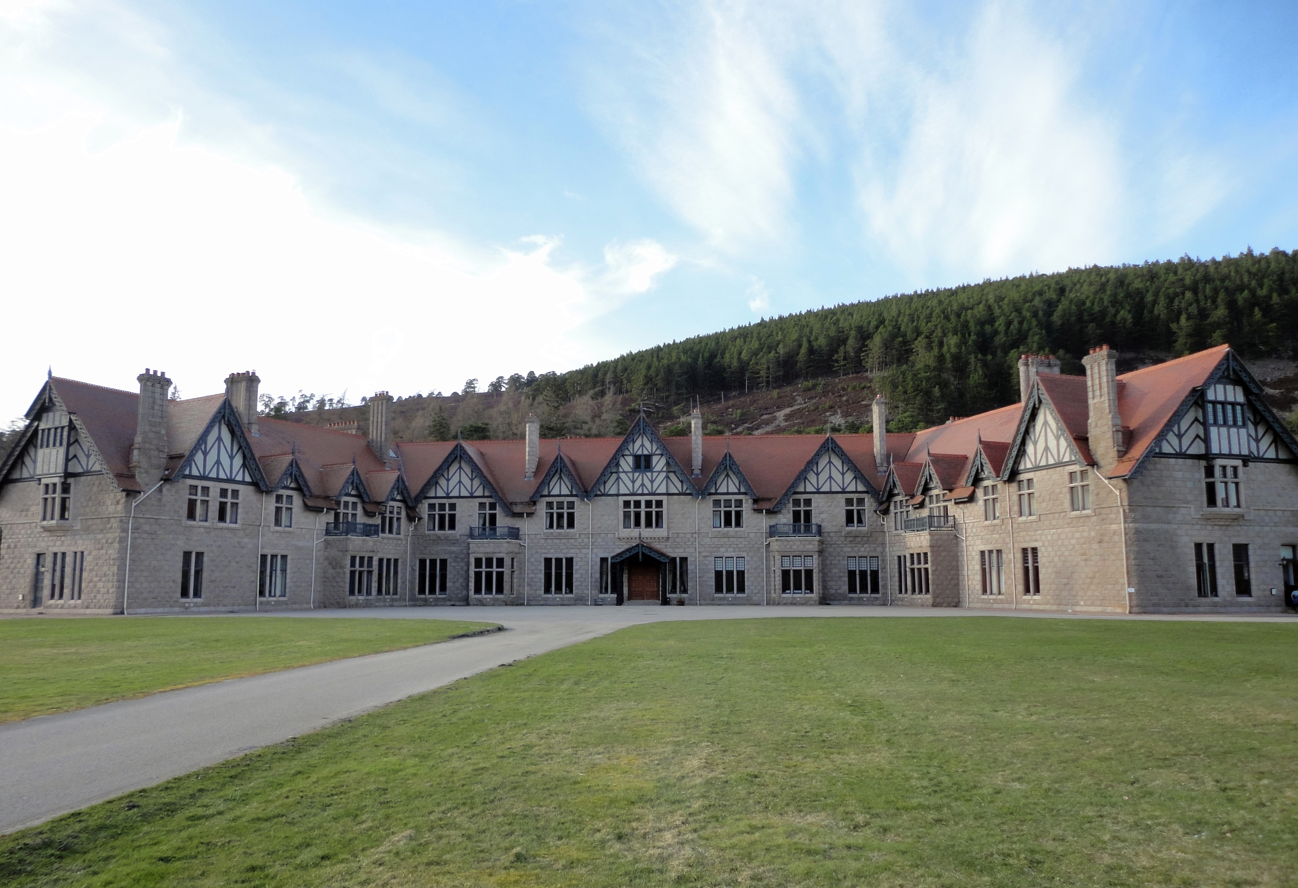
Mar Lodge

Mar Lodge is a sporting lodge 5 miles (8 kilometres) to the west of Braemar and the principal building on the Mar Lodge Estate in Aberdeenshire, Scotland...

Nearby Amenities

Located within 500m of 57.0137,-3.4884897
Ford: yes
Lat/Long: 57.0164389/-3.4871504
The data included in this document is from www.openstreetmap.org. The data is made available under ODbL.

Have you been to Glen Quoich?

Leave your review of Glen Quoich below (or comments, questions and feedback).