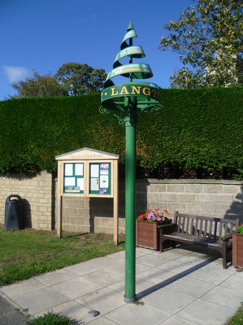
Langtoft

Settlement in Lincolnshire South Kesteven

England

Langtoft

Storm laden clouds near Langtoft Looking over a ripening barley crop from Meadow road towards Langtoft.
Storm laden clouds near Langtoft Credit: Michael Trolove

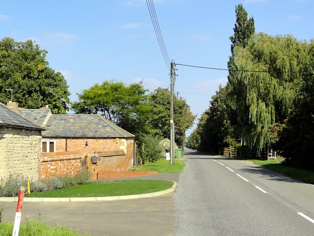
Langtoft is a small village located in the county of Lincolnshire, England. Situated approximately seven miles north of the town of Stamford, Langtoft lies in the South Kesteven district. The village has a population of around 1,500 residents, making it a close-knit community.

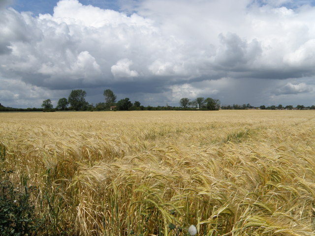
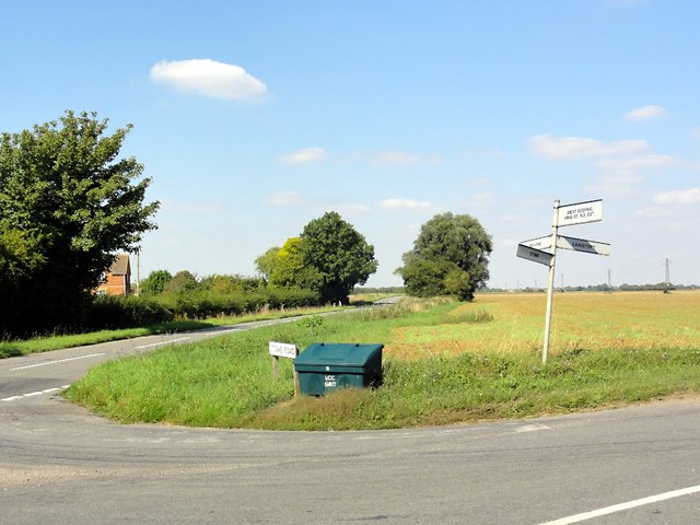
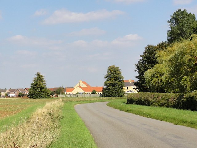
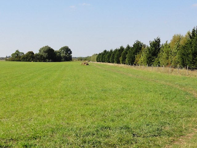
Langtoft is known for its picturesque countryside setting, with rolling hills and charming rural landscapes. The village is surrounded by farmland, which contributes to its agricultural character. The area primarily produces crops such as wheat, barley, and oilseed rape.

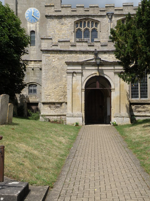
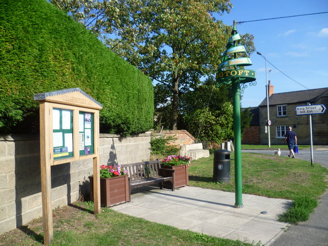
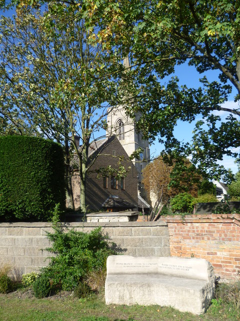
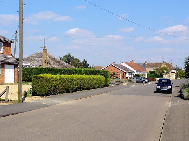
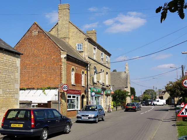
The village itself boasts a range of amenities and facilities for its residents. These include a primary school, a village hall, a post office, and a local shop. Additionally, Langtoft has a historic parish church, St. Michael and All Angels, which dates back to the 13th century and serves as a focal point for the community.

Furthermore, Langtoft hosts various community events and activities throughout the year, such as summer fairs, sports tournaments, and festive celebrations. This helps foster a sense of community spirit and engagement among residents.

Despite its small size, Langtoft has good transport links, with easy access to nearby towns and cities. The A15 road runs close to the village, providing connections to Lincoln and Peterborough. Additionally, Langtoft is served by public bus services, offering convenient travel options for both residents and visitors.

Overall, Langtoft offers a peaceful and idyllic setting for those seeking a rural lifestyle, while still benefiting from the amenities and connections of nearby towns and cities.

If you have any feedback on the listing, please let us know in the comments section below.

Langtoft Images

Images are sourced within 2km of 52.698382/-0.339329 or Grid Reference TF1212. Thanks to Geograph Open Source API. All images are credited.

Storm laden clouds near Langtoft Looking over a ripening barley crop from Meadow road towards Langtoft.
Storm laden clouds near Langtoft
Looking over a ripening barley crop from Meadow road towards Langtoft.
Flush bracket bench mark fixed to the Waggon & Horses An OS flush bracket adjacent to the A15 fixed to the wall of the Waggon & Horses Inn. <a href="https://www.geograph.org.uk/photo/2467644">TF1212 : Pub in Langtoft</a>
Flush bracket bench mark fixed to the Waggon & Horses
An OS flush bracket adjacent to the A15 fixed to the wall of the Waggon & Horses Inn. TF1212 : Pub in Langtoft
Pub in Langtoft Located by the busy A15 trunk road the pub also sports a flush bracket bench mark on the lower right hand side. See <a href="https://www.geograph.org.uk/photo/2467640">TF1212 : Flush bracket bench mark fixed to the Waggon & Horses</a> for close up detail.
Pub in Langtoft
Located by the busy A15 trunk road the pub also sports a flush bracket bench mark on the lower right hand side. See TF1212 : Flush bracket bench mark fixed to the Waggon & Horses for close up detail.
Bench mark on Langtoft church An OS cut mark easily seen on the porch of Langtoft church.
Bench mark on Langtoft church
An OS cut mark easily seen on the porch of Langtoft church.
Langtoft Church A bench mark can be seen on the lower left of the porch and the church clock was showing the right time.
Langtoft Church
A bench mark can be seen on the lower left of the porch and the church clock was showing the right time.
Langtoft village sign One of the more unusual village signs, Langtoft's sign may be unique. It is on the corner of the busy Bourne Road (A15) with East End. The churchyard is behind the hedge.
Langtoft village sign
One of the more unusual village signs, Langtoft's sign may be unique. It is on the corner of the busy Bourne Road (A15) with East End. The churchyard is behind the hedge.
Village sign and notice board at Langtoft One of the more unusual village signs, Langtoft's sign may be unique. It is on the corner of the busy Bourne Road (A15) with East End. The sign, the notice board, the seats and the flower tubs have all brightened up this corner. The churchyard is behind the hedge.
Village sign and notice board at Langtoft
One of the more unusual village signs, Langtoft's sign may be unique. It is on the corner of the busy Bourne Road (A15) with East End. The sign, the notice board, the seats and the flower tubs have all brightened up this corner. The churchyard is behind the hedge.
St Michael and All Angels Church, Langtoft This is the view from the corner of the busy Bourne Road (A15) with East End. The church of St Michael and All Angels is Early English and Decorated.
St Michael and All Angels Church, Langtoft
This is the view from the corner of the busy Bourne Road (A15) with East End. The church of St Michael and All Angels is Early English and Decorated.
Baston village sign The village sign at Baston was erected alongside Main Street to mark the new Millennium. The illustrated sign depicts scenes from the village's past. The village lies between the Roman road known as King Street, and the canal called Car Dyke which the Romans used to haul men and supplies to their armies in the north. The sign includes a Roman soldier, Hudson's corn mill and a stook (representing agriculture). A time capsule is buried beneath the sign.
Baston village sign
The village sign at Baston was erected alongside Main Street to mark the new Millennium. The illustrated sign depicts scenes from the village's past. The village lies between the Roman road known as King Street, and the canal called Car Dyke which the Romans used to haul men and supplies to their armies in the north. The sign includes a Roman soldier, Hudson's corn mill and a stook (representing agriculture). A time capsule is buried beneath the sign.
The Waggon & Horses, Langtoff
The Mill at Mill Farm near Langtoff
At the Junction of Stowe Road and King Street Two roads in a flat fenland landscape.
At the Junction of Stowe Road and King Street
Two roads in a flat fenland landscape.
Approaching Langtoft on Stowe Road A view of modern housing on the south western edge of the village of Langtoft.
Approaching Langtoft on Stowe Road
A view of modern housing on the south western edge of the village of Langtoft.
West End Road, Langtoft Bungalow housing lines the road.
West End Road, Langtoft
Bungalow housing lines the road.
Langtoft Village Centre Looking along West End Road approaching the junction with the A15 at the centre of the village.
Langtoft Village Centre
Looking along West End Road approaching the junction with the A15 at the centre of the village.
Grass and Trees Looking along the edge of a long narrow plantation. The semicircle of trees in the distance cover part of an ancient moat.
Grass and Trees
Looking along the edge of a long narrow plantation. The semicircle of trees in the distance cover part of an ancient moat.
Langtoft Outgang Road Looking north east along the road with Park Farm on the left.
Langtoft Outgang Road
Looking north east along the road with Park Farm on the left.
Show me another place!

Langtoft is located at Grid Ref: TF1212 (Lat: 52.698382, Lng: -0.339329)

Division: Parts of Kesteven

Administrative County: Lincolnshire

District: South Kesteven

Police Authority: Lincolnshire

What 3 Words

///unlocking.opened.giraffes. Near Langtoft, Lincolnshire

Nearby Locations

Langtoft

Related Wikis

Langtoft, Lincolnshire

Langtoft is a village and civil parish in the South Kesteven district of Lincolnshire, England. The population of the civil parish at the 2021 census was...

Kirkstone House School

Kirkstone House School is an independent day school situated in the rural village of Baston in south Lincolnshire, England.The school provides education...
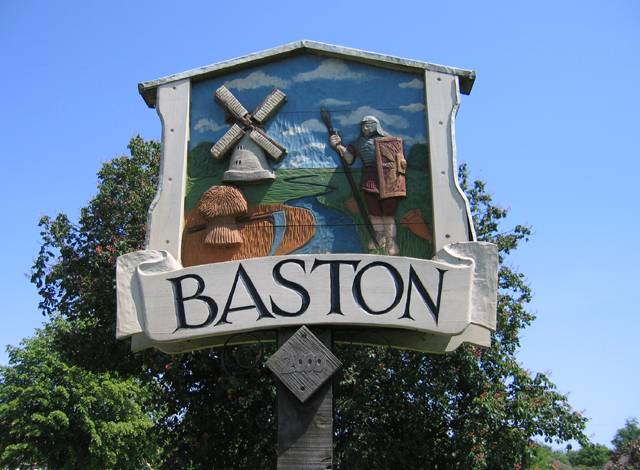
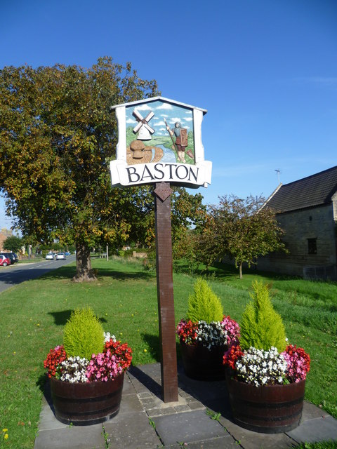
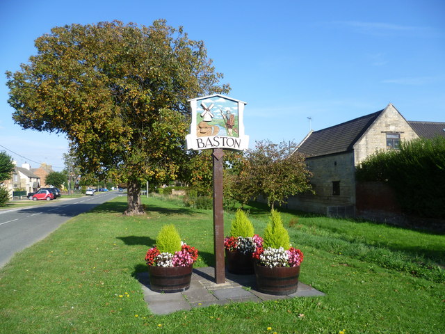
Baston

Baston is a village and parish on the edge of The Fens and in the administrative district of South Kesteven, Lincolnshire, England. The 2011 census reported...

King Street (Roman road)

King Street is the name of a modern road on the line of a Roman road. It runs on a straight course in eastern England, between the City of Peterborough...

Deeping Rangers F.C.

Deeping Rangers F.C. is a football club based in Market Deeping, Lincolnshire, England. They were established in 1964 and originally played at Maxey Road...

St Guthlac's Church, Market Deeping

Saint Guthlac's Church, Market Deeping is a parish church of the Church of England in Market Deeping, Lincolnshire, England. == Background == The largely...

Thetford, Lincolnshire

Thetford is a hamlet and farm in the civil parish of Baston in the South Kesteven district of Lincolnshire, England. Although Thetford has shrunken to...

Market Deeping

Market Deeping is a market town and civil parish in the South Kesteven district of Lincolnshire, England, on the north bank of the River Welland and the...

Nearby Amenities

Located within 500m of 52.698382,-0.339329
Bus Stop
Langtoft Bus Stop
Alt Name: A15 Crossroads
Bench: no
Bin: no
Bus: yes
Departures Board: timetable
Naptan AltCommonName: A15 Crossroads
Naptan AltIndicator: Northbound
Naptan AltLandmark: A15 Crossroads
Naptan AltStreet: Bourne Road
Naptan AtcoCode: 270000009528
Naptan Bearing: NW
Naptan CommonName: Wagon & Horses PH
Naptan Indicator: opp
Naptan Landmark: Wagon & Horses PH
Naptan NaptanCode: linjdgdm
Naptan Street: Bourne Road
Operator: Delaine
Public Transport: platform
Shelter: yes
Source: naptan_import
Lat/Long: 52.698794/-0.3400283
Bus Stop
17 East End
Bus: yes
Naptan AtcoCode: 270002700034
Naptan Bearing: NE
Naptan CommonName: 17 East End
Naptan Indicator: o/s
Naptan Landmark: Number 17
Naptan NaptanCode: linjtagw
Naptan Street: East End
Naptan Verified: no
Public Transport: platform
Source: naptan_import
Lat/Long: 52.6995446/-0.3378246
Bus Stop
20 East End
Bus: yes
Naptan AtcoCode: 270002700035
Naptan Bearing: SW
Naptan CommonName: 20 East End
Naptan Indicator: o/s
Naptan Landmark: Number 20
Naptan NaptanCode: linjtaja
Naptan Street: East End
Naptan Verified: no
Public Transport: platform
Source: naptan_import
Lat/Long: 52.6994978/-0.3376932
Bus Stop
Langtoft Bus Stop
Alt Name: A15 Crossroads
Bus: yes
Departures Board: timetable
Naptan AltCommonName: A15 Crossroads
Naptan AltIndicator: Southbound
Naptan AltLandmark: A15 Crossroads
Naptan AltStreet: Bourne Road
Naptan AtcoCode: 2700LLC00732
Naptan Bearing: SE
Naptan CommonName: Wagon & Horses PH
Naptan Indicator: adj
Naptan Landmark: Wagon & Horses PH
Naptan NaptanCode: linagdwd
Naptan Street: Bourne Road
Operator: Delaine
Public Transport: platform
Shelter: yes
Source: naptan_import
Lat/Long: 52.698713/-0.3396681
Bus Stop
Post Office (opp)
Bus: yes
Naptan AtcoCode: 2700LLWE1866
Naptan Bearing: SW
Naptan CommonName: Post Office
Naptan Indicator: opp
Naptan Landmark: Post Office
Naptan NaptanCode: linamtpm
Naptan Street: West End
Naptan Verified: no
Public Transport: platform
Source: naptan_import
Lat/Long: 52.6981783/-0.3397777
Langtoft
Place: village
Lat/Long: 52.6989859/-0.3395541
Noexit: yes
Lat/Long: 52.6995953/-0.3339005
Crossing
Crossing: traffic_signals
Crossing Ref: pelican
Kerb: lowered
Lat/Long: 52.698619/-0.3396257
Stop
Lat/Long: 52.6984235/-0.3394125
Crossing
Crossing: unmarked
Crossing Markings: no
Kerb: lowered
Source: Bing
Lat/Long: 52.6983916/-0.3394793
Church Farm
Place: farm
Source: Bing
Lat/Long: 52.6988785/-0.3375968
Gee's Farm
Place: farm
Source: Bing
Lat/Long: 52.6995728/-0.3368439
Traffic Signals
Traffic Signals Direction: backward
Lat/Long: 52.6986429/-0.3396634
Traffic Signals
Traffic Signals Direction: forward
Lat/Long: 52.698582/-0.3395674
Crossing
Crossing: unmarked
Crossing Markings: no
Kerb: lowered
Lat/Long: 52.6972585/-0.3369819
Turning Circle
Lat/Long: 52.6957574/-0.3385304
Noexit: yes
Lat/Long: 52.7005378/-0.3348899
Noexit: yes
Lat/Long: 52.698289/-0.3415927
Fixme: check speed limit change point since new housing built
Lat/Long: 52.6995726/-0.3324759
Noexit: yes
Lat/Long: 52.6981533/-0.3416142
Noexit: yes
Lat/Long: 52.699698/-0.3330452
Noexit: yes
Lat/Long: 52.6984485/-0.3391406
Noexit: yes
Lat/Long: 52.7004831/-0.3362783
Noexit: yes
Lat/Long: 52.7003371/-0.3364338
Crossing
Lat/Long: 52.7003847/-0.3365379
Crossing
Lat/Long: 52.700521/-0.336369
Noexit: yes
Lat/Long: 52.7002226/-0.3365782
Crossing
Lat/Long: 52.7002635/-0.3366815
Noexit: yes
Lat/Long: 52.7001142/-0.3366286
Crossing
Lat/Long: 52.7001776/-0.3367892
Noexit: yes
Lat/Long: 52.7000581/-0.3368485
Crossing
Lat/Long: 52.7000834/-0.3369096
Noexit: yes
Lat/Long: 52.6998308/-0.336691
Crossing
Lat/Long: 52.7000049/-0.3370118
Noexit: yes
Lat/Long: 52.6998068/-0.3370193
Crossing
Lat/Long: 52.6998745/-0.3371794
Noexit: yes
Lat/Long: 52.6994773/-0.3371494
Crossing
Lat/Long: 52.69961/-0.3374927
Noexit: yes
Lat/Long: 52.6993825/-0.3375905
Crossing
Lat/Long: 52.6994241/-0.3377069
Noexit: yes
Lat/Long: 52.6992001/-0.3374614
Crossing
Lat/Long: 52.6993233/-0.3378231
Noexit: yes
Lat/Long: 52.6990948/-0.3376443
Crossing
Lat/Long: 52.6992497/-0.3379079
Noexit: yes
Lat/Long: 52.6988903/-0.3381474
Crossing
Lat/Long: 52.6989428/-0.3382578
Noexit: yes
Lat/Long: 52.6987203/-0.3384361
Crossing
Lat/Long: 52.6987808/-0.3385169
Noexit: yes
Lat/Long: 52.6985318/-0.3384139
Crossing
Lat/Long: 52.698726/-0.3386257
Noexit: yes
Lat/Long: 52.7004668/-0.3360118
Crossing
Lat/Long: 52.7006033/-0.3362653
Cafe
Sport Cafe
Addr City: Langtoft
Addr Housename: Langtoft Playing Fields
Addr Postcode: PE6 9NB
Addr Street: Manor Close
Fhrs Authority: South Kesteven
Fhrs Id: 1409464
Fhrs Local Authority Id: 89436
Lat/Long: 52.698523/-0.3453586
Fast Food
Simply Delicious
Addr City: Langtoft
Addr Housenumber: 8
Addr Postcode: PE6 9LS
Addr Street: West End
Fhrs Authority: South Kesteven
Fhrs Id: 427436
Fhrs Local Authority Id: 84855
Lat/Long: 52.6981983/-0.3401183
Crossing
Crossing: unmarked
Crossing Markings: no
Kerb: lowered
Source: Bing
Lat/Long: 52.698528/-0.3392337
Waste Basket
Lat/Long: 52.6987444/-0.3396991
Bench
Material: stone
Lat/Long: 52.6986077/-0.3393607
Defibrillator
Defibrillator Mounting: freestanding
Emergency: defibrillator
Lat/Long: 52.6985967/-0.3393318
Langtoft
Colour: green
Man Made: village_sign
Material: metal
Lat/Long: 52.6986197/-0.3394609
Board Type: notice
Information: board
Tourism: information
Lat/Long: 52.6986459/-0.3394861
Bench
Material: wood
Lat/Long: 52.6986312/-0.3394401
Post Box
Ref: PE6 118
Lat/Long: 52.6982355/-0.3399571
Elysian
Shop: hairdresser
Lat/Long: 52.6980061/-0.3399472
The Ivy Room
Shop: beauty
Lat/Long: 52.6978732/-0.3405329
Defibrillator
Emergency: defibrillator
Lat/Long: 52.6977058/-0.3413377
Entrance: main
Lat/Long: 52.6977261/-0.3413429
Board Type: notice
Information: board
Tourism: information
Lat/Long: 52.6976411/-0.3412887
Waste Basket
Lat/Long: 52.6967676/-0.3426838
Bench
Lat/Long: 52.69679/-0.3426619
Power: pole
Lat/Long: 52.6941805/-0.340727
Power: pole
Lat/Long: 52.6949091/-0.3416731
Power: pole
Lat/Long: 52.6954582/-0.3422708
The data included in this document is from www.openstreetmap.org. The data is made available under ODbL.

Have you been to Langtoft?

Leave your review of Langtoft below (or comments, questions and feedback).