Vale of Clwyd
Valley in Denbighshire
Wales
Vale of Clwyd

The Vale of Clwyd is a picturesque valley located in Denbighshire, Wales. It stretches for approximately 20 miles, from the town of Rhuddlan in the north to the village of Tremeirchion in the south. The valley is surrounded by rolling hills and offers stunning views of the Welsh countryside.
The Vale of Clwyd is renowned for its natural beauty and is often referred to as the "Garden of Wales." The fertile land and mild climate make it an ideal location for agriculture, with fields of crops and grazing livestock dominating the landscape. The valley is particularly famous for its dairy farming, producing high-quality milk and cheese.
The River Clwyd flows through the valley, adding to its charm. The river is a popular spot for fishing, attracting anglers from near and far. Additionally, the Vale of Clwyd offers numerous walking and cycling trails, allowing visitors to explore the area's natural wonders.
The valley is also rich in history and culture. It is home to several historic towns and villages, including Denbigh and Ruthin, which boast well-preserved medieval castles. These castles serve as reminders of the region's turbulent past and provide a fascinating glimpse into Welsh history.
Overall, the Vale of Clwyd is a captivating destination for nature lovers, history enthusiasts, and those seeking a tranquil escape. With its stunning landscapes, rich agricultural heritage, and historical landmarks, it is no wonder why the valley continues to captivate visitors from all over the world.
If you have any feedback on the listing, please let us know in the comments section below.
Vale of Clwyd Images
Images are sourced within 2km of 53.211367/-3.3875132 or Grid Reference SJ0769. Thanks to Geograph Open Source API. All images are credited.


Vale of Clwyd is located at Grid Ref: SJ0769 (Lat: 53.211367, Lng: -3.3875132)
Unitary Authority: Denbighshire
Police Authority: North Wales
What 3 Words
///petty.supply.zoos. Near Trefnant, Denbighshire
Nearby Locations
Related Wikis

Vale of Clwyd
The Vale of Clwyd (Welsh: Dyffryn Clwyd) is a tract of low-lying ground in the county of Denbighshire in north-east Wales. The Vale extends south-southwestwards...
River Wheeler
The River Wheeler (Welsh: Afon Chwiler) is a tributary of the River Clwyd in north-east Wales. Rising on the east side of the Clwydian Range, it is a...

Lleweni Hall
Lleweni Hall (Welsh: Plas Lleweni; sometimes also referred to as Llewenny Palace) was a stately home in Denbighshire, northeast Wales, around 2 miles...

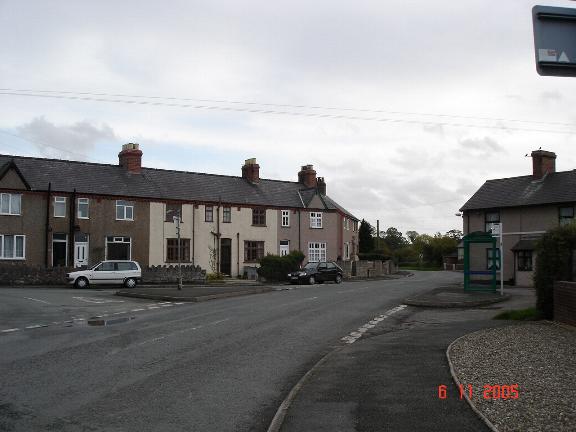
Bodfari
Bodfari is a village and community in Denbighshire, Wales. Until the local government reorganisation of 1974, Bodfari was in the historic county of Flintshire...

Plas Clough
Plas Clough is a country house and Grade II* listed building in North Wales, near Denbigh, built by Sir Richard Clough and begun about 1567. Just to the...
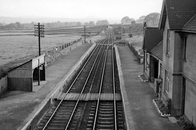
Bodfari railway station
Bodfari railway station was opened on 6 September 1869 by the Mold and Denbigh Junction Railway. Following the Railways Act 1921 the line became part of...
Aberwheeler
Aberwheeler (Welsh: Aberchwiler) is a village and community in the Welsh county of Denbighshire, located on the south bank of the River Wheeler (Welsh...

Moel y Gaer, Bodfari
Moel y Gaer (Welsh for "bald hill of the fortress") is an Iron Age hillfort at the northern end of the Clwydian Range, located on a summit overlooking...
Nearby Amenities
Located within 500m of 53.211367,-3.3875132Have you been to Vale of Clwyd?
Leave your review of Vale of Clwyd below (or comments, questions and feedback).