Cwm Pistyll
Valley in Radnorshire
Wales
Cwm Pistyll

Cwm Pistyll is a picturesque valley located in Radnorshire, Wales. Situated in the heart of the Cambrian Mountains, it offers breathtaking views and a tranquil environment for visitors to enjoy. The valley is named after the Pistyll stream that gracefully meanders through its lush green landscape.
One of the standout features of Cwm Pistyll is its towering waterfall. The Pistyll stream cascades down a rocky cliff face, creating a stunning 100-foot waterfall that attracts nature enthusiasts and photographers alike. The sight and sound of the rushing water provide a mesmerizing experience for those who venture into the valley.
The valley is also home to a diverse array of flora and fauna. The surrounding woodlands are filled with ancient oak and ash trees, creating a rich habitat for various bird species and small mammals. Nature lovers can spot red kites soaring above, while lucky visitors might even catch a glimpse of the elusive otter that resides in the Pistyll stream.
For hikers and walkers, Cwm Pistyll offers a range of scenic trails that allow exploration of the valley's natural wonders. The paths wind through the valley, offering panoramic views of the surrounding mountains and valleys. These trails cater to both experienced hikers and casual strollers, making Cwm Pistyll an ideal destination for outdoor enthusiasts of all levels.
Cwm Pistyll is a hidden gem in Radnorshire, providing visitors with an opportunity to escape the hustle and bustle of everyday life and immerse themselves in the beauty of nature. Whether it's admiring the majestic waterfall, spotting wildlife, or exploring the walking trails, a visit to Cwm Pistyll is sure to leave a lasting impression on all who venture into this idyllic valley.
If you have any feedback on the listing, please let us know in the comments section below.
Cwm Pistyll Images
Images are sourced within 2km of 52.378974/-3.4541172 or Grid Reference SO0176. Thanks to Geograph Open Source API. All images are credited.
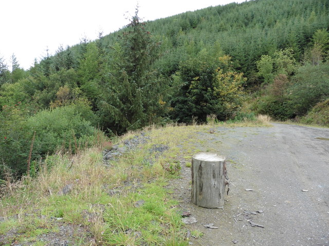


![Fields and forestry On the 1:25,000 map, Glyndwr's Way [long distance footpath] goes through this wood, but on the 1:50,000 it is shown as passing along the base of the hills about a kilometre beyond. Both lines are public rights of way.](https://s2.geograph.org.uk/photos/41/34/413454_7db46c88.jpg)


Cwm Pistyll is located at Grid Ref: SO0176 (Lat: 52.378974, Lng: -3.4541172)
Unitary Authority: Powys
Police Authority: Dyfed Powys
What 3 Words
///trusts.pelt.thuds. Near Rhayader, Powys
Nearby Locations
Related Wikis

Glan-yr-Afon Halt railway station
Glan-yr-Afon Halt railway station was a station to the southeast of Tylwch, Powys, Wales. The station was closed in 1962. == References == == Further... ==
Pantydwr railway station
Pantydwr railway station was a station to the north of St Harmon, Powys, Wales. The station was opened in 1864. The station was built at the highest point...
St Harmons railway station
St Harmons railway station was a station in St Harmon, Powys, Wales. The station opened in 1872 and closed in 1962. == References == == Further reading... ==

Red Lion Hill
Red Lion Hill (Welsh: Bryn Llew Goch) or Banc y Dolau is a hill in Powys, Wales, with a summit 484.6 metres (1,590 ft) above sea level. It is located in...
Nearby Amenities
Located within 500m of 52.378974,-3.4541172Have you been to Cwm Pistyll?
Leave your review of Cwm Pistyll below (or comments, questions and feedback).