Coire Buidhe

Valley in Caithness

Scotland

Coire Buidhe

Beinn nam Bad Mor Bagged on a rainy and misty morning with Jim Bloomer and Tricky Speirs.
Name: Beinn nam Bad Mor
Hill number:4741
Height: 290m / 951ft
Parent (Ma/M):1150  Morven
Area: 16C: Tongue to Wick and Helmsdale
Class: Hu,2
Grid ref: NC 99849 55045
Summit feature:knoll 3m E of trig point
Drop: 114m
Col: 176m  NC960456
Beinn nam Bad Mor Credit: Rude Health

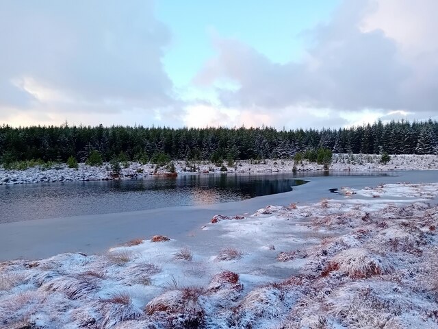
Coire Buidhe is a picturesque valley located in Caithness, a remote and rugged county in the northernmost part of mainland Scotland. Nestled amidst the rolling hills and moorland, this valley is renowned for its breathtaking natural beauty and tranquil ambiance.

Surrounded by towering cliffs and verdant slopes, Coire Buidhe boasts a diverse range of flora and fauna, making it an ideal destination for nature enthusiasts and hikers. The valley is carpeted with vibrant heather, golden gorse, and wildflowers during the summer months, creating a stunning tapestry of colors. It is also home to a variety of bird species, including golden eagles, peregrine falcons, and ptarmigans, providing ample opportunities for birdwatching.

At the heart of Coire Buidhe lies a crystal-clear stream that meanders through the valley, adding to its allure. The stream is fed by the surrounding hills and forms small cascades and pools along its course, offering an enchanting sight and providing a refreshing spot for visitors to relax and unwind.

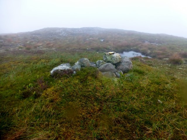
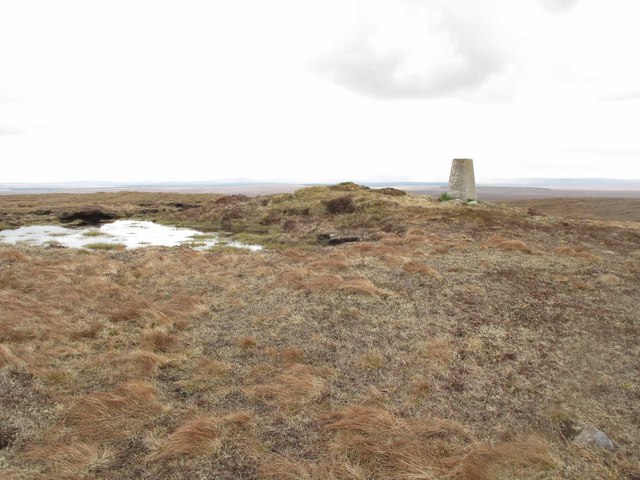
For those seeking adventure, Coire Buidhe offers several hiking trails that provide breathtaking panoramic views of the surrounding landscape. The valley is also a popular spot for rock climbing, with its steep cliffs and crags offering a challenge to experienced climbers.

Overall, Coire Buidhe is a hidden gem in Caithness, offering visitors a chance to immerse themselves in the untouched beauty of the Scottish Highlands. Its dramatic scenery, diverse wildlife, and peaceful atmosphere make it a must-visit destination for nature lovers and those looking to escape the hustle and bustle of modern life.

If you have any feedback on the listing, please let us know in the comments section below.

Coire Buidhe Images

Images are sourced within 2km of 58.466548/-3.7158902 or Grid Reference ND0054. Thanks to Geograph Open Source API. All images are credited.

Beinn nam Bad Mor Bagged on a rainy and misty morning with Jim Bloomer and Tricky Speirs.
Name: Beinn nam Bad Mor
Hill number:4741
Height: 290m / 951ft
Parent (Ma/M):1150  Morven
Area: 16C: Tongue to Wick and Helmsdale
Class: Hu,2
Grid ref: NC 99849 55045
Summit feature:knoll 3m E of trig point
Drop: 114m
Col: 176m  NC960456
Beinn nam Bad Mor
Bagged on a rainy and misty morning with Jim Bloomer and Tricky Speirs. Name: Beinn nam Bad Mor Hill number:4741 Height: 290m / 951ft Parent (Ma/M):1150 Morven Area: 16C: Tongue to Wick and Helmsdale Class: Hu,2 Grid ref: NC 99849 55045 Summit feature:knoll 3m E of trig point Drop: 114m Col: 176m NC960456
Lochan Dubh nan Clachan Geala The "dark lochan of the white stones" is nearly divided into two by an area of boggy ground. This is the western end, and maybe these are some of the white stones referred to...
Lochan Dubh nan Clachan Geala
The "dark lochan of the white stones" is nearly divided into two by an area of boggy ground. This is the western end, and maybe these are some of the white stones referred to...
East End of Lochan Dubh nan Clachan Geala The boggy ground on the right separates this from the western end.
East End of Lochan Dubh nan Clachan Geala
The boggy ground on the right separates this from the western end.
The summit of Beinn nam Bad Mor Showing, from left to right, part of the Dounreay Nuclear Power site, the wind farm west of Thurso, and the island of Hoy (Orkney Islands).
The summit of Beinn nam Bad Mor
Showing, from left to right, part of the Dounreay Nuclear Power site, the wind farm west of Thurso, and the island of Hoy (Orkney Islands).
Back of the Shack Had a snack at the back of the shack.
Back of the Shack
Had a snack at the back of the shack.
Shurrery Track Track on the Shurrery Estate.
Shurrery Track
Track on the Shurrery Estate.
Track on Shurrery Estate A long track across the boggy moorland.
Track on Shurrery Estate
A long track across the boggy moorland.
Lochan Dubh Cul na Beinne A Loch on the Shurrery Estate.
Lochan Dubh Cul na Beinne
A Loch on the Shurrery Estate.
Lochan Dubh nan Clachan Geala Partly frozen. This small lochan is enclosed by commercial conifer plantation. At one time it must have been quite a remote lochan in open peatland.
Lochan Dubh nan Clachan Geala
Partly frozen. This small lochan is enclosed by commercial conifer plantation. At one time it must have been quite a remote lochan in open peatland.
Lochan Dubh nan Clachan Geala Partly frozen. This small lochan is enclosed within Broubster Forest.
Lochan Dubh nan Clachan Geala
Partly frozen. This small lochan is enclosed within Broubster Forest.
Beinn nam Bad Beag Bagged on a rainy and misty morning with Jim Bloomer and Tricky Speirs.
Name: Beinn nam Bad Beag
Hill number:9598
Height: 253m / 830ft
Parent (Ma/M):1150  Morven
Area: 16C: Tongue to Wick and Helmsdale
Class:2
Grid ref: ND011546 (est)
Drop: 77m
Col: 176m
Beinn nam Bad Beag
Bagged on a rainy and misty morning with Jim Bloomer and Tricky Speirs. Name: Beinn nam Bad Beag Hill number:9598 Height: 253m / 830ft Parent (Ma/M):1150 Morven Area: 16C: Tongue to Wick and Helmsdale Class:2 Grid ref: ND011546 (est) Drop: 77m Col: 176m
Track Towards Loch Scye
Lochan Dubh Cul na Beinne. This lochan must be one of the upper sources of the Forss Water. A perfect Flow Country scene where loch and sky are barely parted by the land.
Lochan Dubh Cul na Beinne.
This lochan must be one of the upper sources of the Forss Water. A perfect Flow Country scene where loch and sky are barely parted by the land.
Tin Shack, Shurrery Estate. A lonely spot by the track from Shurrery.
Tin Shack, Shurrery Estate.
A lonely spot by the track from Shurrery.
Pool East of Bad nam Bo The pools were undoubtedly drier than usual at this time of year.
Pool East of Bad nam Bo
The pools were undoubtedly drier than usual at this time of year.
Boggy Area NE of Bad nam Bo This looks like a dried up pool with bogbean growing in it. There are more pools in this area than the map shows.
Boggy Area NE of Bad nam Bo
This looks like a dried up pool with bogbean growing in it. There are more pools in this area than the map shows.
Moorland and Stormy Sky South of Croc na h-Imriche The highest hill in the background is Morven.
Moorland and Stormy Sky South of Croc na h-Imriche
The highest hill in the background is Morven.
Beinn nam Bad Mor The summit of Beinn nam Bad Mor, a prominent hill in the Caithness peatlands.
Beinn nam Bad Mor
The summit of Beinn nam Bad Mor, a prominent hill in the Caithness peatlands.
Show me another place!

Coire Buidhe is located at Grid Ref: ND0054 (Lat: 58.466548, Lng: -3.7158902)

Unitary Authority: Highland

Police Authority: Highlands and Islands

What 3 Words

///trapdoor.proven.speedy. Near Reay, Highland

Nearby Locations

Coire Buidhe

Related Wikis

Loch Shurrery

Loch Shurrery (also known as Loch Shurrey) is a small, shallow, lowland freshwater loch lying approximately 8 mi (13 km) south west of Thurso in the Scottish...

Broubster

Broubster is a village in Highland, Scotland. Near Broubster, there is a Bronze Age megalithic arrangement. Ten stones remain of an original set of approximately...

Ca na Catanach

Ca na Catanach (translation: "Sutherland Men's Path") is a road and footpath between Sutherland and Caithness through the moorland in the northeastern...

Dorrery

Dorrery is a small hamlet lying to the east of Ben Dorrery in the district of Halkirk in Caithness, Scottish Highlands and is in the Scottish council...

Flow Country

The Flow Country is a large, rolling expanse of peatland and wetland area of Caithness and Sutherland in the North of Scotland. It is the largest expanse...

Altnabreac railway station

Altnabreac railway station () is a rural railway station in the Highland council area of Scotland. It serves the area of Altnabreac – a settlement in which...

Shebster

Shebster is a small remote hamlet, which lies 7 miles southwest of Thurso, in northern Caithness, Scottish Highlands and is in the Scottish council area...

Loch Calder

Loch Calder is a lowland freshwater loch lying approximately 5 mi (8.0 km) south west of Thurso in the Scottish Highlands. The loch is large with an irregular...

Have you been to Coire Buidhe?

Leave your review of Coire Buidhe below (or comments, questions and feedback).