Aladdin's Couloir
Valley in Inverness-shire
Scotland
Aladdin's Couloir

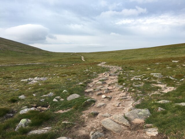
Located in Inverness-shire, Scotland, Aladdin's Couloir is a picturesque valley known for its breathtaking beauty and stunning natural features. Nestled amongst the towering mountains of the Scottish Highlands, this couloir is a popular destination for outdoor enthusiasts and nature lovers alike.
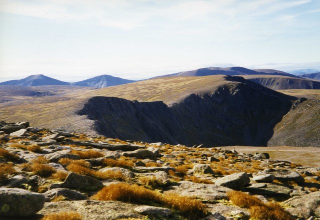
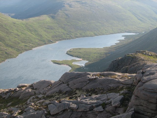
The valley is characterized by its rugged terrain, with steep cliffs and rocky slopes that create a dramatic backdrop against the lush greenery. Aladdin's Couloir is a haven for hikers and mountaineers, offering a challenging and exhilarating experience for those seeking adventure.
The valley is also known for its diverse wildlife, making it a prime spot for birdwatching and animal spotting. Visitors may catch a glimpse of golden eagles soaring overhead or red deer roaming in the distance. The surrounding forests are home to a variety of plant species, adding to the valley's natural beauty.
The valley offers a range of outdoor activities, such as hiking, rock climbing, and skiing during the winter months. The couloir's steep slopes provide a thrilling experience for experienced skiers and snowboarders, with breathtaking views to accompany their descent.
Aladdin's Couloir is accessible from various starting points, with well-marked trails leading to the valley. Visitors can explore the area on their own or join guided tours to learn more about the geological and ecological significance of this remarkable landscape.
Overall, Aladdin's Couloir in Inverness-shire is a must-visit destination for nature enthusiasts and adventure seekers, offering a unique and awe-inspiring experience in the heart of the Scottish Highlands.
If you have any feedback on the listing, please let us know in the comments section below.
Aladdin's Couloir Images
Images are sourced within 2km of 57.107316/-3.6608866 or Grid Reference NH9903. Thanks to Geograph Open Source API. All images are credited.


Aladdin's Couloir is located at Grid Ref: NH9903 (Lat: 57.107316, Lng: -3.6608866)
Unitary Authority: Highland
Police Authority: Highlands and Islands
What 3 Words
///genetics.permit.tenure. Near Aviemore, Highland
Nearby Locations
Related Wikis

Coire an t-Sneachda
Coire an t-Sneachda (sometimes misspelled as Coire an t'Sneachda) is a glacial cirque or corrie landform in the Cairngorm or Am Monadh Ruadh mountain range...
Cairngorms
The Cairngorms (Scottish Gaelic: Am Monadh Ruadh) are a mountain range in the eastern Highlands of Scotland closely associated with the mountain Cairn...

Cairn Gorm
Cairn Gorm (Scottish Gaelic: An Càrn Gorm) is a mountain in the Scottish Highlands. It is part of the Cairngorms range and wider Grampian Mountains. With...

Cairngorm Plateau disaster
The Cairngorm Plateau disaster, also known as the Feith Buidhe disaster, occurred in November 1971 when six fifteen-year-old Edinburgh school students...
Cairngorm Lochs
Cairngorm Lochs is a protected wetland area in the Cairngorms, in the Grampian and Highland regions of Scotland. With a total area of 173 hectares, it...
Loch A'an
Loch A'an is a remote freshwater loch set deep within the central Cairngorms plateau, in the Cairngorms National Park, located in the eastern Highlands...

Cairngorm Mountain Railway
The Cairngorm Mountain Railway, which opened in 2001, is the highest railway in the United Kingdom. The two-kilometre long funicular ascends the northern...

Lochan Buidhe
Lochan Buidhe is a small freshwater loch located on the Cairngorm Plateau in the eastern Highlands of Scotland. At over 1,120 m (3,670 ft) above sea level...
Nearby Amenities
Located within 500m of 57.107316,-3.6608866Have you been to Aladdin's Couloir?
Leave your review of Aladdin's Couloir below (or comments, questions and feedback).