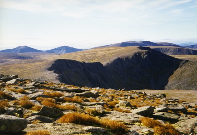
Central Gully

Valley in Inverness-shire

Scotland

Central Gully

Path towards Coire Raibeirt
Path towards Coire Raibeirt Credit: Steven Brown

The requested URL returned error: 429 Too Many Requests

If you have any feedback on the listing, please let us know in the comments section below.

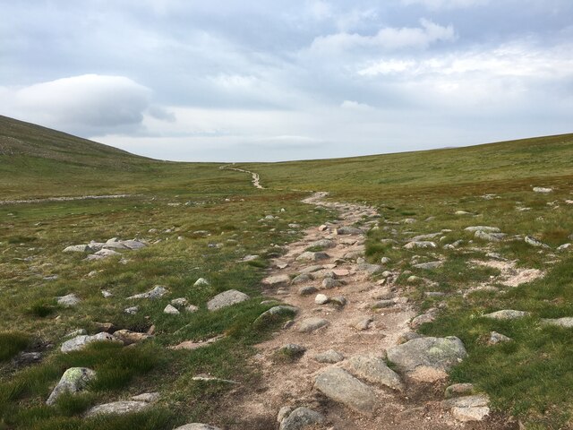
Central Gully Images

Images are sourced within 2km of 57.106684/-3.6632193 or Grid Reference NH9902. Thanks to Geograph Open Source API. All images are credited.

Path towards Coire Raibeirt
Path in Coire Raibeirt
Allt Coire Raibeirt
Allt Coire Raibeirt
Beach on Loch Avon
Beach on Loch Avon
Head of Loch Avon
Head of Loch Avon
Wind-blown snow, Cairn Gorm A little dry snow on the NE side of the summit plateau being picked up by vortices in a strong (50 - 60 mph) W wind. More localised examples are sometimes referred to as snow devils.
Wind-blown snow, Cairn Gorm
A little dry snow on the NE side of the summit plateau being picked up by vortices in a strong (50 - 60 mph) W wind. More localised examples are sometimes referred to as snow devils.
Cairn Gorm Summit An automated weather station on the summit of Cairn Gorm.
Cairn Gorm Summit
An automated weather station on the summit of Cairn Gorm.
Cairn Gorm from the car park
Jean's Hut, Coire an Lochain The hut was gifted by Dr Alasdair Smith in memory of his daughter, Jean, who was killed in a skiing accident. It was originally erected c.1951 in Coire Cas but moved to Coire an Lochain c.1964. It is no longer there having been removed in 1986.
Jean's Hut, Coire an Lochain
The hut was gifted by Dr Alasdair Smith in memory of his daughter, Jean, who was killed in a skiing accident. It was originally erected c.1951 in Coire Cas but moved to Coire an Lochain c.1964. It is no longer there having been removed in 1986.
Faicaill Ridge The ridge lies between Coire an t-Sneachda and Coire an Lochain.
Faicaill Ridge
The ridge lies between Coire an t-Sneachda and Coire an Lochain.
Allt Coire an Lochain
Path towards the Cairngorm plateau
Path towards Ben Macdui
Path, Coire Cas
Path, Coire Cas
Cairngorm plateau
Cairngorm plateau
View from Cairn Lochan Misty view down to Coire an Lochain.
View from Cairn Lochan
Misty view down to Coire an Lochain.
Cairngorm Plateau
Cairngorm Plateau
Show me another place!

Central Gully is located at Grid Ref: NH9902 (Lat: 57.106684, Lng: -3.6632193)

Unitary Authority: Highland

Police Authority: Highlands and Islands

What 3 Words

///pioneered.unicorns.slowness. Near Aviemore, Highland

Related Wikis

Coire an t-Sneachda

Coire an t-Sneachda (sometimes misspelled as Coire an t'Sneachda) is a glacial cirque or corrie landform in the Cairngorm or Am Monadh Ruadh mountain range...

Cairngorms

The Cairngorms (Scottish Gaelic: Am Monadh Ruadh) are a mountain range in the eastern Highlands of Scotland closely associated with the mountain Cairn...

Cairn Gorm

Cairn Gorm (Scottish Gaelic: An Càrn Gorm) is a mountain in the Scottish Highlands. It is part of the Cairngorms range and wider Grampian Mountains. With...

Cairngorm Plateau disaster

The Cairngorm Plateau disaster, also known as the Feith Buidhe disaster, occurred in November 1971 when six fifteen-year-old Edinburgh school students...

Nearby Amenities

Located within 500m of 57.106684,-3.6632193
Stob Coire an t-Sneachda
Ele: 1176
Natural: peak
Lat/Long: 57.1066883/-3.6590658
Coire an t-Sneachda
Place: locality
Wikidata: Q5141651
Wikipedia: en:Coire an t-Sneachda
Lat/Long: 57.1104768/-3.6644794
The data included in this document is from www.openstreetmap.org. The data is made available under ODbL.

Have you been to Central Gully?

Leave your review of Central Gully below (or comments, questions and feedback).