Glen Mavis

Valley in West Lothian

Scotland

Glen Mavis

An Overgrown Old Road, Bathgate This mysterious old road once went the short distance from Edinburgh Road to the other side of the railway line via a bridge, then petered out. The white house ahead sits on the far side of Edinburgh Road and the now demolished bridge is behind camera.
It appears on the first OS map of the 1850s, when both sides of the railway were farmland, so presumably it was there to allow the farmer(s) to move livestock across the railway. The current bridge buttresses look more modern though, which in itself isn't that unusual. However, since the road never really appears to have gone anywhere in particular, it seems a little odd that upgrades were made. In the 1890s the road is merely shown as a bridge, joining up with nothing on either side, and in the 1940s - its possible heyday - once South of the railway it turned into a track leading to sand pits.
An Overgrown Old Road, Bathgate Credit: Ian Dodds

Glen Mavis is a charming village located in West Lothian, Scotland. Situated in a picturesque valley, it offers breathtaking views of the surrounding countryside and is a serene haven away from the bustling city life. The village is nestled between the towns of Bathgate and Armadale, providing easy access to a range of amenities and services.

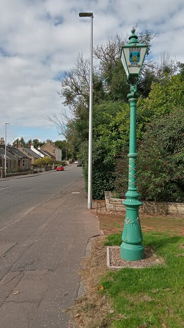
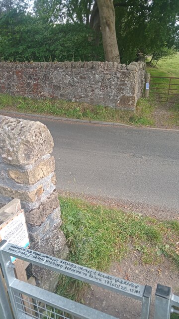
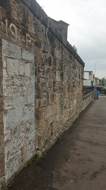
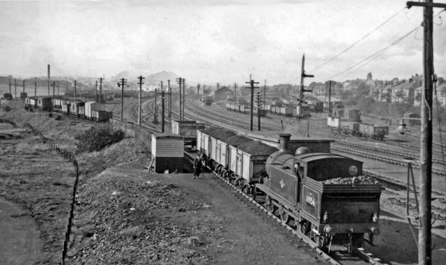
Glen Mavis is known for its rich history, dating back to the 18th century when it was primarily an agricultural community. Today, it retains much of its traditional charm with its well-preserved architecture and quaint cottages. The village is also home to a number of historical landmarks, including the Glen Mavis Viaduct, a striking railway bridge that adds to the village's character.

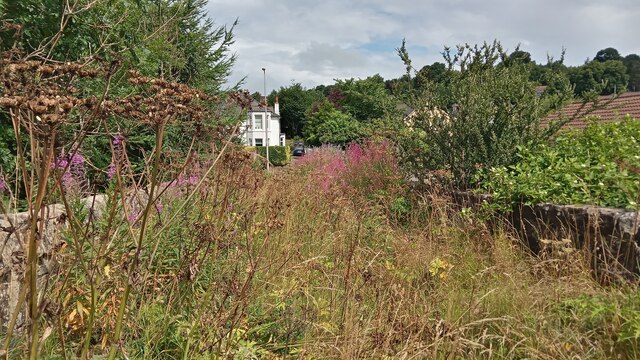
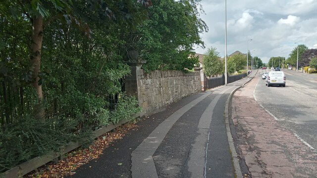
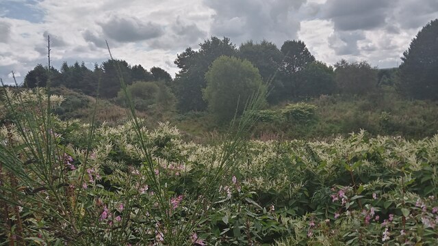
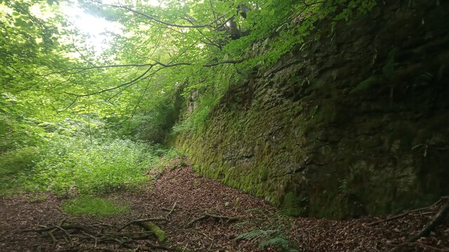
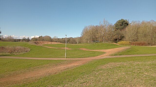
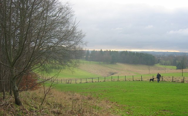
Nature enthusiasts will find Glen Mavis to be a paradise, as it is surrounded by stunning natural landscapes. The nearby Bathgate Hills and Pentland Hills offer numerous walking and hiking trails, allowing residents and visitors to explore the area's beauty. Additionally, the River Almond flows through the village, providing opportunities for fishing and other water activities.

Residents of Glen Mavis enjoy a close-knit community atmosphere, with various local events and activities bringing people together. The village has a primary school, ensuring convenient access to education for families with young children. While Glen Mavis itself is a peaceful retreat, it is within easy reach of larger towns and cities, making it an ideal location for those seeking a balance between rural tranquility and urban convenience.

In summary, Glen Mavis is a charming village in West Lothian, Scotland, offering stunning natural scenery, a rich history, and a close-knit community. Whether you are looking to explore the outdoors, immerse yourself in history, or simply enjoy a peaceful lifestyle, Glen Mavis has something to offer for everyone.

If you have any feedback on the listing, please let us know in the comments section below.
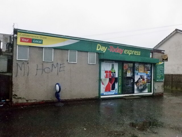
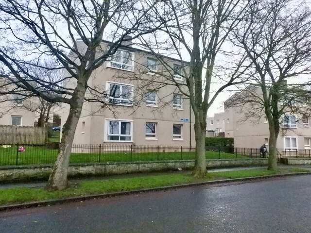
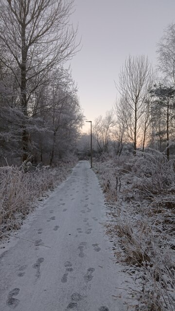
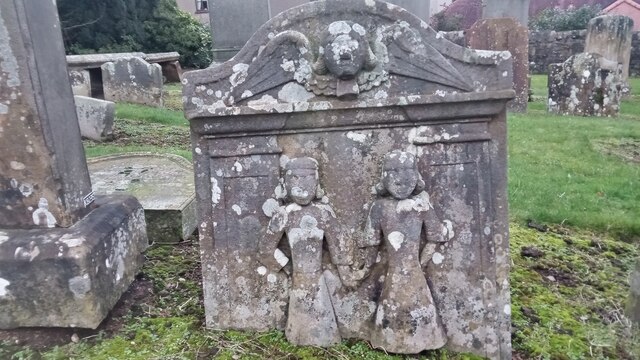
Glen Mavis Images

Images are sourced within 2km of 55.90955/-3.6321387 or Grid Reference NS9869. Thanks to Geograph Open Source API. All images are credited.

An Overgrown Old Road, Bathgate This mysterious old road once went the short distance from Edinburgh Road to the other side of the railway line via a bridge, then petered out. The white house ahead sits on the far side of Edinburgh Road and the now demolished bridge is behind camera.
It appears on the first OS map of the 1850s, when both sides of the railway were farmland, so presumably it was there to allow the farmer(s) to move livestock across the railway. The current bridge buttresses look more modern though, which in itself isn't that unusual. However, since the road never really appears to have gone anywhere in particular, it seems a little odd that upgrades were made. In the 1890s the road is merely shown as a bridge, joining up with nothing on either side, and in the 1940s - its possible heyday - once South of the railway it turned into a track leading to sand pits.
An Overgrown Old Road, Bathgate
This mysterious old road once went the short distance from Edinburgh Road to the other side of the railway line via a bridge, then petered out. The white house ahead sits on the far side of Edinburgh Road and the now demolished bridge is behind camera. It appears on the first OS map of the 1850s, when both sides of the railway were farmland, so presumably it was there to allow the farmer(s) to move livestock across the railway. The current bridge buttresses look more modern though, which in itself isn't that unusual. However, since the road never really appears to have gone anywhere in particular, it seems a little odd that upgrades were made. In the 1890s the road is merely shown as a bridge, joining up with nothing on either side, and in the 1940s - its possible heyday - once South of the railway it turned into a track leading to sand pits.
Last in a Series Of Short Fancy Walls I didn't count them, but I reckon there are six or seven of these short walls on the Edinburgh Road in Bathgate leading towards the town centre from the Guildiehaugh (or Tesco as it is now more usually called) Roundabout. They all have an identical form, though probably vary in length a bit from section to section - the walls are just over five feet high and are always flanked by posts with ball finials which go a couple of feet higher.
Hopefully one day there will be a wall website to clear up these mysteries but at present, sadly, us wall-spotters have nowhere to go! Usually, walls like this mark the boundary of an old estate or something similar, but that seems highly unlikely in this case. The ground  behind the wall descends steeply to the railway line. I mention this because of the gaps between the wall sections - not one of the gaps, as is often the case, could possibly have been there to provide access to anywhere. Furthermore, even if the ground was flat, the gaps are so regular that even then there could never have been a need for so many points of access.
Each wall section is joined by a slightly concave stretch of metal railings. They could be there because the wall fell down, but then again, if that was the case, would it not have been cheaper just to replace the wall as opposed to erecting fancy posts at each end of the surviving walls?
Back then though, sometimes price wasn't a problem - life was tougher, but people expected things to look nicer, if it came from their taxes. In contrast the recent electrification of the railway lines has led to hundreds of ugly identikit concrete bridges everywhere round here, an architectural disaster in my book.
The wall is still a mystery though - before the railway came it was mainly farmland round here.
Last in a Series Of Short Fancy Walls
I didn't count them, but I reckon there are six or seven of these short walls on the Edinburgh Road in Bathgate leading towards the town centre from the Guildiehaugh (or Tesco as it is now more usually called) Roundabout. They all have an identical form, though probably vary in length a bit from section to section - the walls are just over five feet high and are always flanked by posts with ball finials which go a couple of feet higher. Hopefully one day there will be a wall website to clear up these mysteries but at present, sadly, us wall-spotters have nowhere to go! Usually, walls like this mark the boundary of an old estate or something similar, but that seems highly unlikely in this case. The ground behind the wall descends steeply to the railway line. I mention this because of the gaps between the wall sections - not one of the gaps, as is often the case, could possibly have been there to provide access to anywhere. Furthermore, even if the ground was flat, the gaps are so regular that even then there could never have been a need for so many points of access. Each wall section is joined by a slightly concave stretch of metal railings. They could be there because the wall fell down, but then again, if that was the case, would it not have been cheaper just to replace the wall as opposed to erecting fancy posts at each end of the surviving walls? Back then though, sometimes price wasn't a problem - life was tougher, but people expected things to look nicer, if it came from their taxes. In contrast the recent electrification of the railway lines has led to hundreds of ugly identikit concrete bridges everywhere round here, an architectural disaster in my book. The wall is still a mystery though - before the railway came it was mainly farmland round here.
Provost Lamp, Marjoribanks Street This old lamp has stood here for the last 30 years or so, save for a brief period a couple of years back when it was taken away to get tarted up a bit, and modified so it could once again be hooked up to the electricity. In days gone by it used to move about more regularly. The Provost of Bathgate used to have the honour of having the lamp positioned directly in front of his house, and it moved from place to place over time accordingly.
A provost is loosely the equivalent of a mayor in England, though the title seems to have become more ceremonial as time has gone on. Bathgate was a Burgh Council  - this meant it had a certain amount of autonomy in running its own affairs - until everything to do with local administration was shook up in Scotland in the mid 1970s. All its powers were then subsumed into West Lothian Council, which itself still has a provost, along with about two-thirds of Scotland's other local council areas.
The coat of arms adorning the lamp is fanciful in the extreme. There is no disputing that Bathgate once had a castle, but it is generally thought to have been uninhabited since the early 1300s, and a report of the late 1700s states that there wasn't a stone of it left at the time. Then, as now, it was a small unimpressive mound; it is currently located in the middle of Bathgate Golf Course.
The flag in between the two Saltires is supposedly that of a family who lived in the castle several hundreds of years ago. The water seems to arise from artistic license, as the moat was tiny, and there are - and were - only smallish ponds in the area, but these are quite a distance away. The uninspiring and meaningless Latin motto translates as : 'The common good between the walls'.
While it is perfectly fine in my book to retain the lamp in its original state, I would hope that, should there ever be a need for coats of arms here in the future, this lazy heraldry gets replaced. Quicksmart!
Provost Lamp, Marjoribanks Street
This old lamp has stood here for the last 30 years or so, save for a brief period a couple of years back when it was taken away to get tarted up a bit, and modified so it could once again be hooked up to the electricity. In days gone by it used to move about more regularly. The Provost of Bathgate used to have the honour of having the lamp positioned directly in front of his house, and it moved from place to place over time accordingly. A provost is loosely the equivalent of a mayor in England, though the title seems to have become more ceremonial as time has gone on. Bathgate was a Burgh Council - this meant it had a certain amount of autonomy in running its own affairs - until everything to do with local administration was shook up in Scotland in the mid 1970s. All its powers were then subsumed into West Lothian Council, which itself still has a provost, along with about two-thirds of Scotland's other local council areas. The coat of arms adorning the lamp is fanciful in the extreme. There is no disputing that Bathgate once had a castle, but it is generally thought to have been uninhabited since the early 1300s, and a report of the late 1700s states that there wasn't a stone of it left at the time. Then, as now, it was a small unimpressive mound; it is currently located in the middle of Bathgate Golf Course. The flag in between the two Saltires is supposedly that of a family who lived in the castle several hundreds of years ago. The water seems to arise from artistic license, as the moat was tiny, and there are - and were - only smallish ponds in the area, but these are quite a distance away. The uninspiring and meaningless Latin motto translates as : 'The common good between the walls'. While it is perfectly fine in my book to retain the lamp in its original state, I would hope that, should there ever be a need for coats of arms here in the future, this lazy heraldry gets replaced. Quicksmart!
Some Wild Land in Bathgate In between the vast new housing delevopment at Wester Inch and Bathgate Golf Course is quite a bit of wild and fairly scrubby land. A vast network of (mostly interlinking) tracks and paths - hugely confusing to everybody except the local dog-walkers - runs through most of it, particularly at the Western end.
Up-to-date maps, of all scales, wrongly show a track running through the length of the golf course. In reality these are often just short walkways between holes; to get from the far end of the course to the clubhouse a good few fairways have to be negotiated.
Local foragers should note that there were plenty of blackberries available to enjoy at this spot!
Some Wild Land in Bathgate
In between the vast new housing delevopment at Wester Inch and Bathgate Golf Course is quite a bit of wild and fairly scrubby land. A vast network of (mostly interlinking) tracks and paths - hugely confusing to everybody except the local dog-walkers - runs through most of it, particularly at the Western end. Up-to-date maps, of all scales, wrongly show a track running through the length of the golf course. In reality these are often just short walkways between holes; to get from the far end of the course to the clubhouse a good few fairways have to be negotiated. Local foragers should note that there were plenty of blackberries available to enjoy at this spot!
Interesting and Worrying Writing on Gate This gate is one of two leading into the Petershill Wildlife Reserve just North of Bathgate. The writing on the top of the gate says:
AGGRESSIVE OLD MAN IN(?) BLUE BERGHAUS JACKET & BLONDE LABRADOR BITING PEOPLE AND CHASING WILDLIFE REPORTED TO POLICE 17/04/22 12PM
Apart from never having seen anything like this on a metal gate before, two things struck me - (1) The writer used all the space available but never looked like running out of gate, and  (2) To own an aggressive labrador you must surely be some kind of psychopath - luckily he was unarmed!
Interesting and Worrying Writing on Gate
This gate is one of two leading into the Petershill Wildlife Reserve just North of Bathgate. The writing on the top of the gate says: AGGRESSIVE OLD MAN IN(?) BLUE BERGHAUS JACKET & BLONDE LABRADOR BITING PEOPLE AND CHASING WILDLIFE REPORTED TO POLICE 17/04/22 12PM Apart from never having seen anything like this on a metal gate before, two things struck me - (1) The writer used all the space available but never looked like running out of gate, and (2) To own an aggressive labrador you must surely be some kind of psychopath - luckily he was unarmed!
The Hidden Part of Petershill Reserve Petershill Wildlife Reserve occupies most of the site of a former limestone quarry. The bit on the left of the very steep road leading North from Bathgate has two gates and is mostly situated where two former reservoirs had been created from the quarry ponds. The bit on the right of the road caught my attention because of the steep drops down from the stone wall that runs alongside the road, and the lack of any obvious water down below.
There is a stone wall surrounding this sunken area - broken in a few places, with the usual agricultural makeshift defences in place to avoid the rescuing of livestock.
I discovered upon my return that this bit was once part of the quarry too . The stone face pictured isn't actually a part of the perimeter wall as I, disoriented as usual, had initially thought, but is further South. Old maps, at the time of the reservoirs simply denote it as pond (with an area of 0.24 acres). Presumably this was drained at the same time the reservoirs were - in the 1980s. I am always intrigued as to how they manage to drain places that have turned into ponds and lakes, considering that the bodies of water  have formed due to the ground having been excavated to the bedrock. Anyway, all that remains of the pond today  is a big muddy puddle.
And this is actually a part of the Scottish Wildlife Trust managed reserve, they just don't tell anybody.
The Hidden Part of Petershill Reserve
Petershill Wildlife Reserve occupies most of the site of a former limestone quarry. The bit on the left of the very steep road leading North from Bathgate has two gates and is mostly situated where two former reservoirs had been created from the quarry ponds. The bit on the right of the road caught my attention because of the steep drops down from the stone wall that runs alongside the road, and the lack of any obvious water down below. There is a stone wall surrounding this sunken area - broken in a few places, with the usual agricultural makeshift defences in place to avoid the rescuing of livestock. I discovered upon my return that this bit was once part of the quarry too . The stone face pictured isn't actually a part of the perimeter wall as I, disoriented as usual, had initially thought, but is further South. Old maps, at the time of the reservoirs simply denote it as pond (with an area of 0.24 acres). Presumably this was drained at the same time the reservoirs were - in the 1980s. I am always intrigued as to how they manage to drain places that have turned into ponds and lakes, considering that the bodies of water have formed due to the ground having been excavated to the bedrock. Anyway, all that remains of the pond today is a big muddy puddle. And this is actually a part of the Scottish Wildlife Trust managed reserve, they just don't tell anybody.
Philip Avenue, Boghall
Convenience store, Philip Avenue
Philip Avenue, Boghall
Old Footsteps in the Snow Although these footsteps look recent it is certain that they are at least three, but perhaps four days old. Snow first fell in this part of Scotland at around 5am on the Saturday before the Wednesday this picture was taken. There were further small flurries throughout Saturday and Sunday and it has since grown increasingly colder, turning the snow into ice. I like to think that these footsteps were made by people starting and finishing their shifts at the nearby Morrisons supermarket during the first snowfall, but obviously have nothing to base this on!
This tarmacked path is part of the National Cycle Route 75, and this section links two supermarket car parks - Tesco and Morrisons - and must be about a mile and a half long. The bit pictured is marked as a track on a 1960s OS map; the section immediately South of here, behind camera, roughly follows the route of an old railway spur that used to transport coal from a colliery in Blackburn to a long-gone station, Bathgate Lower.
Old Footsteps in the Snow
Although these footsteps look recent it is certain that they are at least three, but perhaps four days old. Snow first fell in this part of Scotland at around 5am on the Saturday before the Wednesday this picture was taken. There were further small flurries throughout Saturday and Sunday and it has since grown increasingly colder, turning the snow into ice. I like to think that these footsteps were made by people starting and finishing their shifts at the nearby Morrisons supermarket during the first snowfall, but obviously have nothing to base this on! This tarmacked path is part of the National Cycle Route 75, and this section links two supermarket car parks - Tesco and Morrisons - and must be about a mile and a half long. The bit pictured is marked as a track on a 1960s OS map; the section immediately South of here, behind camera, roughly follows the route of an old railway spur that used to transport coal from a colliery in Blackburn to a long-gone station, Bathgate Lower.
Eye-catching grave, Old Bathgate Parish Churchyard This gravestone is pictured a few times online, but the only thing written about it anywhere is on the always-informative UndiscoveredScotland site. Underneath a picture of it, it says 'Adam and Eve Stone', and that's it. Had I not come across the description, though, I would have assumed it was commemorating the death of a child (who might possibly have been pictured holding the hand of a sibling/twin to indicate that they would both be reunited in heaven), or worse still, the death of two children at the same time. Although to our eyes today the figures look like two girls, in earlier times there wasn't often much difference between the depiction of males and females on gravestones.
If it is an Adam and Eve grave it is very crudely done as there is no tree or serpent present. Christianity's symbolism is often quite confusing; even the experts don't seem too sure if Adam and Eve are meant to represent the purity of heaven, tying in with the Garden of Eden's perfection before the forbidden fruit was eaten, or whether they are there to deliver a stern warning to people to stay on the path of righteousness.
The whole Adam and Eve story doesn't make that much sense really anyway. Why was it called 'The Tree of Good and Bad', and not just 'The Tree of Bad'? They must surely have eaten good things off good trees before that serpent came along with his tempting words?
Eye-catching grave, Old Bathgate Parish Churchyard
This gravestone is pictured a few times online, but the only thing written about it anywhere is on the always-informative UndiscoveredScotland site. Underneath a picture of it, it says 'Adam and Eve Stone', and that's it. Had I not come across the description, though, I would have assumed it was commemorating the death of a child (who might possibly have been pictured holding the hand of a sibling/twin to indicate that they would both be reunited in heaven), or worse still, the death of two children at the same time. Although to our eyes today the figures look like two girls, in earlier times there wasn't often much difference between the depiction of males and females on gravestones. If it is an Adam and Eve grave it is very crudely done as there is no tree or serpent present. Christianity's symbolism is often quite confusing; even the experts don't seem too sure if Adam and Eve are meant to represent the purity of heaven, tying in with the Garden of Eden's perfection before the forbidden fruit was eaten, or whether they are there to deliver a stern warning to people to stay on the path of righteousness. The whole Adam and Eve story doesn't make that much sense really anyway. Why was it called 'The Tree of Good and Bad', and not just 'The Tree of Bad'? They must surely have eaten good things off good trees before that serpent came along with his tempting words?
Short cycle track Depending on which large-scale online map you go to, this part of the oddly named 'Park of Peace' at the NorthWest edge of Bathgate (more research is required here, but I think the name has something to do with the fact that there are some war memorials within the park) is either broadly described as a play area, or specifically described as a 'cycle racing facility'.
It is obviously designed with fun in mind as, despite the bumps and berms, it is downhill all the way. However, the starting point and finishing point must only be 50 feet apart. So why not join them up, thereby facilitating (pun intended) proper races over several laps. As every true fan of cycling knows, it is the uphill struggles that are the most exciting. There is a vague grassy route between the two ends but it is obviously not designed to be ridden up.
I passed by on the first proper T-Shirt day of spring. Therefore all the targeted users were just drinking and socializing. Good on 'em - I have to admit I felt  twinge of jealousy!
Short cycle track
Depending on which large-scale online map you go to, this part of the oddly named 'Park of Peace' at the NorthWest edge of Bathgate (more research is required here, but I think the name has something to do with the fact that there are some war memorials within the park) is either broadly described as a play area, or specifically described as a 'cycle racing facility'. It is obviously designed with fun in mind as, despite the bumps and berms, it is downhill all the way. However, the starting point and finishing point must only be 50 feet apart. So why not join them up, thereby facilitating (pun intended) proper races over several laps. As every true fan of cycling knows, it is the uphill struggles that are the most exciting. There is a vague grassy route between the two ends but it is obviously not designed to be ridden up. I passed by on the first proper T-Shirt day of spring. Therefore all the targeted users were just drinking and socializing. Good on 'em - I have to admit I felt twinge of jealousy!
Doorway painted on a wall This is one of two. There is one behind camera exactly the same size which has '20 P' above it. They were painted in the 1990s to mark the former entrances to air raid shelters that were dug out of the banking behind the wall. There is a plaque nearby which says that it is all connected to 50th anniversary VE Day goings-on, and the writing above the imaginary lintels denotes how many people each air raid shelter could accommodate. The plaque also mentions that Challenge Anneka, a popular TV programme back then, filmed here at the time and that the challenge had something to do with relocating a war memorial. Whether the presenter, Anneka Rice, ever did a piece about the air raid shelters, or was filmed in front of them, is not mentioned.
Considering that Bathgate has (and also had during the war) a population of several thousand I should hope that there were a few more dotted about and that these two were highlighted due to their central location, on Bathgate's main road. Thankfully they were never really needed. The plaque states that only one bomb fell on Bathgate in World War Two and didn't explode. For those that know the area it fell on the West side of Whitburn Road, on the ground now occupied by the big surgery just up from Morrisons supermarket.
Doorway painted on a wall
This is one of two. There is one behind camera exactly the same size which has '20 P' above it. They were painted in the 1990s to mark the former entrances to air raid shelters that were dug out of the banking behind the wall. There is a plaque nearby which says that it is all connected to 50th anniversary VE Day goings-on, and the writing above the imaginary lintels denotes how many people each air raid shelter could accommodate. The plaque also mentions that Challenge Anneka, a popular TV programme back then, filmed here at the time and that the challenge had something to do with relocating a war memorial. Whether the presenter, Anneka Rice, ever did a piece about the air raid shelters, or was filmed in front of them, is not mentioned. Considering that Bathgate has (and also had during the war) a population of several thousand I should hope that there were a few more dotted about and that these two were highlighted due to their central location, on Bathgate's main road. Thankfully they were never really needed. The plaque states that only one bomb fell on Bathgate in World War Two and didn't explode. For those that know the area it fell on the West side of Whitburn Road, on the ground now occupied by the big surgery just up from Morrisons supermarket.
A North British 'Glen' 4-4-0 at Bathgate Locomotive Depot View  northward, just east of Bathgate Upper station, which was then on the ex-NB Edinburgh - Bathgate - Glasgow secondary line. Passenger services had ceased in 1956, so the Depot was then (1962) only servicing freight locomotives and had become mainly a dump for withdrawn engines: this D34, No. 62484 'Glen Lyon', had been condemned in 11/61, nearly a year before the photograph.
A North British 'Glen' 4-4-0 at Bathgate Locomotive Depot
View northward, just east of Bathgate Upper station, which was then on the ex-NB Edinburgh - Bathgate - Glasgow secondary line. Passenger services had ceased in 1956, so the Depot was then (1962) only servicing freight locomotives and had become mainly a dump for withdrawn engines: this D34, No. 62484 'Glen Lyon', had been condemned in 11/61, nearly a year before the photograph.
Condemned ex-NB 0-6-0 dumped with many other locomotives at Bathgate View NE, in a dump on the Edinburgh side of Bathgate (Upper) station on the ex-North British subsidiary Edinburgh - Glasgow line. This was one of about 25 withdrawn Scottish Region engines at that site awaiting disposal in September 1962; ex-NB Reid J35 0-6-0 No. 64479. Note the tender-cab, fitted for protection of the crew when running backwards in bad weather. (See also <a href="https://www.geograph.org.uk/photo/2328735">NS9768 : A North British 'Glen' 4-4-0 at Bathgate Locomotive Depot</a>).
Condemned ex-NB 0-6-0 dumped with many other locomotives at Bathgate
View NE, in a dump on the Edinburgh side of Bathgate (Upper) station on the ex-North British subsidiary Edinburgh - Glasgow line. This was one of about 25 withdrawn Scottish Region engines at that site awaiting disposal in September 1962; ex-NB Reid J35 0-6-0 No. 64479. Note the tender-cab, fitted for protection of the crew when running backwards in bad weather. (See also NS9768 : A North British 'Glen' 4-4-0 at Bathgate Locomotive Depot).
Shunting operations in the marshalling yard at Bathgate View NW, towards Bathgate (Upper), Airdrie and Glasgow; ex-North British Edinburgh - Bathgate - Glasgow line (closed to passengers 1956, reopened throughout in 2010). The locomotive shunting is ex-NB N15 0-6-2T No. 69156, with plenty of traffic in the Yard.
Shunting operations in the marshalling yard at Bathgate
View NW, towards Bathgate (Upper), Airdrie and Glasgow; ex-North British Edinburgh - Bathgate - Glasgow line (closed to passengers 1956, reopened throughout in 2010). The locomotive shunting is ex-NB N15 0-6-2T No. 69156, with plenty of traffic in the Yard.
The Steelyard, Bathgate View across the plaza called The Steelyard in Bathgate, with the spire of St David's church on George Street showing above the roofs of the shops on King's Street.  Built in 1904, the church is now used for some commercial purpose.  See also close-up shot at <a href="https://www.geograph.org.uk/photo/2627742">NS9768 : Belltower of St David's, Bathgate</a>.
The Steelyard, Bathgate
View across the plaza called The Steelyard in Bathgate, with the spire of St David's church on George Street showing above the roofs of the shops on King's Street. Built in 1904, the church is now used for some commercial purpose. See also close-up shot at NS9768 : Belltower of St David's, Bathgate.
Show me another place!

Glen Mavis is located at Grid Ref: NS9869 (Lat: 55.90955, Lng: -3.6321387)

Unitary Authority: West Lothian

Police Authority: The Lothians and Scottish Borders

What 3 Words

///rinsed.tadpole.currently. Near Bathgate, West Lothian

Related Wikis

Balbardie House

Balbardie House was an 18th-century Scottish mansion house in West Lothian, Scotland, near to the town of Bathgate. == History == The house stood on the...

Ballencrieff, West Lothian

Ballencrieff is a settlement in West Lothian, Scotland, situated equidistant between the towns of Bathgate and Torphichen and seven miles south of Linlithgow...

Bathgate

Bathgate (Scots: Bathket or Bathkit, Scottish Gaelic: Both Chèit) is a town in West Lothian, Scotland, 5 miles (8 km) west of Livingston and adjacent to...

Mill Park, Bathgate

Mill Park was a football ground in Bathgate, Scotland. It was the home ground of Bathgate F.C. from 1902 until they folded in 1938. == History == Bathgate...

Nearby Amenities

Located within 500m of 55.90955,-3.6321387
Turning Circle
Lat/Long: 55.9087332/-3.6346502
Barrier: bollard
Bicycle: yes
Foot: yes
Lat/Long: 55.9062017/-3.6370892
Bench
Backrest: yes
Colour: black
Material: metal
Lat/Long: 55.9110025/-3.6386706
Post Box
Collection Times: Mo-Fr 09:00; Sa 07:00
Operator: Royal Mail
Post Box Type: pillar
Ref: EH48 11D
Royal Cypher: scottish_crown
Lat/Long: 55.905447/-3.6324401
Post Box
Collection Times: Mo-Fr 09:00; Sa 07:00
Operator: Royal Mail
Post Box Type: pillar
Ref: EH48 12D
Royal Cypher: GVIR
Royal Cypher Wikidata: Q33102169
Lat/Long: 55.9065446/-3.6367056
Barrier: kissing_gate
Lat/Long: 55.9077012/-3.6250967
Barrier: kissing_gate
Lat/Long: 55.9073157/-3.6260885
Barrier: stile
Bicycle: no
Foot: yes
Horse: no
Motor Vehicle: no
Lat/Long: 55.9072648/-3.6372749
Shelter
Lat/Long: 55.9072512/-3.6382888
Waste Basket
Waste: dog_excrement
Lat/Long: 55.9053528/-3.6323859
Power: pole
Lat/Long: 55.9063399/-3.6269683
Power: pole
Lat/Long: 55.9055611/-3.6287348
Power: pole
Lat/Long: 55.9127899/-3.6368239
Power: pole
Lat/Long: 55.9120987/-3.6369093
Power: pole
Lat/Long: 55.9113877/-3.6370093
Power: pole
Lat/Long: 55.9107187/-3.6371072
Golf: pin
Lat/Long: 55.909722/-3.6386959
Golf: pin
Lat/Long: 55.9103475/-3.639394
Waste Basket
Waste: dog_excrement
Lat/Long: 55.9073482/-3.6260892
The data included in this document is from www.openstreetmap.org. The data is made available under ODbL.

Have you been to Glen Mavis?

Leave your review of Glen Mavis below (or comments, questions and feedback).