Ceunant y Gwylliaid

Valley in Montgomeryshire

Wales

Ceunant y Gwylliaid

Minor road in Cwm Twrch
Minor road in Cwm Twrch Credit: Steven Brown

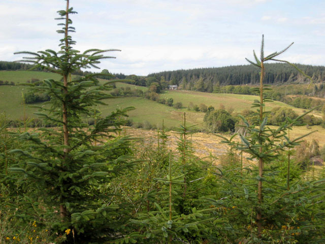
Ceunant y Gwylliaid, also known as Ceunant Gwylliaid, is a picturesque valley located in Montgomeryshire, Wales. Nestled amidst the rolling hills and lush countryside, the valley is renowned for its natural beauty and rich history.

The name "Ceunant y Gwylliaid" translates to "Valley of the Gwylliaid" in English, referring to the mythical Welsh tribe said to have once inhabited the area. The valley is characterized by its deep gorge, formed by the cascading waters of the Afon Ceunant River, which flows through the valley, creating stunning waterfalls along the way.

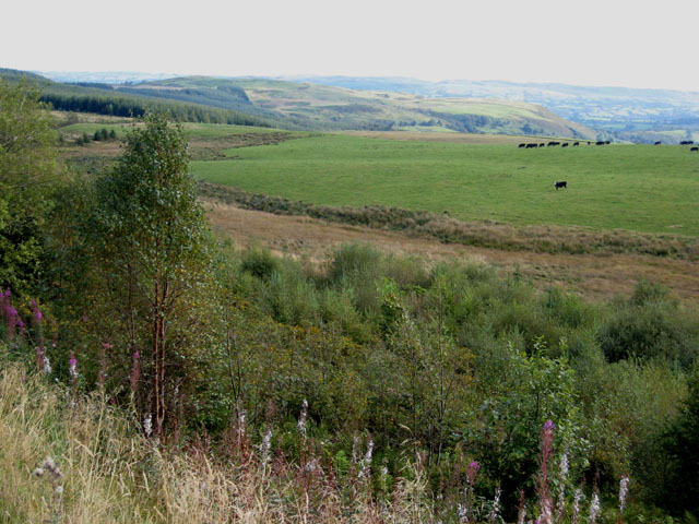
The flora and fauna in Ceunant y Gwylliaid are diverse and abundant, with a variety of plant species, including rare ferns and mosses, thriving in the damp and sheltered conditions of the valley. The valley is also home to an array of wildlife, such as otters, badgers, and a wide range of bird species, making it a haven for nature enthusiasts and birdwatchers.

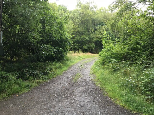
Visitors to Ceunant y Gwylliaid can explore the valley by following the well-maintained footpaths that wind through the ancient woodlands and alongside the river. These paths offer breathtaking views of the waterfalls and the surrounding hills, providing a perfect setting for hiking and photography.

Additionally, the valley boasts historical significance, with remnants of ancient settlements and prehistoric remains scattered throughout the area. Archaeological sites, including burial mounds and standing stones, offer glimpses into the valley's past and its connection to early human habitation.

Overall, Ceunant y Gwylliaid is a truly enchanting destination, where visitors can immerse themselves in the beauty of nature while uncovering the mysteries of its historical heritage.

If you have any feedback on the listing, please let us know in the comments section below.

Ceunant y Gwylliaid Images

Images are sourced within 2km of 52.716485/-3.5149156 or Grid Reference SH9714. Thanks to Geograph Open Source API. All images are credited.

Minor road in Cwm Twrch
Gravel road towards Dyfnant Forest
Minor road towards Foel
Tryfel Stones prehistoric stone row A double stone row measuring 10m long, including 16 mainly small and some medium-sized stones.  The row is orientated north to south and leads down slope from a cairn at the northern end. <span class="nowrap"><a title="https://stonerows.wordpress.com/gazetteer/region/mid-wales/tryfel-stones/" rel="nofollow ugc noopener" href="https://stonerows.wordpress.com/gazetteer/region/mid-wales/tryfel-stones/">Link</a><img style="margin-left:2px;" alt="External link" title="External link - shift click to open in new window" src="https://s1.geograph.org.uk/img/external.png" width="10" height="10"/></span>
Tryfel Stones prehistoric stone row
A double stone row measuring 10m long, including 16 mainly small and some medium-sized stones. The row is orientated north to south and leads down slope from a cairn at the northern end. LinkExternal link
Pen-y-coed "It rains a lot in Wales" is not good enough for the Environment Agency; they want it quantified. So they have created this rainfall measurement station (gorsaf mesur glaw) in the valley of Afon Twrch. The two rain gauges presumably connect to the green portaloo sized hut which relays the data back to base. [First image for this hectad - being the last non-coastal hectad in England and Wales to have images posted.]
Pen-y-coed
"It rains a lot in Wales" is not good enough for the Environment Agency; they want it quantified. So they have created this rainfall measurement station (gorsaf mesur glaw) in the valley of Afon Twrch. The two rain gauges presumably connect to the green portaloo sized hut which relays the data back to base. [First image for this hectad - being the last non-coastal hectad in England and Wales to have images posted.]
Afon Twrch After heavy rain this bridge becomes a ford.
Afon Twrch
After heavy rain this bridge becomes a ford.
Cwm Twrch One of countless disused and derelict chapels in Wales.
Cwm Twrch
One of countless disused and derelict chapels in Wales.
Road from Pen y Coed down to the Afon Twrch A very rough and stony road, despite being "yellow" on the map.
Road from Pen y Coed down to the Afon Twrch
A very rough and stony road, despite being "yellow" on the map.
Cattle grid in the valley of the Afon Twrch Remote valley to the south-west of Lake Vyrnwy.
Cattle grid in the valley of the Afon Twrch
Remote valley to the south-west of Lake Vyrnwy.
Afon Twrch A tributary of the Afon Banwy.
Afon Twrch
A tributary of the Afon Banwy.
Old style telephone box in Cwm Twrch The old style telephone boxes have often been retained in remote areas. Personally, I am not one to appreciate its supposed charm relative to the new model.
Old style telephone box in Cwm Twrch
The old style telephone boxes have often been retained in remote areas. Personally, I am not one to appreciate its supposed charm relative to the new model.
A good crop of rowan berries, Cwm Twrch Near Pen-y-coed in a remote valley off the Banwy valley.
A good crop of rowan berries, Cwm Twrch
Near Pen-y-coed in a remote valley off the Banwy valley.
Edge of Dyfnant Forest Forest gives way to farmland above the Banwy valley.
Edge of Dyfnant Forest
Forest gives way to farmland above the Banwy valley.
Field and fence in the Twrch valley
Rural crossroads This is a crossroads, with the drivable road going from north to west; the other two arms are muddy tracks.
Rural crossroads
This is a crossroads, with the drivable road going from north to west; the other two arms are muddy tracks.
Welsh hill farm I avoided shin-deep mud at the entrance to this field by a traverse along a gate. The sweeping views of hill farmland are what Wales is all about.
Welsh hill farm
I avoided shin-deep mud at the entrance to this field by a traverse along a gate. The sweeping views of hill farmland are what Wales is all about.
Across the moors towards Bryniau from point 390m Although it's unmarked on the 1:50,000 map, the larger scale map shows a spot height of 390m here, which appears to be the snow-covered lump just left of centre in the picture. It proved really tough ground to walk in the conditions - knee-deep snow covering soft tussock grass, through which every footstep broke, leaving me with frozen trousers and boots full of snow. How we suffer for our geographing...
Across the moors towards Bryniau from point 390m
Although it's unmarked on the 1:50,000 map, the larger scale map shows a spot height of 390m here, which appears to be the snow-covered lump just left of centre in the picture. It proved really tough ground to walk in the conditions - knee-deep snow covering soft tussock grass, through which every footstep broke, leaving me with frozen trousers and boots full of snow. How we suffer for our geographing...
Show me another place!

Ceunant y Gwylliaid is located at Grid Ref: SH9714 (Lat: 52.716485, Lng: -3.5149156)

Unitary Authority: Powys

Police Authority: Dyfed Powys

What 3 Words

///extra.duties.towel. Near Llangadfan, Powys

Related Wikis

Dyfnant Forest

Dyfnant Forest is a remote forest in northeastern-central Powys, Wales. == Location == Dyfnant Forest lies to the west of the B4395 road, a road which...

Llangadfan

Llangadfan is a small village in Powys, Wales, based in the community of Banwy. The village lies on the A458 between Foel and Llanerfyl, 12 kilometres...

Llwydiarth

Llwydiarth is a small village in Powys, Wales. It is located near Lake Vyrnwy. The village is mostly made up of a caravan park and holiday centre. It does...

Llanwddyn

Llanwddyn () is a village and community in Montgomeryshire, Powys, Wales. The community is centred on the Lake Vyrnwy reservoir. The original Llanwddyn...

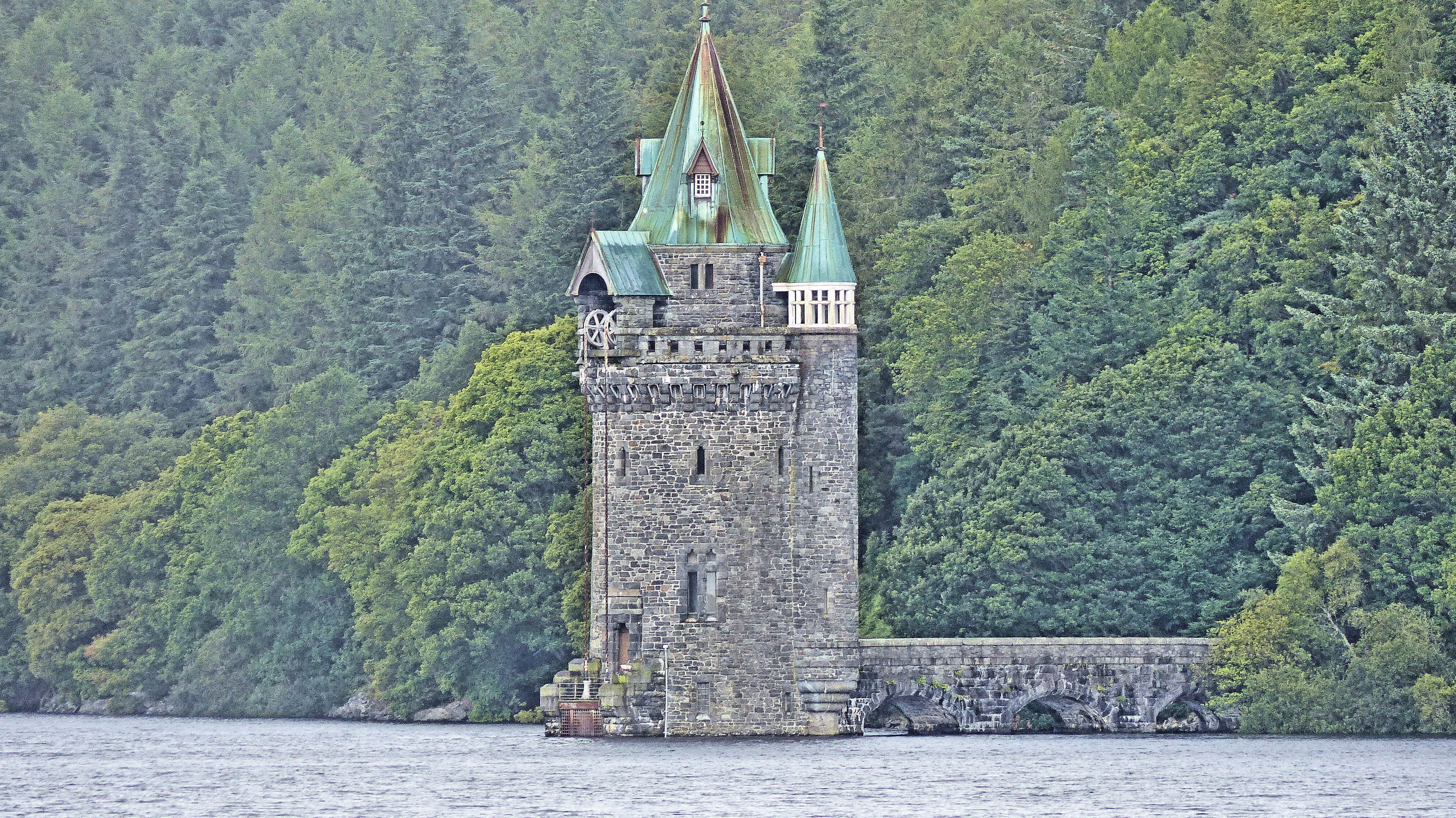
Lake Vyrnwy Straining Tower

The Straining Tower at Lake Vyrnwy is an intake tower built to extract water from the lake. The tower stands on the north shore of Lake Vyrnwy, near the...
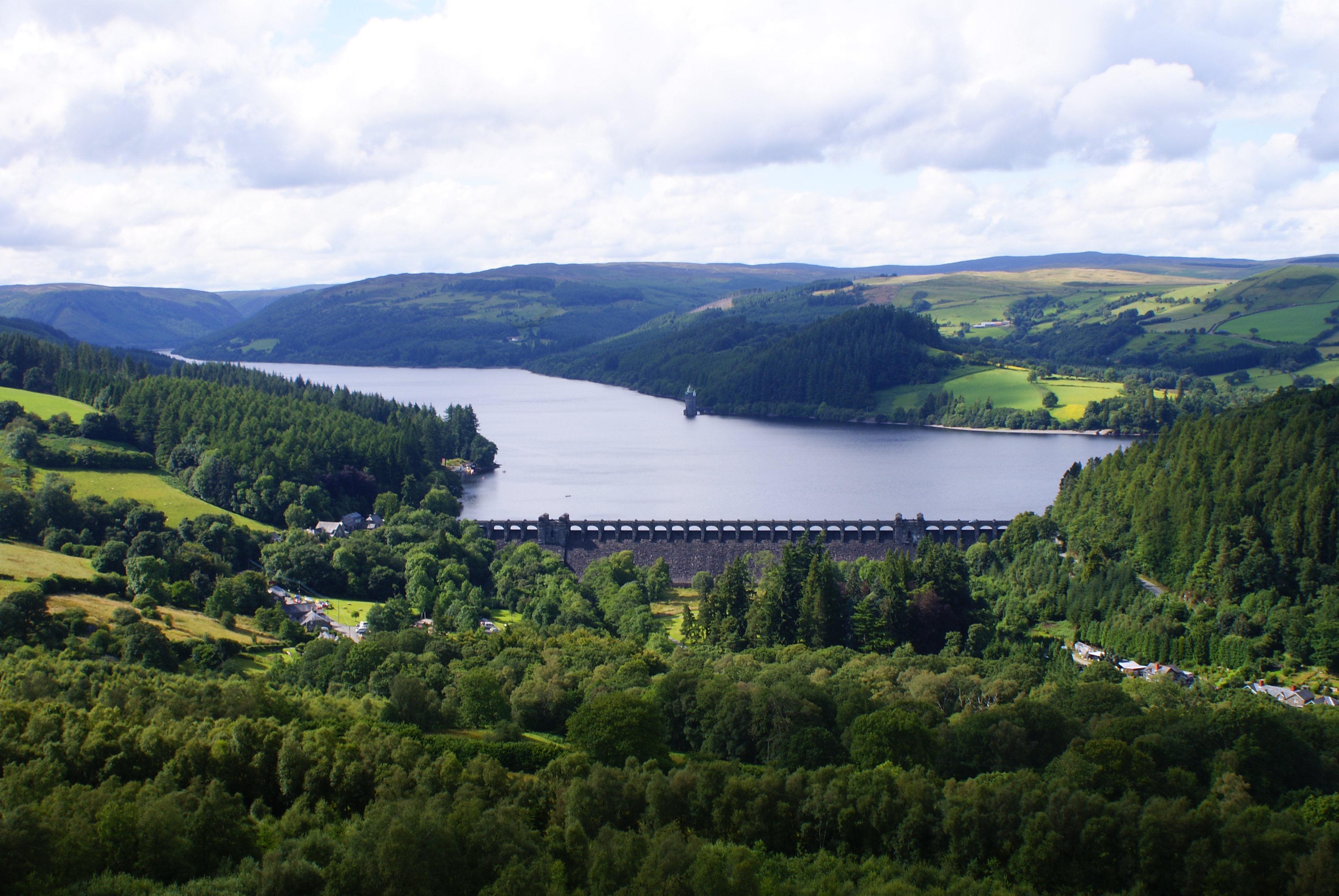
Lake Vyrnwy

Lake Vyrnwy (Welsh: Llyn Efyrnwy, pronounced [ɛˈvərnʊɨ] or Llyn Llanwddyn) is a reservoir in Powys, Wales, built in the 1880s for Liverpool Corporation...

Abertridwr, Powys

Abertridwr () is a small village in the historic county of Montgomeryshire in the north of Powys and close to Lake Vyrnwy in the community (civil parish...

Llanerfyl

Llanerfyl is a village and community in Montgomeryshire, Powys, Wales. Located near the River Banwy, the community includes the village of Llanerfyl, several...

Nearby Amenities

Located within 500m of 52.716485,-3.5149156
Place: farm
Lat/Long: 52.7186782/-3.5144868
SK53 Solar: missing_building
Building: yes
Fixme: building area needed
Lat/Long: 52.7186998/-3.5147586
Direction: SSW
Generator Method: photovoltaic
Generator Output Electricity: yes
Generator Solar Modules: 16
Generator Source: solar
Generator Type: solar_photovoltaic_panel
Location: roof
Power: generator
Lat/Long: 52.7185779/-3.5148829
The data included in this document is from www.openstreetmap.org. The data is made available under ODbL.

Have you been to Ceunant y Gwylliaid?

Leave your review of Ceunant y Gwylliaid below (or comments, questions and feedback).