Cwm y Plant

Valley in Montgomeryshire

Wales

Cwm y Plant

Minor road near Clatter
Minor road near Clatter Credit: Steven Brown

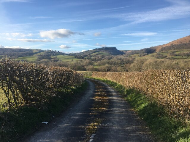
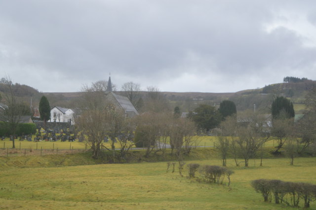
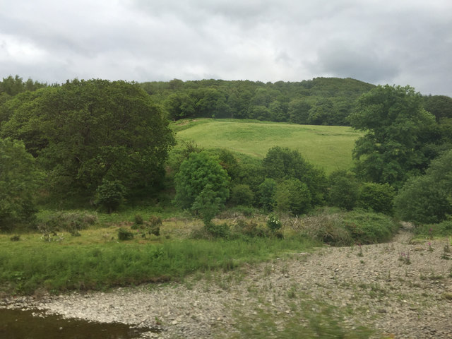
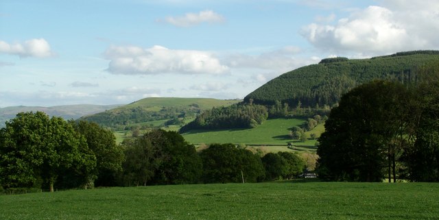
Cwm y Plant is a picturesque valley located in the county of Montgomeryshire, Wales. Situated in the heart of the Welsh countryside, this valley is known for its stunning natural beauty and tranquil atmosphere.

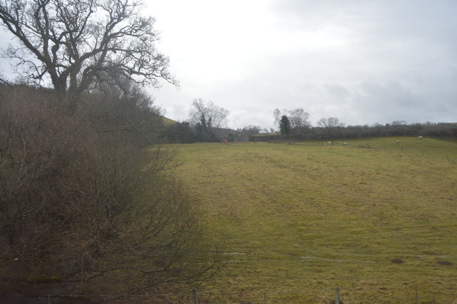
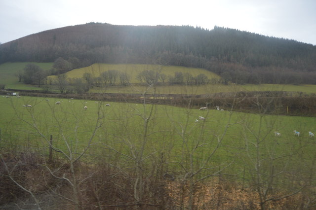
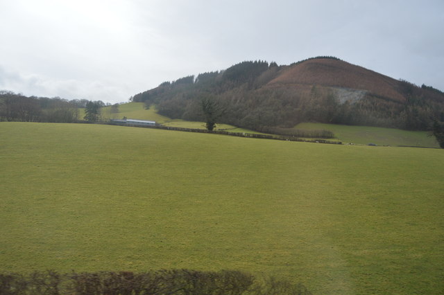
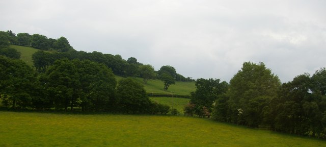
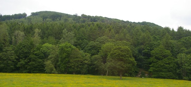
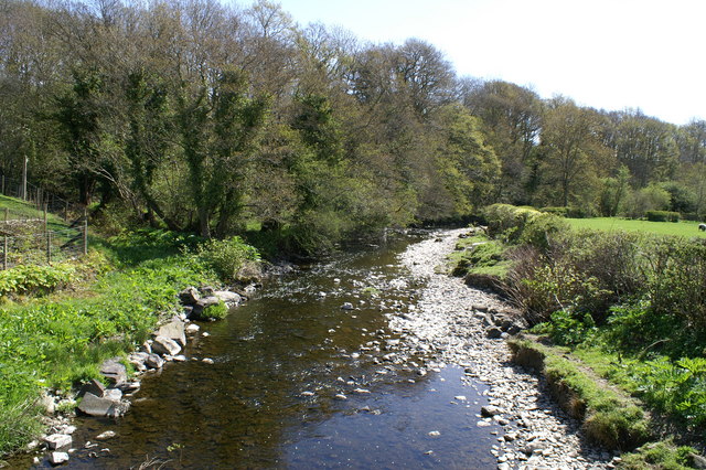
The valley is surrounded by rolling hills covered in lush greenery, with the River Severn winding its way through the landscape. The river adds to the charm of the valley, providing a soothing backdrop and attracting a variety of wildlife.

Cwm y Plant is a popular destination for nature lovers and outdoor enthusiasts. The valley offers numerous walking trails and hiking routes, allowing visitors to explore its scenic surroundings. The trails lead to breathtaking viewpoints, offering panoramic vistas of the surrounding countryside.

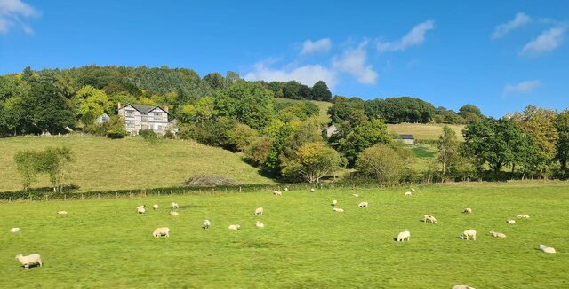
The valley is also home to a diverse range of flora and fauna. Wildflowers bloom in abundance during the spring and summer months, creating a vibrant and colorful landscape. Birdwatchers will be delighted by the variety of species that can be spotted in the area, including red kites, buzzards, and kingfishers.

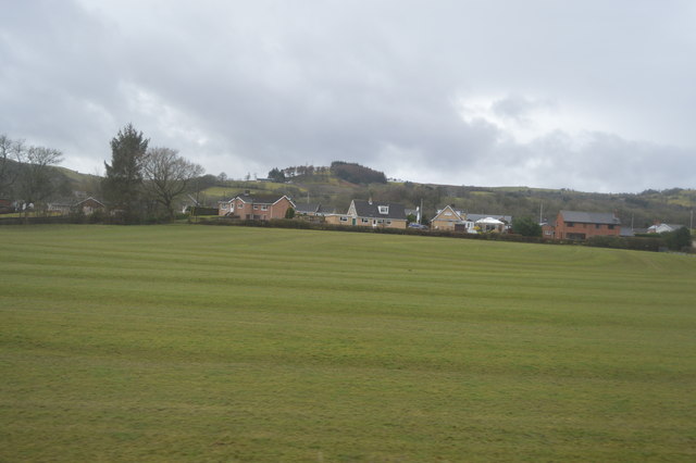
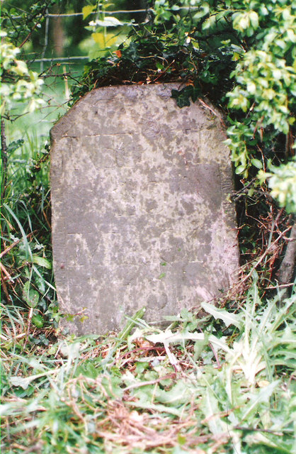
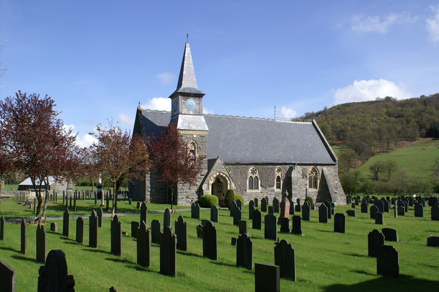
In addition to its natural beauty, Cwm y Plant boasts a rich history. The valley is dotted with ancient ruins and historical sites, providing glimpses into the past. Visitors can explore the remains of old farmsteads and learn about the agricultural traditions that have shaped the landscape over the centuries.

Overall, Cwm y Plant is a hidden gem in Montgomeryshire, offering a peaceful retreat for those seeking to immerse themselves in nature and discover the historical and natural wonders of the Welsh countryside.

If you have any feedback on the listing, please let us know in the comments section below.

Cwm y Plant Images

Images are sourced within 2km of 52.556538/-3.5103721 or Grid Reference SN9796. Thanks to Geograph Open Source API. All images are credited.

Minor road near Clatter
Plasnewydd
Plasnewydd
Old Milestone by the A470, Frankwell By the A470, in parish of Carno (Powys District), South of The Aleppo Merchant Inn, Frankwell, set into wall on West side of road. An earlier photograph can be found here <a title="https://www.geograph.org.uk/photo/6038359" href="https://www.geograph.org.uk/photo/6038359">Link</a>.

Inscription reads:-
NEWT
11
MACH
17

Grade II listed by Cadw. Reference Number: 17575

Milestone Society National ID: MOT_NTMC11
Old Milestone by the A470, Frankwell
By the A470, in parish of Carno (Powys District), South of The Aleppo Merchant Inn, Frankwell, set into wall on West side of road. An earlier photograph can be found here Link. Inscription reads:- NEWT 11 MACH 17 Grade II listed by Cadw. Reference Number: 17575 Milestone Society National ID: MOT_NTMC11
Church of St John The Baptist
Hillside, Afon Carno Valley
Oerffrwd
Oerffrwd
House at Oerffrwd Crossing
View to Allt Y Genlli
Wooded slope northeast of the River Carno near Carno, Powys Seen in passing from an Aberystwyth-bound train.
Wooded slope northeast of the River Carno near Carno, Powys
Seen in passing from an Aberystwyth-bound train.
North side of Afon Carno valley, below Plasnewydd
Wooded hillside above Afon Carno
Carno Community Centre Venue for the Montgomery Federation of Women's Institutes Spring Show in May 2015.
<span class="nowrap"><a title="https://carno.org.uk/community-centre/carno-community-centre" rel="nofollow ugc noopener" href="https://carno.org.uk/community-centre/carno-community-centre">Link</a><img style="margin-left:2px;" alt="External link" title="External link - shift click to open in new window" src="https://s1.geograph.org.uk/img/external.png" width="10" height="10"/></span>
Carno Community Centre
Venue for the Montgomery Federation of Women's Institutes Spring Show in May 2015. LinkExternal link
Carno Football Ground Home of Clwb Peldroed Carno Football Club <span class="nowrap"><a title="http://www.pitchero.com/clubs/clwbpeldroedcarnofootballclub" rel="nofollow ugc noopener" href="http://www.pitchero.com/clubs/clwbpeldroedcarnofootballclub">Link</a><img style="margin-left:2px;" alt="External link" title="External link - shift click to open in new window" src="https://s1.geograph.org.uk/img/external.png" width="10" height="10"/></span>
Carno Football Ground
Home of Clwb Peldroed Carno Football Club LinkExternal link
Old Milestone by the A470, Frankwell By the A470, in parish of Carno (Powys District), South of The Aleppo Merchant Inn, Frankwell, set into wall on West side of road.

Inscription reads:-
NEWT
11
MACH
17

Grade II listed by Cadw. Reference Number: 17575
<span class="nowrap"><a title="https://cadwpublic-api.azurewebsites.net/reports/listedbuilding/FullReport?lang=&id=17575" rel="nofollow ugc noopener" href="https://cadwpublic-api.azurewebsites.net/reports/listedbuilding/FullReport?lang=&id=17575">Link</a><img style="margin-left:2px;" alt="External link" title="External link - shift click to open in new window" src="https://s1.geograph.org.uk/img/external.png" width="10" height="10"/></span>

Surveyed

Milestone Society National ID: MOT_NTMC11
Old Milestone by the A470, Frankwell
By the A470, in parish of Carno (Powys District), South of The Aleppo Merchant Inn, Frankwell, set into wall on West side of road. Inscription reads:- NEWT 11 MACH 17 Grade II listed by Cadw. Reference Number: 17575 LinkExternal link Surveyed Milestone Society National ID: MOT_NTMC11
Old Milestone by the A470, east of Carno Milestone by the A470, in parish of Carno (Powys District), North of Ty-Coch, Frankwell, on verge.

Inscription once read:-
(NEWT)
(10)
(MACH)
(18)

Grade II listed by Cadw.
Reference Number 17578: <span class="nowrap"><a title="https://cadwpublic-api.azurewebsites.net/reports/listedbuilding/FullReport?lang=&id=17578" rel="nofollow ugc noopener" href="https://cadwpublic-api.azurewebsites.net/reports/listedbuilding/FullReport?lang=&id=17578">Link</a><img style="margin-left:2px;" alt="External link" title="External link - shift click to open in new window" src="https://s1.geograph.org.uk/img/external.png" width="10" height="10"/></span>

Surveyed

Milestone Society National ID: MOT_NTMC10
Old Milestone by the A470, east of Carno
Milestone by the A470, in parish of Carno (Powys District), North of Ty-Coch, Frankwell, on verge. Inscription once read:- (NEWT) (10) (MACH) (18) Grade II listed by Cadw. Reference Number 17578: LinkExternal link Surveyed Milestone Society National ID: MOT_NTMC10
View across the Afon Carno valley A view to the South across the Afon Carno valley between Clatter and Carno, and West of Newtown, Powys
View across the Afon Carno valley
A view to the South across the Afon Carno valley between Clatter and Carno, and West of Newtown, Powys
Church of St John the Baptist in Carno
Show me another place!

Cwm y Plant is located at Grid Ref: SN9796 (Lat: 52.556538, Lng: -3.5103721)

Unitary Authority: Powys

Police Authority: Dyfed Powys

What 3 Words

///turkey.proceeds.acquaint. Near Staylittle, Powys

Nearby Locations

Plasnewydd Cwm y Plant

Related Wikis

River Carno

The River Carno (Welsh: Afon Carno) is a river in Powys, mid Wales, and a tributary of the River Severn. The river is named after the village of Carno...

Carno

Carno is a village in Powys, Wales. The community, which is also a parish in the historic county of Montgomeryshire, comprises the townships of Derlwyn...

Carno F.C.

Carno Football Club is an amateur Welsh football team based in the village of Carno. The team competes in the Central Wales Northern Division. The club...

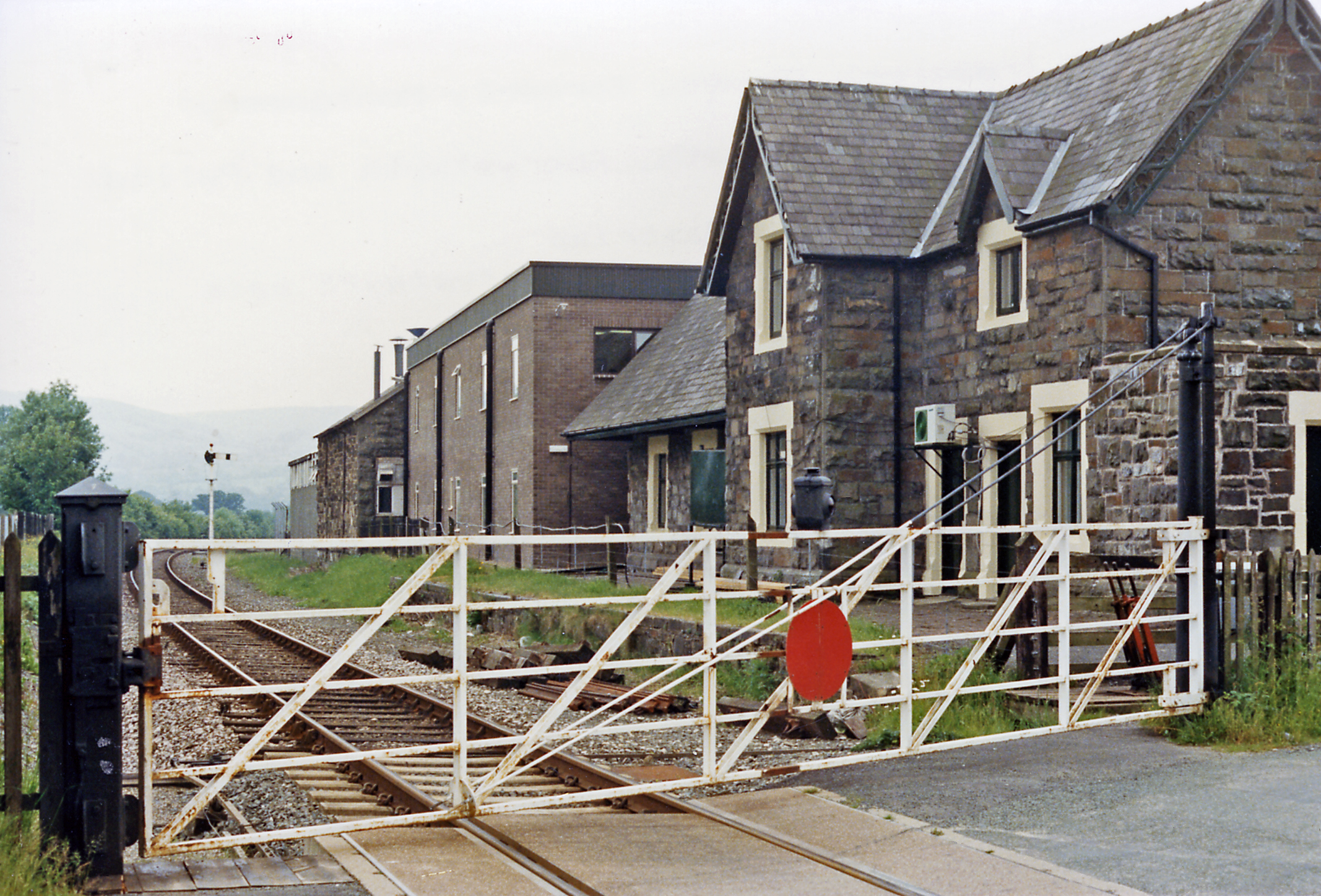
Carno railway station

Carno is a closed railway station in Carno, on the Cambrian Line, that was part of the Newtown and Machynlleth Railway. The station was closed in 1965...

Plasau Duon

Plasau Duon or Plasauduon is a timber-framed house, formerly in the parish of Carno, but now within the area of the community council of Caersws in...

Clatter, Powys

Clatter is a small village in Powys, Wales located in the community of Caersws on the main A470 road between Carno and Caersws village. == External... ==

Montgomeryshire

Montgomeryshire (Welsh: Sir Drefaldwyn meaning "the Shire of Baldwin's town") is one of thirteen historic counties and a former administrative county of...

Golfa railway station

Golfa railway station is a preserved station that serves the area of Golfa, Powys, Wales, on the Welshpool and Llanfair Light Railway. == History == The...

Nearby Amenities

Located within 500m of 52.556538,-3.5103721
Place: farm
Lat/Long: 52.5570689/-3.5058597
The data included in this document is from www.openstreetmap.org. The data is made available under ODbL.

Have you been to Cwm y Plant?

Leave your review of Cwm y Plant below (or comments, questions and feedback).