East Gully

Valley in Aberdeenshire

Scotland

East Gully

Cairn at summit of Braeriach
Cairn at summit of Braeriach Credit: Colin Park

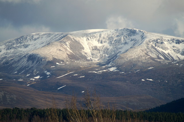
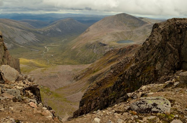
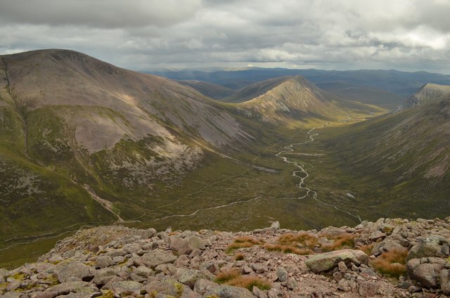
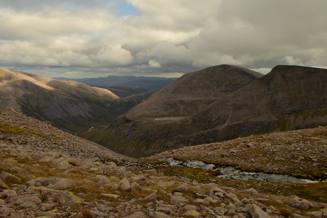
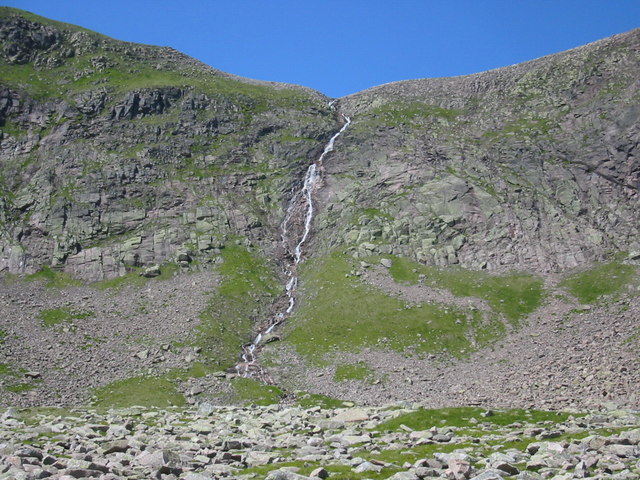
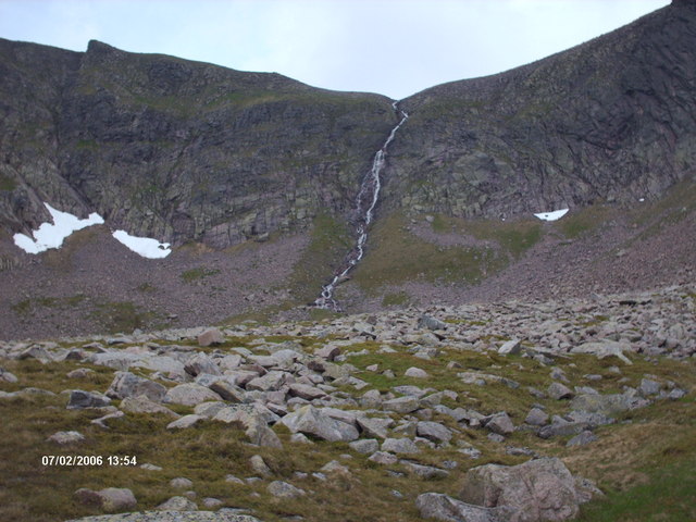
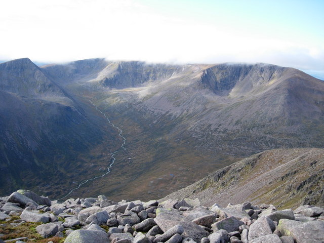
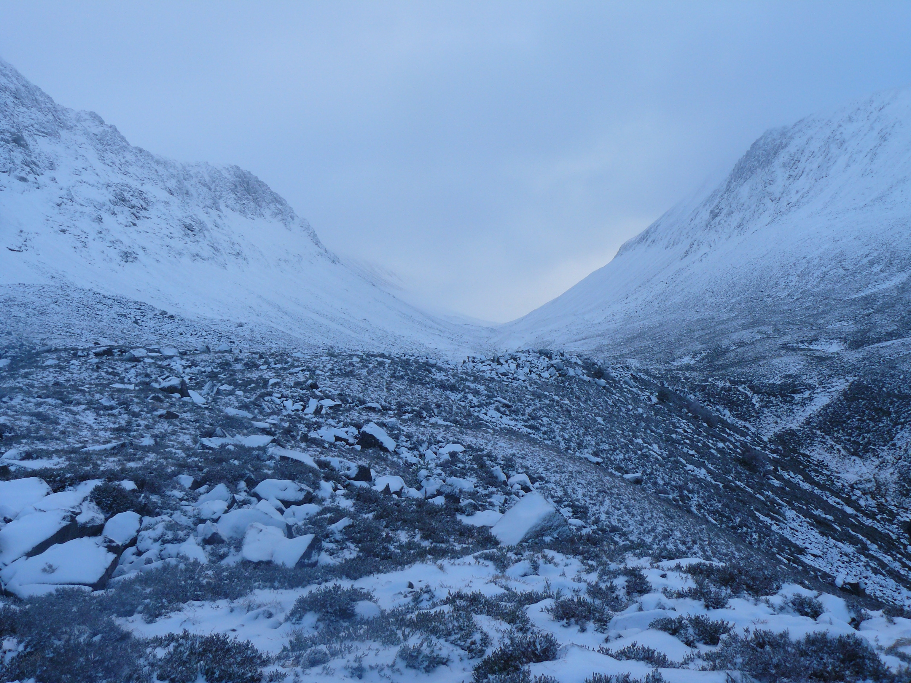
East Gully is a picturesque valley located in Aberdeenshire, Scotland. Nestled amidst the stunning Cairngorms National Park, this valley is renowned for its breathtaking natural beauty and diverse wildlife.

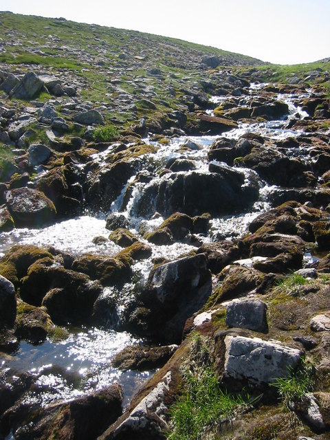
Surrounded by rolling hills and dense forests, East Gully offers a serene and tranquil environment for nature enthusiasts and outdoor adventurers alike. The gully is formed by the meandering River Dee, which flows gracefully through the valley, creating a stunning centerpiece for the landscape.

The valley is characterized by its lush greenery and abundant flora and fauna. The surrounding woodlands are home to a variety of tree species, including native Scots pines and birch trees. The valley floor is adorned with vibrant wildflowers during the summer months, adding a splash of color to the already picturesque scenery.

East Gully is also a haven for wildlife. Visitors may spot red deer, mountain hares, and a wide array of bird species, including golden eagles and ospreys. The river itself is teeming with fish, particularly salmon and trout, making it a popular spot for anglers.

In addition to its natural wonders, East Gully offers several recreational activities for visitors. Hiking trails crisscross the valley, providing opportunities for stunning walks and hikes. The river is also ideal for kayaking and canoeing, allowing visitors to explore the valley from a different perspective.

Overall, East Gully in Aberdeenshire is a true gem of natural beauty, offering a tranquil escape and a wealth of outdoor adventures for nature lovers and adventurers alike.

If you have any feedback on the listing, please let us know in the comments section below.
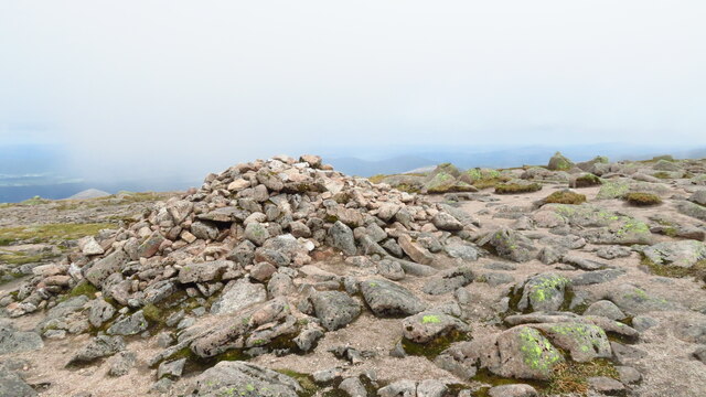
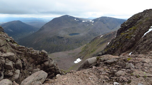
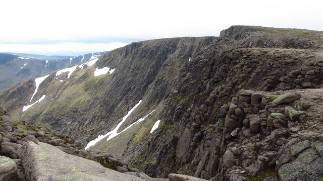
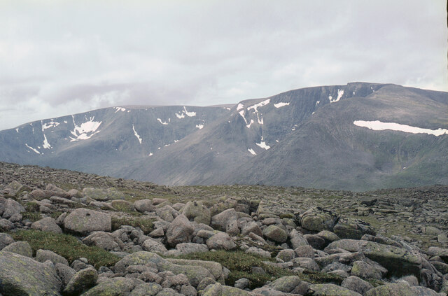
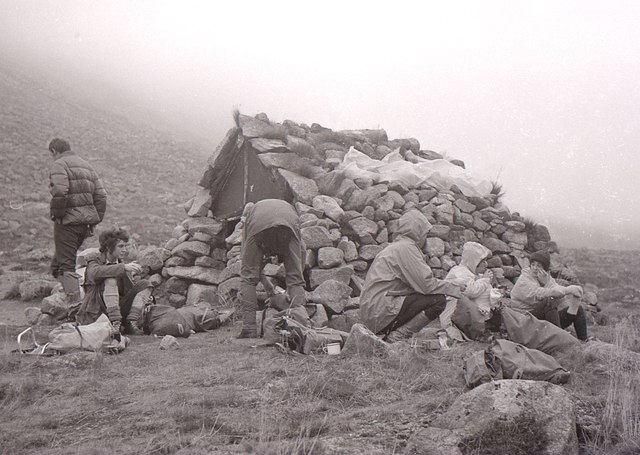
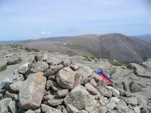
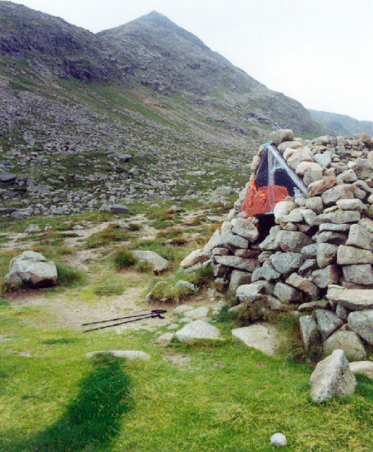
East Gully Images

Images are sourced within 2km of 57.078881/-3.7246702 or Grid Reference NN9599. Thanks to Geograph Open Source API. All images are credited.

Cairn at summit of Braeriach
View towards Cairn Toul & Sgor an Lochain Uaine from Braeriach
Cliffs on the southern face of Braeriach
The Braeriach massif from across the Lairig Ghru Coire Bhrochain below the summit is well seen here. The photo was taken from near Lochan Buidhe.
The Braeriach massif from across the Lairig Ghru
Coire Bhrochain below the summit is well seen here. The photo was taken from near Lochan Buidhe.
Braeriach from Aviemore
Braeriach, Cairngorm National Park View down the west gully from the summit of Braeriach, Britain's 3rd highest mountain.
Braeriach, Cairngorm National Park
View down the west gully from the summit of Braeriach, Britain's 3rd highest mountain.
View of the Lairig Ghru Pass from Braeriach, Scotland View from the northern end of the Braeriach horseshoe over the mountain pass of Lairig Ghru below.  Braeriach is Britain's 3rd highest mountain.  The watercourse in the glen below is the head of the river Dee, which eventually flows to Aberdeen.
View of the Lairig Ghru Pass from Braeriach, Scotland
View from the northern end of the Braeriach horseshoe over the mountain pass of Lairig Ghru below. Braeriach is Britain's 3rd highest mountain. The watercourse in the glen below is the head of the river Dee, which eventually flows to Aberdeen.
Top of the Falls of Dee, Aberdeenshire The River Dee finds its source in the Cairngorm Mountains at over 4000 ft above sea level on the summit plateau of Braeriach, Britain's 3rd highest mountain.  The view here is of the top of the falls where the Dee, at this stage a small stream, leaves the Plateau.
Top of the Falls of Dee, Aberdeenshire
The River Dee finds its source in the Cairngorm Mountains at over 4000 ft above sea level on the summit plateau of Braeriach, Britain's 3rd highest mountain. The view here is of the top of the falls where the Dee, at this stage a small stream, leaves the Plateau.
Garbh Choire Refuge Members of Aberdeen Mountaineering Club have a rest beside the refuge.

The small structure was built by members of Aberdeen University Lairig Club in 1966 to provide a place to stay overnight for three or four people  to give access to nearby winter ice climbing in the Garbh Choire area. 

In more recent years it has fallen into disrepair, and is only used as an emergency refuge. There are plans to renovate it in 2018
Garbh Choire Refuge
Members of Aberdeen Mountaineering Club have a rest beside the refuge. The small structure was built by members of Aberdeen University Lairig Club in 1966 to provide a place to stay overnight for three or four people to give access to nearby winter ice climbing in the Garbh Choire area. In more recent years it has fallen into disrepair, and is only used as an emergency refuge. There are plans to renovate it in 2018
Summit of Sron na Lairige - view N
Summit of Sron na Lairige - view towards Braeraich
Braeriach : Munro No 3 1296m, 4252ft. The summit cairn is in the foreground, looking over it and east to Ben MacDui (Munro No 2, 1309m)
Braeriach : Munro No 3
1296m, 4252ft. The summit cairn is in the foreground, looking over it and east to Ben MacDui (Munro No 2, 1309m)
Shelter in An Garbh Coire Cairngorms Basic shelter at entrance to An Garbh Coire (The rough corrie), with Angels Peak the pyramid shaped hill behind
Shelter in An Garbh Coire Cairngorms
Basic shelter at entrance to An Garbh Coire (The rough corrie), with Angels Peak the pyramid shaped hill behind
Stream above Falls of Dee on Braeriach Very young River Dee about to flow down into Coire Dee/An Garbh Choire
Stream above Falls of Dee on Braeriach
Very young River Dee about to flow down into Coire Dee/An Garbh Choire
Falls of Dee, Braeriach Coire Dee/An Garbh Choire
Falls of Dee, Braeriach
Coire Dee/An Garbh Choire
An Garbh Choire/Coire Dee on Braeriach From upper coire towards Ben Macdui. Cairn Toul with Lochan Uaine to the right.
An Garbh Choire/Coire Dee on Braeriach
From upper coire towards Ben Macdui. Cairn Toul with Lochan Uaine to the right.
Falls of Dee The baby River Dee tumbles over the cliffs down into AnGarbh Choire
Falls of Dee
The baby River Dee tumbles over the cliffs down into AnGarbh Choire
Braeriach and  An Garbh Choire A view of the South Eastern slopes of Braeriach, with the Dee flowing out of An Garbh Choire.
Braeriach and An Garbh Choire
A view of the South Eastern slopes of Braeriach, with the Dee flowing out of An Garbh Choire.
Show me another place!

East Gully is located at Grid Ref: NN9599 (Lat: 57.078881, Lng: -3.7246702)

Unitary Authority: Aberdeenshire

Police Authority: North East

What 3 Words

///fluctuate.privately.backers. Near Aviemore, Highland

Related Wikis

Braeriach

Braeriach or Brae Riach (Scottish Gaelic: Am Bràigh Riabhach, 'the brindled upland') is the third-highest mountain in Scotland and all of the British Isles...

Loch Coire an Lochain

Loch Coire an Lochain is a small freshwater loch located below the summit of Braeriach in the eastern Highlands of Scotland. At 997 m (3,271 ft) above...

Lairig Ghru

The Lairig Ghru (Scottish Gaelic: Làirig Dhrù) is one of the mountain passes through the Cairngorms of Scotland. The route and mountain pass partially...

Sgòr an Lochain Uaine

Sgòr an Lochain Uaine (Scottish Gaelic for 'peak of the little green lake') is one of the Cairngorms mountains in the Scottish Highlands. Rising to 1,258...

Nearby Amenities

Located within 500m of 57.078881,-3.7246702
Braeriach
Description: Brindled greyish upper part
Ele: 1296
Marilyn: yes
Munro: yes
Munro Number: M003
Name Gd: Am Bràigh Riabhach
Natural: peak
Prominence: 461
Wikidata: Q897186
Wikipedia: en:Braeriach
Lat/Long: 57.0781682/-3.7288293
Coire Bhrochain
Place: locality
Lat/Long: 57.0756534/-3.7227774
The data included in this document is from www.openstreetmap.org. The data is made available under ODbL.

Have you been to East Gully?

Leave your review of East Gully below (or comments, questions and feedback).