Ceunant Trawsnant

Valley in Merionethshire

Wales

Ceunant Trawsnant

Early morning in Cwm Hirnant by the ruin at Foel -y-ddinas
Early morning in Cwm Hirnant by the ruin at Foel -y-ddinas Credit: Colin Park

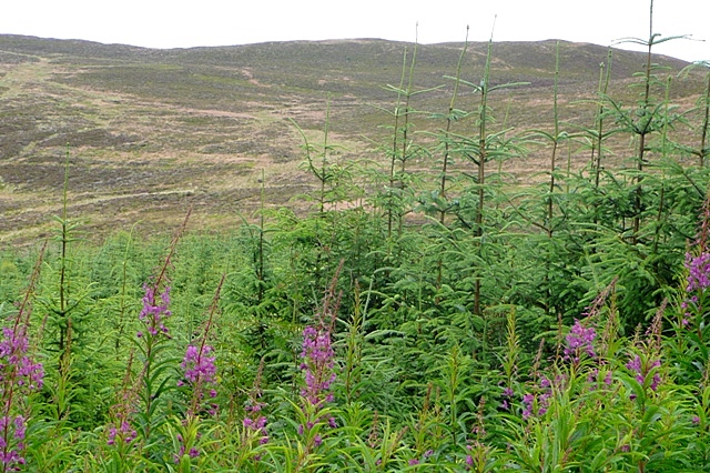
Ceunant Trawsnant is a picturesque valley located in the historic county of Merionethshire, Wales. Nestled in the heart of Snowdonia National Park, this stunning natural attraction offers visitors a glimpse into the region's breathtaking beauty. The valley is situated near the village of Llan Ffestiniog and is surrounded by towering mountains and lush, verdant landscapes.

Ceunant Trawsnant is renowned for its spectacular waterfall, which cascades down the steep cliffs with immense force. The rushing waters create a mesmerizing display, attracting nature enthusiasts and photographers alike. The sound of the waterfall echoing through the valley adds to the enchanting ambiance.

Visitors can explore the valley by following a well-maintained footpath that winds its way alongside the river. The trail offers breathtaking views of the surrounding mountains and allows visitors to fully immerse themselves in the tranquility of the area.

The valley is home to a variety of wildlife, including rare bird species, otters, and even the occasional glimpse of red deer. The diverse flora and fauna make Ceunant Trawsnant an ideal location for nature lovers and wildlife enthusiasts.

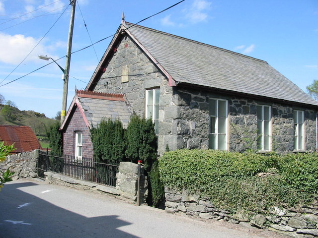
In addition to its natural beauty, the valley has historical significance as well. It was once home to several slate quarries, which played a vital role in the local economy during the 19th century. The remnants of these quarries can still be seen today, adding an extra layer of interest to the valley's heritage.

Overall, Ceunant Trawsnant is a truly remarkable destination that combines stunning natural scenery, rich wildlife, and historical significance. It offers visitors a unique opportunity to experience the splendor of Snowdonia National Park and immerse themselves in the tranquility of the Welsh countryside.

If you have any feedback on the listing, please let us know in the comments section below.

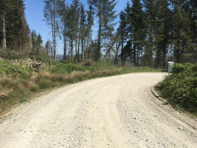
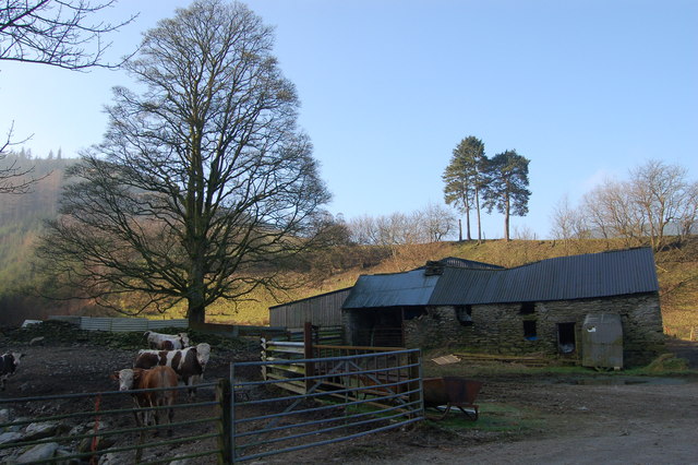
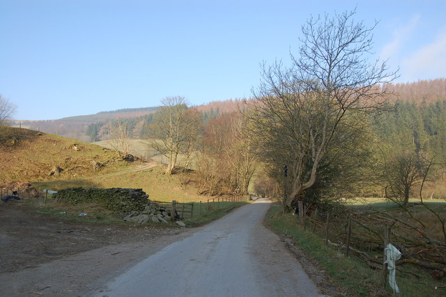
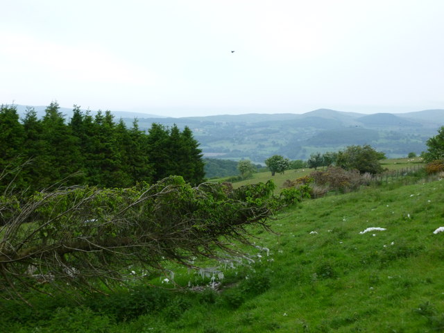
Ceunant Trawsnant Images

Images are sourced within 2km of 52.874489/-3.5614721 or Grid Reference SH9531. Thanks to Geograph Open Source API. All images are credited.

Early morning in Cwm Hirnant by the ruin at Foel -y-ddinas
Forestry road near Aber-Hirnant
Forestry road near Ystrad-y-groes
Bridge in Cwm Hirnant
Farm buildings in Cwm Hirnant
Cattle enjoying an early morning paddle
Lane passes through Cwm Hirnant
River at Aberhirnant Just downstream from the picnic area
River at Aberhirnant
Just downstream from the picnic area
Forestry quarry A magnificent exposure of a fault-plane cutting across rocks of the Foel-y-Ddinas Mudstones, which belong to the Hirnantian stage at the very end of the Ordovician Period. The Forestry Commission must be commended for creating so much new rock exposure when the network of forest roads was built. Now, with maturing trees and self-sown recruits, the site has a pleasant and dramatic aspect.
Forestry quarry
A magnificent exposure of a fault-plane cutting across rocks of the Foel-y-Ddinas Mudstones, which belong to the Hirnantian stage at the very end of the Ordovician Period. The Forestry Commission must be commended for creating so much new rock exposure when the network of forest roads was built. Now, with maturing trees and self-sown recruits, the site has a pleasant and dramatic aspect.
Forestry track Angular rubble and dried brashings make a hard contrast with regenerating forest on the slope of Foel-y-Ddinas. In the background the lower part of Cwm Hirnant stretches out through the forest.
Forestry track
Angular rubble and dried brashings make a hard contrast with regenerating forest on the slope of Foel-y-Ddinas. In the background the lower part of Cwm Hirnant stretches out through the forest.
Forest track 2 It was most generous that the Forestry Commission should make such a fine track for us to traverse the remarkably steep slopes of Foel-y-Ddinas above Bwlch yr Hwch.
Forest track 2
It was most generous that the Forestry Commission should make such a fine track for us to traverse the remarkably steep slopes of Foel-y-Ddinas above Bwlch yr Hwch.
Cleaved mudstones The Foel-y-Ddinas Mudstones belong to the Hirnantian stage of the Ordovician Period, and are exposed all along the forestry road that circles the eponymous peak of Foel-y-Ddinas. It is interesting to observe the change of dip of the beds, which is not related to the way that the rock breaks along well-defined planes, or cleavage. Here the cleavage is inclined steeply to the lower left of the image, while the bedding is much less obvious and inclined slightly less steeply to the right. This can be seen most clearly in the middle and upper parts of the image.
Cleaved mudstones
The Foel-y-Ddinas Mudstones belong to the Hirnantian stage of the Ordovician Period, and are exposed all along the forestry road that circles the eponymous peak of Foel-y-Ddinas. It is interesting to observe the change of dip of the beds, which is not related to the way that the rock breaks along well-defined planes, or cleavage. Here the cleavage is inclined steeply to the lower left of the image, while the bedding is much less obvious and inclined slightly less steeply to the right. This can be seen most clearly in the middle and upper parts of the image.
Frost-shattered outcrop Strongly-cleaved outcrops of the Foel-y-Ddinas Mudstones have weathered and shattered under glacial and peri-glacial conditions. In the left of the image the resulting frost-shattered outcrop has collapsed so that the individual slatey shards are aligned with the outcrop surface. To the right, the original cleavage orientation has been maintained except where soil movement downhill has rotated the shards progressively, giving the appearance of a folded outcrop.
Frost-shattered outcrop
Strongly-cleaved outcrops of the Foel-y-Ddinas Mudstones have weathered and shattered under glacial and peri-glacial conditions. In the left of the image the resulting frost-shattered outcrop has collapsed so that the individual slatey shards are aligned with the outcrop surface. To the right, the original cleavage orientation has been maintained except where soil movement downhill has rotated the shards progressively, giving the appearance of a folded outcrop.
Abandoned house near Ysbyddadog
Near Ysbyddadog
Near Ysbyddadog
Edge of the forest trail.
Footpath entrance to Moelfryn forest
Footpath through Moelfryn forest
Show me another place!

Ceunant Trawsnant is located at Grid Ref: SH9531 (Lat: 52.874489, Lng: -3.5614721)

Unitary Authority: Gwynedd

Police Authority: North Wales

What 3 Words

///grumbles.overt.spins. Near Bala, Gwynedd

Nearby Locations

Ceunant Trawsnant

Related Wikis

Foel Goch (Hirnant)

Foel Goch is a subsidiary summit of Esgeiriau Gwynion, and is included in a group of hills known as the Hirnantau. These hills rise from the south east...

Rhos-y-gwaliau

Rhos-y-gwaliau is a small hamlet in Meirionnydd, Gwynedd, North Wales, about 1.5 miles (2.4 km) south-east of Bala. It is home to the Rhos y Gwaliau Outdoor...

Rhiwaedog

Rhiwaedog is the name of an ancient estate in North Wales, located in the Penllyn forest near Bala, Gwynedd. It gives its name today to two hills, Rhiwaedog...

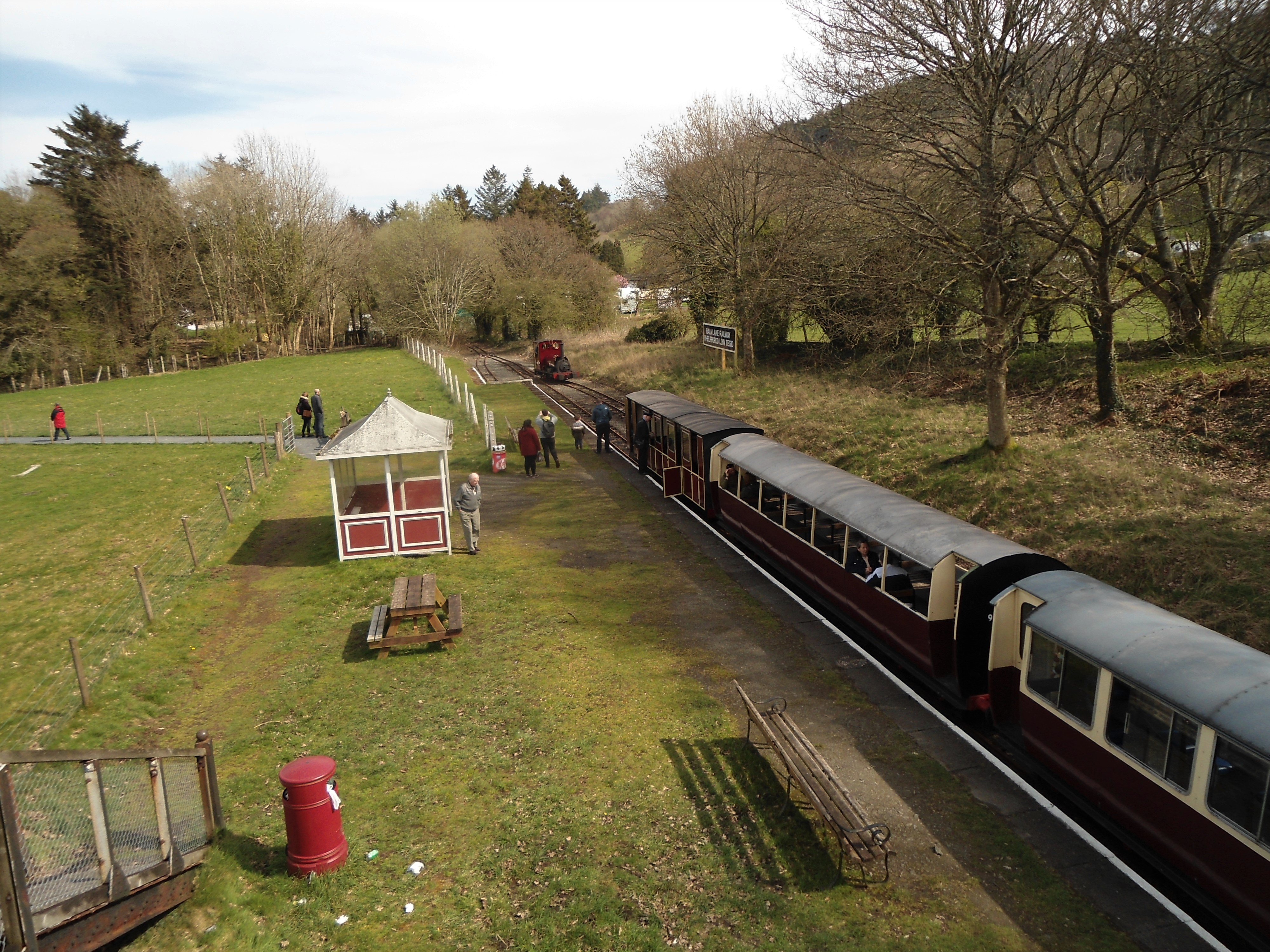
Bala (Penybont) railway station

Bala (Penybont) is the current terminus of the heritage Bala Lake Railway, in Gwynedd, Wales, since 1976. The site was formerly the location of the Bala...

Bala Junction railway station

Bala Junction railway station was on the Ruabon to Barmouth line in southern Gwynedd, Wales. It closed to passengers on Monday 18 January 1965. Bala Junction...

Hirnant Limestone

The Hirnant Limestone is an old name for a geologic formation in England and Wales, defining the Hirnantian. It preserves fossils dating back to the Ordovician...
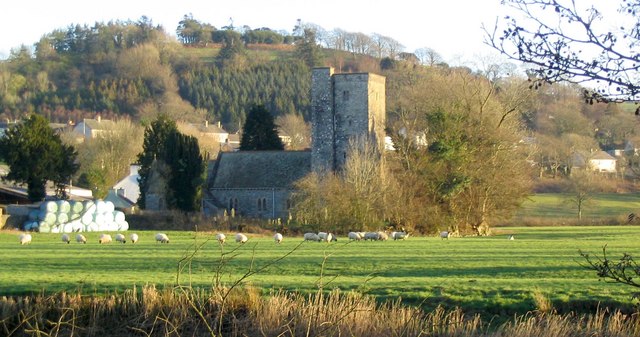
Llanycil

Llanycil is a community in the county of Gwynedd, Wales, near Bala, and is 99.9 miles (160.7 km) from Cardiff and 176.2 miles (283.6 km) from London. In...

Bala Lake Railway

The Bala Lake Railway (Welsh: Rheilffordd Llyn Tegid) is a narrow-gauge railway along the southern shore of Bala Lake in Gwynedd, North Wales. The line...

Nearby Amenities

Located within 500m of 52.874489,-3.5614721
Ford: yes
Lat/Long: 52.8722917/-3.5557146
The data included in this document is from www.openstreetmap.org. The data is made available under ODbL.

Have you been to Ceunant Trawsnant?

Leave your review of Ceunant Trawsnant below (or comments, questions and feedback).