Coire Creagach

Valley in Inverness-shire

Scotland

Coire Creagach

Bridge over Am Beanaidh, Gleann Eanaich A more recent replacement to the older bridge.
Bridge over Am Beanaidh, Gleann Eanaich Credit: Colin Park

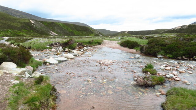
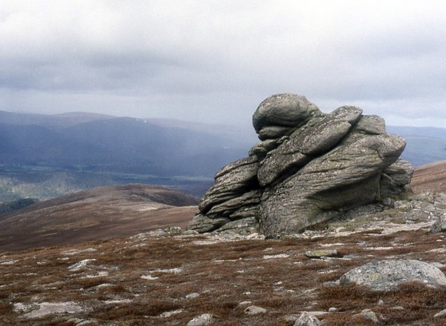
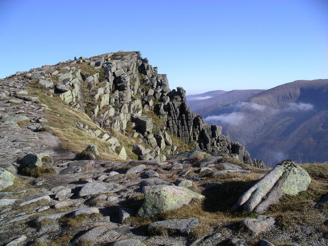
Coire Creagach is a stunning valley located in Inverness-shire, Scotland. Nestled within the rugged and picturesque Highlands, this valley is known for its dramatic cliffs, lush greenery, and crystal-clear streams. The name "Coire Creagach" translates to "rocky corrie," which accurately describes the landscape of this area.

The valley is a popular destination for hikers and nature enthusiasts, offering a variety of trails that showcase the natural beauty of the Scottish countryside. Visitors can expect to encounter a diverse range of flora and fauna, including native species such as red deer, golden eagles, and wildflowers.

Coire Creagach is also steeped in history, with ancient ruins and archaeological sites scattered throughout the area. These remnants of the past provide a glimpse into the lives of the people who once inhabited this remote and rugged landscape.

Overall, Coire Creagach is a must-visit destination for anyone looking to experience the beauty and tranquility of the Scottish Highlands. Whether you're an avid hiker, a history buff, or simply looking to escape the hustle and bustle of city life, this valley has something to offer everyone.

If you have any feedback on the listing, please let us know in the comments section below.

Coire Creagach Images

Images are sourced within 2km of 57.106928/-3.8028182 or Grid Reference NH9003. Thanks to Geograph Open Source API. All images are credited.

Bridge over Am Beanaidh, Gleann Eanaich A more recent replacement to the older bridge.
Bridge over Am Beanaidh, Gleann Eanaich
A more recent replacement to the older bridge.
Track through glacial moraines, Gleann Eanaich
Stream crossing of Beanaidh Bheag, Gleann Eanaich Stepping stones aids the crossing of this stream.
Stream crossing of Beanaidh Bheag, Gleann Eanaich
Stepping stones aids the crossing of this stream.
Track through Gleann Eanaich & glacial moraines
Windswept summit of Creag Dhubh Looking towards Loch Eanaich.
Windswept summit of Creag Dhubh
Looking towards Loch Eanaich.
Clach Mhic Cailein On Clach Mhic Cailein.
Clach Mhic Cailein
On Clach Mhic Cailein.
An early version of the footbridge over the Allt Beanaidh Back in the days when the footbridge was actually a footbridge, and the track would have forded the stream just to the right here. The rather more modern version of this same picture is <a href="https://www.geograph.org.uk/photo/3619338">NH9204 : Footbridge over Am Beanaidh</a>
An early version of the footbridge over the Allt Beanaidh
Back in the days when the footbridge was actually a footbridge, and the track would have forded the stream just to the right here. The rather more modern version of this same picture is NH9204 : Footbridge over Am Beanaidh
Crossing the Am Beanaidh in 1980 Gleann Eanaich and its surrounding mountains are drained  by the Am Beanaidh. A straightforward outing had been planned from Whitewell with a return to be made involving a crossing of the river at the location in the image, unfortunately the bridge indicated had been swept away resulting in a fording.
The rather rickety supports for the bridge can be seen upstream and Richard Law's image from 1990 shows that a footbridge was reinstalled - <a title="https://www.geograph.org.uk/photo/6451051" href="https://www.geograph.org.uk/photo/6451051">Link</a>. Johns Ross shows an improved version in 2001 - <a title="https://www.geograph.org.uk/photo/371219" href="https://www.geograph.org.uk/photo/371219">Link</a> and John Ferguson's photo of 2013 shows an even grander crossing! - <a title="https://www.geograph.org.uk/photo/3619338" href="https://www.geograph.org.uk/photo/3619338">Link</a>
Crossing the Am Beanaidh in 1980
Gleann Eanaich and its surrounding mountains are drained by the Am Beanaidh. A straightforward outing had been planned from Whitewell with a return to be made involving a crossing of the river at the location in the image, unfortunately the bridge indicated had been swept away resulting in a fording. The rather rickety supports for the bridge can be seen upstream and Richard Law's image from 1990 shows that a footbridge was reinstalled - Link. Johns Ross shows an improved version in 2001 - Link and John Ferguson's photo of 2013 shows an even grander crossing! - Link
Weather station, Craig Follais Inshriach and Feshie Muir is an area where a lot of research is taking place. There is a weather station at 690m, just above the developing tree line.
Weather station, Craig Follais
Inshriach and Feshie Muir is an area where a lot of research is taking place. There is a weather station at 690m, just above the developing tree line.
Montane heath on Creag Dubh Weather clipped heather and grass moorland above Strathspey.
Montane heath on Creag Dubh
Weather clipped heather and grass moorland above Strathspey.
Establishing a natural treeline The woodland is returning to the Markie Glen. Here around 600m the trees are hanging on, but this is approaching the upper limit of their growth. This can be at about 1000m in southern Norway, but Scotland does not have the shelter of deep snow in most years and the tree line is lower.  Sgòran Dubh in the background is making a fairly good impersonation of a hill in central southern Scandinavia. 

The hill is a benign lump from this side, but falls sharply to the east into the glacial trench of Gleann Eanaich.
Establishing a natural treeline
The woodland is returning to the Markie Glen. Here around 600m the trees are hanging on, but this is approaching the upper limit of their growth. This can be at about 1000m in southern Norway, but Scotland does not have the shelter of deep snow in most years and the tree line is lower. Sgòran Dubh in the background is making a fairly good impersonation of a hill in central southern Scandinavia. The hill is a benign lump from this side, but falls sharply to the east into the glacial trench of Gleann Eanaich.
Struggling to survive At 690m these self seeded Scots pines have a tough struggle ahead of them. They can cope with the nutrient poor granite based soils, but the short growing season at this altitude will tell against them.  Self seeded trees can be found in high places. 800m Sitka saplings are not a rare sight (that is altitude, not half mile high trees).
Struggling to survive
At 690m these self seeded Scots pines have a tough struggle ahead of them. They can cope with the nutrient poor granite based soils, but the short growing season at this altitude will tell against them. Self seeded trees can be found in high places. 800m Sitka saplings are not a rare sight (that is altitude, not half mile high trees).
Craig Follais A spur juts out over the Muir of Feshie. The Monadh Liath across the Spey are also snow covered.
Craig Follais
A spur juts out over the Muir of Feshie. The Monadh Liath across the Spey are also snow covered.
Path into the west Grampian summits above Glen Feshie
Footpath in the Allt a' Mharcaidh Valley, Cairngorms This small footpath climbs up the north side of the valley of the Allt a' Mharcaidh watercourse in the Cairngorm Mountains.  At the time of writing, the location of this path on the OS mapping seems to be 100 m or so away from the correct location.
Footpath in the Allt a' Mharcaidh Valley, Cairngorms
This small footpath climbs up the north side of the valley of the Allt a' Mharcaidh watercourse in the Cairngorm Mountains. At the time of writing, the location of this path on the OS mapping seems to be 100 m or so away from the correct location.
Clach Choutsaich Looking at from the SW Clach Choutsaich
Clach Choutsaich
Looking at from the SW Clach Choutsaich
Rocky slope Southern side of spot height 803 in the Cairngorms
Rocky slope
Southern side of spot height 803 in the Cairngorms
Mist lifting Small knoll on the northern side of Sgoran Dubh Beag
Mist lifting
Small knoll on the northern side of Sgoran Dubh Beag
Show me another place!

Coire Creagach is located at Grid Ref: NH9003 (Lat: 57.106928, Lng: -3.8028182)

Unitary Authority: Highland

Police Authority: Highlands and Islands

What 3 Words

///seashell.freedom.bleat. Near Aviemore, Highland

Related Wikis

Sgòr Gaoith

Sgòr Gaoith (Scottish Gaelic: Sgòr Gaoithe, 'windy peak') is a mountain peak in the far western massif of the Cairngorms in the Scottish Highlands. It...

Loch Coire an Lochain

Loch Coire an Lochain is a small freshwater loch located below the summit of Braeriach in the eastern Highlands of Scotland. At 997 m (3,271 ft) above...

Loch an Eilein

Loch an Eilein is a small irregular shaped, freshwater loch in the Rothiemurchus Forest about 5 km (3.1 mi) south of Aviemore, Scotland in Cairngorms National...

Braeriach

Braeriach or Brae Riach (Scottish Gaelic: Am Bràigh Riabhach, 'the brindled upland') is the third-highest mountain in Scotland and all of the British Isles...

Have you been to Coire Creagach?

Leave your review of Coire Creagach below (or comments, questions and feedback).