Muir Cleuch

Valley in Dumfriesshire

Scotland

Muir Cleuch

Looking down the main road through Durisdeer
Looking down the main road through Durisdeer Credit: Gordon Brown

Muir Cleuch is a picturesque valley located in Dumfriesshire, Scotland. Nestled among rolling hills and surrounded by stunning natural beauty, it is a haven for outdoor enthusiasts and nature lovers. The valley is situated approximately 10 miles south of the town of Moffat and covers an area of around 12 square miles.

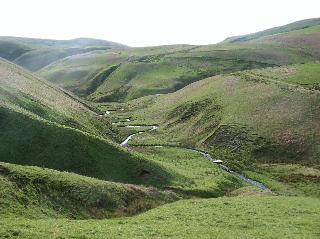
Muir Cleuch is characterized by its rugged terrain, with steep slopes and deep gorges carved by the meandering Muir Cleuch Burn. The valley is home to a diverse range of flora and fauna, including heather moorland, woodland, and open grassland. It provides a habitat for a variety of bird species, such as red grouse, golden plover, and merlin.

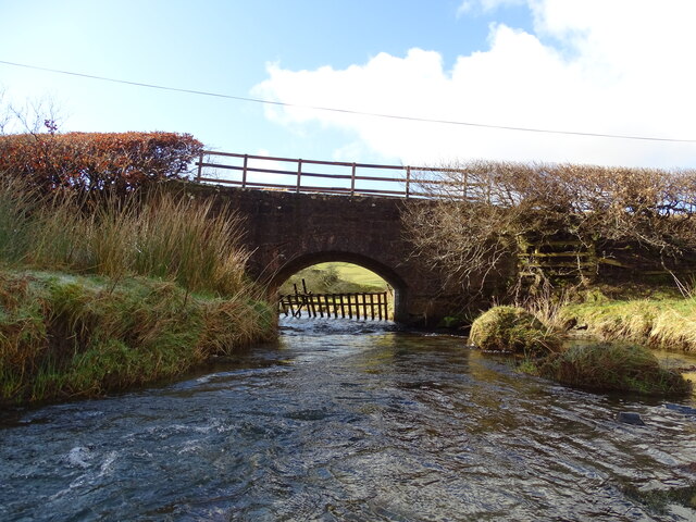
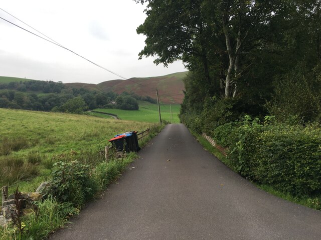
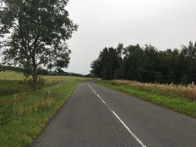
The valley is crisscrossed by a network of footpaths and trails, making it a popular destination for walkers, hikers, and cyclists. One of the most famous routes in the area is the Southern Upland Way, a long-distance trail that passes through Muir Cleuch. The valley also offers opportunities for fishing in the Muir Cleuch Burn, which is known for its population of brown trout.

Visitors to Muir Cleuch can enjoy breathtaking views of the surrounding hills and valleys, with notable landmarks including Hart Fell, Saddle Yoke, and White Coomb. The area is relatively remote and untouched, providing a sense of tranquility and seclusion for those seeking a peaceful retreat in the heart of nature.

In summary, Muir Cleuch is a stunning valley in Dumfriesshire, Scotland, offering a wealth of natural beauty, outdoor activities, and a peaceful escape from the hustle and bustle of city life.

If you have any feedback on the listing, please let us know in the comments section below.
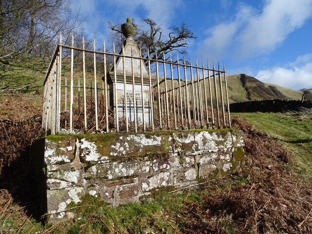
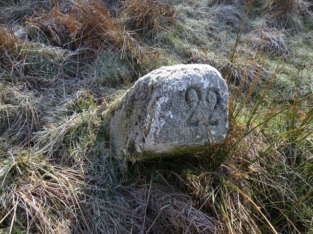
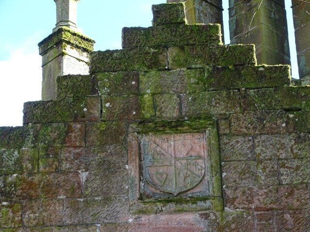
Muir Cleuch Images

Images are sourced within 2km of 55.328709/-3.7499068 or Grid Reference NS8905. Thanks to Geograph Open Source API. All images are credited.

Looking down the main road through Durisdeer
Durisdeer village Looking down to the burial ground.
Durisdeer village
Looking down to the burial ground.
Durisdeer Parish Church and war memorial The old church is marked as Dursdyire Kirk in a 1654 map. It was demolished to make way for the present-day Georgian church, a category A listed building in the village, that also serves Drumlanrig Castle, the 17th-century home of the Duke of Queensberry. Durisdeer Church was rebuilt by the third Duke in the 1720s, to designs by James Smith.  Wikipedia.
Durisdeer Parish Church and war memorial
The old church is marked as Dursdyire Kirk in a 1654 map. It was demolished to make way for the present-day Georgian church, a category A listed building in the village, that also serves Drumlanrig Castle, the 17th-century home of the Duke of Queensberry. Durisdeer Church was rebuilt by the third Duke in the 1720s, to designs by James Smith. Wikipedia.
Durisdeer Church Clock The clock in the church tower was a gift from the Buccleuch Estates to mark the millennium and the tercentenary of Durisdeer Church.
Durisdeer Church Clock
The clock in the church tower was a gift from the Buccleuch Estates to mark the millennium and the tercentenary of Durisdeer Church.
Ducal apartments  A marked feature of the church complex are the ducal apartments, which were later used as the parish school at the behest of the Duke. These apartments were renovated and in 1968 were opened again for church use.
Ducal apartments
A marked feature of the church complex are the ducal apartments, which were later used as the parish school at the behest of the Duke. These apartments were renovated and in 1968 were opened again for church use.
Covenanter's Memorial Daniel McMichael memorial stone, Nether Dalveen.
Photo taken 1st March 2022.
Covenanter's Memorial
Daniel McMichael memorial stone, Nether Dalveen. Photo taken 1st March 2022.
Old Milestone 22 miles to Dumfries from this old milestone beside the A702.
Photo taken on the 1st March 2022.
Old Milestone
22 miles to Dumfries from this old milestone beside the A702. Photo taken on the 1st March 2022.
Douglas Coat of Arms Douglas coat-of-arms from the old Dalveen Castle, built into the 
wall of Nether Dalveen.
Photo taken on the 1st March 2022.
Douglas Coat of Arms
Douglas coat-of-arms from the old Dalveen Castle, built into the wall of Nether Dalveen. Photo taken on the 1st March 2022.
Old Milestone 20 miles to Dumfries from this old milestone beside the A702.
Photo taken on the 1st March 2022.
Old Milestone
20 miles to Dumfries from this old milestone beside the A702. Photo taken on the 1st March 2022.
Bridge over the Carron Water This wee bridge carries the track to Nether Dalveen over the Carron Water.
Photo taken on the 1st March 2022.
Bridge over the Carron Water
This wee bridge carries the track to Nether Dalveen over the Carron Water. Photo taken on the 1st March 2022.
A Benchmark A benchmark on an old gate-post on the Well Path.
This photo was taken on the 16th September 2022.
A Benchmark
A benchmark on an old gate-post on the Well Path. This photo was taken on the 16th September 2022.
Durisdeer War Memorial Durisdeer War Memorial and Durisdeer kirk.
This photo was taken on the 16th September 2022.
Durisdeer War Memorial
Durisdeer War Memorial and Durisdeer kirk. This photo was taken on the 16th September 2022.
Durisdeer viewed from Nether Hill A long-range view showing the tiny village of Durisdeer nestled below Wether Hill and Black Hill. The radar dome which appears from this view to be on Black Hill is actually on Lowther Hill, about 5km to the north.
Durisdeer viewed from Nether Hill
A long-range view showing the tiny village of Durisdeer nestled below Wether Hill and Black Hill. The radar dome which appears from this view to be on Black Hill is actually on Lowther Hill, about 5km to the north.
Track approaching Durisdeer Nearing the tiny village of Durisdeer on the track from Glenaggart.

A red kite can be seen gliding over the fields.
Track approaching Durisdeer
Nearing the tiny village of Durisdeer on the track from Glenaggart. A red kite can be seen gliding over the fields.
Durisdeer Village A view of Durisdeer, with Cairn Kinna in the distance.
Durisdeer Village
A view of Durisdeer, with Cairn Kinna in the distance.
A702 near Dalveen Toll Cottage
Farm road to Dalveen
A702 towards Thornhill
Show me another place!

Muir Cleuch is located at Grid Ref: NS8905 (Lat: 55.328709, Lng: -3.7499068)

Unitary Authority: Dumfries and Galloway

Police Authority: Dumfries and Galloway

What 3 Words

///escapades.next.profited. Near Thornhill, Dumfries & Galloway

Related Wikis

Durisdeer

Durisdeer is a small village in Dumfries and Galloway, south-west Scotland, and in the historic county of Dumfries-shire. It lies 6 miles (9.7 km) north...

Enterkinfoot

Enterkinfoot is a small village or hamlet which lies 6 miles (9.7 km) north of Thornhill on the A76 on the route to Sanquhar, in Dumfriesshire, Durisdeer...

Kirkbride, Durisdeer

Kirkbride, previously Kilbride was an ancient parish close to the village of Enterkinfoot, the lands of which lay on both sides of the River Nith in the...

Carronbridge railway station

Carronbridge railway station was a railway station in Dumfries and Galloway north of Dumfries, serving the village of Carronbridge and district. The station...

Ballencleuch Law

Ballencleuch Law is a hill in the Lowther Hills range, part of the Southern Uplands of Scotland. Surrounded on most sides by tracks or roads, there are...

Morton Castle

Morton Castle is located by an artificial loch in the hills above Nithsdale, in Dumfries and Galloway, south-west Scotland. It lies 2.5 miles (4 km) north...

Green Lowther

Green Lowther is a hill in the Lowther Hills range, part of the Southern Uplands of Scotland. It is the highest point of the Lowther Hills and lies in...

Drumlanrig

Drumlanrig (Scottish Gaelic: Druim Lannraig) is a settlement in Dumfries and Galloway, Scotland, which is best known for nearby Drumlanrig Castle. The...

Nearby Amenities

Located within 500m of 55.328709,-3.7499068
Wether Hill
Corbett: no
Donald: no
Ele: 367
Graham: no
Munro: no
Natural: peak
Source: height gps trip
Lat/Long: 55.3286715/-3.7439671
Barrier: stile
Source: gps trip
Lat/Long: 55.3304232/-3.7435424
The data included in this document is from www.openstreetmap.org. The data is made available under ODbL.

Have you been to Muir Cleuch?

Leave your review of Muir Cleuch below (or comments, questions and feedback).