Blaennant

Valley in Merionethshire

Wales

Blaennant

Llanymawddwy Arwydd pentref Llanymawddwy / Llanymawddwy village sign.
Llanymawddwy Credit: Ian Medcalf

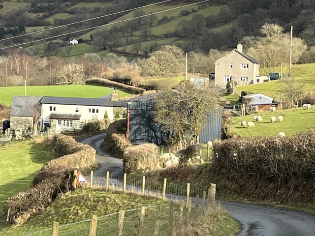
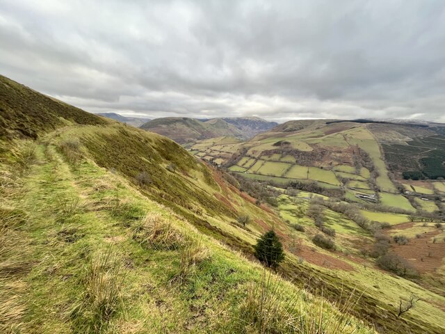
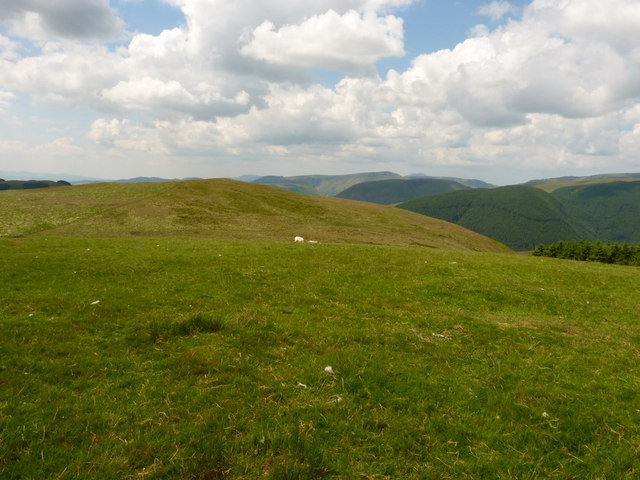
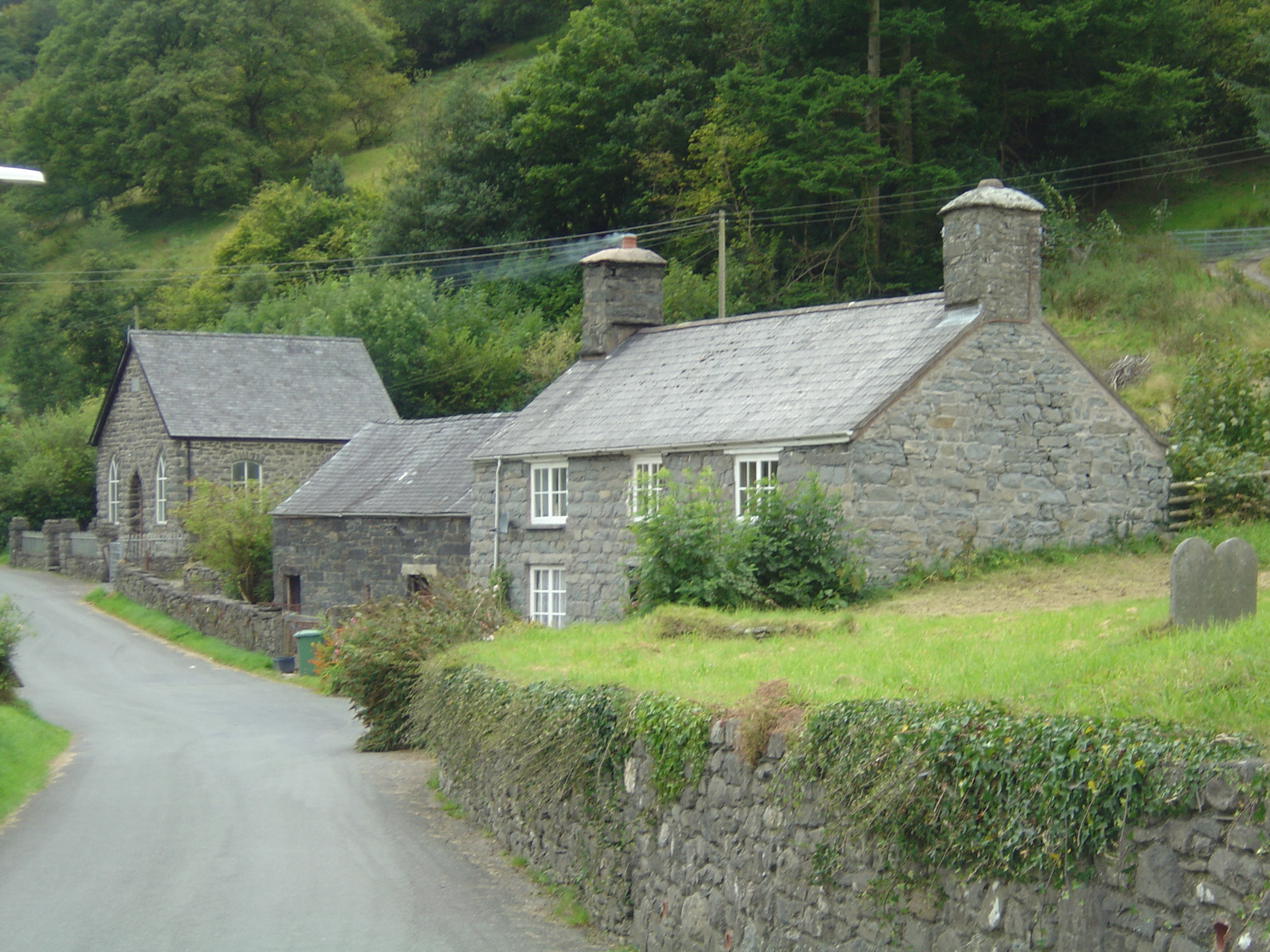
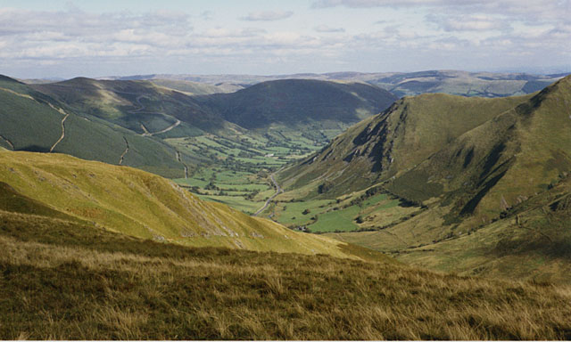
Blaennant is a small valley located in the historic county of Merionethshire, Wales. Situated in the heart of the Snowdonia National Park, Blaennant is surrounded by breathtaking mountain scenery, lush green fields, and cascading waterfalls. The valley is known for its tranquil atmosphere and unspoiled natural beauty, making it a popular destination for outdoor enthusiasts and nature lovers.

The village of Blaennant is home to a small community of residents who take pride in preserving the area's traditional Welsh culture and heritage. The village is dotted with charming stone cottages, a quaint church, and a local pub where visitors can sample traditional Welsh cuisine and locally brewed ales.

Visitors to Blaennant can enjoy a variety of outdoor activities such as hiking, birdwatching, and cycling along the scenic trails that wind through the valley. The nearby mountains offer opportunities for rock climbing and mountaineering, while the rivers and streams are perfect for fishing and kayaking.

Overall, Blaennant is a hidden gem in the Welsh countryside, offering a peaceful retreat for those looking to escape the hustle and bustle of city life and immerse themselves in the beauty of nature.

If you have any feedback on the listing, please let us know in the comments section below.

Blaennant Images

Images are sourced within 2km of 52.74125/-3.6498811 or Grid Reference SH8817. Thanks to Geograph Open Source API. All images are credited.

Llanymawddwy Arwydd pentref Llanymawddwy / Llanymawddwy village sign.
Llanymawddwy
Arwydd pentref Llanymawddwy / Llanymawddwy village sign.
A daffodil welcome to Llanymawddwy A very healthy crop greets travellers from the south.
A daffodil welcome to Llanymawddwy
A very healthy crop greets travellers from the south.
Approaching Glanllynmawr A hamlet in the upper Dyfi valley.
Approaching Glanllynmawr
A hamlet in the upper Dyfi valley.
Two lone pines Remaining after the felling of a forestry plantation.
Two lone pines
Remaining after the felling of a forestry plantation.
Isolated moorland hut
Bridleway above the Dyfi valley
Road into Llanymawddwy This was a drovers' road used for driving cattle and other stock to markets in England.
This was the way to Bwlch-y-Groes and the road to Bala. It was a very spiritual place because drovers and pilgrims needed somewhere to pray before tackling the pass.
They also needed somewhere to rest and at one time there were 7 public houses in the village with names linked to droving.
Road into Llanymawddwy
This was a drovers' road used for driving cattle and other stock to markets in England. This was the way to Bwlch-y-Groes and the road to Bala. It was a very spiritual place because drovers and pilgrims needed somewhere to pray before tackling the pass. They also needed somewhere to rest and at one time there were 7 public houses in the village with names linked to droving.
Y Foel, Tarren Cwmbachgen
Tarren Cwmbachgen
Tarren Cwmbachgen
Llanerchfydaf from Y Gribin
Y Foel from the southern side of Y Gribin
Hillside track up onto Llanerchfydaf Looking down the hill track from Coed-cae farm to Llanerchfydaf, with Cwm Isaf beyond.
Hillside track up onto Llanerchfydaf
Looking down the hill track from Coed-cae farm to Llanerchfydaf, with Cwm Isaf beyond.
The summit of Llanerchfydaf I use the word 'summit' rather loosely here - it's a large flat field with a notional spot height of 485m on the NW side. So finding the precise high point is a bit of a lottery without surveying equipment. The view is SW towards Y Gribin and the hills on the far side of Dinas Mawddwy.
The summit of Llanerchfydaf
I use the word 'summit' rather loosely here - it's a large flat field with a notional spot height of 485m on the NW side. So finding the precise high point is a bit of a lottery without surveying equipment. The view is SW towards Y Gribin and the hills on the far side of Dinas Mawddwy.
Y Gribin from Llanerchfydaf With the upper valley of the Nant Cil-cwm forming the low ground between the two hills.
Y Gribin from Llanerchfydaf
With the upper valley of the Nant Cil-cwm forming the low ground between the two hills.
Westwards from the side of Llanerchfydaf Across the valley of the Afon Dyfi towards the outlying hills of the Arans ridge.
Westwards from the side of Llanerchfydaf
Across the valley of the Afon Dyfi towards the outlying hills of the Arans ridge.
Fences and rough grazing below Llanerchfydaf On the edge of Access Land at the saddle between Llanerchfydaf and Y Gribin. The rough grazing in the foreground proved to be very trying to walk over.
Fences and rough grazing below Llanerchfydaf
On the edge of Access Land at the saddle between Llanerchfydaf and Y Gribin. The rough grazing in the foreground proved to be very trying to walk over.
The summit of Y Gribin A slightly more pronounced summit than that of Llanerchfydaf; at least the high point is a little more identifiable. View is to the south-west along the line of the Dyfi valley towards the hills beyond Dinas Mawddwy.
The summit of Y Gribin
A slightly more pronounced summit than that of Llanerchfydaf; at least the high point is a little more identifiable. View is to the south-west along the line of the Dyfi valley towards the hills beyond Dinas Mawddwy.
Round-leaved sundew (Drosera rotundifolia) I've not seen one for years, then there was a profusion of these in the bog just here; impossible to walk across the bog without treading on them, in fact. This particular example had recently caught a small fly, which is visible in the centre of the image.
<span class="nowrap"><a title="http://www.plantlife.org.uk/wild_plants/plant_species/round-leaved_sundew/" rel="nofollow ugc noopener" href="http://www.plantlife.org.uk/wild_plants/plant_species/round-leaved_sundew/">Link</a><img style="margin-left:2px;" alt="External link" title="External link - shift click to open in new window" src="https://s1.geograph.org.uk/img/external.png" width="10" height="10"/></span>
Round-leaved sundew (Drosera rotundifolia)
I've not seen one for years, then there was a profusion of these in the bog just here; impossible to walk across the bog without treading on them, in fact. This particular example had recently caught a small fly, which is visible in the centre of the image. LinkExternal link
Show me another place!

Blaennant is located at Grid Ref: SH8817 (Lat: 52.74125, Lng: -3.6498811)

Unitary Authority: Gwynedd

Police Authority: North Wales

What 3 Words

///deflection.replaying.nutrients. Near Cwm-Llinau, Powys

Nearby Locations

Blaennant

Related Wikis

Llanymawddwy

Llanymawddwy () is a village in the community of Mawddwy in south-east Gwynedd, Wales, which is to the north of the larger village of Dinas Mawddwy, on...

Cywarch

Cywarch (also known as Aber-Cywarch or Aber Cywarch) is a location at the head of Cwm Cywarch in the Snowdonia National Park, in Gwynedd, Wales. Several...

Afon Cerist

The Afon Cerist is a small river that flows from underneath Craig Portas, the cliffs on the north side of Maesglase mountain, to meet the River Dyfi at...

Dinas Mawddwy

Dinas Mawddwy (Welsh pronunciation: [ˈdiːnas mau̯ðʊɨ̯]; ) is a town in the community of Mawddwy in south-east Gwynedd, north Wales. It lies within the...

Nearby Amenities

Located within 500m of 52.74125,-3.6498811
Place: farm
Lat/Long: 52.7414677/-3.6451086
The data included in this document is from www.openstreetmap.org. The data is made available under ODbL.

Have you been to Blaennant?

Leave your review of Blaennant below (or comments, questions and feedback).