Barrack Hill

Settlement in Monmouthshire

Wales

Barrack Hill

Northern edge of St Woolos Cemetery, Newport A small part of a large municipal cemetery. Most burials in Newport were originally in the churchyard of St Woolos cathedral, but by the middle of the 19th century this was totally inadequate for a town with a rapidly-growing population. 15 acres of land to the west of the cathedral, between Risca Road and Bassaleg Road, were obtained from the Tredegar Estate for the new St Woolos Cemetery, which opened in 1854.

It is the UK's oldest municipal cemetery. Its current dimensions are about 600 metres by 400 metres, roughly 60 acres.
Northern edge of St Woolos Cemetery, Newport Credit: Jaggery

Barrack Hill is a small village located in Monmouthshire, a county in southeastern Wales, United Kingdom. Situated near the town of Usk, Barrack Hill is nestled amidst the picturesque countryside, offering its residents a tranquil and scenic setting.

The village is known for its close-knit community and friendly atmosphere. It features a small population, predominantly consisting of families and retirees. The village boasts a range of housing options, from traditional cottages to more modern properties, catering to diverse preferences.

Barrack Hill benefits from its strategic location, with easy access to major transportation routes. The A449 road runs nearby, connecting the village to larger towns and cities, including Newport and Monmouth. This convenient connectivity enables residents to easily commute to neighboring areas for work or leisure activities.

While Barrack Hill itself is primarily residential, there are a few local amenities available to its residents. These include a village hall, which serves as a community hub for various events and gatherings. Additionally, a small convenience store provides essential goods and services to meet the day-to-day needs of the locals.

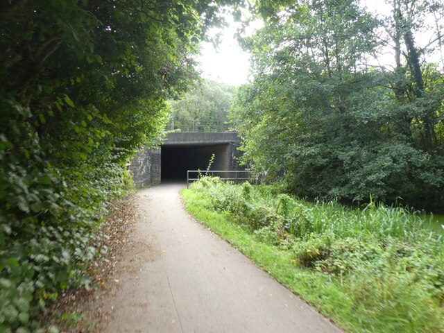
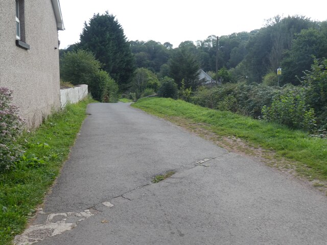
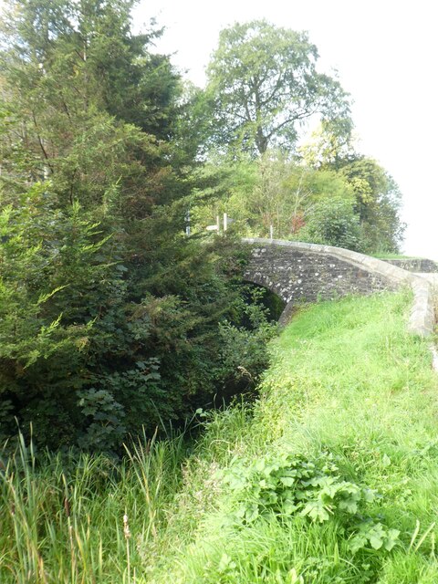
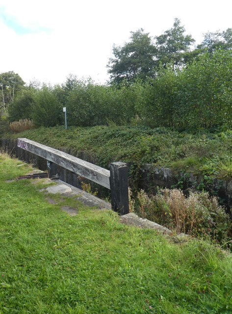
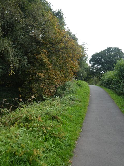
The village is surrounded by beautiful natural landscapes, making it a haven for outdoor enthusiasts. There are numerous walking and cycling trails in the vicinity, allowing residents to explore the stunning Monmouthshire countryside. The nearby River Usk also offers opportunities for fishing and water-based activities.

Overall, Barrack Hill offers a peaceful and idyllic living environment, combining the charm of a rural setting with convenient access to essential amenities and nearby towns.

If you have any feedback on the listing, please let us know in the comments section below.
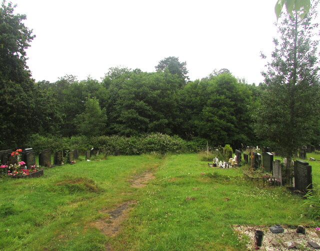
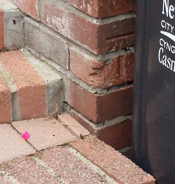
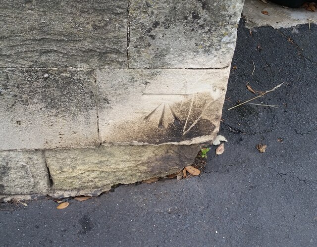
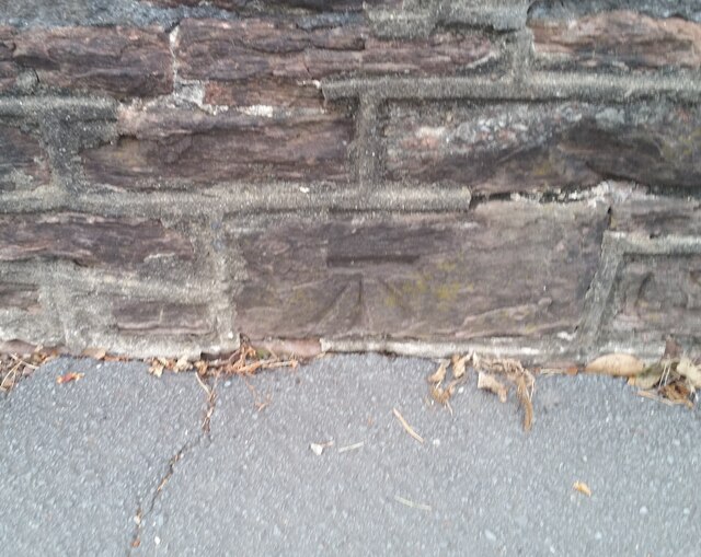
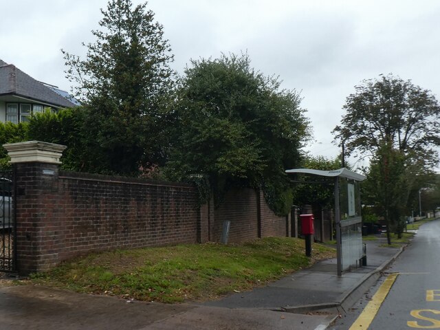
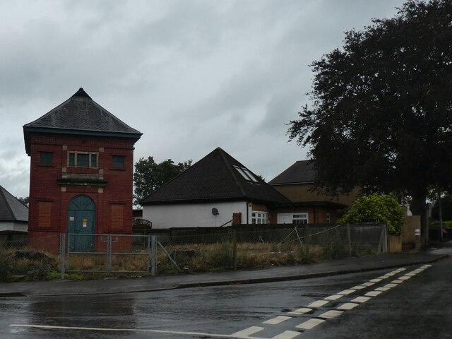
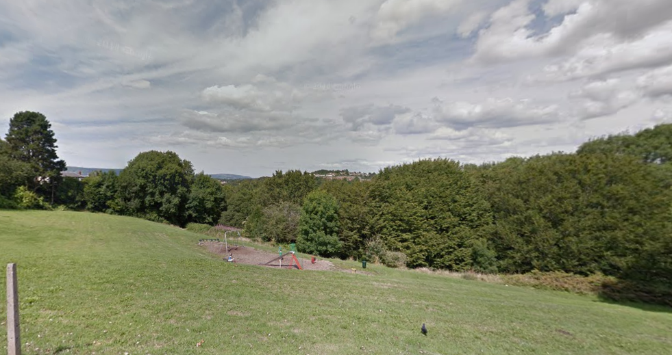
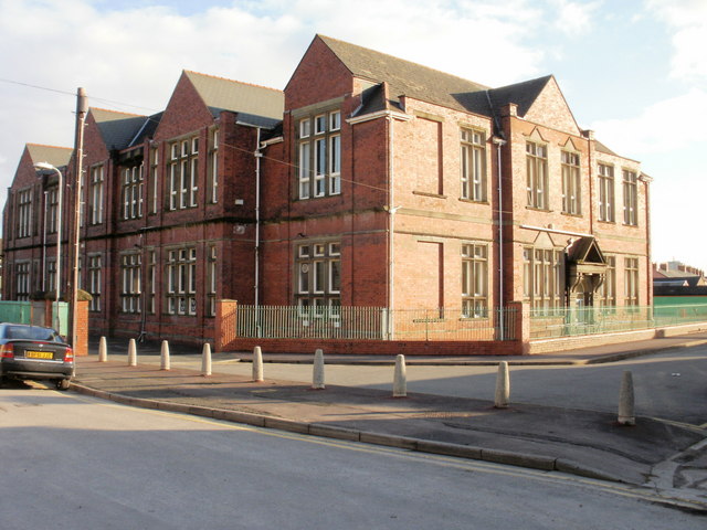
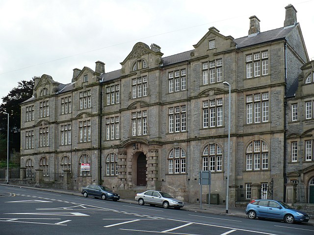
Barrack Hill Images

Images are sourced within 2km of 51.597195/-3.005674 or Grid Reference ST3089. Thanks to Geograph Open Source API. All images are credited.

Northern edge of St Woolos Cemetery, Newport A small part of a large municipal cemetery. Most burials in Newport were originally in the churchyard of St Woolos cathedral, but by the middle of the 19th century this was totally inadequate for a town with a rapidly-growing population. 15 acres of land to the west of the cathedral, between Risca Road and Bassaleg Road, were obtained from the Tredegar Estate for the new St Woolos Cemetery, which opened in 1854.

It is the UK's oldest municipal cemetery. Its current dimensions are about 600 metres by 400 metres, roughly 60 acres.
Northern edge of St Woolos Cemetery, Newport
A small part of a large municipal cemetery. Most burials in Newport were originally in the churchyard of St Woolos cathedral, but by the middle of the 19th century this was totally inadequate for a town with a rapidly-growing population. 15 acres of land to the west of the cathedral, between Risca Road and Bassaleg Road, were obtained from the Tredegar Estate for the new St Woolos Cemetery, which opened in 1854. It is the UK's oldest municipal cemetery. Its current dimensions are about 600 metres by 400 metres, roughly 60 acres.
Ordnance Survey Cut Mark This OS cut mark can be found on No83 Bassaleg Road. It marks a point 73.460m above mean sea level.
Ordnance Survey Cut Mark
This OS cut mark can be found on No83 Bassaleg Road. It marks a point 73.460m above mean sea level.
Ordnance Survey Cut Mark This OS cut mark can be found on wall post at the cemetery entrance on Bassaleg Road. It marks a point 78.002m above mean sea level.
Ordnance Survey Cut Mark
This OS cut mark can be found on wall post at the cemetery entrance on Bassaleg Road. It marks a point 78.002m above mean sea level.
Ordnance Survey Cut Mark This OS cut mark can be found on the cemetery wall on Bassaleg Road. It marks a point 79.733m above mean sea level.
Ordnance Survey Cut Mark
This OS cut mark can be found on the cemetery wall on Bassaleg Road. It marks a point 79.733m above mean sea level.
Ordnance Survey Cut Mark This OS cut mark can be found on the post at the entrance of Coed Melyn Park. It marks a point 70.434m above mean sea level.
Ordnance Survey Cut Mark
This OS cut mark can be found on the post at the entrance of Coed Melyn Park. It marks a point 70.434m above mean sea level.
Ordnance Survey Cut Mark This OS cut mark can be found on the wall of Clewer Court, Oakfield Road. It marks a point 63.108m above mean sea level.
Ordnance Survey Cut Mark
This OS cut mark can be found on the wall of Clewer Court, Oakfield Road. It marks a point 63.108m above mean sea level.
Ordnance Survey Cut Mark This OS cut mark can be found on No2 Upton Road. It marks a point 75.242m above mean sea level.
Ordnance Survey Cut Mark
This OS cut mark can be found on No2 Upton Road. It marks a point 75.242m above mean sea level.
Ordnance Survey Cut Mark This OS cut mark can be found on the cemetery gatepost SW side of Risca Road. It marks a point 76.615m above mean sea level.
Ordnance Survey Cut Mark
This OS cut mark can be found on the cemetery gatepost SW side of Risca Road. It marks a point 76.615m above mean sea level.
Ordnance Survey Cut Mark This OS cut mark can be found on the wall of No18 Woodville Road. It marks a point 75.926m above mean sea level.
Ordnance Survey Cut Mark
This OS cut mark can be found on the wall of No18 Woodville Road. It marks a point 75.926m above mean sea level.
Ordnance Survey Cut Mark This OS cut mark can be found on the wall of No6 Woodville Road. It marks a point 81.064m above mean sea level.
Ordnance Survey Cut Mark
This OS cut mark can be found on the wall of No6 Woodville Road. It marks a point 81.064m above mean sea level.
Cycle route at foot of Fourteen Locks, with underpass beneath M4 The M4 is 190 miles long and runs from London to South Wales. Major centres close to the motorway include Reading, Swindon, Bristol, Newport, Cardiff and Swansea. The motorway was constructed between 1961 and 1996. The M4 originally crossed the first Severn Road Bridge. It has now been diverted to use the Second Severn Crossing and the motorway over the older bridge has been renumbered as M48.
Wikipedia: <span class="nowrap"><a title="http://en.wikipedia.org/wiki/M4_motorway" rel="nofollow ugc noopener" href="http://en.wikipedia.org/wiki/M4_motorway">Link</a><img style="margin-left:2px;" alt="External link" title="External link - shift click to open in new window" src="https://s1.geograph.org.uk/img/external.png" width="10" height="10"/></span>
Cycle route at foot of Fourteen Locks, with underpass beneath M4
The M4 is 190 miles long and runs from London to South Wales. Major centres close to the motorway include Reading, Swindon, Bristol, Newport, Cardiff and Swansea. The motorway was constructed between 1961 and 1996. The M4 originally crossed the first Severn Road Bridge. It has now been diverted to use the Second Severn Crossing and the motorway over the older bridge has been renumbered as M48. Wikipedia: LinkExternal link
Cycle route by Monmouthshire and Brecon Canal north of Allt-yr-yn
Bridge over the overgrown Monmouthshire and Brecon Canal The Monmouthshire and Brecon Canal (popularly referred to as the Mon & Brec) was originally two separate canals: the Brecknock & Abergavenny Canal, and the Monmouthshire Canal. The 35-mile navigable section seen today is mostly the former. Following discussions in the 1790s, it was decided to link the two canals at Pontymoile. The Monmouthshire Canal, including a branch from Malpas to Crumlin, was opened in 1799 with the Brecknock & Abergavenny extending from Brecon to Gilwern by 1800, finally reaching Pontymoile by 1812.

Though originally constructed to transport coal, lime and agricultural products the canal was used extensively by ironmasters and industrialists as their main transport network, bringing the raw iron ore up the canal from Newport to Llanfoist Wharf and thence by tramroads to the iron works and returning with trams loaded with iron, the finished product. 

In 1880 the Monmouthshire & Brecon Canals were taken over by the Great Western Railway. Within 35 years, commercial carrying had all but ceased. Throughout the 20th century various parts of the Monmouthshire Canal were filled in for road construction. Both canals were abandoned by the early 1960s but restoration work from Brecon to Pontymoile began in 1968 following vigorous campaigning by canal enthusiasts. Recent developments have included a complete regeneration of the terminus at Brecon, and various works continue to reclaim the navigation between Pontymoile and Newport. The Blaenavon area and a section of the canal were granted World Heritage status in 2000 in recognition of its historical significance. 
<span class="nowrap"><a title="https://canalrivertrust.org.uk/enjoy-the-waterways/canal-and-river-network/monmouthshire-and-brecon-canal" rel="nofollow ugc noopener" href="https://canalrivertrust.org.uk/enjoy-the-waterways/canal-and-river-network/monmouthshire-and-brecon-canal">Link</a><img style="margin-left:2px;" alt="External link" title="External link - shift click to open in new window" src="https://s1.geograph.org.uk/img/external.png" width="10" height="10"/></span>  Canal and River Trust
Bridge over the overgrown Monmouthshire and Brecon Canal
The Monmouthshire and Brecon Canal (popularly referred to as the Mon & Brec) was originally two separate canals: the Brecknock & Abergavenny Canal, and the Monmouthshire Canal. The 35-mile navigable section seen today is mostly the former. Following discussions in the 1790s, it was decided to link the two canals at Pontymoile. The Monmouthshire Canal, including a branch from Malpas to Crumlin, was opened in 1799 with the Brecknock & Abergavenny extending from Brecon to Gilwern by 1800, finally reaching Pontymoile by 1812. Though originally constructed to transport coal, lime and agricultural products the canal was used extensively by ironmasters and industrialists as their main transport network, bringing the raw iron ore up the canal from Newport to Llanfoist Wharf and thence by tramroads to the iron works and returning with trams loaded with iron, the finished product. In 1880 the Monmouthshire & Brecon Canals were taken over by the Great Western Railway. Within 35 years, commercial carrying had all but ceased. Throughout the 20th century various parts of the Monmouthshire Canal were filled in for road construction. Both canals were abandoned by the early 1960s but restoration work from Brecon to Pontymoile began in 1968 following vigorous campaigning by canal enthusiasts. Recent developments have included a complete regeneration of the terminus at Brecon, and various works continue to reclaim the navigation between Pontymoile and Newport. The Blaenavon area and a section of the canal were granted World Heritage status in 2000 in recognition of its historical significance. LinkExternal link Canal and River Trust
Old lock on Monmouthshire and Brecon Canal The Monmouthshire and Brecon Canal (popularly referred to as the Mon & Brec) was originally two separate canals: the Brecknock & Abergavenny Canal, and the Monmouthshire Canal. The 35-mile navigable section seen today is mostly the former. Following discussions in the 1790s, it was decided to link the two canals at Pontymoile. The Monmouthshire Canal, including a branch from Malpas to Crumlin, was opened in 1799 with the Brecknock & Abergavenny extending from Brecon to Gilwern by 1800, finally reaching Pontymoile by 1812.

Though originally constructed to transport coal, lime and agricultural products the canal was used extensively by ironmasters and industrialists as their main transport network, bringing the raw iron ore up the canal from Newport to Llanfoist Wharf and thence by tramroads to the iron works and returning with trams loaded with iron, the finished product. 

In 1880 the Monmouthshire & Brecon Canals were taken over by the Great Western Railway. Within 35 years, commercial carrying had all but ceased. Throughout the 20th century various parts of the Monmouthshire Canal were filled in for road construction. Both canals were abandoned by the early 1960s but restoration work from Brecon to Pontymoile began in 1968 following vigorous campaigning by canal enthusiasts. Recent developments have included a complete regeneration of the terminus at Brecon, and various works continue to reclaim the navigation between Pontymoile and Newport. The Blaenavon area and a section of the canal were granted World Heritage status in 2000 in recognition of its historical significance. 
<span class="nowrap"><a title="https://canalrivertrust.org.uk/enjoy-the-waterways/canal-and-river-network/monmouthshire-and-brecon-canal" rel="nofollow ugc noopener" href="https://canalrivertrust.org.uk/enjoy-the-waterways/canal-and-river-network/monmouthshire-and-brecon-canal">Link</a><img style="margin-left:2px;" alt="External link" title="External link - shift click to open in new window" src="https://s1.geograph.org.uk/img/external.png" width="10" height="10"/></span>  Canal and River Trust
Old lock on Monmouthshire and Brecon Canal
The Monmouthshire and Brecon Canal (popularly referred to as the Mon & Brec) was originally two separate canals: the Brecknock & Abergavenny Canal, and the Monmouthshire Canal. The 35-mile navigable section seen today is mostly the former. Following discussions in the 1790s, it was decided to link the two canals at Pontymoile. The Monmouthshire Canal, including a branch from Malpas to Crumlin, was opened in 1799 with the Brecknock & Abergavenny extending from Brecon to Gilwern by 1800, finally reaching Pontymoile by 1812. Though originally constructed to transport coal, lime and agricultural products the canal was used extensively by ironmasters and industrialists as their main transport network, bringing the raw iron ore up the canal from Newport to Llanfoist Wharf and thence by tramroads to the iron works and returning with trams loaded with iron, the finished product. In 1880 the Monmouthshire & Brecon Canals were taken over by the Great Western Railway. Within 35 years, commercial carrying had all but ceased. Throughout the 20th century various parts of the Monmouthshire Canal were filled in for road construction. Both canals were abandoned by the early 1960s but restoration work from Brecon to Pontymoile began in 1968 following vigorous campaigning by canal enthusiasts. Recent developments have included a complete regeneration of the terminus at Brecon, and various works continue to reclaim the navigation between Pontymoile and Newport. The Blaenavon area and a section of the canal were granted World Heritage status in 2000 in recognition of its historical significance. LinkExternal link Canal and River Trust
Trees overhanging the canal by NCN49 The Monmouthshire and Brecon Canal (popularly referred to as the Mon & Brec) was originally two separate canals: the Brecknock & Abergavenny Canal, and the Monmouthshire Canal. The 35-mile navigable section seen today is mostly the former. Following discussions in the 1790s, it was decided to link the two canals at Pontymoile. The Monmouthshire Canal, including a branch from Malpas to Crumlin, was opened in 1799 with the Brecknock & Abergavenny extending from Brecon to Gilwern by 1800, finally reaching Pontymoile by 1812.

Though originally constructed to transport coal, lime and agricultural products the canal was used extensively by ironmasters and industrialists as their main transport network, bringing the raw iron ore up the canal from Newport to Llanfoist Wharf and thence by tramroads to the iron works and returning with trams loaded with iron, the finished product. 

In 1880 the Monmouthshire & Brecon Canals were taken over by the Great Western Railway. Within 35 years, commercial carrying had all but ceased. Throughout the 20th century various parts of the Monmouthshire Canal were filled in for road construction. Both canals were abandoned by the early 1960s but restoration work from Brecon to Pontymoile began in 1968 following vigorous campaigning by canal enthusiasts. Recent developments have included a complete regeneration of the terminus at Brecon, and various works continue to reclaim the navigation between Pontymoile and Newport. The Blaenavon area and a section of the canal were granted World Heritage status in 2000 in recognition of its historical significance. 
<span class="nowrap"><a title="https://canalrivertrust.org.uk/enjoy-the-waterways/canal-and-river-network/monmouthshire-and-brecon-canal" rel="nofollow ugc noopener" href="https://canalrivertrust.org.uk/enjoy-the-waterways/canal-and-river-network/monmouthshire-and-brecon-canal">Link</a><img style="margin-left:2px;" alt="External link" title="External link - shift click to open in new window" src="https://s1.geograph.org.uk/img/external.png" width="10" height="10"/></span>  Canal and River Trust
Trees overhanging the canal by NCN49
The Monmouthshire and Brecon Canal (popularly referred to as the Mon & Brec) was originally two separate canals: the Brecknock & Abergavenny Canal, and the Monmouthshire Canal. The 35-mile navigable section seen today is mostly the former. Following discussions in the 1790s, it was decided to link the two canals at Pontymoile. The Monmouthshire Canal, including a branch from Malpas to Crumlin, was opened in 1799 with the Brecknock & Abergavenny extending from Brecon to Gilwern by 1800, finally reaching Pontymoile by 1812. Though originally constructed to transport coal, lime and agricultural products the canal was used extensively by ironmasters and industrialists as their main transport network, bringing the raw iron ore up the canal from Newport to Llanfoist Wharf and thence by tramroads to the iron works and returning with trams loaded with iron, the finished product. In 1880 the Monmouthshire & Brecon Canals were taken over by the Great Western Railway. Within 35 years, commercial carrying had all but ceased. Throughout the 20th century various parts of the Monmouthshire Canal were filled in for road construction. Both canals were abandoned by the early 1960s but restoration work from Brecon to Pontymoile began in 1968 following vigorous campaigning by canal enthusiasts. Recent developments have included a complete regeneration of the terminus at Brecon, and various works continue to reclaim the navigation between Pontymoile and Newport. The Blaenavon area and a section of the canal were granted World Heritage status in 2000 in recognition of its historical significance. LinkExternal link Canal and River Trust
Houses in Nant Coch Drive
Bus shelter by Risca Road
Electricity substation by road junction, Fields Park Road
Show me another place!

Barrack Hill is located at Grid Ref: ST3089 (Lat: 51.597195, Lng: -3.005674)

Unitary Authority: Newport

Police Authority: Gwent

What 3 Words

///icon.sushi.fades. Near Newport

Related Wikis

Barrack Hill

Barrack Hill is an area in Newport, Wales, in the suburb and electoral ward and coterminous community parish of Allt-yr-yn. It is most well known for...

Raglan Barracks, Newport

Raglan Barracks is a military installation at Barrack Hill in Allt-yr-yn in Newport, Wales. == History == The barracks were built as a cavalry barracks...

01633

The 01633 telephone area code covers the city of Newport and surrounding areas in the United Kingdom. Before PhONEday the area code was 0633, which was...

Shaftesbury, Newport

Shaftesbury is a community (civil parish) and coterminous electoral district (ward) of the city of Newport, South Wales. The community is bounded by the...

Marshes Turnpike Gate railway station

Marshes Turnpike Gate railway station was a temporary station opened by the Monmouthshire Railway and Canal Company in central Newport, Wales. == History... ==

Crindau

Crindau (Welsh: Crindai) is a Victorian inner-city area just north of the city centre in Newport in south-east Wales. It lies within the Shaftesbury electoral...

Shire Hall, Newport

The Shire Hall (Welsh: Neuadd y Sir, Casnewydd) is a municipal building in Newport, south Wales. It is a Grade II listed building. == History == Following...

Newport Mill Street railway station

Newport Mill Street railway station was one of four stations in central Newport, Wales. == History == === Opening === A part of Monmouthshire at the time...

Nearby Amenities

Located within 500m of 51.597195,-3.005674
Motorway Junction
Malpas Interchange
Exit To: A4051 Newport, Cwmbrân, Caerleon
Layer: 3
Ref: 26
Lat/Long: 51.5980858/-3.0120011
Waterway: lock_gate
Lat/Long: 51.5974956/-3.0117687
Malpas Junction
Lat/Long: 51.5993561/-3.0073186
Information: guidepost
Ncn Milepost: rowe
Source: survey
Sustrans Ref: MP585
Tourism: information
Lat/Long: 51.5995111/-3.0071178
Fuel
Shell Fuel
Addr City: Newport
Addr Housenumber: 1
Addr Postcode: NP20 5PA
Addr Street: Malpas Road
Brand: Shell
Brand Wikidata: Q110716465
Brand Wikipedia: en:Royal Dutch Shell
Opening Hours: 24/7
Phone: +44 1633 850033
Ref Navads: NVDS353_10019063
Website: https://find.shell.com/gb/fuel/10019063-shell-newport
Lat/Long: 51.597377/-2.9997404
Created By: GPSBabel-1.3.6
Lat/Long: 51.595797/-3.003692
Created By: GPSBabel-1.3.6
Lat/Long: 51.5955381/-2.9997588
Created By: GPSBabel-1.3.6
Lat/Long: 51.595104/-3.002904
Created By: GPSBabel-1.3.6
Lat/Long: 51.595448/-3.002373
Created By: GPSBabel-1.3.6
Lat/Long: 51.59819/-3.000899
Created By: GPSBabel-1.3.6
Lat/Long: 51.596063/-3.005201
Created By: GPSBabel-1.3.6
Lat/Long: 51.595346/-3.005421
Created By: GPSBabel-1.3.6
Lat/Long: 51.595764/-3.009197
Created By: GPSBabel-1.3.6
Lat/Long: 51.595698/-3.009296
Created By: GPSBabel-1.3.6
Lat/Long: 51.595903/-3.008936
Created By: GPSBabel-1.3.6
Lat/Long: 51.597194/-3.006897
Created By: GPSBabel-1.3.6
Lat/Long: 51.597274/-3.006912
Created By: GPSBabel-1.3.6
Lat/Long: 51.595992/-3.002007
Created By: GPSBabel-1.3.6
Lat/Long: 51.596053/-3.003318
Created By: GPSBabel-1.3.6
Lat/Long: 51.596127/-3.003254
Created By: GPSBabel-1.3.6
Lat/Long: 51.596275/-3.003128
Created By: GPSBabel-1.3.6
Lat/Long: 51.595747/-3.003792
Created By: GPSBabel-1.3.6
Lat/Long: 51.595858/-3.003584
Created By: GPSBabel-1.3.6
Lat/Long: 51.59592/-3.003481
Created By: GPSBabel-1.3.6
Lat/Long: 51.595986/-3.003391
Created By: GPSBabel-1.3.6
Lat/Long: 51.596669/-3.002857
Created By: GPSBabel-1.3.6
Lat/Long: 51.595705/-3.003895
Created By: GPSBabel-1.3.6
Lat/Long: 51.595661/-3.004006
Created By: GPSBabel-1.3.6
Lat/Long: 51.595626/-3.00412
Created By: GPSBabel-1.3.6
Lat/Long: 51.595133/-3.0009
Created By: GPSBabel-1.3.6
Lat/Long: 51.595146/-3.001068
Created By: GPSBabel-1.3.6
Lat/Long: 51.595161/-3.001244
Created By: GPSBabel-1.3.6
Lat/Long: 51.5951/-3.00173
Created By: GPSBabel-1.3.6
Lat/Long: 51.595222/-3.002691
Created By: GPSBabel-1.3.6
Lat/Long: 51.595289/-3.002587
Created By: GPSBabel-1.3.6
Lat/Long: 51.595362/-3.002474
Created By: GPSBabel-1.3.6
Lat/Long: 51.59506/-3.003023
Created By: GPSBabel-1.3.6
Lat/Long: 51.595161/-3.002796
Created By: GPSBabel-1.3.6
Lat/Long: 51.5949061/-3.0036466
Turning Circle
Lat/Long: 51.5941973/-3.0014088
Created By: GPSBabel-1.3.6
Lat/Long: 51.598253/-3.000758
Created By: GPSBabel-1.3.6
Lat/Long: 51.599692/-3.002472
Created By: GPSBabel-1.3.6
Lat/Long: 51.599772/-3.00235
Created By: GPSBabel-1.3.6
Lat/Long: 51.592983/-3.00438
Created By: GPSBabel-1.3.6
Lat/Long: 51.600802/-3.0032094
Created By: GPSBabel-1.3.6
Lat/Long: 51.598884/-2.999949
Created By: GPSBabel-1.3.6
Lat/Long: 51.598298/-2.99923
Crindau
Is In City: Newport
Place: suburb
Wikidata: Q5185733
Lat/Long: 51.5999449/-3.0009637
Barrack Hill
Is In City: Newport
Name Cy: Bryn Baric
Place: suburb
Wikidata: Q25171463
Lat/Long: 51.5977351/-3.005916
Bus Stop
Lyceum (outside)
Bus: yes
Naptan AtcoCode: 5310AWB30518
Network: Newport Bus
Operator: Newport Bus
Public Transport: platform
Ref: nwpdatg
Route Ref: 16A;16C;18;19;23;SJ6;SJ9;SJ12;X24;X30;YGI1
Lat/Long: 51.5999818/-3.0019456
Bus Stop
Prospect
Bus: yes
Name Cy: Rhagolygon
Naptan AtcoCode: 5310AWB30516
Naptan NaptanCode: nwpdawg
Network: Newport Bus
Operator: Newport Bus
Public Transport: platform
Lat/Long: 51.5986916/-3.0003253
Pub
Lyceum Tavern
Addr City: Newport
Addr Housenumber: 110
Addr Postcode: NP20 5PL
Addr Street: Malpas Road
Cuisine: british
Email: hello@LyceumTavern.co.uk
Opening Hours: Mo-Th 12:00-23:30; Fr 12:00-00:00; Sa 00:00-00:30,12:00-00:00; Su 00:00-00:30,12:00-23:00
Outdoor Seating: yes
Phone: +44 1633 858 636
Source: Local Knowledge
Website: https://lyceumtavern.co.uk/
Lat/Long: 51.6001972/-3.002066
Pub
Crindau Constitutional Club
Addr City: Newport
Addr Housenumber: 45-47
Addr Postcode: NP20 5PJ
Addr Street: Malpas Road
Opening Hours: Mo-Th 16:00-23:00; Fr-Sa 13:00-23:30; Su 12:00-23:00
Phone: +44 1633 761 494
Postal Code: NP20 5PJ
Lat/Long: 51.5984758/-3.0005281
Traffic Signals
Traffic Signals: part-time
Traffic Signals Direction: forward
Lat/Long: 51.6013426/-3.0053821
Bus Stop
Barrack Hill
Bus: yes
Name Cy: Bryn y Barics
Naptan AtcoCode: 5310AWB30514
Naptan NaptanCode: nwpapga
Network: Newport Bus
Operator: Newport Bus
Public Transport: platform
Lat/Long: 51.5968196/-2.9990037
Note: 30 mph speed limit sign
Lat/Long: 51.6007748/-3.0057732
Note: 50 mph speed limit sign
Lat/Long: 51.6004346/-3.0054431
Traffic Signals
Traffic Signals: part-time
Traffic Signals Direction: forward
Lat/Long: 51.6014516/-3.0054309
Traffic Signals
Traffic Signals: part-time
Traffic Signals Direction: forward
Lat/Long: 51.6011624/-3.0040996
Bus Stop
Lyceum (opposite)
Bench: yes
Bus: yes
Departures Board: timetable;realtime
Naptan AtcoCode: 5310AWB30517
Network: Newport Bus
Operator: Newport Bus
Passenger Information Display: yes
Public Transport: platform
Ref: nwpdatd
Route Ref: 16A;16C;18;19;23;29;SJ6;SJ7;SJ9;X24;X30;YGI1
Shelter: yes
Lat/Long: 51.5995139/-3.0016558
Waterway: lock_gate
Lat/Long: 51.5965243/-3.0127986
Waterway: lock_gate
Lat/Long: 51.5976564/-3.0115863
Garry Evans Tackle Centres
Addr City: Newport
Addr Housenumber: 29
Addr Postcode: NP20 5LZ
Addr Street: Redland Street
Email: sales@garryevans.co.uk
Name Cy: Canolfannau Taclo Garry Evans
Opening Hours: Mo-Fr 09:00-17:30; Sa 08:30-17:00; Su off
Opening Hours Covid19: Mo-Fr 09:00-17:30; Sa 08:30-17:00; Su Off
Phone: +44 1633 855 086
Shop: sports
Sport: fishing
Website: https://www.garryevans.co.uk/
Lat/Long: 51.5989973/-2.9991435
Speed Camera
Maxspeed: 50 mph
Lat/Long: 51.5978077/-3.0123798
Turning Circle
Lat/Long: 51.5943915/-3.0005668
Traffic Signals
Traffic Signals: part-time
Traffic Signals Direction: forward
Lat/Long: 51.6011301/-3.0043065
Speed Camera
Maxspeed: 50 mph
Note: overhead gantry with variable speed limit signs
Lat/Long: 51.5979253/-3.0124779
Clinic
Malpas Brook Health Centre
Addr City: Newport
Addr Housenumber: 107
Addr Postcode: NP20 5PJ
Addr Street: Malpas Road
Email: Enquiries.Malpasbrookhc@wales.nhs.uk
Healthcare: clinic
Healthcare Speciality: general
Name Cy: Canolfan Iechyd Nant Malpas
Opening Hours: Mo-We 08:00-17:50; Th 07:30-18:50; Fr 08:00-17:50; Sa off; Su off
Phone: +44 1633 855 808
Website: https://111.wales.nhs.uk/LocalServices/ViewLocalService.aspx?id=5008
Wheelchair: yes
Wikidata: Q91199884
Lat/Long: 51.5999135/-3.0030831
Lifestyle Express
Addr City: Newport
Addr Housenumber: 3
Addr Postcode: NP20 5GB
Addr Street: Allt-Yr-Yn View
Brand: Lifestyle Express
Brand Wikidata: Q61994869
Phone: +44 1633 259 441
Shop: convenience
Lat/Long: 51.5967238/-3.0068307
Bus Stop
Ross Street
Bus: yes
Name Cy: Stryd Ross
Network: Newport Bus
Operator: Newport Bus
Public Transport: platform
Lat/Long: 51.599393/-3.0005515
Bus Stop
Redland Street Bottom
Bus: yes
Name Cy: Gwaelod Stryd Redland
Naptan AtcoCode: 5310AWB30569
Naptan NaptanCode: nwpapja
Network: Newport Bus
Operator: Newport Bus
Public Transport: platform
Lat/Long: 51.5981267/-2.9995405
Bus Stop
Belvedere Terrace
Bus: yes
Name Cy: Teras Belvedere
Naptan AtcoCode: 5310AWB30584
Naptan NaptanCode: nwpadtp
Network: Newport Bus
Operator: Newport Bus
Public Transport: platform
Lat/Long: 51.5968199/-3.0005025
Bus Stop
Canal Street
Bus: yes
Name Cy: Stryd y Gamlas
Network: Newport Bus
Operator: Newport Bus
Public Transport: platform
Lat/Long: 51.5953962/-2.9996937
Bus Stop
Wickes (opposite)
Bus: yes
Name Cy: Wickes (gyferbyn)
Network: Newport Bus
Operator: Newport Bus
Public Transport: platform
Lat/Long: 51.5953411/-2.9998338
Direction: 280
Generator Method: photovoltaic
Generator Output Electricity: yes
Generator Solar Modules: 8
Generator Source: solar
Generator Type: solar_photovoltaic_panel
Location: roof
Power: generator
Lat/Long: 51.5961789/-3.0011585
Direction: 100
Generator Method: photovoltaic
Generator Output Electricity: yes
Generator Solar Modules: 8
Generator Source: solar
Generator Type: solar_photovoltaic_panel
Location: roof
Power: generator
Lat/Long: 51.5961681/-3.0010915
Direction: SE
Generator Method: photovoltaic
Generator Output Electricity: yes
Generator Solar Modules: 10
Generator Source: solar
Generator Type: solar_photovoltaic_panel
Location: roof
Power: generator
Lat/Long: 51.5956316/-3.0010432
Direction: 170
Generator Method: photovoltaic
Generator Output Electricity: yes
Generator Solar Modules: 10
Generator Source: solar
Generator Type: solar_photovoltaic_panel
Location: roof
Power: generator
Lat/Long: 51.5955116/-3.0006489
Direction: 175
Generator Method: photovoltaic
Generator Output Electricity: yes
Generator Solar Modules: 8
Generator Source: solar
Generator Type: solar_photovoltaic_panel
Location: roof
Power: generator
Lat/Long: 51.5949751/-3.0005658
Direction: 175
Generator Method: photovoltaic
Generator Output Electricity: yes
Generator Solar Modules: 10
Generator Source: solar
Generator Type: solar_photovoltaic_panel
Location: roof
Power: generator
Lat/Long: 51.5949884/-3.0003217
Direction: 175
Generator Method: photovoltaic
Generator Output Electricity: yes
Generator Solar Modules: 10
Generator Source: solar
Generator Type: solar_photovoltaic_panel
Location: roof
Power: generator
Lat/Long: 51.59525/-3.0003324
Direction: 170
Generator Method: photovoltaic
Generator Output Electricity: yes
Generator Solar Modules: 8
Generator Source: solar
Generator Type: solar_photovoltaic_panel
Location: roof
Power: generator
Lat/Long: 51.5952683/-3.0000749
Direction: 170
Generator Method: photovoltaic
Generator Output Electricity: yes
Generator Solar Modules: 8
Generator Source: solar
Generator Type: solar_photovoltaic_panel
Location: roof
Power: generator
Lat/Long: 51.5952783/-2.9999757
Direction: 185
Generator Method: photovoltaic
Generator Output Electricity: yes
Generator Solar Modules: 10
Generator Source: solar
Generator Type: solar_photovoltaic_panel
Location: roof
Power: generator
Lat/Long: 51.5952383/-3.0010352
Direction: 185
Generator Method: photovoltaic
Generator Output Electricity: yes
Generator Solar Modules: 10
Generator Source: solar
Generator Type: solar_photovoltaic_panel
Location: roof
Power: generator
Lat/Long: 51.5952433/-3.0011371
Direction: 185
Generator Method: photovoltaic
Generator Output Electricity: yes
Generator Solar Modules: 8
Generator Source: solar
Generator Type: solar_photovoltaic_panel
Location: roof
Power: generator
Lat/Long: 51.595275/-3.0013248
Direction: 185
Generator Method: photovoltaic
Generator Output Electricity: yes
Generator Solar Modules: 10
Generator Source: solar
Generator Type: solar_photovoltaic_panel
Location: roof
Power: generator
Lat/Long: 51.5952817/-3.0014026
Direction: SE
Generator Method: photovoltaic
Generator Output Electricity: yes
Generator Solar Modules: 10
Generator Source: solar
Generator Type: solar_photovoltaic_panel
Location: roof
Power: generator
Lat/Long: 51.5952383/-3.0017795
Direction: SW
Generator Method: photovoltaic
Generator Output Electricity: yes
Generator Solar Modules: 12
Generator Source: solar
Generator Type: solar_photovoltaic_panel
Location: roof
Power: generator
Lat/Long: 51.5952025/-3.0018713
Direction: SE
Generator Method: photovoltaic
Generator Output Electricity: yes
Generator Solar Modules: 8
Generator Source: solar
Generator Type: solar_photovoltaic_panel
Location: roof
Power: generator
Lat/Long: 51.5951267/-3.0019283
Direction: SE
Generator Method: photovoltaic
Generator Output Electricity: yes
Generator Solar Modules: 10
Generator Source: solar
Generator Type: solar_photovoltaic_panel
Location: roof
Power: generator
Lat/Long: 51.5950859/-3.0020095
Direction: SE
Generator Method: photovoltaic
Generator Output Electricity: yes
Generator Solar Modules: 10
Generator Source: solar
Generator Type: solar_photovoltaic_panel
Location: roof
Power: generator
Lat/Long: 51.5949751/-3.0021858
Direction: 145
Generator Method: photovoltaic
Generator Output Electricity: yes
Generator Solar Modules: 8
Generator Source: solar
Generator Type: solar_photovoltaic_panel
Location: roof
Power: generator
Lat/Long: 51.5956349/-3.0037576
Direction: 125
Generator Method: photovoltaic
Generator Output Electricity: yes
Generator Solar Modules: 6
Generator Source: solar
Generator Type: solar_photovoltaic_panel
Location: roof
Power: generator
Lat/Long: 51.5959365/-3.0032721
Direction: 175
Generator Method: photovoltaic
Generator Output Electricity: yes
Generator Solar Modules: 10
Generator Source: solar
Generator Type: solar_photovoltaic_panel
Location: roof
Power: generator
Lat/Long: 51.5949976/-3.0101962
Direction: 170
Generator Method: photovoltaic
Generator Output Electricity: yes
Generator Solar Modules: 12
Generator Source: solar
Generator Type: solar_photovoltaic_panel
Location: roof
Power: generator
Lat/Long: 51.5933538/-3.0021161
Place Of Worship
Malpas Road Evangelical Church
Addr City: Newport
Addr Postcode: NP20 5PJ
Addr Street: Malpas Road
Phone: +44 1633 855 781
Religion: christian
Website: https://www.facebook.com/MREChurch
Lat/Long: 51.5987115/-3.0008242
Grate Choice Fires
Addr City: Newport
Addr Housenumber: 55
Addr Postcode: NP20 5PJ
Addr Street: Malpas Road
Email: jon@gratechoice.co.uk
Opening Hours: Mo-Sa 10:00-16:00; Su off
Phone: +44 1633 850 220
Shop: fireplace
Website: http://www.gratechoice.co.uk/
Lat/Long: 51.5988151/-3.0009236
Addr City: Newport
Addr Housenumber: 39-43
Addr Postcode: NP20 5PB
Addr Street: Malpas Road
Email: enquiries@narduzzo.com
Opening Hours: Mo-Fr 09:00-17:00; Sa 09:30-16:00; Su off
Phone: +44 1633 858 097
Shop: kitchen
Website: https://www.narduzzo.com/
Lat/Long: 51.5983031/-3.0003068
Fast Food
Kenabella
Addr City: Newport
Addr Housenumber: 37
Addr Postcode: NP20 5PB
Addr Street: Malpas Road
Drive Through: no
Opening Hours: Mo-Sa 17:30-23:30; Su 18:00-23:00
Phone: +44 1633 821 257
Lat/Long: 51.5982064/-3.0001718
Smiths Carpets
Addr City: Newport
Addr Housenumber: 35
Addr Postcode: NP20 5PB
Addr Street: Malpas Road
Email: smithscarpetscymru@gmail.com
Opening Hours: Mo off; Tu-Fr 10:00-16:00; Sa 10:00-14:00; Su off
Phone: +44 1633 546 420
Shop: carpet
Website: https://www.facebook.com/Smithscarpetscymru/
Lat/Long: 51.5981563/-3.0001304
Lavande Designer Wear
Addr City: Newport
Addr Housenumber: 33
Addr Postcode: NP20 5PB
Addr Street: Malpas Road
Email: lavandedesignerwear@gmail.com
Phone: +44 1633 855 545
Shop: clothes
Website: https://lavandedesignerwear.co.uk/contact/
Lat/Long: 51.5981216/-3.000087
Coco
Addr City: Newport
Addr Housenumber: 31
Addr Postcode: NP20 5PB
Addr Street: Malpas Road
Email: walestracy@gmail.com
Not Brand Wikidata: Q65084369
Opening Hours: Mo off; Tu-Fr 09:00-17:00; Sa 08:00-14:00; Su off
Phone: +44 1633 984 309
Shop: hairdresser
Website: https://www.facebook.com/CocoHairNewport/
Lat/Long: 51.5980843/-3.0000622
B Beautiful
Addr City: Newport
Addr Housenumber: 27
Addr Postcode: NP20 5PB
Addr Street: Malpas Road
Opening Hours: Mo off; Tu-We 09:30-18:00; Th 09:30-19:00; Fr 09:30-18:00; Sa 08:00-14:00; Su off
Phone: +44 1633 853 935
Shop: beauty
Lat/Long: 51.5979978/-2.9999971
CWE Crimewatch Electrical
Addr City: Newport
Addr Housenumber: 9-11
Addr Postcode: NP20 5PA
Addr Street: Malpas Road
Office: security
Website: https://www.crimewatchalarms.co.uk
Lat/Long: 51.5976431/-2.999679
Nigel Davies Accountants
Addr City: Newport
Addr Housenumber: 17
Addr Postcode: NP20 5PA
Addr Street: Malpas Road
Office: accountant
Phone: +44 1633 850 051
Website: https://www.nigel-davies.co.uk
Lat/Long: 51.5977908/-2.9998168
Place Of Worship
Crindau Community Church
Addr City: Newport
Addr Housenumber: 2
Addr Postcode: NP20 5PA
Addr Street: Malpas Road
Email: leadership@crindau.org.uk
Religion: christian
Website: https://www.crindau.org.uk/
Lat/Long: 51.5971906/-2.9989624
Dyfed Menswear
Addr City: Newport
Addr Housenumber: 2c
Addr Postcode: NP20 5PA
Addr Street: Malpas Road
Clothes: formal;mens
Email: newport@dyfedmenswear.co.uk
Opening Hours: Mo-Fr 09:30-17:30; Sa 09:30-17:00; Su off
Phone: +44 1633 244 151
Shop: clothes
Website: https://www.dyfedmenswear.co.uk/
Lat/Long: 51.5972915/-2.9990555
CPC Business Services
Addr City: Newport
Addr Housenumber: 2e
Addr Postcode: NP20 5PA
Addr Street: Malpas Road
Opening Hours: Mo-Fr 09:00-17:00; Sa off; Su off
Phone: +44 1633 262 293
Shop: computer
Lat/Long: 51.5973387/-2.9990961
Malpas Convenience
Addr City: Newport
Addr Housenumber: 6
Addr Postcode: NP20 5PA
Addr Street: Malpas Road
Brand: Premier
Brand Wikidata: Q7240340
Opening Hours: Mo-Sa 05:00-21:00; Su 07:00-21:00
Phone: +44 1633 760 600
Shop: convenience
Website: https://www.premier-stores.co.uk/our-stores/malpas-convenience-store
Lat/Long: 51.5974397/-2.9991831
Fast Food
Golden Grill
Addr City: Newport
Addr Housenumber: 8
Addr Postcode: NP20 5PA
Addr Street: Malpas Road
Cuisine: kebab
Drive Through: no
Opening Hours: Mo-Th 14:00-23:50; Fr 14:00-00:00; Sa 00:00-00:50,14:00-00:00; Su 00:00-00:50,14:00-23:50
Phone: +44 1633 547 575
Website: https://www.goldengrillnewport.co.uk/
Lat/Long: 51.5974981/-2.9992335
Detail Barbers
Addr City: Newport
Addr Housenumber: 12
Addr Postcode: NP20 5PA
Addr Street: Malpas Road
Opening Hours: Mo off; Tu-Th 09:00-20:00; Fr-Sa 09:00-21:00; Su 10:00-15:00
Phone: +44 7939 186 003
Shop: hairdresser
Website: https://booksy.com/en-gb/37070_detail-barbers_barber-shop_1769897_newport
Lat/Long: 51.59758/-2.9993041
Newport Nails
Addr City: Newport
Addr Housenumber: 14-16
Addr Postcode: NP20 5PA
Addr Street: Malpas Road
Beauty: nails
Shop: beauty
Lat/Long: 51.5976254/-2.9993433
Restaurant
Indian Cottage
Addr City: Newport
Addr Housenumber: 18
Addr Postcode: NP20 5PA
Addr Street: Malpas Road
Cuisine: indian
Opening Hours: Mo-Th 17:00-23:00; Fr 17:00-00:00; Sa 11:00-00:00; Su 17:00-23:00
Phone: +44 1633 852 724
Website: https://www.newindiancottage.co.uk/
Lat/Long: 51.5976712/-2.9993828
No Regrets Custom Tattoo
Addr City: Newport
Addr Housenumber: 20
Addr Postcode: NP20 5PA
Addr Street: Malpas Road
Opening Hours: Mo-Sa 09:00-18:00; Su off
Phone: +44 1633 850 994
Shop: tattoo
Website: http://www.noregretstatooist.co.uk/
Lat/Long: 51.5977116/-2.9994175
Fast Food
Salt & Vinegar Fish & Chips
Addr City: Newport
Addr Housenumber: 22
Addr Postcode: NP20 5PA
Addr Street: Malpas Road
Cuisine: fish_and_chips
Drive Through: no
Opening Hours: Mo-Sa 12:00-22:30; Su 16:00-22:30
Phone: +44 1633 665 212
Website: https://www.just-eat.co.uk/restaurants-salt-and-vinegar-fish-and-chips-newport/menu
Lat/Long: 51.5977537/-2.9994539
Orla's
Addr City: Newport
Addr Housenumber: 24
Addr Postcode: NP20 5PA
Addr Street: Malpas Road
Alt Name: Orla's Cake Boutique
Email: orlascakeboutique@gmail.com
Opening Hours: Mo-Th 10:00-16:00; Fr 09:00-16:00; Sa 09:00-15:00; Su Off
Phone: +44 7398 865 850
Shop: pastry
Website: https://www.facebook.com/OrlaRoseCakes
Lat/Long: 51.597798/-2.999492
Icon Computing
Addr City: Newport
Addr Housenumber: 26
Addr Postcode: NP20 5PA
Addr Street: Malpas Road
Email: info@iconcomputing.co.uk
Opening Hours: Mo-Fr 09:00-17:00; Sa off; Su off
Phone: +44 1633 859 991
Shop: computer
Website: http://iconcomputing.co.uk/
Lat/Long: 51.5978387/-2.9995271
Hair Granted
Addr City: Newport
Addr Housenumber: 28
Addr Postcode: NP20 5PA
Addr Street: Malpas Road
Opening Hours: Mo off; Tu 09:00-19:00; We 09:00-18:00; Th 09:00-19:00; Fr 09:00-18:30; Sa 08:00-16:00; Su off
Phone: +44 7795 101 042
Shop: hairdresser
Website: https://www.beautynailhairsalons.com/GB/Newport/913379668685709/Hair-Granted
Lat/Long: 51.59788/-2.9995628
Restaurant
Shoboraj
Addr City: Newport
Addr Housenumber: 30
Addr Postcode: NP20 5PA
Addr Street: Malpas Road
Cuisine: indian
Opening Hours: Mo-Su 17:30-22:30
Phone: +44 1633 822 822
Website: https://www.shoboraj.co.uk/
Lat/Long: 51.597923/-2.9995998
Phone Box
Addr City: Newport
Addr Housenumber: 34
Addr Postcode: NP20 5PA
Addr Street: Malpas Road
Opening Hours: Mo-Fr 09:30-15:30; Sa 10:00-14:00; Su off
Phone: +44 1633 858 300
Shop: mobile_phone
Website: https://www.facebook.com/thephonebox34/
Lat/Long: 51.5981091/-2.9997081
Spectrum Hair Artistry
Addr City: Newport
Addr Housenumber: 56
Addr Postcode: NP20 5PB
Addr Street: Malpas Road
Email: spectrumhairartistry@gmail.com
Opening Hours: Mo off; Tu 09:30-17:30; We 09:30-14:30; Th 09:30-19:30; Fr 09:30-17:30; Sa 09:00-14:00; Su off
Shop: hairdresser
Website: https://www.facebook.com/Spectrumhairartistry
Lat/Long: 51.5985556/-3.0001082
Addr City: Newport
Addr Housenumber: 14
Addr Street: Brynglas Road
Lat/Long: 51.5989748/-3.0003214
Addr City: Newport
Addr Housenumber: 12
Addr Street: Brynglas Road
Lat/Long: 51.5989297/-3.0003089
Addr City: Newport
Addr Housenumber: 10
Addr Street: Brynglas Road
Lat/Long: 51.5988932/-3.0002991
Michael G Ryan Son & Daughters
Addr City: Newport
Addr Housenumber: 106-108
Addr Postcode: NP20 5PL
Addr Street: Malpas Road
Phone: +44 1633 854 522
Shop: funeral_directors
Website: https://michaelgryansonanddaughters.com/
Lat/Long: 51.6001054/-3.0019518
Addr City: Newport
Addr Housenumber: 51
Addr Street: Malpas Road
Shop: vacant
Lat/Long: 51.5986175/-3.0007381
Addr City: Newport
Addr Housenumber: 19
Addr Postcode: NP20 5PA
Addr Street: Malpas Road
Shop: vacant
Lat/Long: 51.5978264/-2.9998685
Shell Select
Addr City: Newport
Addr Housenumber: 1
Addr Postcode: NP20 5PA
Addr Street: Malpas Road
Brand: Shell Select
Brand Wikidata: Q110716465
Opening Hours: addr:city=Newport addr:housenumber=1 addr:postcode=NP20 5PA addr:street=Malpas Road amenity=fuel brand=Shell brand:wikidata=Q110716465 brand:wikipedia=en:Royal Dutch Shell name=Shell operator=Shell phone=+44 1633 850033 ref:navads=NVDS353_10019063
Phone: +44 1633 850033
Ref Navads: NVDS353_10019063
Shop: convenience
Lat/Long: 51.5974806/-2.9998314
Toilets
Access: customers
Opening Hours: 24/7
Toilets Handwashing: yes
Unisex: yes
Lat/Long: 51.5974344/-2.999911
Atm
Covered: yes
Drive Through: no
Lit: yes
Opening Hours: 24/7
Website: https://find.shell.com/gb/fuel/10019063-shell-newport
Lat/Long: 51.5974696/-2.9997199
Vending Machine
Costa Express
Brand: Costa Express
Brand Wikidata: Q113556385
Covered: yes
Indoor: yes
Operator: Shell
Vending: coffee
Website: https://find.shell.com/gb/fuel/10019063-shell-newport
Lat/Long: 51.5974707/-2.9998792
Victoria Grocery
Addr City: Newport
Addr Housenumber: 32
Addr Postcode: NP20 5PA
Addr Street: Malpas Road
Building: retail
Shop: convenience
Lat/Long: 51.5979672/-2.9996347
Pharmacy
Malpas Brook Pharmacy
Addr City: Newport
Addr Housenumber: 135
Addr Postcode: NP20 5PF
Addr Street: Goodrich Crescent
Dispensing: yes
Drive Through: no
Healthcare: pharmacy
Opening Hours: Mo-Fr 08:30-18:30; Sa Off; Su Off
Operator: Malpas Brook Pharmacy
Operator Type: state_primary_health_care
Phone: +441633855686
Lat/Long: 51.5999231/-3.002775
Glam Shack
Addr City: Newport
Addr Housenumber: 74a
Addr Postcode: NP20 5PG
Addr Street: Walford Street
Shop: beauty
Lat/Long: 51.599638/-3.0023695
Telephone
Booth: KX100
Covered: booth
Fee: yes
Indoor: no
Level: 0
Lit: yes
Operator: BT
Operator Wikidata: Q593786
Lat/Long: 51.5984782/-3.000407
Bonkers Bakes
Addr City: Newport
Addr Housenumber: 1a
Addr Postcode: NP20 5QZ
Addr Street: Brynglas Road
Email: bonkersbakesnewport@gmail.com
Fhrs Id: 1579769
Opening Hours: Mo-Fr 10:00-14:00; Sa Off; Su Off
Shop: bakery
Lat/Long: 51.5992422/-3.0006173
WS Moore Memorial Masons
Addr City: Newport
Addr Housenumber: 160
Addr Postcode: NP20 5PN
Addr Street: Malpas Road
Craft: stonemason
Email: info@wsmoore.co.uk
Opening Hours: Mo-Fr 09:00-17:00; Sa-Su "by appointment"
Phone: +44 1633 855 902
Website: https://www.wsmoore.co.uk/
Lat/Long: 51.6012681/-3.0035939
The data included in this document is from www.openstreetmap.org. The data is made available under ODbL.

Have you been to Barrack Hill?

Leave your review of Barrack Hill below (or comments, questions and feedback).