Central Gully

Valley in Perthshire

Scotland

Central Gully

Track heading north from Glen Almond
Track heading north from Glen Almond Credit: Gordon Brown

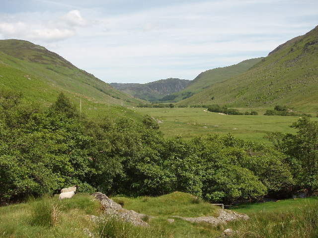
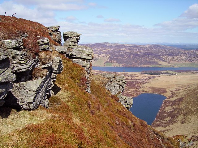
Central Gully is a picturesque valley located in Perthshire, Scotland. It is situated in the heart of the Scottish Highlands and is renowned for its stunning natural beauty and rugged landscape. The valley is surrounded by towering mountains, including the iconic Ben Lawers, which stands at an impressive height of 1,214 meters.

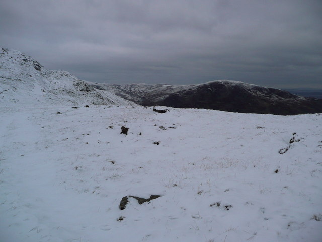
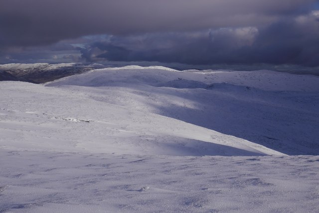
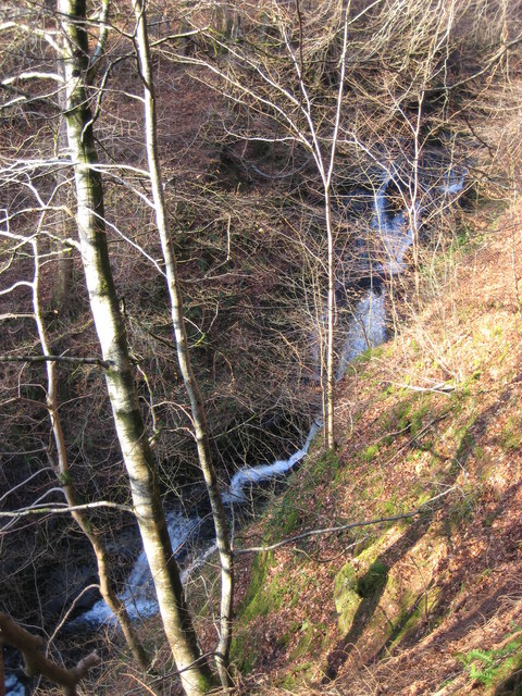
Central Gully is characterized by its deep, U-shaped profile, carved out by ancient glaciers during the last Ice Age. The valley features steep sides, with rocky outcrops and scree slopes, creating a dramatic and awe-inspiring environment. The gully is also intersected by a crystal-clear river, which flows through the valley, adding to its charm.

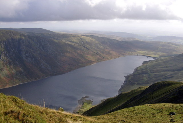
The area is a haven for outdoor enthusiasts and nature lovers, offering a range of activities and opportunities to explore the great outdoors. Hiking and mountaineering are popular pursuits in Central Gully, with numerous trails and routes catering to all experience levels. The valley provides breathtaking views of the surrounding peaks and offers a chance to spot local wildlife, including red deer, golden eagles, and ptarmigans.

Central Gully is also known for its rich biodiversity, with a variety of plant species thriving in the valley's unique microclimate. Visitors can expect to see colorful wildflowers, mosses, and lichens, adding to the valley's natural allure.

Overall, Central Gully is a must-visit destination for those seeking a true Scottish Highland experience. Its rugged beauty, diverse wildlife, and challenging outdoor activities make it a paradise for adventurers and nature enthusiasts alike.

If you have any feedback on the listing, please let us know in the comments section below.

Central Gully Images

Images are sourced within 2km of 56.455351/-3.8430351 or Grid Reference NN8630. Thanks to Geograph Open Source API. All images are credited.

Track heading north from Glen Almond
The River Almond at Dalmore The steep slopes of Creag Chruinn rising on the right.
The River Almond at Dalmore
The steep slopes of Creag Chruinn rising on the right.
River Almond in Glen Almond Approaching Craignavar.
River Almond in Glen Almond
Approaching Craignavar.
Alder trees by the River Almond On the track from Newton Bridge to Auchnafree.
Alder trees by the River Almond
On the track from Newton Bridge to Auchnafree.
Glen Almond near Dalmore Looking towards Meall Reamhar (the fat or bulky hill, in Gaelic) with the alder-lined River Almond on the right.
Glen Almond near Dalmore
Looking towards Meall Reamhar (the fat or bulky hill, in Gaelic) with the alder-lined River Almond on the right.
The end of the track - although lost in the deepening snow!  Looking towards the hillside above Coire Cruinn with the glen of the River Almond way down to the right.  Meall Reamhar is the dark high ground in the distance.
The end of the track
- although lost in the deepening snow! Looking towards the hillside above Coire Cruinn with the glen of the River Almond way down to the right. Meall Reamhar is the dark high ground in the distance.
Looking towards Coire Mhurcha Meall Reamhar in the distance.
Looking towards Coire Mhurcha
Meall Reamhar in the distance.
Ridge between Glen Almond and Strath Earn Gentle and boggy southern slopes contrast with the unseen craggy north side of the hill.
Ridge between Glen Almond and Strath Earn
Gentle and boggy southern slopes contrast with the unseen craggy north side of the hill.
Ford at Craignavar Ford over the river Almond near Craignavar.
Ford at Craignavar
Ford over the river Almond near Craignavar.
River Almond and Creag Chruinn Looking over the River Almond to Creag Chruinn near Dalmore. (Position best guess)
River Almond and Creag Chruinn
Looking over the River Almond to Creag Chruinn near Dalmore. (Position best guess)
View down Glen Almond View from near the mouth of the Henzie Burn down towards Sma Glen.
View down Glen Almond
View from near the mouth of the Henzie Burn down towards Sma Glen.
River Almond. Fast flowing upland river. The sandpipers (Actitis hypoleucos) have now arrived so quite a noisy place.
River Almond.
Fast flowing upland river. The sandpipers (Actitis hypoleucos) have now arrived so quite a noisy place.
Glen Almond blackfaces. Sheep below the northern sides of Glen Almond.
Glen Almond blackfaces.
Sheep below the northern sides of Glen Almond.
Blackface lambs Fresh from their first night, lambing has started in the hills.
Blackface lambs
Fresh from their first night, lambing has started in the hills.
Allt a'Bharnie The burn has been fenced in as part of widespread tree planting in Glen Almond. Mixed woodland is encouraged on the headwaters of rivers as it encourages insect life in the burns and eventually breeding success of fish.
Allt a'Bharnie
The burn has been fenced in as part of widespread tree planting in Glen Almond. Mixed woodland is encouraged on the headwaters of rivers as it encourages insect life in the burns and eventually breeding success of fish.
River Almond View up Glen Almond with Sron a' Chaoruinn, a spur of Auchnafree Hill in the distance.
River Almond
View up Glen Almond with Sron a' Chaoruinn, a spur of Auchnafree Hill in the distance.
Dalmore Once there were more farms in Glen Almond. A ruin, looking up the glen.
Dalmore
Once there were more farms in Glen Almond. A ruin, looking up the glen.
Henzie Burn Woodland now enclosed to encourage regeneration and improve water quality. The striking spur is Connichan Castle.
Henzie Burn
Woodland now enclosed to encourage regeneration and improve water quality. The striking spur is Connichan Castle.
Show me another place!

Central Gully is located at Grid Ref: NN8630 (Lat: 56.455351, Lng: -3.8430351)

Unitary Authority: Perth and Kinross

Police Authority: Tayside

What 3 Words

///such.middle.plugs. Near Crieff, Perth & Kinross

Related Wikis

Achnafauld

Achnafauld (, Scottish Gaelic: Achadh na Follt) is a settlement in the Scottish Highlands, about 15 miles (24 km) northwest of Perth. It is located in...

A822 road

The A822 is a road which runs through Perthshire in Scotland. It runs from the A9 road at Greenloaning, and rejoins the A9 at Dunkeld. It goes through...

Monzie Castle

Monzie Castle is a castellated mansion, near Monzie in Perth and Kinross, Scotland that incorporates an L-plan, early 17th-century building that was enlarged...

Loch Turret

Loch Turret is a large freshwater reservoir on a north-east to south-west orientation, that is located at the head of Glen Turret and 5.39 miles (8.67...

Falls of Barvick

Falls of Barvick is a waterfall in Scotland. It is 492 feet (150 m) at its highest point and has an average width of 20 feet (6.1 m). It is a cascades...

Amulree

Amulree (Scottish Gaelic: Àth Maol Ruibhe, 'Ford of [St.] Maelrubha') is a small hamlet in Perth and Kinross, Scotland. It lies in hilly country on the...

Loch Freuchie

Loch Freuchie, also known as Fraoch, the heatherly loch, is a large freshwater loch on a north-west to south-east orientation, within Glen Quaich in Perth...

Falls of Turret

Falls of Turret is a waterfall of Scotland. == See also == Waterfalls of Scotland == References ==

Have you been to Central Gully?

Leave your review of Central Gully below (or comments, questions and feedback).