Nant Rhenfaes

Valley in Denbighshire

Wales

Nant Rhenfaes

Moel Maelogen Wind Farm Moel Maelogen Wind Farm is situated on the western edge of the Denbigh Moors or Mynydd Hiraethog.
Moel Maelogen Wind Farm Credit: Philip Halling

Nant Rhenfaes is a picturesque valley located in Denbighshire, a county in north-east Wales, United Kingdom. Known for its stunning natural beauty, the valley is nestled between rolling hills and is blessed with lush greenery, meandering rivers, and tranquil forests.

The valley is home to a diverse range of flora and fauna, making it a haven for nature lovers and outdoor enthusiasts. Walking trails traverse the valley, allowing visitors to explore its enchanting landscapes and discover hidden gems along the way. The valley's streams and rivers, such as the Afon Clywedog, offer opportunities for fishing and provide a peaceful backdrop for picnics and leisurely strolls.

Nant Rhenfaes also boasts a rich history and cultural heritage. The area is scattered with remnants of ancient settlements, including hillforts and burial mounds, which provide a fascinating glimpse into the valley's past. The nearby town of Denbigh offers a variety of historical attractions, including the imposing Denbigh Castle, which dates back to the 13th century.

Visitors to Nant Rhenfaes can enjoy a range of activities, from hiking and wildlife spotting to exploring historical sites and immersing themselves in the local culture. The valley's idyllic setting and tranquil atmosphere make it a perfect destination for those seeking relaxation and rejuvenation in the heart of the Welsh countryside.

If you have any feedback on the listing, please let us know in the comments section below.

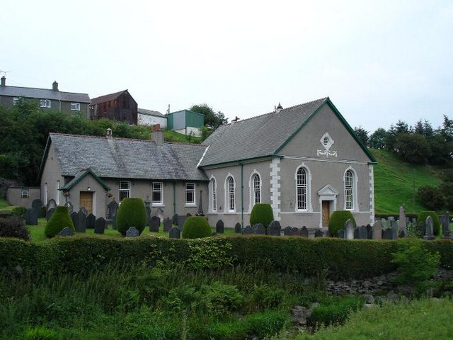
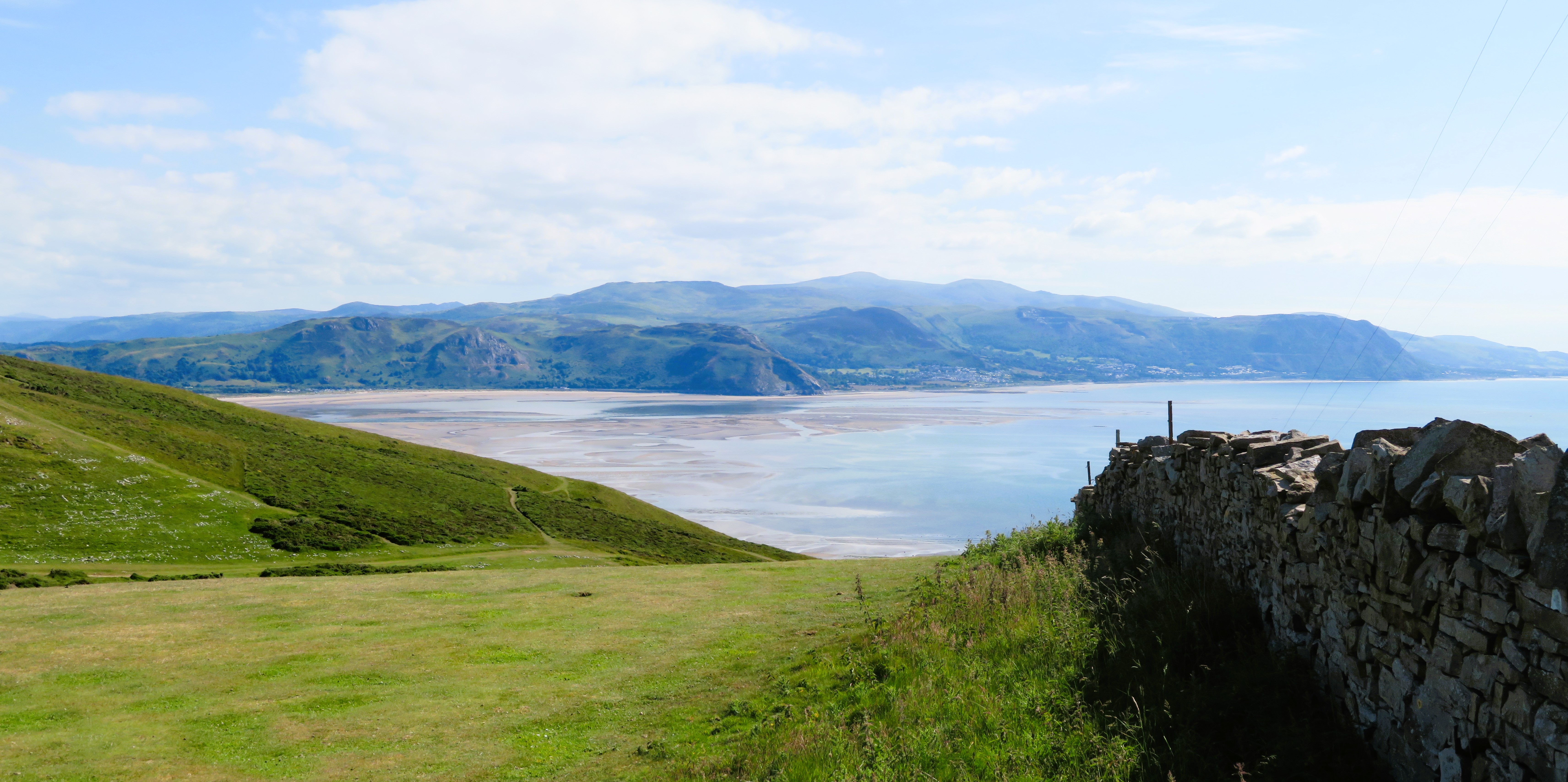
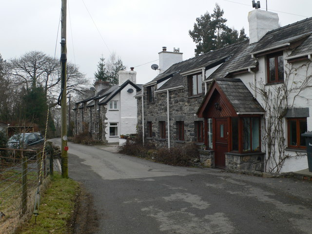
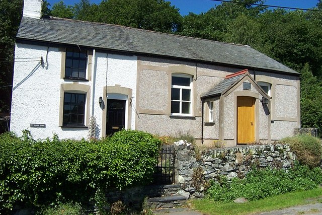
Nant Rhenfaes Images

Images are sourced within 2km of 53.139707/-3.7123278 or Grid Reference SH8561. Thanks to Geograph Open Source API. All images are credited.

Moel Maelogen Wind Farm Moel Maelogen Wind Farm is situated on the western edge of the Denbigh Moors or Mynydd Hiraethog.
Moel Maelogen Wind Farm
Moel Maelogen Wind Farm is situated on the western edge of the Denbigh Moors or Mynydd Hiraethog.
Wind turbine Wind turbine Moel Maelogen Wind Farm.
Wind turbine
Wind turbine Moel Maelogen Wind Farm.
Moel Maelogen Wind Farm Wind turbines on Moel Maelogen Wind Farm on the western edge of the Denbigh Moors.
Moel Maelogen Wind Farm
Wind turbines on Moel Maelogen Wind Farm on the western edge of the Denbigh Moors.
Upland stream Upland stream drain moorland near Foelasfechan.  Wind turbines on the Moel Maelogen Wind Farm can be seen in the background.
Upland stream
Upland stream drain moorland near Foelasfechan. Wind turbines on the Moel Maelogen Wind Farm can be seen in the background.
Ffriddog Upland grazing at Ffriddog on the Denbigh Moors.
Ffriddog
Upland grazing at Ffriddog on the Denbigh Moors.
Moel Gydia Sheep on Moel Gydia on the Denbigh Moors.
Moel Gydia
Sheep on Moel Gydia on the Denbigh Moors.
Sheep near Ffrithuchaf Sheep on upland grazing near Ffrithuchaf.
Sheep near Ffrithuchaf
Sheep on upland grazing near Ffrithuchaf.
Road to Gwytherin Road to Gwytherin passing Ffrithuchaf on the Denbigh Moors.
Road to Gwytherin
Road to Gwytherin passing Ffrithuchaf on the Denbigh Moors.
Country road descending to Gwytherin Country road descending to Gwytherin in the Cledwen valley.
Country road descending to Gwytherin
Country road descending to Gwytherin in the Cledwen valley.
Derelict quarries The headwaters of the Afon Derfyn flow out of the broad, boggy upland and start to descend into a valley as they flow northwards past a line of long-disused quarries. The rock strata belong to the Nantglyn Flags, of Silurian (Wenlock-Ludlow) age. Exactly what was quarried here is not obvious, as the rock is not of sufficient quality to make useful slates, and it is not a useful building stone. Many small quarries are situated nearby on the same strata.
Derelict quarries
The headwaters of the Afon Derfyn flow out of the broad, boggy upland and start to descend into a valley as they flow northwards past a line of long-disused quarries. The rock strata belong to the Nantglyn Flags, of Silurian (Wenlock-Ludlow) age. Exactly what was quarried here is not obvious, as the rock is not of sufficient quality to make useful slates, and it is not a useful building stone. Many small quarries are situated nearby on the same strata.
Spoil heap A small spoil heap associated with the adjacent, disused quarry. The river runs in a deep channel through the boggy ground covered with rushes. Better drainage on the margin of the heap has encouraged a better class of grass which the sheep appreciate.
Spoil heap
A small spoil heap associated with the adjacent, disused quarry. The river runs in a deep channel through the boggy ground covered with rushes. Better drainage on the margin of the heap has encouraged a better class of grass which the sheep appreciate.
Slate outcrop A good exposure of the Nantglyn Flags Formation, of Silurian (Wenlock to Ludlow) age. This pillar has been left intact, so it was probably of poor quality. After a long period of weathering the rock is deeply split along what appears to be its bedding planes, and no cleavage is obvious. It may be that flagstones were produced, or crude roofing slabs. The outcrop is about 2m in height. In the background are turbines of the Moel Maelogan wind-farm.
Slate outcrop
A good exposure of the Nantglyn Flags Formation, of Silurian (Wenlock to Ludlow) age. This pillar has been left intact, so it was probably of poor quality. After a long period of weathering the rock is deeply split along what appears to be its bedding planes, and no cleavage is obvious. It may be that flagstones were produced, or crude roofing slabs. The outcrop is about 2m in height. In the background are turbines of the Moel Maelogan wind-farm.
Moorland footpath Not many people come this way, I am sure. The way that this wet footpath follows the boundary fence is a strange, local feature. In places, there appears also to be a drainage ditch into which it is easy to sink. Thank goodness for wellies! The wind turbines were very noisy on this very windy day.
Moorland footpath
Not many people come this way, I am sure. The way that this wet footpath follows the boundary fence is a strange, local feature. In places, there appears also to be a drainage ditch into which it is easy to sink. Thank goodness for wellies! The wind turbines were very noisy on this very windy day.
Ffrithuchaf An extraordinary place, which seems to have more relief than is indicated by the map and is clothed in ankle-high grass, moss and heather with patches of rushes. Somehow, I cannot help but think it is, or has been, more intensively managed than it appears. As usual, the real excitement for me is the wonderful palette of winter colours. What a joy at the vernal equinox!
Ffrithuchaf
An extraordinary place, which seems to have more relief than is indicated by the map and is clothed in ankle-high grass, moss and heather with patches of rushes. Somehow, I cannot help but think it is, or has been, more intensively managed than it appears. As usual, the real excitement for me is the wonderful palette of winter colours. What a joy at the vernal equinox!
Green tussock Landmarks are few on Ffrithuchaf, but this one proved irresistible to my assistants. Whether elevated nutrient levels were the cause of the change of moss species and habit is unsure, but several owl pellets were found here, and one complete leg of large bird, possibly a chicken, judging by the length of its toes and claws. Most intriguing.
Green tussock
Landmarks are few on Ffrithuchaf, but this one proved irresistible to my assistants. Whether elevated nutrient levels were the cause of the change of moss species and habit is unsure, but several owl pellets were found here, and one complete leg of large bird, possibly a chicken, judging by the length of its toes and claws. Most intriguing.
View to Snowdonia A view over the moorland of Ffrithuchaf. By exposing the image for the sky, the distant mountains and turbines have been brought into the view.
View to Snowdonia
A view over the moorland of Ffrithuchaf. By exposing the image for the sky, the distant mountains and turbines have been brought into the view.
Gwytherin cottages A row of cottages in the village of Gwytherin
Gwytherin cottages
A row of cottages in the village of Gwytherin
Arrival in Gwytherin Lane leading into the village with the bridge crossing the Afon Clodwen in the foreground.
Arrival in Gwytherin
Lane leading into the village with the bridge crossing the Afon Clodwen in the foreground.
Show me another place!

Nant Rhenfaes is located at Grid Ref: SH8561 (Lat: 53.139707, Lng: -3.7123278)

Unitary Authority: Conwy

Police Authority: North Wales

What 3 Words

///tightrope.vibes.solves. Near Llanrwst, Conwy

Nearby Locations

Nant Rhenfaes

Related Wikis

Moel Maelogan

Moel Maelogan (shown on O.S. maps as 'Maelogen', and also sometimes spelled 'Moelogan' and 'Mælogan') is a hill (summit height 424m) on the western edge...

Gwytherin

Gwytherin is a village in Conwy county borough, Wales. It lies in a small valley through which the River Cledwen flows and has been winner of 'Best Kept...

Pandy Tudur

Pandy Tudur is a village in Conwy county borough, in the north-west of Wales. It lies 5 miles northeast of Llanrwst. == Origins of the name == The name...

Conwy County Borough

Conwy County Borough (Welsh: Bwrdeistref Sirol Conwy) is a county borough in the north of Wales. It borders Gwynedd to the west and south and Denbighshire...

Melin-y-Coed

Melin-y-Coed is a small rural village in the county of Conwy, Wales. (Translated as Mill in the Woods into English). The earliest surviving building in...

Llanddoged

Llanddoged is a small village which lies in the hills a little over a mile to the north of Llanrwst, in Conwy county borough, Wales. The village itself...

Ysgol Dyffryn Conwy

Ysgol Dyffryn Conwy is a bilingual co-educational comprehensive school in the town of Llanrwst in Conwy County Borough, North Wales. The school serves...

Llanddoged and Maenan

Llanddoged and Maenan (Welsh: Llanddoged a Maenan) is a community in Conwy County Borough, in Wales. It is located in the Conwy Valley, on the eastern...

Have you been to Nant Rhenfaes?

Leave your review of Nant Rhenfaes below (or comments, questions and feedback).