Glen Feshie

Valley in Inverness-shire

Scotland

Glen Feshie

Path crossing Allt Fhearnagan Whilst an easy hop from rock to rock in this dry weather, stream crossings like this are exactly what makes walking in Scotland sporting when the weather can cause the level to rise dramatically between outward and return journeys. There is plenty of evidence of huge floods in Glen Feshie, not far away at all...
Path crossing Allt Fhearnagan Credit: Andy Waddington

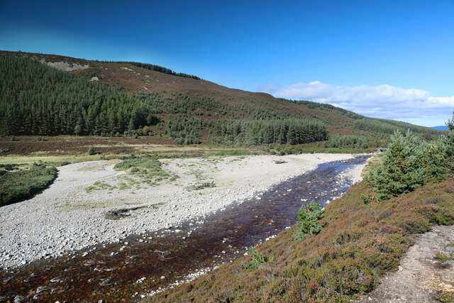
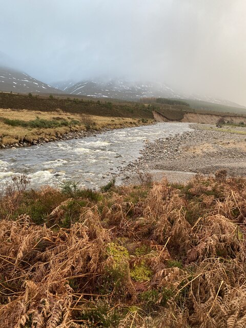
Glen Feshie is a picturesque valley located in the Inverness-shire region of Scotland. Situated in the Cairngorms National Park, it is renowned for its stunning natural beauty and diverse wildlife. The valley stretches approximately 20 kilometers from south to north, flanked by towering mountains on either side.

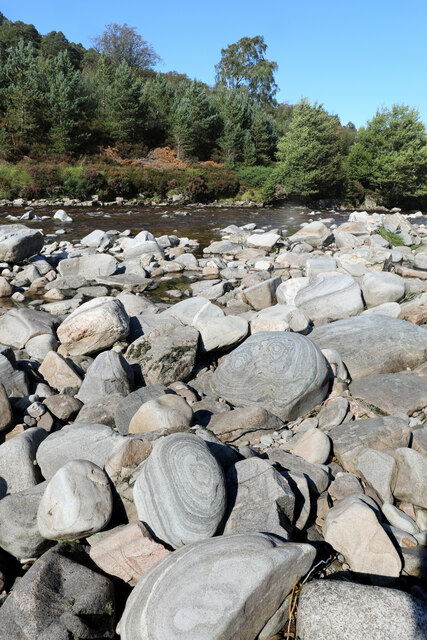
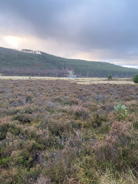
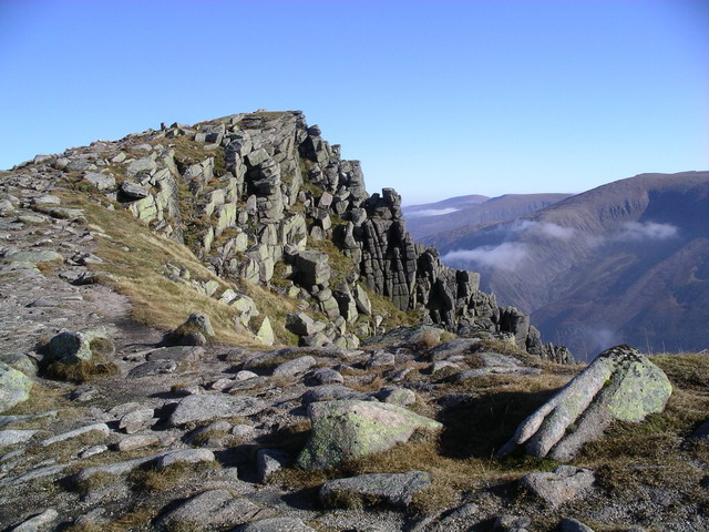
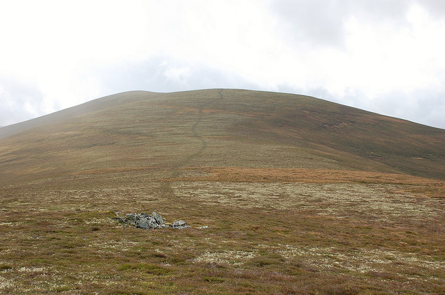
The landscape of Glen Feshie is characterized by rolling moorland, ancient Caledonian pine forests, and the meandering River Feshie. The valley is home to a rich variety of plant and animal species, including red deer, golden eagles, and ospreys. The area has been designated as a Special Area of Conservation, highlighting its importance for preserving the natural environment.

Hikers and nature enthusiasts are drawn to Glen Feshie for its extensive network of trails that offer breathtaking views of the surrounding mountains and forests. Some of the popular routes include the Feshiebridge Circuit, which takes visitors through the heart of the valley, and the Glen Feshie Munros, which offers the chance to conquer several majestic peaks.

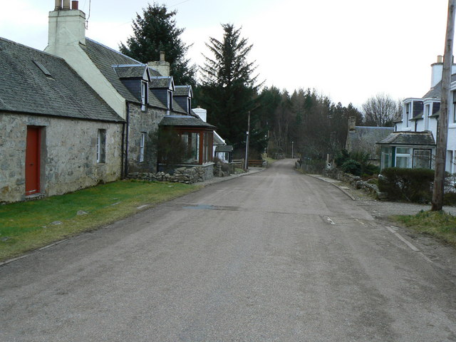
In addition to its natural attractions, Glen Feshie has a rich cultural heritage. The area is dotted with historic ruins, such as the 18th-century Ruthven Barracks, which once served as a government garrison. Visitors can also explore the ruins of old crofts and sheilings, providing a glimpse into the traditional way of life in the Scottish Highlands.

Overall, Glen Feshie is a haven for nature lovers and history enthusiasts alike. Its unspoiled landscapes and diverse wildlife make it a must-visit destination for those seeking an authentic Scottish experience.

If you have any feedback on the listing, please let us know in the comments section below.

Glen Feshie Images

Images are sourced within 2km of 57.045257/-3.8945484 or Grid Reference NN8596. Thanks to Geograph Open Source API. All images are credited.

Path crossing Allt Fhearnagan Whilst an easy hop from rock to rock in this dry weather, stream crossings like this are exactly what makes walking in Scotland sporting when the weather can cause the level to rise dramatically between outward and return journeys. There is plenty of evidence of huge floods in Glen Feshie, not far away at all...
Path crossing Allt Fhearnagan
Whilst an easy hop from rock to rock in this dry weather, stream crossings like this are exactly what makes walking in Scotland sporting when the weather can cause the level to rise dramatically between outward and return journeys. There is plenty of evidence of huge floods in Glen Feshie, not far away at all...
River Feshie with scoured bed You'd believe that a bridge was hardly needed when seen at this water level, but there is plenty of evidence for some fairly recent large floods, including a large area of scoured cobbles on the approach to the new bridge. There's also much evidence of colonisation of the valley by new pine trees, able to survive once more with a reduction in deer numbers. In time, as the forest regenerates, the land will hold more water and release it more slowly, leading to less flooding, unless, of course, climate change makes for ever bigger storms...
River Feshie with scoured bed
You'd believe that a bridge was hardly needed when seen at this water level, but there is plenty of evidence for some fairly recent large floods, including a large area of scoured cobbles on the approach to the new bridge. There's also much evidence of colonisation of the valley by new pine trees, able to survive once more with a reduction in deer numbers. In time, as the forest regenerates, the land will hold more water and release it more slowly, leading to less flooding, unless, of course, climate change makes for ever bigger storms...
River Feshie has a bouldery bed For much of its length, the River Feshie is a braided river flowing over a fairly flat flood plain among high mountains. There's not much bedrock in evidence, but the bed is composed largely of Quartzose Psammite boulders of the Grampian Group, Dalradian Supergroup of Neoproterozoic age. That's a pretty broad age range, from 1000 Ma to 541 Ma, predating the widespread occurrence of fossils in the geological record. Much of this rock has attractive bedding and minimal mineral veining, so despite its great and somewhat indeterminate age, it's easy to see that it was laid down as sediment by the same processes that operate today.
River Feshie has a bouldery bed
For much of its length, the River Feshie is a braided river flowing over a fairly flat flood plain among high mountains. There's not much bedrock in evidence, but the bed is composed largely of Quartzose Psammite boulders of the Grampian Group, Dalradian Supergroup of Neoproterozoic age. That's a pretty broad age range, from 1000 Ma to 541 Ma, predating the widespread occurrence of fossils in the geological record. Much of this rock has attractive bedding and minimal mineral veining, so despite its great and somewhat indeterminate age, it's easy to see that it was laid down as sediment by the same processes that operate today.
River Feshie extending its floodplain Compare this photo with one taken by John Ferguson less than a deacde ago <a href="https://www.geograph.org.uk/photo/2819368">NN8495 : Allt Garbhlach joins the River Feshie</a>. Floods soon after that picture was taken have caused the Feshie to abandon its former course over the now dry cobble banks on the left of this photo, and cut a deep scar into the hillside, transporting a huge amount of material away downstream. The tributary entering from river right at this point, the Allt Garbhlach, has also cut down and had its bed load shifted away by the Feshie. What was once an easy path ford at this point, with a not too steep climb up the far side, is now rather hazardously steep and loose on both sides of the stream, part of the path among the trees opposite having been removed completely. Although we managed to cross here on our way up Glen Feshie, we chose to find an easier crossing upstream three or four hundred metres to the east on our way back.
River Feshie extending its floodplain
Compare this photo with one taken by John Ferguson less than a deacde ago NN8495 : Allt Garbhlach joins the River Feshie. Floods soon after that picture was taken have caused the Feshie to abandon its former course over the now dry cobble banks on the left of this photo, and cut a deep scar into the hillside, transporting a huge amount of material away downstream. The tributary entering from river right at this point, the Allt Garbhlach, has also cut down and had its bed load shifted away by the Feshie. What was once an easy path ford at this point, with a not too steep climb up the far side, is now rather hazardously steep and loose on both sides of the stream, part of the path among the trees opposite having been removed completely. Although we managed to cross here on our way up Glen Feshie, we chose to find an easier crossing upstream three or four hundred metres to the east on our way back.
Dead tree above the Allt Garbhlach Although there is widespread regeneration of the Caledonian Forest in Glen Feshie owing to a reduction in deer numbers and consequent increased survival of tree seedlings with less grazing pressure, the cycle of renewal continues to include death for some of the older trees. This still-standing snag clearly had a favoured position with no shortage of sunlight but has nonetheless succumbed to one of the hazards of life in the Cairngorms. It has lost much of its bark, and with it the colonising lichens and mosses which it supported in life. Soon the branches will fall and decay, providing nutrients for the next generations of trees which are already establishing close by.
Dead tree above the Allt Garbhlach
Although there is widespread regeneration of the Caledonian Forest in Glen Feshie owing to a reduction in deer numbers and consequent increased survival of tree seedlings with less grazing pressure, the cycle of renewal continues to include death for some of the older trees. This still-standing snag clearly had a favoured position with no shortage of sunlight but has nonetheless succumbed to one of the hazards of life in the Cairngorms. It has lost much of its bark, and with it the colonising lichens and mosses which it supported in life. Soon the branches will fall and decay, providing nutrients for the next generations of trees which are already establishing close by.
View from the footbridge downstream I'm really more of a lucky shot photographer - most pictures from that day are hopelessly dark, the glimpses of sunshine, the clouds, the snow, all collaborating against me. But this was a moment where they let it all happen.
View from the footbridge downstream
I'm really more of a lucky shot photographer - most pictures from that day are hopelessly dark, the glimpses of sunshine, the clouds, the snow, all collaborating against me. But this was a moment where they let it all happen.
Estate track on ascent to Carn Dearg Beag
There is supposed to be a track here to Carn Dearg Beag We couldn't find it despite being bang on it according to my GPSr
There is supposed to be a track here to Carn Dearg Beag
We couldn't find it despite being bang on it according to my GPSr
Back on the estate track
Coming up to track junction
Carry on along the tarmac estate road
River Feshie
River Feshie
Estate road Glen Feshie
Last crossing over the river sign
The river Feshie
The river Feshie
Bridge over the Feshie
Footpath near Auchlean
Are we nearly back at the car yet? It was much wetter than it looked!
Are we nearly back at the car yet?
It was much wetter than it looked!
Show me another place!

Glen Feshie is located at Grid Ref: NN8596 (Lat: 57.045257, Lng: -3.8945484)

Unitary Authority: Highland

Police Authority: Highlands and Islands

What 3 Words

///outfitter.lighter.slamming. Near Kingussie, Highland

Nearby Locations

Badan Mosach Glen Feshie

Related Wikis

Mullach Clach a' Bhlàir

Mullach Clach a' Bhlàir or Meall Tional is a Munro in the Cairngorm mountain range of Scotland. == Sources ==

Sgòr Gaoith

Sgòr Gaoith (Scottish Gaelic: Sgòr Gaoithe, 'windy peak') is a mountain peak in the far western massif of the Cairngorms in the Scottish Highlands. It...

Càrn Dearg Mòr

Carn Dearg Mor (857 m) is a mountain in the Grampian Mountains of Scotland. It lies in the Badenoch and Strathspey area of Inverness-shire, east of the...

Insh

Insh (Scottish Gaelic: Am Baile Ùr) is a village in Highland, Scotland that lies on the east coast of the Insh Marshes. It is in the Badenoch and Strathspey...

Have you been to Glen Feshie?

Leave your review of Glen Feshie below (or comments, questions and feedback).