Nant Bwlch-y-gwynt

Valley in Denbighshire

Wales

Nant Bwlch-y-gwynt

Winter hedgerow Bare trees in a tributary valley of Nant y Goron. A few sheep have found their way through the hedge to this field of turnips.
Winter hedgerow Credit: Jonathan Wilkins

The requested URL returned error: 429 Too Many Requests

If you have any feedback on the listing, please let us know in the comments section below.

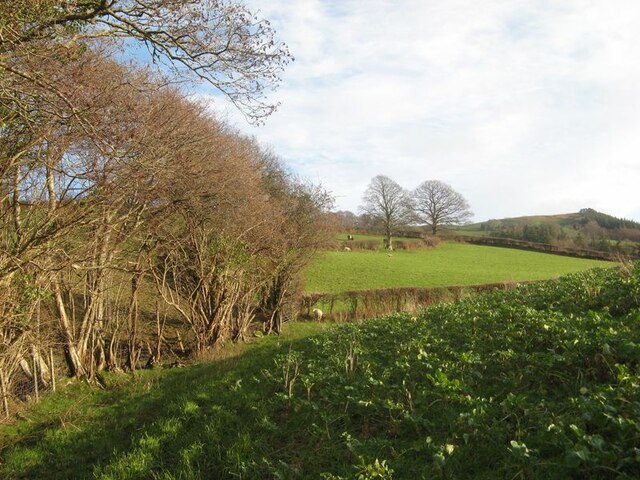
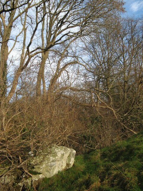
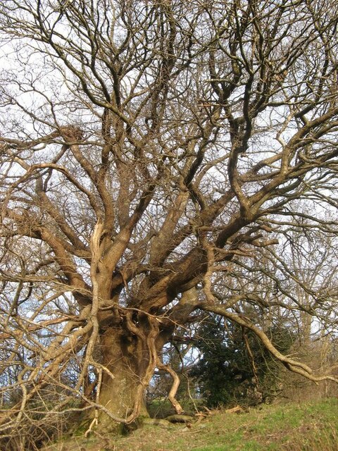
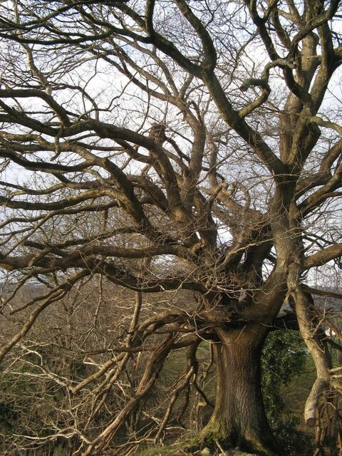
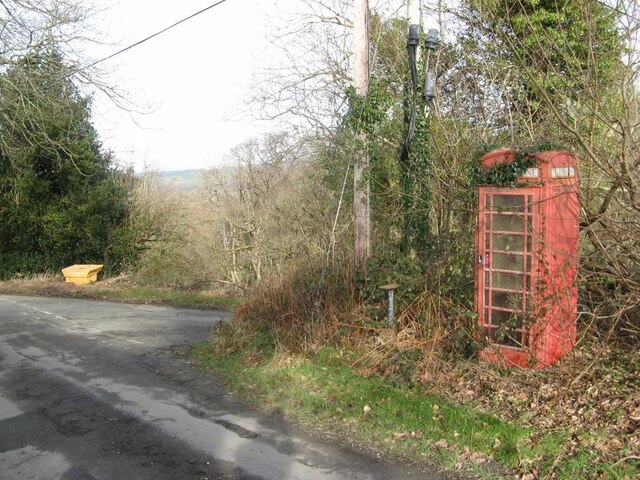
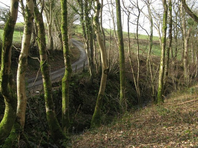
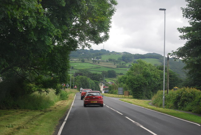
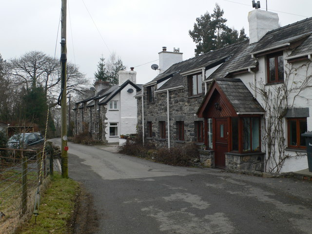
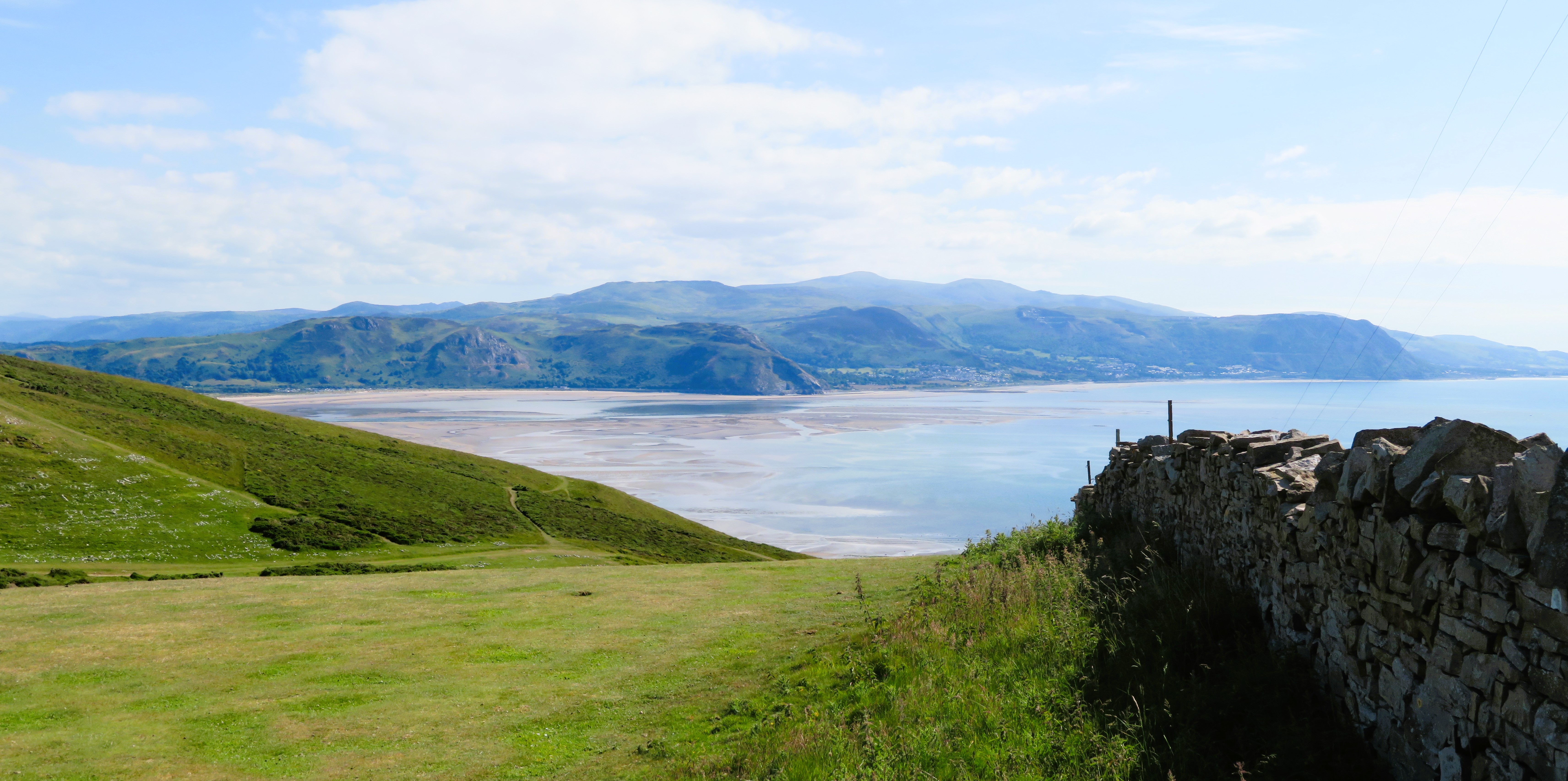
Nant Bwlch-y-gwynt Images

Images are sourced within 2km of 53.128452/-3.7603822 or Grid Reference SH8260. Thanks to Geograph Open Source API. All images are credited.

Winter hedgerow Bare trees in a tributary valley of Nant y Goron. A few sheep have found their way through the hedge to this field of turnips.
Winter hedgerow
Bare trees in a tributary valley of Nant y Goron. A few sheep have found their way through the hedge to this field of turnips.
Erratic boulder The Conwy Valley and its environs at the last glacial maximum was the site of a major ice stream carrying material eroded by glaciation in eastern Snowdonia. Rock outcrop in this area is rare, and significant glacial erratic boulders are seldom found, but here is one (approximately 3 metres in length) near to a tributary of Nant y Goron. In post-glacial times water has eroded the glacial deposits to expose this large, remnant boulder. Another lies on the bank downstream near to its junction with the Nant y Goron, but it is deep in undergrowth and not easily imaged.
Erratic boulder
The Conwy Valley and its environs at the last glacial maximum was the site of a major ice stream carrying material eroded by glaciation in eastern Snowdonia. Rock outcrop in this area is rare, and significant glacial erratic boulders are seldom found, but here is one (approximately 3 metres in length) near to a tributary of Nant y Goron. In post-glacial times water has eroded the glacial deposits to expose this large, remnant boulder. Another lies on the bank downstream near to its junction with the Nant y Goron, but it is deep in undergrowth and not easily imaged.
Spreading oak tree 1 A remarkable oak with a dense, spreading crown and descending branches. The absence of a tall trunk suggests that it may have been damaged in antiquity, but at any rate it is a tree to celebrate at a time of year which permits examination of its structure. See also <a href="https://www.geograph.org.uk/photo/7684355">SH8160 : Spreading oak tree 2</a>.
Spreading oak tree 1
A remarkable oak with a dense, spreading crown and descending branches. The absence of a tall trunk suggests that it may have been damaged in antiquity, but at any rate it is a tree to celebrate at a time of year which permits examination of its structure. See also SH8160 : Spreading oak tree 2.
Spreading oak tree 2 Another aspect of this fine tree. See also <a href="https://www.geograph.org.uk/photo/7684354">SH8160 : Spreading oak tree 1</a>.
Spreading oak tree 2
Another aspect of this fine tree. See also SH8160 : Spreading oak tree 1.
Woodland, Afon Cyffdy Bare trees in the dingle of Afon Cyffdy below Fedw.
Woodland, Afon Cyffdy
Bare trees in the dingle of Afon Cyffdy below Fedw.
Track to Ty Mawr Sun filling the dingle of the Afon Cyffdy as the track descends past pasture towards the woodland.
Track to Ty Mawr
Sun filling the dingle of the Afon Cyffdy as the track descends past pasture towards the woodland.
Re-wilding in Nant-y-Rhiw Once upon a time, a telephone kiosk at a significant road junction was the definition of connection, but not now. Still a nodal point; just look at all those cables in the junction boxes on the adjacent pole.
Re-wilding in Nant-y-Rhiw
Once upon a time, a telephone kiosk at a significant road junction was the definition of connection, but not now. Still a nodal point; just look at all those cables in the junction boxes on the adjacent pole.
Waterfall, Afon Cyffdy The Afon Cyffdy falls steeply down Nant-y-Rhiw through tangled woodland of ash and oak with many small falls and rapids. An impossible photograph in summer with a leafy canopy, but winter is helpful in woodlands.
Waterfall, Afon Cyffdy
The Afon Cyffdy falls steeply down Nant-y-Rhiw through tangled woodland of ash and oak with many small falls and rapids. An impossible photograph in summer with a leafy canopy, but winter is helpful in woodlands.
Wooded dingle Mossy trees lining the bank of the Afon Cyffdy in Nant-y-Rhiw. The road crosses the nant in a series of hairpin bends, climbing steeply on both banks. See also <a href="https://www.geograph.org.uk/photo/7442017">SH8258 : Nant-y-Rhiw pastures</a>.
Wooded dingle
Mossy trees lining the bank of the Afon Cyffdy in Nant-y-Rhiw. The road crosses the nant in a series of hairpin bends, climbing steeply on both banks. See also SH8258 : Nant-y-Rhiw pastures.
Capel Nant-y-Rhiw A plain building in an idyllic location, high above the Conwy Valley. Nant-y-Rhiw is a very rural hamlet, or collection of small farms strung out along a road climbing steeply to the edge of the Denbighshire moorland. The building is no longer in religious use, having become a dwelling, though recorded by Coflein (the online database of the National Monuments Record of Wales) as a chapel as recently as 1998.
The stone plaque on the gable reads "Adeiladwyd gyntaf 1827. Adeiladwyd eilwaith  1861" (Engl: First built 1827. Rebuilt 1861).
Capel Nant-y-Rhiw
A plain building in an idyllic location, high above the Conwy Valley. Nant-y-Rhiw is a very rural hamlet, or collection of small farms strung out along a road climbing steeply to the edge of the Denbighshire moorland. The building is no longer in religious use, having become a dwelling, though recorded by Coflein (the online database of the National Monuments Record of Wales) as a chapel as recently as 1998. The stone plaque on the gable reads "Adeiladwyd gyntaf 1827. Adeiladwyd eilwaith 1861" (Engl: First built 1827. Rebuilt 1861).
Nant-y-Rhiw pastures Looking down the sheep pasture towards the Conwy Valley. The adjacent chapel sits on a sandstone spur between two valleys carved into softer mudstones, all belonging to the Denbigh Grits Formation of Silurian, Wenlock age. Strong winds are blowing fine rain off the mountains, forming a rainbow in the right of the image.
Nant-y-Rhiw pastures
Looking down the sheep pasture towards the Conwy Valley. The adjacent chapel sits on a sandstone spur between two valleys carved into softer mudstones, all belonging to the Denbigh Grits Formation of Silurian, Wenlock age. Strong winds are blowing fine rain off the mountains, forming a rainbow in the right of the image.
Spring, Pant Glas
Spring, Pant Glas
Lay-by south of Llanrwst
A470 south of Llanrwst The A470(T) is a major long-distance road in Wales, from Cardiff on the south coast to Llandudno on the north coast. It is 186 miles long, with a tortuous route through the country's mountainous central region, including the Brecon Beacons and Snowdonia National Park.
Wikipedia: <span class="nowrap"><a title="http://en.wikipedia.org/wiki/A470_road" rel="nofollow ugc noopener" href="http://en.wikipedia.org/wiki/A470_road">Link</a><img style="margin-left:2px;" alt="External link" title="External link - shift click to open in new window" src="https://s1.geograph.org.uk/img/external.png" width="10" height="10"/></span>
A470 south of Llanrwst
The A470(T) is a major long-distance road in Wales, from Cardiff on the south coast to Llandudno on the north coast. It is 186 miles long, with a tortuous route through the country's mountainous central region, including the Brecon Beacons and Snowdonia National Park. Wikipedia: LinkExternal link
Industrial unit near Bryn
Texaco filling station, Bryn Texaco is an American based Trans-National energy company.The name stands for The "Texas Company".
Wikipedia: <span class="nowrap"><a title="http://en.wikipedia.org/wiki/Texaco" rel="nofollow ugc noopener" href="http://en.wikipedia.org/wiki/Texaco">Link</a><img style="margin-left:2px;" alt="External link" title="External link - shift click to open in new window" src="https://s1.geograph.org.uk/img/external.png" width="10" height="10"/></span>
Texaco filling station, Bryn
Texaco is an American based Trans-National energy company.The name stands for The "Texas Company". Wikipedia: LinkExternal link
A470, southbound The A470(T) is a major long-distance road in Wales, from Cardiff on the south coast to Llandudno on the north coast. It is 186 miles long, with a tortuous route through the country's mountainous central region, including the Brecon Beacons and Snowdonia National Park.
Wikipedia: <span class="nowrap"><a title="http://en.wikipedia.org/wiki/A470_road" rel="nofollow ugc noopener" href="http://en.wikipedia.org/wiki/A470_road">Link</a><img style="margin-left:2px;" alt="External link" title="External link - shift click to open in new window" src="https://s1.geograph.org.uk/img/external.png" width="10" height="10"/></span>
A470, southbound
The A470(T) is a major long-distance road in Wales, from Cardiff on the south coast to Llandudno on the north coast. It is 186 miles long, with a tortuous route through the country's mountainous central region, including the Brecon Beacons and Snowdonia National Park. Wikipedia: LinkExternal link
A470, Siambar-wen The A470(T) is a major long-distance road in Wales, from Cardiff on the south coast to Llandudno on the north coast. It is 186 miles long, with a tortuous route through the country's mountainous central region, including the Brecon Beacons and Snowdonia National Park.
Wikipedia: <span class="nowrap"><a title="http://en.wikipedia.org/wiki/A470_road" rel="nofollow ugc noopener" href="http://en.wikipedia.org/wiki/A470_road">Link</a><img style="margin-left:2px;" alt="External link" title="External link - shift click to open in new window" src="https://s1.geograph.org.uk/img/external.png" width="10" height="10"/></span>
A470, Siambar-wen
The A470(T) is a major long-distance road in Wales, from Cardiff on the south coast to Llandudno on the north coast. It is 186 miles long, with a tortuous route through the country's mountainous central region, including the Brecon Beacons and Snowdonia National Park. Wikipedia: LinkExternal link
Show me another place!

Nant Bwlch-y-gwynt is located at Grid Ref: SH8260 (Lat: 53.128452, Lng: -3.7603822)

Unitary Authority: Conwy

Police Authority: North Wales

What 3 Words

///encloses.bluntly.polite. Near Llanrwst, Conwy

Nearby Locations

Nant Bwlch-y-gwynt

Related Wikis

Melin-y-Coed

Melin-y-Coed is a small rural village in the county of Conwy, Wales. (Translated as Mill in the Woods into English). The earliest surviving building in...

Conwy County Borough

Conwy County Borough (Welsh: Bwrdeistref Sirol Conwy) is a county borough in the north of Wales. It borders Gwynedd to the west and south and Denbighshire...

St Mary's Church, Llanrwst

St Mary's Church, Llanrwst, was located in Betws Road, Llanrwst, Conwy, Wales. It had been built in 1841–42, and was designed by Henry Kennedy. Intended...

Ysgol Dyffryn Conwy

Ysgol Dyffryn Conwy is a bilingual co-educational comprehensive school in the town of Llanrwst in Conwy County Borough, North Wales. The school serves...

Nearby Amenities

Located within 500m of 53.128452,-3.7603822
Place: farm
Lat/Long: 53.1310733/-3.7641319
Direction: SW
Generator Method: photovoltaic
Generator Output Electricity: yes
Generator Solar Modules: 8
Generator Source: solar
Generator Type: solar_photovoltaic_panel
Location: roof
Power: generator
Lat/Long: 53.1269585/-3.7619351
Direction: SW
Generator Method: photovoltaic
Generator Output Electricity: yes
Generator Solar Modules: 8
Generator Source: solar
Generator Type: solar_photovoltaic_panel
Location: roof
Power: generator
Lat/Long: 53.1269726/-3.7619089
The data included in this document is from www.openstreetmap.org. The data is made available under ODbL.

Have you been to Nant Bwlch-y-gwynt?

Leave your review of Nant Bwlch-y-gwynt below (or comments, questions and feedback).