Appin of Dull

Valley in Perthshire

Scotland

Appin of Dull

Camserney Burn The ford is deep, so the bridge is welcome.
Camserney Burn Credit: Richard Webb

Appin of Dull is a picturesque valley located in Perthshire, Scotland. Situated just northwest of the village of Dull, this scenic spot is known for its breathtaking landscapes and tranquil atmosphere.

The valley is surrounded by rolling hills and lush green meadows, offering stunning views in every direction. The River Tay flows through the valley, adding to the beauty of the area. The river provides a habitat for various wildlife species, including otters, salmon, and a wide variety of bird species, making it a popular spot for birdwatching and nature enthusiasts.

Appin of Dull is also home to several traditional Scottish farmsteads, adding to the rural charm of the area. These farms are often seen with grazing sheep and cattle, contributing to the agricultural character of the valley.

The valley is a haven for outdoor activities, attracting hikers, cyclists, and anglers throughout the year. There are numerous walking trails that wind through the valley and surrounding hills, offering opportunities for both leisurely strolls and more challenging hikes. Fishing is also popular, with the River Tay providing excellent spots for salmon and trout fishing.

For those seeking a peaceful retreat, Appin of Dull offers a range of accommodation options, including cozy cottages and bed and breakfasts. Visitors can enjoy the tranquility of the valley while still being within reach of nearby amenities and attractions.

Overall, Appin of Dull is a true gem in the Perthshire countryside, offering natural beauty, outdoor activities, and a sense of peacefulness that is sure to captivate all who visit.

If you have any feedback on the listing, please let us know in the comments section below.

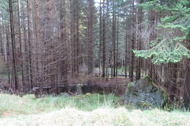
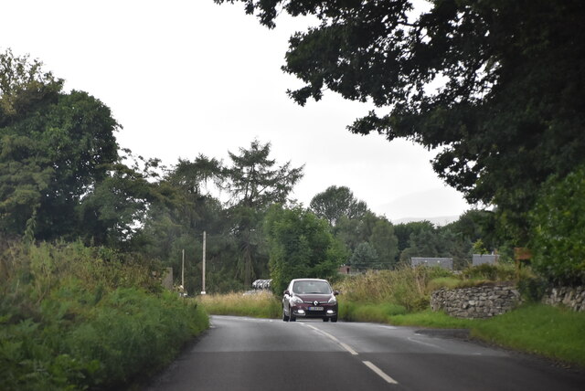
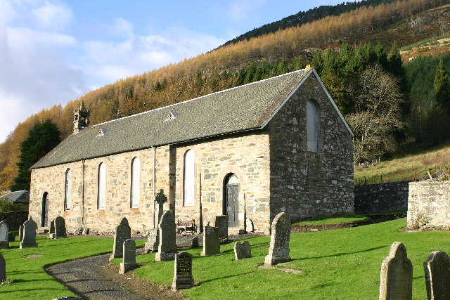
Appin of Dull Images

Images are sourced within 2km of 56.615393/-3.9285634 or Grid Reference NN8148. Thanks to Geograph Open Source API. All images are credited.

Camserney Burn The ford is deep, so the bridge is welcome.
Camserney Burn
The ford is deep, so the bridge is welcome.
Road, Lurgan The road to Lurgan takes a sharp bend here, while a smaller road continues up the hill to hill grazings and Loch Farleyer.
Road, Lurgan
The road to Lurgan takes a sharp bend here, while a smaller road continues up the hill to hill grazings and Loch Farleyer.
Coppiced woodland The road to Shenavail emerges from a dark cypress wood to the relative brightness of the broadleaved woods here.
Coppiced woodland
The road to Shenavail emerges from a dark cypress wood to the relative brightness of the broadleaved woods here.
Road to Shenavail The road has just emerged (going uphill) from a night black cypress wood. Not too bright here either.
Road to Shenavail
The road has just emerged (going uphill) from a night black cypress wood. Not too bright here either.
Dull Wood Mature Sitka spruce over a ruined dyke.
Dull Wood
Mature Sitka spruce over a ruined dyke.
Edge of Dull Wood A track leads down to a footbridge over the Camserney Burn.
Edge of Dull Wood
A track leads down to a footbridge over the Camserney Burn.
Camserney Burn View downstream from the ford and footbridge on the Dull Wood circular walk.
Camserney Burn
View downstream from the ford and footbridge on the Dull Wood circular walk.
Lurgan sign Old road sign style signpost above Camserney.
Lurgan sign
Old road sign style signpost above Camserney.
Bridge over Camserney Burn This bridge links the path from the Lurgan farm on the east side to the track towards Dull.
Bridge over Camserney Burn
This bridge links the path from the Lurgan farm on the east side to the track towards Dull.
Another bridge over Camserney Burn This bridge is hidden in the woods, next to a ford, and just above a stretch of the river that consists of multiple waterfalls, marked as Falls of Camserney in the OS map. The bridge is reached from Lurgan by walking west across a field.
Another bridge over Camserney Burn
This bridge is hidden in the woods, next to a ford, and just above a stretch of the river that consists of multiple waterfalls, marked as Falls of Camserney in the OS map. The bridge is reached from Lurgan by walking west across a field.
Hill road rising above Camserney A minor public road leaves the B846 giving access to the small settlement at Camserney. The road continues beyond the village, unmetalled, giving off a number of branches, passing through trees to emerge at open moorland beyond the gate.
Hill road rising above Camserney
A minor public road leaves the B846 giving access to the small settlement at Camserney. The road continues beyond the village, unmetalled, giving off a number of branches, passing through trees to emerge at open moorland beyond the gate.
Timber stacks beside forest road The log piles are alongside a forest road on the eastern side of Dull Hill.
Timber stacks beside forest road
The log piles are alongside a forest road on the eastern side of Dull Hill.
B846 The B846 runs 37 miles from Aberfeldy to Rannoch Station.
<span class="nowrap"><a title="https://www.sabre-roads.org.uk/wiki/index.php?title=B846" rel="nofollow ugc noopener" href="https://www.sabre-roads.org.uk/wiki/index.php?title=B846">Link</a><img style="margin-left:2px;" alt="External link" title="External link - shift click to open in new window" src="https://s1.geograph.org.uk/img/external.png" width="10" height="10"/></span>
B846
The B846 runs 37 miles from Aberfeldy to Rannoch Station. LinkExternal link
Entering Dull, B846 Dull is twinned with Boring!
Entering Dull, B846
Dull is twinned with Boring!
Show me another place!

Appin of Dull is located at Grid Ref: NN8148 (Lat: 56.615393, Lng: -3.9285634)

Unitary Authority: Perth and Kinross

Police Authority: Tayside

What 3 Words

///ritual.following.plodding. Near Aberfeldy, Perth & Kinross

Nearby Locations

Appin of Dull

Related Wikis

Dull, Perth and Kinross

Dull (Scottish Gaelic: Dul, pronounced [t̪ul̪ˠ]) is a village in Perth and Kinross, Scotland. It is paired with Boring, Oregon. Bland, New South Wales...
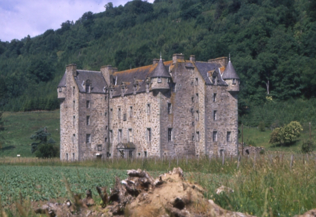
Castle Menzies

Castle Menzies in Scotland is the ancestral seat of the Clan Menzies and the Menzies Baronets. It is located a little to the west of the small village...

Harpswell Cattle Pound

The Harpswell Cattle Pound is a stone enclosure in Harpswell, Maine, United States. It was used to hold stray animals until they could be reunited with...

Croft Moraig Stone Circle

Croft Moraig Stone Circle (also Croftmoraig) is a prehistoric stone circle situated four miles southwest of Aberfeldy, Scotland (grid reference NN79754726...

Nearby Amenities

Located within 500m of 56.615393,-3.9285634
Power: pole
Lat/Long: 56.6120867/-3.9232104
Power: pole
Lat/Long: 56.6177773/-3.9216784
Power: pole
Lat/Long: 56.6176685/-3.9225876
Power: pole
Lat/Long: 56.6175689/-3.9234396
Power: pole
Lat/Long: 56.6174804/-3.9242564
Power: pole
Lat/Long: 56.6173503/-3.9254558
Material: wood
Power: pole
Lat/Long: 56.617211/-3.9266256
Material: wood
Power: pole
Lat/Long: 56.6170696/-3.9278638
Material: wood
Power: pole
Lat/Long: 56.6169303/-3.9291223
Material: wood
Power: pole
Lat/Long: 56.6167869/-3.9303679
Material: wood
Power: pole
Lat/Long: 56.6166283/-3.931765
Material: wood
Power: pole
Lat/Long: 56.6164524/-3.9332952
Power: pole
Lat/Long: 56.6163487/-3.9341656
Power: pole
Lat/Long: 56.6162449/-3.9350545
Power: pole
Lat/Long: 56.6161473/-3.9359305
Power: pole
Lat/Long: 56.6188806/-3.931741
Power: pole
Lat/Long: 56.6191561/-3.9308465
Power: pole
Lat/Long: 56.6194571/-3.9299114
Power: pole
Lat/Long: 56.6196981/-3.9291593
Power: pole
Lat/Long: 56.6181688/-3.9248884
Power: pole
Lat/Long: 56.6185725/-3.9252857
Power: pole
Lat/Long: 56.619268/-3.9261562
Power: pole
Lat/Long: 56.6197581/-3.9267586
Shelter
Shelter Type: public_transport
Lat/Long: 56.6189782/-3.9240703
The data included in this document is from www.openstreetmap.org. The data is made available under ODbL.

Have you been to Appin of Dull?

Leave your review of Appin of Dull below (or comments, questions and feedback).