Chough Glen

Valley in Stirlingshire

Scotland

Chough Glen

Road to Boards Quarry Now blocked off.
Road to Boards Quarry Credit: Richard Webb

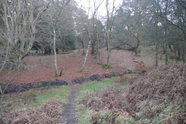
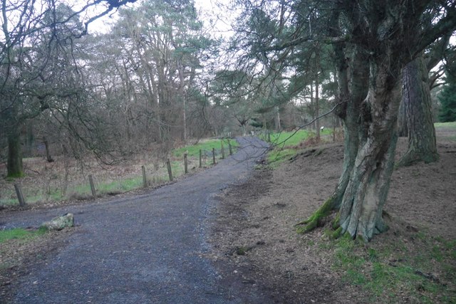
Chough Glen is a picturesque valley located in Stirlingshire, Scotland. It is nestled within the stunning Trossachs National Park, renowned for its breathtaking landscapes and natural beauty. The glen is named after the chough, a bird species that can be spotted in the area.

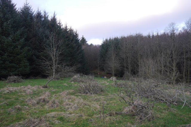
The valley is characterized by its lush greenery, rolling hills, and enchanting waterfalls. It is a haven for nature enthusiasts and hikers, offering a variety of walking trails that cater to different skill levels. Visitors can explore the glen's tranquil atmosphere while enjoying the soothing sounds of cascading water and the gentle rustling of leaves.

Chough Glen is also home to a diverse range of wildlife, including red deer, otters, and various bird species. Birdwatchers will be delighted by the opportunity to spot golden eagles, buzzards, and the elusive choughs, after which the glen is named. The valley's rich biodiversity is protected by conservation efforts, ensuring the preservation of its natural habitats.

For those seeking a peaceful retreat, Chough Glen offers a serene environment perfect for relaxation and rejuvenation. The glen's idyllic setting provides ample opportunities for photography and capturing the beauty of nature. Visitors can enjoy a picnic by the riverbanks or simply soak in the tranquility of the surroundings.

Chough Glen is a hidden gem in Stirlingshire, offering a unique blend of natural beauty, wildlife, and recreational activities. Whether you are an avid hiker, nature lover, or simply in search of a peaceful escape, this valley is sure to captivate your senses and leave a lasting impression.

If you have any feedback on the listing, please let us know in the comments section below.
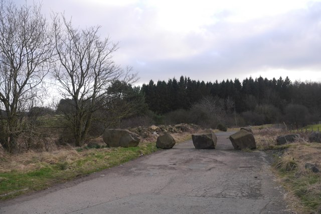
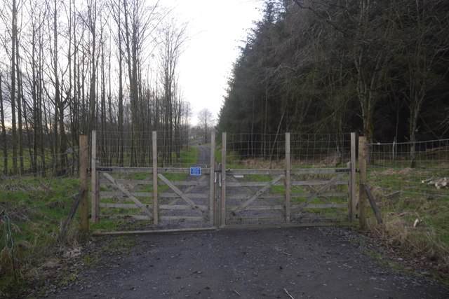
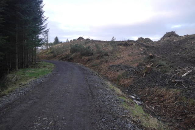
Chough Glen Images

Images are sourced within 2km of 56.048978/-3.9152573 or Grid Reference NS8085. Thanks to Geograph Open Source API. All images are credited.

Road to Boards Quarry Now blocked off.
Road to Boards Quarry
Now blocked off.
New road, Barr Wood The road, which is new and not on the latest edition of the orienteering map runs up to a shelter at NS790867. It has been used to extract timber and services the scout camp without destroying the wild feel of the part of the camp most often used.
New road, Barr Wood
The road, which is new and not on the latest edition of the orienteering map runs up to a shelter at NS790867. It has been used to extract timber and services the scout camp without destroying the wild feel of the part of the camp most often used.
Barr Wood By the new road on the edge of the woodland. This is a small commercial plantation and does not appear to be used by the Scout camp.
Barr Wood
By the new road on the edge of the woodland. This is a small commercial plantation and does not appear to be used by the Scout camp.
New road and felled area, Barr Wood The road is of very recent construction.
New road and felled area, Barr Wood
The road is of very recent construction.
Barr Wood Much of the wood is used as a Scout camp, so best visited in Winter.
Barr Wood
Much of the wood is used as a Scout camp, so best visited in Winter.
Path, Barr Wood Newly upgraded path. The wood is used as a Scout camp.
Path, Barr Wood
Newly upgraded path. The wood is used as a Scout camp.
M80, northbound The M80 joins Glasgow to Stirling. It runs 25 miles from Glasgow to Bannockburn.
<span class="nowrap"><a title="https://www.sabre-roads.org.uk/wiki/index.php?title=M80" rel="nofollow ugc noopener" href="https://www.sabre-roads.org.uk/wiki/index.php?title=M80">Link</a><img style="margin-left:2px;" alt="External link" title="External link - shift click to open in new window" src="https://s1.geograph.org.uk/img/external.png" width="10" height="10"/></span>
M80, northbound
The M80 joins Glasgow to Stirling. It runs 25 miles from Glasgow to Bannockburn. LinkExternal link
Access bridge, M80 The M80 joins Glasgow to Stirling. It runs 25 miles from Glasgow to Bannockburn.
<span class="nowrap"><a title="https://www.sabre-roads.org.uk/wiki/index.php?title=M80" rel="nofollow ugc noopener" href="https://www.sabre-roads.org.uk/wiki/index.php?title=M80">Link</a><img style="margin-left:2px;" alt="External link" title="External link - shift click to open in new window" src="https://s1.geograph.org.uk/img/external.png" width="10" height="10"/></span>
Access bridge, M80
The M80 joins Glasgow to Stirling. It runs 25 miles from Glasgow to Bannockburn. LinkExternal link
Tourist information on M80 The M80 joins Glasgow to Stirling. It runs 25 miles from Glasgow to Bannockburn.
<span class="nowrap"><a title="https://www.sabre-roads.org.uk/wiki/index.php?title=M80" rel="nofollow ugc noopener" href="https://www.sabre-roads.org.uk/wiki/index.php?title=M80">Link</a><img style="margin-left:2px;" alt="External link" title="External link - shift click to open in new window" src="https://s1.geograph.org.uk/img/external.png" width="10" height="10"/></span>
Tourist information on M80
The M80 joins Glasgow to Stirling. It runs 25 miles from Glasgow to Bannockburn. LinkExternal link
M80, northbound The M80 joins Glasgow to Stirling. It runs 25 miles from Glasgow to Bannockburn.
<span class="nowrap"><a title="https://www.sabre-roads.org.uk/wiki/index.php?title=M80" rel="nofollow ugc noopener" href="https://www.sabre-roads.org.uk/wiki/index.php?title=M80">Link</a><img style="margin-left:2px;" alt="External link" title="External link - shift click to open in new window" src="https://s1.geograph.org.uk/img/external.png" width="10" height="10"/></span>
M80, northbound
The M80 joins Glasgow to Stirling. It runs 25 miles from Glasgow to Bannockburn. LinkExternal link
Building site at Dunipace New development of house building at Rosebank
Building site at Dunipace
New development of house building at Rosebank
Northfield Looking towards the farm.
Northfield
Looking towards the farm.
Boards Quarry entrance If you ignored the signs you might think you were entering a country estate.
Boards Quarry entrance
If you ignored the signs you might think you were entering a country estate.
Barr Wood, boundary dyke They use big stones in these parts to build their dykes.
Barr Wood, boundary dyke
They use big stones in these parts to build their dykes.
Banks of Broom Near Myres Farm, south of Barr wood.
Banks of Broom
Near Myres Farm, south of Barr wood.
Show me another place!

Chough Glen is located at Grid Ref: NS8085 (Lat: 56.048978, Lng: -3.9152573)

Unitary Authority: Falkirk

Police Authority: Forth Valley

What 3 Words

///petal.corporate.upward. Near Dunipace, Falkirk

Related Wikis

Battle of Sauchieburn

The Battle of Sauchieburn was fought on 11 June 1488, at the side of Sauchie Burn, a stream about two miles (3 km) south of Stirling, Scotland. The battle...

Auchenbowie House

Auchenbowie House is a laird's house (mansion) in Stirling, Scotland. The location is about 3.5 miles (5.6 km) south of Stirling, on minor road west of...

Dunipace

Dunipace (Scottish Gaelic: Dùn a' Bhàis) is a village in the west of the Falkirk council area of Scotland. The village is 6.3 miles (10.1 km) south of...

Herbertshire Castle

Herbertshire Castle was a castle built in the Barony of Herbertshire in the early fifteenth century, located near Dunipace, Falkirk, central Scotland....

Have you been to Chough Glen?

Leave your review of Chough Glen below (or comments, questions and feedback).