Ceunant Blaen-y-cwm

Valley in Caernarfonshire

Wales

Ceunant Blaen-y-cwm

Moel Marchyria
Moel Marchyria Credit: Peter McDermott

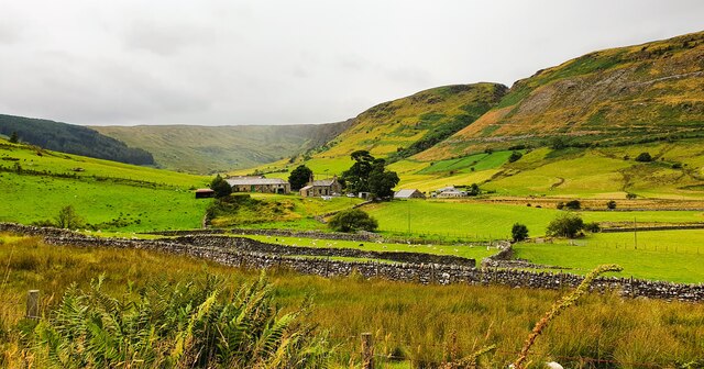
Ceunant Blaen-y-cwm is a picturesque valley located in Caernarfonshire, Wales. Nestled within the Snowdonia National Park, it offers breathtaking views and an abundance of natural beauty. The valley is situated near the village of Llanberis and is surrounded by rugged mountains, including the famous Snowdon, the highest peak in Wales.

The valley is known for its stunning waterfalls, with the Afon Llanberis cascading down the hillside, creating a mesmerizing display of rushing water. Visitors can enjoy a peaceful walk along the riverside, immersing themselves in the tranquil atmosphere and taking in the sights and sounds of nature.

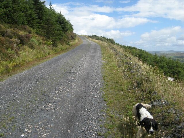
Ceunant Blaen-y-cwm is also a popular destination for outdoor enthusiasts and hikers. The valley offers a range of walking trails, varying in difficulty, catering to both beginners and experienced trekkers. These trails provide the opportunity to explore the surrounding mountains and take in panoramic views of the valley.

Wildlife enthusiasts will be delighted by the diversity of species that call the valley home. The area is teeming with various bird species, including the majestic red kite and peregrine falcon. The valley's rich vegetation provides a habitat for a wide range of plants and flowers, adding to its natural charm.

Overall, Ceunant Blaen-y-cwm is a haven for nature lovers and adventurers alike. Its stunning scenery, captivating waterfalls, and diverse wildlife make it a must-visit destination for anyone seeking a tranquil and awe-inspiring experience in the heart of Snowdonia National Park.

If you have any feedback on the listing, please let us know in the comments section below.

Ceunant Blaen-y-cwm Images

Images are sourced within 2km of 53.017339/-3.8591699 or Grid Reference SH7548. Thanks to Geograph Open Source API. All images are credited.

Moel Marchyria
Moel Marchyria
Approaching Capel Rhyd y Meirch
Penmachno Quarry
Penmachno Quarry
Lower quarry area A view over the lower quarry area of Chwarel Cwm Machno, which was severely landscaped in the 1980s with the removal of a number of structures and the old mills buildings.
Lower quarry area
A view over the lower quarry area of Chwarel Cwm Machno, which was severely landscaped in the 1980s with the removal of a number of structures and the old mills buildings.
Ash tree Growing at the base of a slope of slate waste. Part of the process whereby the old tips will in time become completely lost in a new forest.
Ash tree
Growing at the base of a slope of slate waste. Part of the process whereby the old tips will in time become completely lost in a new forest.
Rising track The main forest track rising up the open hillside now that trees have been felled to the south, and trees are set back from the track on the other side. On the left of the track there are sporadic rock outcrops (see <a href="https://www.geograph.org.uk/photo/7555539">SH7649 : Track-side rock outcrop</a>).
Rising track
The main forest track rising up the open hillside now that trees have been felled to the south, and trees are set back from the track on the other side. On the left of the track there are sporadic rock outcrops (see SH7649 : Track-side rock outcrop).
Rhyd-y-gro
Rhyd-y-gro
Carreg filltir / Milestone The inscription reads:

[Illegible] Miles
[Ffestiniog?] 8
Penmachno 2
Bettws y Coed 6
Llanrwst 10
Carreg filltir / Milestone
The inscription reads: [Illegible] Miles [Ffestiniog?] 8 Penmachno 2 Bettws y Coed 6 Llanrwst 10
Beniarth Terrace o'r gorllewin / Beniarth Terrace from the west
Arwydd "Cwm-Penmachno" sign A pre-Worboys village sign, with raised lettering.  Unusually for Caernarvonshire County Council village signs, this one does not give the distance to the preceding or the next village.  The latter can be explained by the fact that Cwm Penmachno is at the head of the valley.
Arwydd "Cwm-Penmachno" sign
A pre-Worboys village sign, with raised lettering. Unusually for Caernarvonshire County Council village signs, this one does not give the distance to the preceding or the next village. The latter can be explained by the fact that Cwm Penmachno is at the head of the valley.
Carrog, Cwm Penmachno
Eglwys Cwm Penmachno Church Now converted to a dwelling.
Eglwys Cwm Penmachno Church
Now converted to a dwelling.
Tai yng Nghwm Penmachno / Houses in Cwm Penmachno
Capel Shilo Wesleyan Methodist chapel, built in 1864. Closed in 1987.
Heritage Lottery funds have turned the building including the one on the left into a Community and Heritage Centre which opened in 1999.
Capel Shilo
Wesleyan Methodist chapel, built in 1864. Closed in 1987. Heritage Lottery funds have turned the building including the one on the left into a Community and Heritage Centre which opened in 1999.
Cottages in Cwm Penmachno Once a thriving village dependent upon the quarry, but since its closure in 1962 many villagers left creating a holiday cottage village environment.
Cottages in Cwm Penmachno
Once a thriving village dependent upon the quarry, but since its closure in 1962 many villagers left creating a holiday cottage village environment.
Lane towards Penmachno Descending Cwm Hafodyredwydd.
Lane towards Penmachno
Descending Cwm Hafodyredwydd.
Foxglove and tree trunk By the lane above Cwm Penmachno.
Foxglove and tree trunk
By the lane above Cwm Penmachno.
Craig Blaen-y-cwm Disgyn dros Molinia rhwng y Coedwig a Craig Blaen-y-cwm / Descending over Molinia between the forest and Craig Blaen-y-cwm.
Craig Blaen-y-cwm
Disgyn dros Molinia rhwng y Coedwig a Craig Blaen-y-cwm / Descending over Molinia between the forest and Craig Blaen-y-cwm.
Show me another place!

Ceunant Blaen-y-cwm is located at Grid Ref: SH7548 (Lat: 53.017339, Lng: -3.8591699)

Unitary Authority: Conwy

Police Authority: North Wales

What 3 Words

///starring.baseline.prepped. Near Blaenau-Ffestiniog, Gwynedd

Related Wikis

Cwm Penmachno

Cwm Penmachno (historically called Tre-Gynwal) is a village at the head of Cwm Machno in North Wales. == History == The village was built in the 1860s...

Penmachno quarry

The Penmachno quarry (also known as Cwm Machno quarry, Rhiwfachno quarry, or Tan-y-Rhiw quarry) was a slate quarry near Cwm Penmachno, Conwy, North Wales...

Arllechwedd

Arllechwedd was an ancient Welsh cantref in north-west Wales. It was part of the kingdom of Gwynedd for much of its history until it was included in the...

Cwt y Bugail quarry

The Cwt y Bugail quarry is a former slate quarry located east of Blaenau Ffestiniog in Wales. It was first worked as a trial pit around 1840. Continuous...

Nearby Amenities

Located within 500m of 53.017339,-3.8591699
Ford: yes
Lat/Long: 53.0178214/-3.8565152
The data included in this document is from www.openstreetmap.org. The data is made available under ODbL.

Have you been to Ceunant Blaen-y-cwm?

Leave your review of Ceunant Blaen-y-cwm below (or comments, questions and feedback).