Boiling Glen

Valley in Stirlingshire

Scotland

Boiling Glen

Tak Ma Doon Road, Kilsyth Hills Looking southward from near to the entrance to the View Point Car Park.
Tak Ma Doon Road, Kilsyth Hills Credit: Peter Wood

Boiling Glen is a picturesque valley located in Stirlingshire, Scotland. Nestled amidst the stunning landscape of the Scottish Highlands, it is renowned for its natural beauty and captivating surroundings. The glen is situated near the village of Balfron, and its name originates from the bubbling and churning waters of the Boiling Burn that runs through the valley.

The main attraction of Boiling Glen is its enchanting woodland, which is home to a diverse range of flora and fauna. The dense forest is composed of a variety of native trees, including oak, birch, and pine, creating a rich and vibrant ecosystem. The glen is well-known for its impressive displays of wildflowers during the spring and summer months, adding a burst of color to the already stunning landscape.

Visitors to Boiling Glen can enjoy a range of outdoor activities. The glen offers numerous walking trails that cater to all levels of fitness and experience, allowing visitors to explore the area at their own pace. The trails wind through the woodland, offering breathtaking views of the surrounding hills and valleys. Additionally, the Boiling Burn provides opportunities for fishing and relaxation by its tranquil waters.

The glen is also steeped in history, with traces of ancient settlements and archaeological sites scattered throughout the area. These remnants serve as a testament to the rich cultural heritage of the region and provide a fascinating insight into the lives of the people who once called Boiling Glen home.

Overall, Boiling Glen is a place of natural wonder and tranquility, offering visitors a chance to escape the hustle and bustle of everyday life and immerse themselves in the unparalleled beauty of the Scottish countryside.

If you have any feedback on the listing, please let us know in the comments section below.
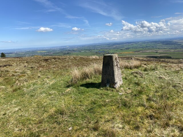
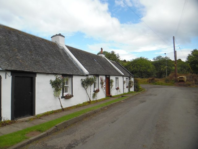
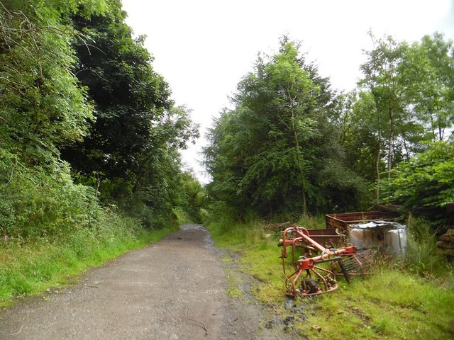
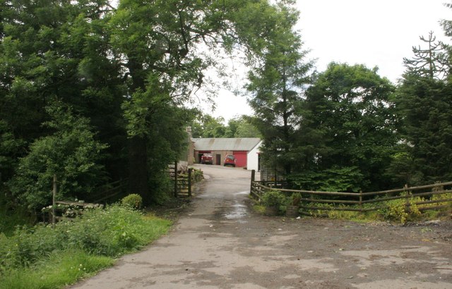
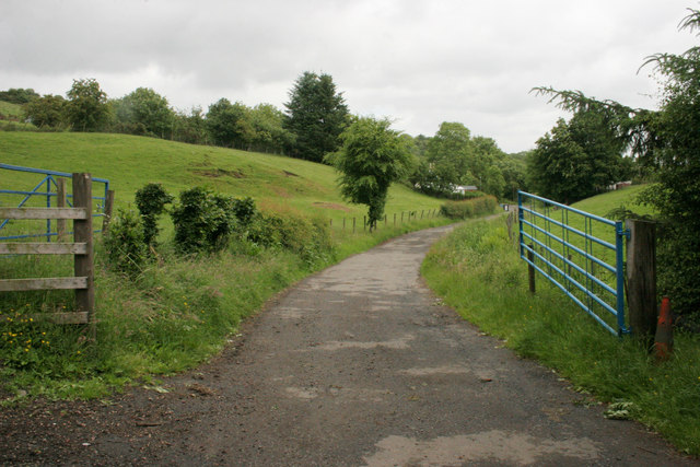
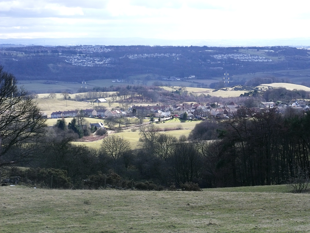
Boiling Glen Images

Images are sourced within 2km of 56.000807/-4.0025856 or Grid Reference NS7580. Thanks to Geograph Open Source API. All images are credited.

Tak Ma Doon Road, Kilsyth Hills Looking southward from near to the entrance to the View Point Car Park.
Tak Ma Doon Road, Kilsyth Hills
Looking southward from near to the entrance to the View Point Car Park.
Cleared, replanted forest on Denny Muir The dense forest seen ten years ago in <a href="https://www.geograph.org.uk/photo/3485770">NS7582 : Forest, Denny Muir</a> has been felled and replanted. For now one has a clear view across the Denny Muir to Birns Hill and beyond.
Cleared, replanted forest on Denny Muir
The dense forest seen ten years ago in NS7582 : Forest, Denny Muir has been felled and replanted. For now one has a clear view across the Denny Muir to Birns Hill and beyond.
Birns hill A rocky knoll above the boggy moorland of Denny Muir. The dry stane dyke runs across the hill from the west.
Birns hill
A rocky knoll above the boggy moorland of Denny Muir. The dry stane dyke runs across the hill from the west.
Birns trig point The pillar is seen looking roughly west, with Tomtain at upper left.
Birns trig point
The pillar is seen looking roughly west, with Tomtain at upper left.
Nearly at the end of the track
Birns Hill on the horizon
Fence to be crossed on the way to Birns Hill
Birns Hill Trig Point Flush Bracket S3645
View from Birns Hill
Fence crossing point Someone had wrapped some ribbon around the barbed wire
Fence crossing point
Someone had wrapped some ribbon around the barbed wire
Fence crossing point Someone had wrapped some ribbon around the barbed wire
Fence crossing point
Someone had wrapped some ribbon around the barbed wire
View towards Birns Hill
Views North
Views North
High Banton Picturesque cottages in the old village of Banton.
High Banton
Picturesque cottages in the old village of Banton.
Forest track east of High Banton
Viewpoint, Tak Ma Doon Road A small car park and picnic tables are situated at a point on the Tak Ma Doon Road that affords great views over the surrounding area. It was possible to see as far as the Forth bridges to the east - about 40km away.
Viewpoint, Tak Ma Doon Road
A small car park and picnic tables are situated at a point on the Tak Ma Doon Road that affords great views over the surrounding area. It was possible to see as far as the Forth bridges to the east - about 40km away.
Glenhead The end of the road.
Glenhead
The end of the road.
Gates, Glenhead The road leads from Glenhead to High Banton.
Gates, Glenhead
The road leads from Glenhead to High Banton.
Show me another place!

Boiling Glen is located at Grid Ref: NS7580 (Lat: 56.000807, Lng: -4.0025856)

Unitary Authority: North Lanarkshire

Police Authority: Lanarkshire

What 3 Words

///troubles.garden.unfilled. Near Banknock, Falkirk

Nearby Locations

Boiling Glen

Related Wikis

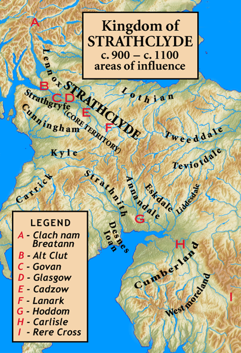
Kingdom of Strathclyde

Strathclyde (lit. "broad valley of the Clyde", Welsh: Ystrad Clud, Latin: Cumbria) was a Brittonic kingdom in northern Britain during the Middle Ages....

Banton, North Lanarkshire

Banton is a small village situated near Kilsyth in North Lanarkshire, Scotland. == History == The Covenanter army under General William Baillie formed...

Kelvinhead

Kelvinhead is a small hamlet in the vicinity of the village of Banton in Scotland. Located close to the source of the River Kelvin, it is little more than...

Battle of Kilsyth

The Battle of Kilsyth, fought on 15 August 1645 near Kilsyth, was an engagement of the Wars of the Three Kingdoms. The largest battle of the conflict in...

Nearby Amenities

Located within 500m of 56.000807,-4.0025856
High Banton
Is In: North Lanarkshire
Place: hamlet
Lat/Long: 55.9968614/-4.0063245
Old Coal Pit
Historic: mine
Lat/Long: 55.9994324/-4.0039055
Old Coal Pit
Historic: mine
Lat/Long: 55.9982205/-4.0014057
Old Coal Pit
Historic: mine
Lat/Long: 55.9974225/-4.0007191
Old Coal Pit
Historic: mine
Lat/Long: 55.9972305/-4.0020923
Power: pole
Lat/Long: 55.9974192/-4.0073311
Power: pole
Lat/Long: 56.0023346/-4.0097216
Power: pole
Lat/Long: 56.0016531/-4.0092924
Power: pole
Lat/Long: 56.0009728/-4.0088425
Power: pole
Lat/Long: 56.0002774/-4.0084154
Power: pole
Lat/Long: 55.9996006/-4.0079613
Power: pole
Lat/Long: 55.9989144/-4.0075072
Power: pole
Lat/Long: 55.9982271/-4.0070843
The data included in this document is from www.openstreetmap.org. The data is made available under ODbL.

Have you been to Boiling Glen?

Leave your review of Boiling Glen below (or comments, questions and feedback).