Ceunant Cae-gwegi

Valley in Caernarfonshire

Wales

Ceunant Cae-gwegi

Capel Curig War Memorial This memorial stands on the inside corner of the bend in the A5 at the junction with the A4086, outside the former church of St Curig.

The memorial is in the form of a wheel cross standing on a pyramidal plinth. The front shaft of the cross bears the commemoration in Welsh “Er diolchus gof am y rhai a roddasant eu bywydau drosom o’r plwyf hwn yn y rhyfel 1914-1918.” This translates as: “In grateful memory of the ones from this parish who gave their lives on our behalf in the war 1914-1918” (<span class="nowrap"><a title="https://historypoints.org/index.php?page=capel-curig-war-memorial" rel="nofollow ugc noopener" href="https://historypoints.org/index.php?page=capel-curig-war-memorial">Link</a><img style="margin-left:2px;" alt="External link" title="External link - shift click to open in new window" src="https://s1.geograph.org.uk/img/external.png" width="10" height="10"/></span> History Points)
Capel Curig War Memorial Credit: David Dixon

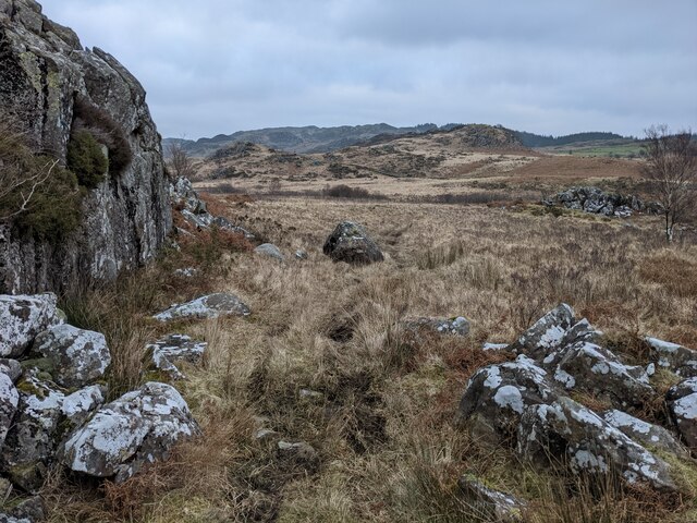
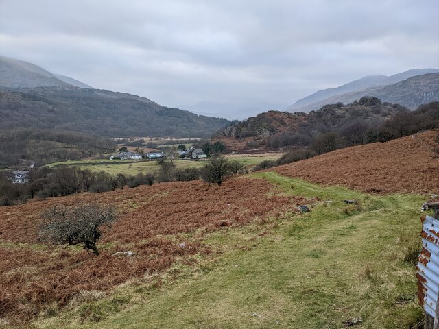
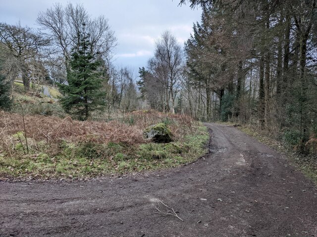
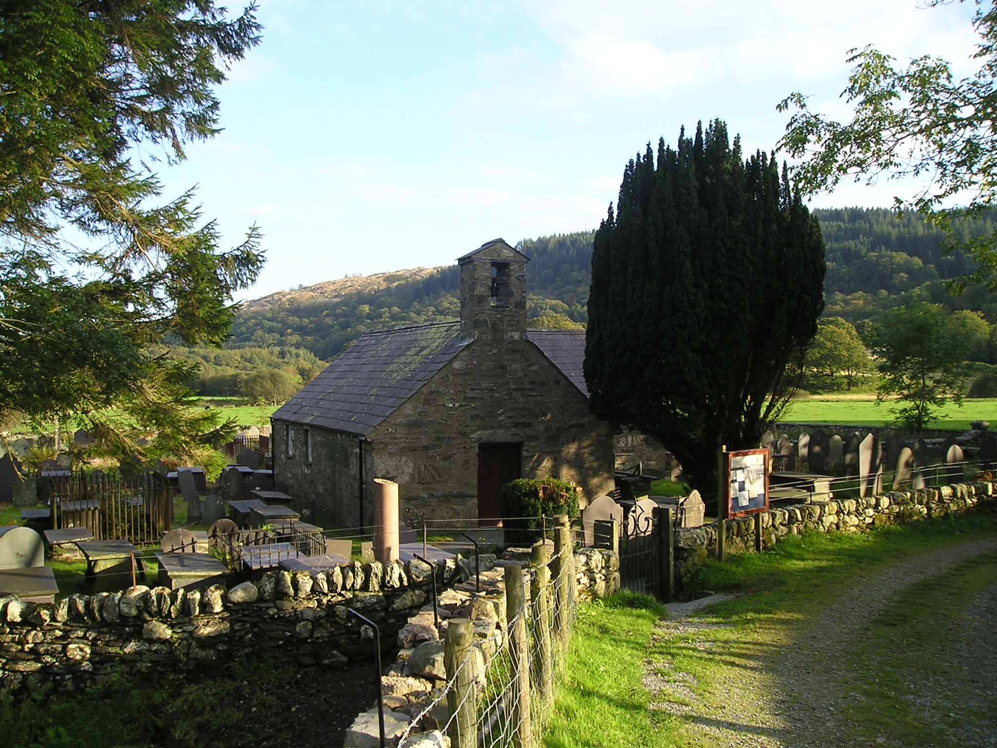
Ceunant Cae-gwegi is a stunning valley located in the historic county of Caernarfonshire, Wales. Nestled within the Snowdonia National Park, this valley boasts breathtaking natural beauty and is a popular destination for nature lovers and hikers.

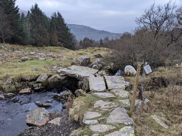
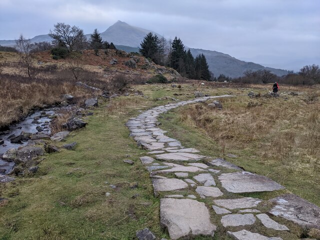
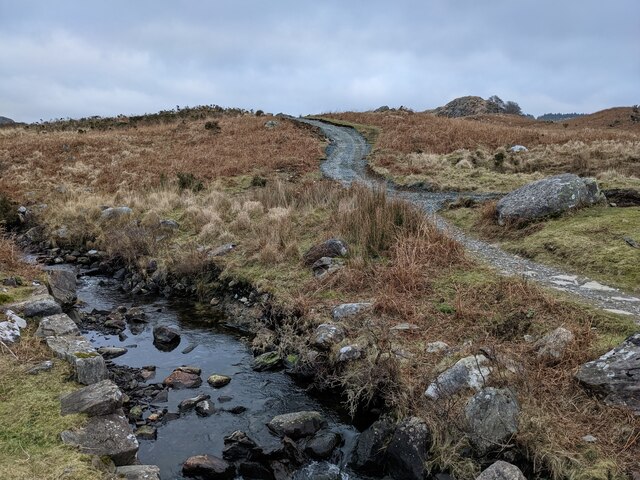
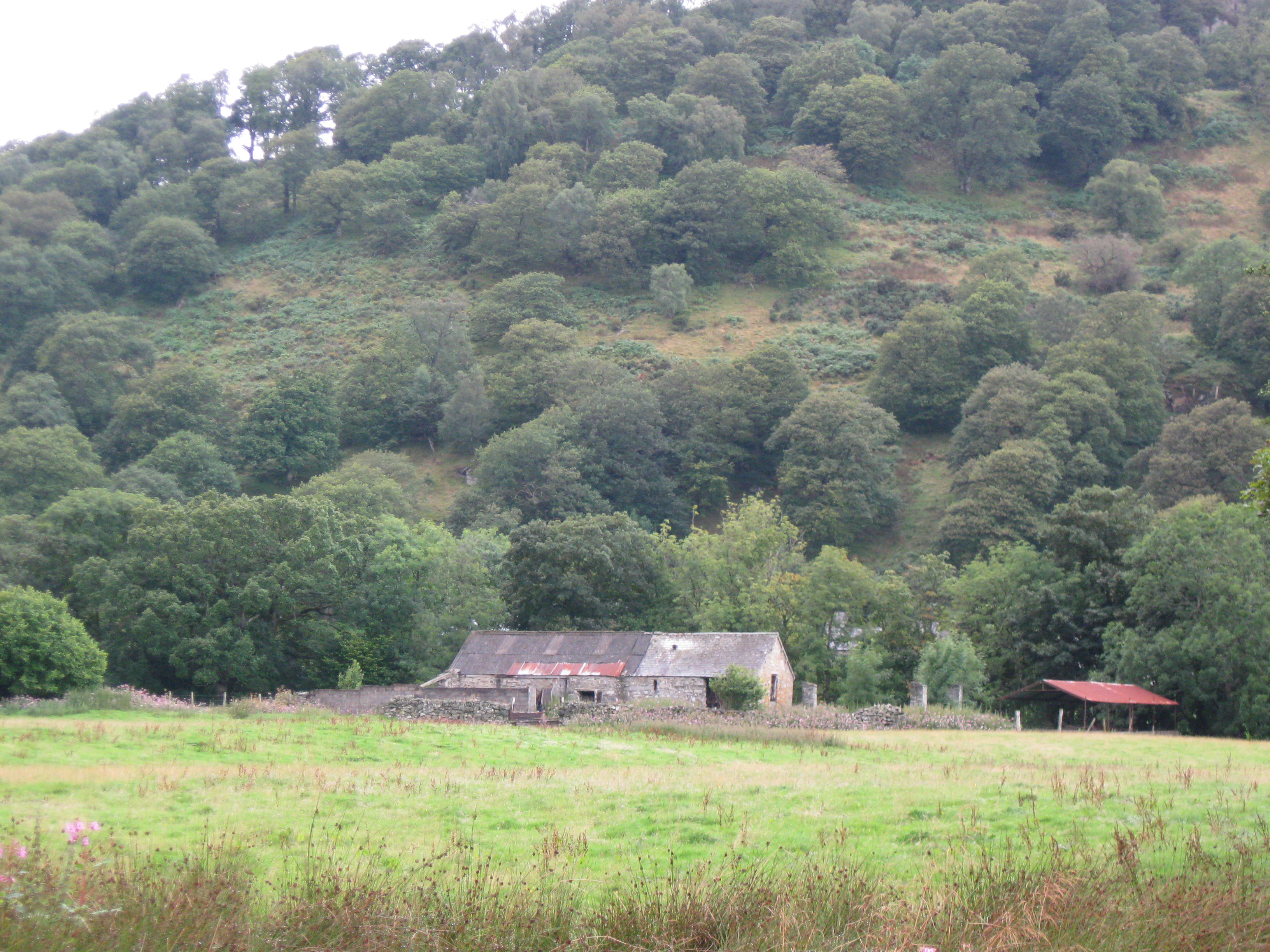
The valley is characterized by its steep cliffs and rugged terrain, with the Afon Gwyrfai river meandering through it. The river is known for its crystal-clear waters and is a haven for various species of fish, making it a popular spot for fishing enthusiasts.

Ceunant Cae-gwegi is also home to a diverse range of flora and fauna. The lush vegetation includes ancient woodlands, moss-covered rocks, and colorful wildflowers that create a picturesque landscape. The valley is particularly famous for its population of rare and endangered bird species, making it a paradise for birdwatching enthusiasts.

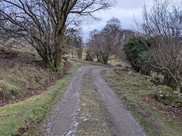
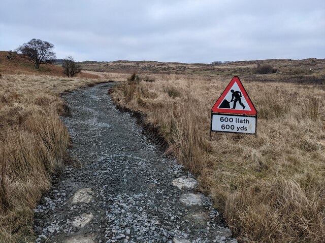
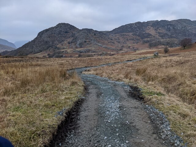
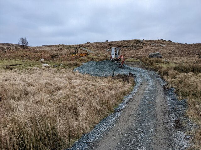
For those seeking adventure, Ceunant Cae-gwegi offers numerous hiking trails that cater to all levels of difficulty. The paths wind through the valley, offering breathtaking views of cascading waterfalls, towering cliffs, and panoramic vistas of the surrounding mountains.

Visitors to Ceunant Cae-gwegi can also explore the nearby attractions, such as the historic town of Caernarfon with its famous 13th-century castle, or take a steam train journey on the Welsh Highland Railway.

Overall, Ceunant Cae-gwegi is a hidden gem within the Snowdonia National Park, offering a tranquil and awe-inspiring retreat for those seeking a connection with nature and a taste of Wales' rich natural heritage.

If you have any feedback on the listing, please let us know in the comments section below.

Ceunant Cae-gwegi Images

Images are sourced within 2km of 53.096075/-3.8968564 or Grid Reference SH7357. Thanks to Geograph Open Source API. All images are credited.

Capel Curig War Memorial This memorial stands on the inside corner of the bend in the A5 at the junction with the A4086, outside the former church of St Curig.

The memorial is in the form of a wheel cross standing on a pyramidal plinth. The front shaft of the cross bears the commemoration in Welsh “Er diolchus gof am y rhai a roddasant eu bywydau drosom o’r plwyf hwn yn y rhyfel 1914-1918.” This translates as: “In grateful memory of the ones from this parish who gave their lives on our behalf in the war 1914-1918” (<span class="nowrap"><a title="https://historypoints.org/index.php?page=capel-curig-war-memorial" rel="nofollow ugc noopener" href="https://historypoints.org/index.php?page=capel-curig-war-memorial">Link</a><img style="margin-left:2px;" alt="External link" title="External link - shift click to open in new window" src="https://s1.geograph.org.uk/img/external.png" width="10" height="10"/></span> History Points)
Capel Curig War Memorial
This memorial stands on the inside corner of the bend in the A5 at the junction with the A4086, outside the former church of St Curig. The memorial is in the form of a wheel cross standing on a pyramidal plinth. The front shaft of the cross bears the commemoration in Welsh “Er diolchus gof am y rhai a roddasant eu bywydau drosom o’r plwyf hwn yn y rhyfel 1914-1918.” This translates as: “In grateful memory of the ones from this parish who gave their lives on our behalf in the war 1914-1918” (LinkExternal link History Points)
The A5 at Capel Curig The A5 is a major trunk road which runs for about 181 miles from London, in England, to Holyhead, in Wales. For part of its route, it follows a section of the Roman route which later took the Anglo-Saxon name Watling Street.  At Oswestry, the A5 joins the A483 and becomes the bypass to the east of the town. It continues to multiplex with the A483 until it reaches Halton, where it diverges towards Llangollen and Holyhead.
The A5 at Capel Curig
The A5 is a major trunk road which runs for about 181 miles from London, in England, to Holyhead, in Wales. For part of its route, it follows a section of the Roman route which later took the Anglo-Saxon name Watling Street. At Oswestry, the A5 joins the A483 and becomes the bypass to the east of the town. It continues to multiplex with the A483 until it reaches Halton, where it diverges towards Llangollen and Holyhead.
Gelli, near Capel Curig
The bridleway to Crafnant
Rocks below Clogwyn Mawr
The footpath down to Bryntyrch
The bridleway down to Capel Curig
Perched erratic boulders above Capel Curig
The bridleway down to Capel Curig
An ancient bridge on the bridleway The wonky sign states that the path goes through a garden and please respect this.
An ancient bridge on the bridleway
The wonky sign states that the path goes through a garden and please respect this.
Path protected from erosion - the old way There is controversy (in 2022) about the National Park's heavy-handed treatment of the Crafnant bridleway. This is a good example of previous, landscape sensitive, work using natural stone.  See other photos for the modern process.
Path protected from erosion - the old way
There is controversy (in 2022) about the National Park's heavy-handed treatment of the Crafnant bridleway. This is a good example of previous, landscape sensitive, work using natural stone. See other photos for the modern process.
Path protected from erosion - the 2022 method There is great controversy about the Snowdonia National Park using heavy machinery to dig up this bridleway and then resurfacing with gravel and not natural stone. This is already being washed out by recent storms in places, so the detractors seem to have a case.
Path protected from erosion - the 2022 method
There is great controversy about the Snowdonia National Park using heavy machinery to dig up this bridleway and then resurfacing with gravel and not natural stone. This is already being washed out by recent storms in places, so the detractors seem to have a case.
A section of resurfaced path
Newly resurfaced path Scraped out and filled with gravel, thus becoming a clichéd 'scar on the landscape' which is likely to be washed out by winter storms.
Newly resurfaced path
Scraped out and filled with gravel, thus becoming a clichéd 'scar on the landscape' which is likely to be washed out by winter storms.
Men at work A digger and gravel pile, ready to cover the old stone path. It is not surprising that the National Park is getting adverse comments about this process.
Men at work
A digger and gravel pile, ready to cover the old stone path. It is not surprising that the National Park is getting adverse comments about this process.
Llynnau Mymbyr Llynnau Mymbyr are two lakes located in Dyffryn Mymbyr, a valley running from the village of Capel Curig to the Pen-y-Gwryd hotel in Snowdonia, north-west Wales. The A4086 runs along their northern banks.
This is one lake, originally called Llyn Mymbyr, with a maximum depth of 30 feet. About 3/4 mile long in total, a delta has built up midway along the north shore, and this has to all purposes cut the lake in two - hence the plural name.
The river feeding the lakes is the Nantygwryd, which has its source at Llyn Cwm-y-ffynnon, also marked on maps as the Nant Gwryd, which is a tributary of the Afon Llugwy. The two rivers join at Capel Curig.
Llynnau Mymbyr
Llynnau Mymbyr are two lakes located in Dyffryn Mymbyr, a valley running from the village of Capel Curig to the Pen-y-Gwryd hotel in Snowdonia, north-west Wales. The A4086 runs along their northern banks. This is one lake, originally called Llyn Mymbyr, with a maximum depth of 30 feet. About 3/4 mile long in total, a delta has built up midway along the north shore, and this has to all purposes cut the lake in two - hence the plural name. The river feeding the lakes is the Nantygwryd, which has its source at Llyn Cwm-y-ffynnon, also marked on maps as the Nant Gwryd, which is a tributary of the Afon Llugwy. The two rivers join at Capel Curig.
A4086, Capel Curig The A4086 runs for almost 18 miles between Caernarfon and Capel Curig. It is a popular tourist route as it passes through some of the most memorable and famous parts of Snowdonia including the Llanberis Pass.
A4086, Capel Curig
The A4086 runs for almost 18 miles between Caernarfon and Capel Curig. It is a popular tourist route as it passes through some of the most memorable and famous parts of Snowdonia including the Llanberis Pass.
A5 passing Moel Siabod Cafe, Capel Curig The A5 is a major trunk road which runs for about 181 miles from London, in England, to Holyhead, in Wales. For part of its route, it follows a section of the Roman route which later took the Anglo-Saxon name Watling Street.  At Oswestry, the A5 joins the A483 and becomes the bypass to the east of the town. It continues to multiplex with the A483 until it reaches Halton, where it diverges towards Llangollen and Holyhead.
A5 passing Moel Siabod Cafe, Capel Curig
The A5 is a major trunk road which runs for about 181 miles from London, in England, to Holyhead, in Wales. For part of its route, it follows a section of the Roman route which later took the Anglo-Saxon name Watling Street. At Oswestry, the A5 joins the A483 and becomes the bypass to the east of the town. It continues to multiplex with the A483 until it reaches Halton, where it diverges towards Llangollen and Holyhead.
Show me another place!

Ceunant Cae-gwegi is located at Grid Ref: SH7357 (Lat: 53.096075, Lng: -3.8968564)

Unitary Authority: Conwy

Police Authority: North Wales

What 3 Words

///shred.beans.middle. Near Betws-y-Coed, Conwy

Related Wikis

Cobden's Hotel

Cobden's Hotel is a 19th-century hotel in Capel Curig, Conwy, Wales. It became famous after it was bought by the celebrated cricketer Frank Cobden and...

Capel Curig

Capel Curig (Welsh pronunciation: [ˈkɑːpɛl ˈkɨːrɪɡ]; meaning "Curig's Chapel") is a village and community in Conwy County Borough, Wales. Historically...

Caer Llugwy

Caer Llugwy, or Bryn-y-Gefeiliau, is the site of a Roman fort in a loop of the Afon Llugwy near Capel Curig in Conwy, Wales. It is notable in that there...

Plas y Brenin

Plas y Brenin, located in Conwy County Borough, Wales, is a National Outdoor Centre owned by Sport England. The centre is situated in Dyffryn Mymbyr, the...

Nearby Amenities

Located within 500m of 53.096075,-3.8968564
Created By: Merkaartor 0.12
Lat/Long: 53.0955579/-3.891457
Whitewater: egress
Lat/Long: 53.0968396/-3.8928126
Whitewater: egress
Lat/Long: 53.1001799/-3.8987288
Whitewater: put_in
Lat/Long: 53.1001221/-3.8961881
Whitewater: put_in
Lat/Long: 53.095095/-3.8900599
Telephone
Booth: K6
Covered: booth
Lat/Long: 53.0970724/-3.8922219
Post Box
Post Box Type: wall
Ref: LL24 30
Royal Cypher: GR
Royal Cypher Wikidata: Q33102273
Lat/Long: 53.0970246/-3.8921025
Created By: Merkaartor 0.12
Lat/Long: 53.097681/-3.8931329
Created By: Merkaartor 0.12
Lat/Long: 53.0976399/-3.8929879
Created By: Merkaartor 0.12
Lat/Long: 53.097682/-3.892852
Created By: Merkaartor 0.12
Lat/Long: 53.0978309/-3.8926719
Created By: Merkaartor 0.12
Lat/Long: 53.098091/-3.8924289
Created By: Merkaartor 0.12
Lat/Long: 53.098496/-3.892062
Created By: Merkaartor 0.12
Lat/Long: 53.098709/-3.891663
Created By: Merkaartor 0.12
Lat/Long: 53.0987059/-3.891505
Created By: Merkaartor 0.12
Lat/Long: 53.098498/-3.891386
Created By: Merkaartor 0.12
Lat/Long: 53.0982879/-3.8912919
Created By: Merkaartor 0.12
Lat/Long: 53.098251/-3.8909779
Created By: Merkaartor 0.12
Lat/Long: 53.0982609/-3.890666
Rhos
Place: hamlet
Source: OS_OpenData_StreetView
Lat/Long: 53.0940888/-3.895106
Pont Cyfyng
Place: village
Source: OS_OpenData_StreetView
Lat/Long: 53.0958798/-3.8918229
Bron Eryri Guest House
Addr City: Betws y Coed
Addr Country: GB
Addr Place: Capel Curig
Addr Postcode: LL24 0EE
Fhrs Authority: Conwy
Fhrs Id: 550538
Fhrs Local Authority Id: 13623
Name Cy: Ty Llety Bron Eryri
Name En: Bron Eryri Guest House
Tourism: guest_house
Wheelchair: no
Lat/Long: 53.0979093/-3.8937678
Bus Stop
Cyfyng Falls
Bench: yes
Bin: no
Bus: yes
Lit: no
Naptan AtcoCode: 5130AWF80348
Naptan NaptanCode: cnwagjw
Public Transport: platform
Shelter: yes
Tactile Paving: no
Lat/Long: 53.0970457/-3.892171
Ford: yes
Lat/Long: 53.0965949/-3.8935422
Tyn-Y-Coed Hotel
Addr City: Betws y Coed
Addr Country: GB
Addr Place: Capel Curig
Addr Postcode: LL24 0EE
Description: Traditional Welsh hotel and pub
Email: res@tyn-y-coed.co.uk
Fhrs Authority: Conwy
Fhrs Id: 62623
Fhrs Local Authority Id: 13835
Name En: Tyn Y Coed Hotel
Phone: +441690720331
Rooms: 14
Source: OS_OpenData_StreetView
Tourism: hotel
Website: https://www.tyn-y-coed.co.uk
Wikidata: Q41963012
Lat/Long: 53.098825/-3.8945589
Pub
Tyn-Y-Coed
Addr City: Betws y Coed
Addr Country: GB
Addr Place: Capel Curig
Addr Postcode: LL24 0EE
Description: Traditional Welsh hotel and pub
Fhrs Authority: Conwy
Fhrs Id: 62623
Fhrs Local Authority Id: 13835
Outdoor Seating: yes
Phone: +441690720331
Website: https://www.tyn-y-coed.co.uk
Wikidata: Q41963012
Lat/Long: 53.0986992/-3.8944001
The data included in this document is from www.openstreetmap.org. The data is made available under ODbL.

Have you been to Ceunant Cae-gwegi?

Leave your review of Ceunant Cae-gwegi below (or comments, questions and feedback).