Lochrennie Glen

Valley in Dumfriesshire

Scotland

Lochrennie Glen

Rough grazing on the Minnygryle Burn Rough grazing on the Minnygryle Burn near Moniaive.
Rough grazing on the Minnygryle Burn Credit: Colin Kinnear

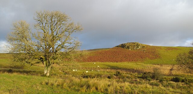
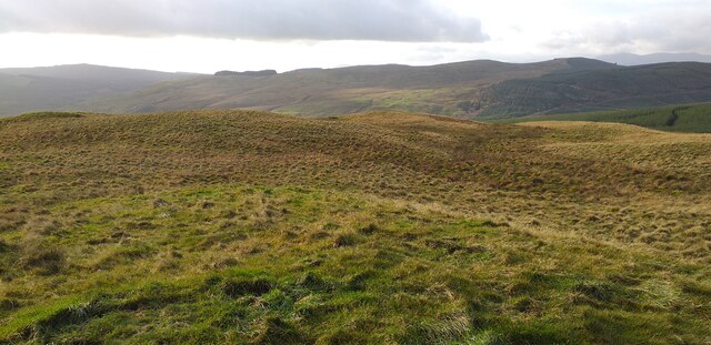
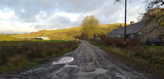
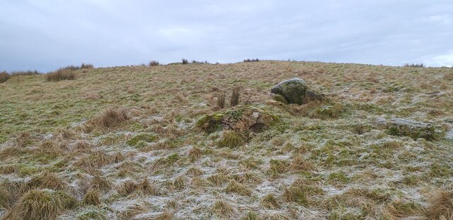
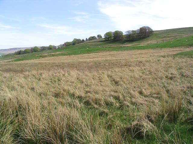
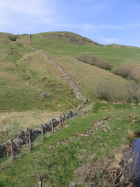
Lochrennie Glen is a picturesque valley located in Dumfriesshire, Scotland. Nestled amidst the rolling hills and lush greenery, this serene glen is a popular destination for nature lovers and outdoor enthusiasts. The glen stretches for approximately 5 miles, offering visitors a tranquil escape from the hustle and bustle of city life.

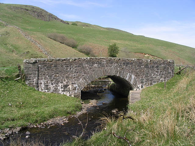
The valley is characterized by its stunning natural beauty, with a meandering river, dense woodlands, and striking rock formations. The river, known as Lochrennie Burn, flows through the glen, creating a soothing atmosphere and providing a habitat for various wildlife species.

The glen is also home to a diverse range of plant life, including ancient oak trees, wildflowers, and ferns. Walking along the well-maintained trails, visitors can enjoy the vibrant colors and fragrant scents of the flora that thrives in this idyllic setting.

For those seeking adventure, Lochrennie Glen offers ample opportunities for activities such as hiking, birdwatching, and fishing. The glen is traversed by several trails, providing access to its hidden gems and breathtaking viewpoints. Anglers can try their luck in the crystal-clear waters of the Lochrennie Burn, where trout and salmon can be found.

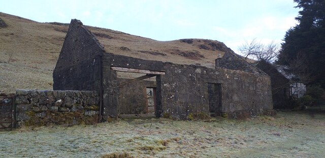
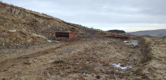
In addition to its natural beauty, Lochrennie Glen also has a rich history. The area is dotted with remnants of ancient settlements and historic sites, adding an element of intrigue to the glen. Visitors can explore the ruins of old stone buildings and learn about the people who once called this place home.

Overall, Lochrennie Glen is a captivating destination that offers a perfect blend of natural splendor and cultural heritage. Whether you are seeking tranquility, adventure, or a glimpse into Scotland's past, this valley is sure to leave a lasting impression.

If you have any feedback on the listing, please let us know in the comments section below.

Lochrennie Glen Images

Images are sourced within 2km of 55.165507/-4.0072602 or Grid Reference NX7287. Thanks to Geograph Open Source API. All images are credited.

Rough grazing on the Minnygryle Burn Rough grazing on the Minnygryle Burn near Moniaive.
Rough grazing on the Minnygryle Burn
Rough grazing on the Minnygryle Burn near Moniaive.
Climbing Big Morton Hill Climbing Big Morton Hill, a mixture of woodland and tusocky moorland.
Climbing Big Morton Hill
Climbing Big Morton Hill, a mixture of woodland and tusocky moorland.
Forest track near Minnygryle Forest track near Minnygryle.
Forest track near Minnygryle
Forest track near Minnygryle.
Summit area of Glencrosh Hill Summit area of Glencrosh Hill.
Summit area of Glencrosh Hill
Summit area of Glencrosh Hill.
Start of the road to Minnygryle Start of the road to Minnygryle.
Start of the road to Minnygryle
Start of the road to Minnygryle.
Small copse on Big Morton Hill A small copse of native trees inside an old sheep fank on the slopes of Big Morton Hill.
Small copse on Big Morton Hill
A small copse of native trees inside an old sheep fank on the slopes of Big Morton Hill.
Lochrennie An old derelict outbuilding at Lochrennie.
Lochrennie
An old derelict outbuilding at Lochrennie.
Cairn on Ewe Hill The map shows a cairn up here but this was the best that I could find.
Cairn on Ewe Hill
The map shows a cairn up here but this was the best that I could find.
Feed Station on Ewe Hill Cattle feed station at the end of the track on Ewe Hill.
Feed Station on Ewe Hill
Cattle feed station at the end of the track on Ewe Hill.
Lochrennie Bridge Spans the Blackmark Burn.
Lochrennie Bridge
Spans the Blackmark Burn.
Rough grazing Near Craigmuie Bridge with Crow Wood in the background centre right.
Rough grazing
Near Craigmuie Bridge with Crow Wood in the background centre right.
Sheep pasture Viewed from the A702 with Craigmuie Farm beyond.
Sheep pasture
Viewed from the A702 with Craigmuie Farm beyond.
Hill farmland Hill grazing for sheep opposite Castlefairn Farm.
Hill farmland
Hill grazing for sheep opposite Castlefairn Farm.
Midden Craig Viewed from Lochrennie Bridge.
Midden Craig
Viewed from Lochrennie Bridge.
Forestry clear fell area Near Pointfoot Hill.
Forestry clear fell area
Near Pointfoot Hill.
Log ends A recently felled pile of logs marked and ready for transportation.
Log ends
A recently felled pile of logs marked and ready for transportation.
Wind damaged trees Some trees in the foreground have been completely uprooted and stripped the trees immediately behind, in forestry to the east of Pointfoot Hill.
Wind damaged trees
Some trees in the foreground have been completely uprooted and stripped the trees immediately behind, in forestry to the east of Pointfoot Hill.
Clear fell area and lumber A good area of the forest to the southeast of Minnygryle Hill has been clear felled and stacks of timber are ready for uplifting.
Clear fell area and lumber
A good area of the forest to the southeast of Minnygryle Hill has been clear felled and stacks of timber are ready for uplifting.
Show me another place!

Lochrennie Glen is located at Grid Ref: NX7287 (Lat: 55.165507, Lng: -4.0072602)

Unitary Authority: Dumfries and Galloway

Police Authority: Dumfries and Galloway

What 3 Words

///packages.micro.sunk. Near Thornhill, Dumfries & Galloway

Nearby Locations

Lochrennie Glen

Related Wikis

Craigdarroch

"Craigdarroch, An Accessory to Murder" is an expansion set for the board game Kill Doctor Lucky Craigdarroch is a house near Moniaive, Dumfries and Galloway...

Loch Skae

Loch Skae is a small, upland freshwater loch to the north of Blackcraig Hill, approximately 18 miles (29 km) west of Dumfries, Scotland, 0.5 mi (0.80 km...

Loch Howie

Loch Howie is a small, narrow, upland freshwater loch on the north side of Blackcraig Hill, approximately 18 miles (29 km) west of Dumfries, Scotland....

Carsphairn and Scaur Hills

The Carsphairn and Scaur Hills are the western and eastern hills respectively of a hill range in the Southern Uplands of Scotland. Ordnance Survey maps...

Nearby Amenities

Located within 500m of 55.165507,-4.0072602
Ford: yes
Lat/Long: 55.1669373/-4.0055209
Barrier: cattle_grid
Lat/Long: 55.1626654/-4.0016418
Ford: yes
Lat/Long: 55.1687991/-4.0115188
Ford: yes
Lat/Long: 55.1627974/-4.0016039
Ford: yes
Lat/Long: 55.1656582/-4.0111294
Ford: yes
Lat/Long: 55.1672607/-4.01215
Ford: yes
Lat/Long: 55.1675579/-4.0134266
Ford: yes
Lat/Long: 55.1676578/-4.0136096
Ford: yes
Lat/Long: 55.1645572/-3.9998417
The data included in this document is from www.openstreetmap.org. The data is made available under ODbL.

Have you been to Lochrennie Glen?

Leave your review of Lochrennie Glen below (or comments, questions and feedback).