Bombie Glen

Valley in Kirkcudbrightshire

Scotland

Bombie Glen

Kirkstead, Kirkcudbright Now in ruins, the cottage of Kirkstead stands 350 yards to the WNW of St Michael's Kirk, of which there is now no trace. The Ordnance Survey Name Book states that the cottage was supposed to have been built on the site of the church's graveyard, hence Kirk (church) and Stead (farmhouse and its outbuildings - compare with homestead, steading etc). Two other names in the area also relate to the church: Kirkstead Bridge (44 yards to the WNW of the cottage), and St Michael's Glen (which carries a burn to the north of the church).
Kirkstead, Kirkcudbright Credit: Forrest and Jen

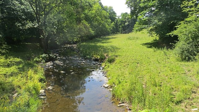
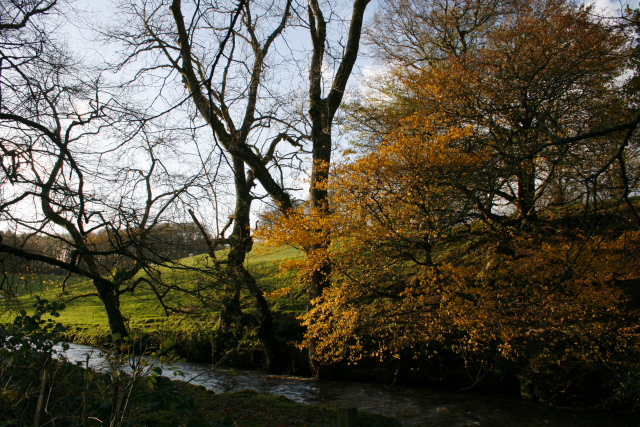
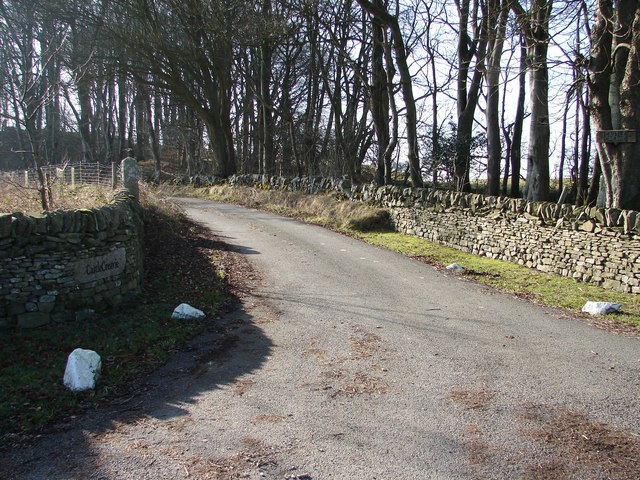
Bombie Glen is a picturesque valley located in Kirkcudbrightshire, a historic county in southwest Scotland. Nestled among green rolling hills, this tranquil valley offers breathtaking natural beauty and a haven for wildlife. The glen is named after the Bombie Burn, a small stream that flows through the area, adding to the charm of this idyllic spot.

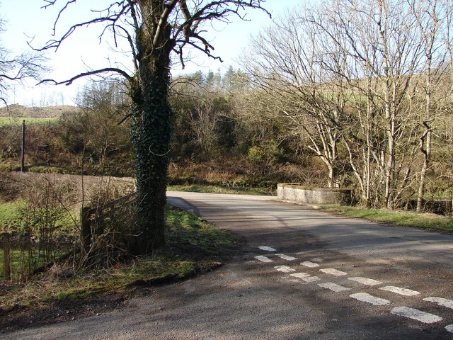
The valley is characterized by its lush vegetation, with dense forests of native trees, including oak, birch, and ash, covering the surrounding slopes. This creates a rich habitat for a variety of wildlife, including deer, foxes, badgers, and a vast array of bird species. The glen is particularly renowned for its birdwatching opportunities, attracting enthusiasts from far and wide.

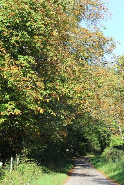
Walking enthusiasts are drawn to Bombie Glen for its scenic trails, which meander through the valley and offer stunning panoramic views of the surrounding countryside. The trails are relatively easy to navigate, making them suitable for hikers of all levels. Along the way, visitors can enjoy the soothing sounds of the babbling brooks and the sweet scent of wildflowers that dot the landscape.

At the heart of Bombie Glen, there is a small picnic area where visitors can relax and enjoy a meal amidst the peaceful surroundings. This area also serves as a popular spot for families to gather and children to play, with ample space for outdoor activities.

Overall, Bombie Glen is a hidden gem in Kirkcudbrightshire, offering a serene escape from the hustle and bustle of daily life. Its natural beauty, diverse wildlife, and picturesque trails make it a must-visit destination for nature lovers and outdoor enthusiasts alike.

If you have any feedback on the listing, please let us know in the comments section below.

Bombie Glen Images

Images are sourced within 2km of 54.832104/-3.9980103 or Grid Reference NX7150. Thanks to Geograph Open Source API. All images are credited.

Kirkstead, Kirkcudbright Now in ruins, the cottage of Kirkstead stands 350 yards to the WNW of St Michael's Kirk, of which there is now no trace. The Ordnance Survey Name Book states that the cottage was supposed to have been built on the site of the church's graveyard, hence Kirk (church) and Stead (farmhouse and its outbuildings - compare with homestead, steading etc). Two other names in the area also relate to the church: Kirkstead Bridge (44 yards to the WNW of the cottage), and St Michael's Glen (which carries a burn to the north of the church).
Kirkstead, Kirkcudbright
Now in ruins, the cottage of Kirkstead stands 350 yards to the WNW of St Michael's Kirk, of which there is now no trace. The Ordnance Survey Name Book states that the cottage was supposed to have been built on the site of the church's graveyard, hence Kirk (church) and Stead (farmhouse and its outbuildings - compare with homestead, steading etc). Two other names in the area also relate to the church: Kirkstead Bridge (44 yards to the WNW of the cottage), and St Michael's Glen (which carries a burn to the north of the church).
High Banks Steading, nr Kirkcudbright Now in ruins, High Banks Steading dates back to before 1850. The wooden stables in the foreground were built about 2018. To the NW is High Banks House.
High Banks Steading, nr Kirkcudbright
Now in ruins, High Banks Steading dates back to before 1850. The wooden stables in the foreground were built about 2018. To the NW is High Banks House.
Farm track, Bombie Galloway, dry at last. The armco suggests that cattle are loaded here.
Farm track, Bombie
Galloway, dry at last. The armco suggests that cattle are loaded here.
Road, Bombie A minor road between Dundrennan and Kirkcudbright. A near miss: Bombie Hill only overlooks the military lands - it would have been priceless if the name applied to one of the range hills instead.
Road, Bombie
A minor road between Dundrennan and Kirkcudbright. A near miss: Bombie Hill only overlooks the military lands - it would have been priceless if the name applied to one of the range hills instead.
Fields, Bombie Hill A previous view: <a href="https://www.geograph.org.uk/photo/736083">NX7149 : Bombie Hill</a>
Fields, Bombie Hill
A previous view: NX7149 : Bombie Hill
Road and fields, Bombie Grassland, somewhat parched at the end of a long dry spell.
Road and fields, Bombie
Grassland, somewhat parched at the end of a long dry spell.
Buckland Burn Downstream from Buckland Bridge.
Buckland Burn
Downstream from Buckland Bridge.
Minor Road SW of Buckland Bridge
Buckland Bridge
Buckland Bridge
Sign for the delightfully named tongue of Bombie
The Buckland Burn The burn about 150 yards from the bridge, on the road to Corbie Nest.
The Buckland Burn
The burn about 150 yards from the bridge, on the road to Corbie Nest.
Castle Creavie Copse View from Castle Creavie entrance, the Drumboy-Buckland lane continues westward past the copse.
Castle Creavie Copse
View from Castle Creavie entrance, the Drumboy-Buckland lane continues westward past the copse.
Castle Creavie Entrance Entrance to Castle Creavie farm and holiday workshops.
Castle Creavie Entrance
Entrance to Castle Creavie farm and holiday workshops.
Buckland Bridge Buckland Bridge crosses the Buckland Burn at the lower end of Bombie Glen. It is also a junction of 4 lanes to/from Dundrennan, Kirkcudbright, Mutehill and Whinnieliggate.
Buckland Bridge
Buckland Bridge crosses the Buckland Burn at the lower end of Bombie Glen. It is also a junction of 4 lanes to/from Dundrennan, Kirkcudbright, Mutehill and Whinnieliggate.
Bombie Hill Grazing fields on northern slopes of Bombie Hill.
Bombie Hill
Grazing fields on northern slopes of Bombie Hill.
Castlecreavie Hill View of Castlecreavie Hill (160m) from Castle Creavie Farm.
Castlecreavie Hill
View of Castlecreavie Hill (160m) from Castle Creavie Farm.
Castle Creavie Settlement View from ancient settlement site at Castle Creavie to the north-eastern slopes of Bombie Hill. In the distance an Easter Day snow shower approaches Bombie Farm.
Castle Creavie Settlement
View from ancient settlement site at Castle Creavie to the north-eastern slopes of Bombie Hill. In the distance an Easter Day snow shower approaches Bombie Farm.
Less than friendly cattle These cows were distinctly bullish - protecting the cup and ring markings?
Less than friendly cattle
These cows were distinctly bullish - protecting the cup and ring markings?
Show me another place!

Bombie Glen is located at Grid Ref: NX7150 (Lat: 54.832104, Lng: -3.9980103)

Unitary Authority: Dumfries and Galloway

Police Authority: Dumfries and Galloway

What 3 Words

///crispy.whimpered.presides. Near Kirkcudbright, Dumfries & Galloway

Nearby Locations

Bombie Glen

Related Wikis

High Banks cup and ring markings

The High Banks cup and ring markings are a series of Neolithic or Bronze Age carvings on an outcrop of rock near High Banks farm, 3 km SE of Kirkcudbright...

Kirkcudbright

Kirkcudbright ( kur-KOO-bree; Scots: Kirkcoubrie; Scottish Gaelic: Cille Chùithbeirt) is a town, parish and a Royal Burgh from 1455 in Kirkcudbrightshire...

Kirkcudbright railway station

Kirkcudbright railway station served the town of Kirkcudbright, Dumfries and Galloway, Scotland from 1864 to 1965 on the Kirkcudbright Railway. == History... ==

Kirkcudbright Railway

The Kirkcudbright Railway was a railway branch line linking Kirkcudbright to the Castle Douglas and Dumfries Railway at Castle Douglas. It opened in 1864...

Nearby Amenities

Located within 500m of 54.832104,-3.9980103
The data included in this document is from www.openstreetmap.org. The data is made available under ODbL.

Have you been to Bombie Glen?

Leave your review of Bombie Glen below (or comments, questions and feedback).