Ceunant Cynfal

Valley in Merionethshire

Wales

Ceunant Cynfal

Fields above Sychnant Looking over farmland from the road.
Fields above Sychnant Credit: DS Pugh

Ceunant Cynfal is a picturesque valley located in Merionethshire, Wales. Nestled within the Snowdonia National Park, it is renowned for its stunning natural beauty and diverse wildlife. The valley is formed by the Cynfal River, which cascades down a series of magnificent waterfalls, adding to the enchanting atmosphere.

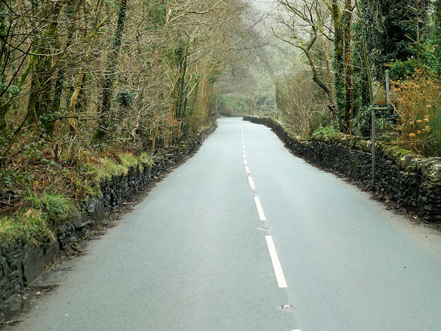
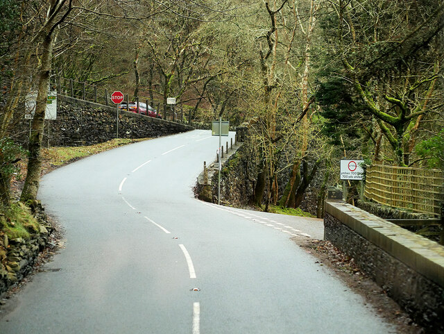
The scenery in Ceunant Cynfal is truly breathtaking, with steep cliffs covered in lush greenery and ancient oak forests. The valley is a haven for nature enthusiasts and hikers, offering a multitude of walking trails that meander through the stunning landscape. Along these trails, visitors can discover a variety of native flora and fauna, including rare species such as peregrine falcons and red squirrels.

One of the main attractions in Ceunant Cynfal is the Cynfal Falls, a series of dramatic waterfalls that plummet down the rocky slopes. The cascades create a mesmerizing spectacle, especially after heavy rainfall when the water rushes through the narrow gorge with thunderous force.

Aside from its natural beauty, Ceunant Cynfal also holds historical significance. In the valley, there are remnants of old mining activities, serving as a reminder of the area's industrial past. Visitors can explore these relics and learn about the region's mining heritage.

Overall, Ceunant Cynfal offers a tranquil escape from the hustle and bustle of modern life. Whether it's immersing oneself in nature, marveling at the waterfalls, or exploring the valley's history, this picturesque corner of Merionethshire is a must-visit destination for nature lovers and history enthusiasts alike.

If you have any feedback on the listing, please let us know in the comments section below.

Ceunant Cynfal Images

Images are sourced within 2km of 52.952725/-3.9318257 or Grid Reference SH7041. Thanks to Geograph Open Source API. All images are credited.

Fields above Sychnant Looking over farmland from the road.
Fields above Sychnant
Looking over farmland from the road.
Stream above Sychnant Looking at a stream dropping down the hillside.
Stream above Sychnant
Looking at a stream dropping down the hillside.
Fallen sign A footpath sign lying on the ground as the footpath leaves the road.
Fallen sign
A footpath sign lying on the ground as the footpath leaves the road.
Road descending Looking across the moorland above the A470.
Road descending
Looking across the moorland above the A470.
Footpath over the moor The footpath leads to the A470.
Footpath over the moor
The footpath leads to the A470.
Cattle grid on a minor road Looking down the road leading to the A470.
Cattle grid on a minor road
Looking down the road leading to the A470.
Road descending to the A470 Looking along a minor road as it descends to the main road.
Road descending to the A470
Looking along a minor road as it descends to the main road.
Road leading towards the Roman Amphitheatre Looking along the road leading up to the Ffestiniog transmitter.
Road leading towards the Roman Amphitheatre
Looking along the road leading up to the Ffestiniog transmitter.
View from A470 The Stwlan Dam is just visible in the centre - white image.
View from A470
The Stwlan Dam is just visible in the centre - white image.
Pencefn Road The A496 is a major coastal and mountainous road in southern Snowdonia. It runs for almost 33 miles from Blaenau Ffestiniog to Llanelltyd, via Harlech. The road passes through a diverse landscape, including the mountainous region of Blaenau Ffestiniog.
Pencefn Road
The A496 is a major coastal and mountainous road in southern Snowdonia. It runs for almost 33 miles from Blaenau Ffestiniog to Llanelltyd, via Harlech. The road passes through a diverse landscape, including the mountainous region of Blaenau Ffestiniog.
Mercedes Actros on the A496 Wynnstay Mercedes Actros (KX65 MVZ) Driving Along Pencefn Road.
Mercedes Actros on the A496
Wynnstay Mercedes Actros (KX65 MVZ) Driving Along Pencefn Road.
A496 near Rhyd-y-Sarn The A496 is a major coastal and mountainous road in southern Snowdonia. It runs for almost 33 miles from Blaenau Ffestiniog to Llanelltyd, via Harlech. The road passes through a diverse landscape, including the mountainous region of Blaenau Ffestiniog.
A496 near Rhyd-y-Sarn
The A496 is a major coastal and mountainous road in southern Snowdonia. It runs for almost 33 miles from Blaenau Ffestiniog to Llanelltyd, via Harlech. The road passes through a diverse landscape, including the mountainous region of Blaenau Ffestiniog.
A496 near Pont Taly-y-bont The A496 is a major coastal and mountainous road in southern Snowdonia. It runs for almost 33 miles from Blaenau Ffestiniog to Llanelltyd, via Harlech. The road passes through a diverse landscape, including the mountainous region of Blaenau Ffestiniog.
A496 near Pont Taly-y-bont
The A496 is a major coastal and mountainous road in southern Snowdonia. It runs for almost 33 miles from Blaenau Ffestiniog to Llanelltyd, via Harlech. The road passes through a diverse landscape, including the mountainous region of Blaenau Ffestiniog.
Afon Teigl in October Afon Teigl yn lliwiau mis hydref.

The River Teigl in the Vale of Ffestiniog, in October colours. Ref:PA280076a.
Afon Teigl in October
Afon Teigl yn lliwiau mis hydref. The River Teigl in the Vale of Ffestiniog, in October colours. Ref:PA280076a.
Afon Teigl in November Afon Teigl yn lliwiau mis tachwedd.

The River Teigl in the Vale of Ffestiniog, in November colours. Ref:PB140276a.
Afon Teigl in November
Afon Teigl yn lliwiau mis tachwedd. The River Teigl in the Vale of Ffestiniog, in November colours. Ref:PB140276a.
Afon Teigl in December Afon Teigl yn lliwiau mis rhagfyr.

The River Teigl in the Vale of Ffestiniog, in December colours. Ref:PC200010a.
Afon Teigl in December
Afon Teigl yn lliwiau mis rhagfyr. The River Teigl in the Vale of Ffestiniog, in December colours. Ref:PC200010a.
Llan Ffestiniog The village of Llan Ffestiniog in front of the two peaks (L to R) Manod Bach (511m) and Manod Mawr (661m), with in the distance the Gloddfa Ganol, Llechwedd and Maenofferen slate quarries of Blaenau Ffestiniog on the slopes of  the two peaks (L to R) Allt Fawr ( 698m) and  Moel Penamnen (623m). Ref:P3250065ag.
Llan Ffestiniog
The village of Llan Ffestiniog in front of the two peaks (L to R) Manod Bach (511m) and Manod Mawr (661m), with in the distance the Gloddfa Ganol, Llechwedd and Maenofferen slate quarries of Blaenau Ffestiniog on the slopes of the two peaks (L to R) Allt Fawr ( 698m) and Moel Penamnen (623m). Ref:P3250065ag.
Hammered Shield Lichen The Hammered Shield Lichen (Parmelia sulcata), photographed on a wall in the Vale of Ffestiniog, Gwynedd, in Parc Cenedlaethol Eryri (Snowdonia National Park). Ref:P3260232ag.
Hammered Shield Lichen
The Hammered Shield Lichen (Parmelia sulcata), photographed on a wall in the Vale of Ffestiniog, Gwynedd, in Parc Cenedlaethol Eryri (Snowdonia National Park). Ref:P3260232ag.
Show me another place!

Ceunant Cynfal is located at Grid Ref: SH7041 (Lat: 52.952725, Lng: -3.9318257)

Unitary Authority: Gwynedd

Police Authority: North Wales

What 3 Words

///rewrites.like.pint. Near Ffestiniog, Gwynedd

Related Wikis

Festiniog railway station

Festiniog railway station served the village of Llan Ffestiniog, Gwynedd, Wales. This station was one of many 19th century institutions in Wales to be...

Llan Ffestiniog

Llan Ffestiniog, also known as Ffestiniog or simply Llan, is a village in Gwynedd (formerly in the county of Merionethshire), Wales, lying south of Blaenau...

Ceunant Cynfal National Nature Reserve

Ceunant Cynfal National Nature Reserve is a river gorge which forms part of a wet wooded ravine of the Afon Cynfal near Ffestiniog in Gwynedd, Wales. The...

Maentwrog Road railway station

Maentwrog Road railway station was on the Great Western Railway's Bala Ffestiniog Line in Gwynedd, Wales. == History == The station opened in 1882 when...

Nearby Amenities

Located within 500m of 52.952725,-3.9318257
Rhaeadr Cynfal
Name Cy: Rhaeadr Cynfal
Waterway: waterfall
Wikidata: Q25929501
Lat/Long: 52.9515674/-3.9280243
Power: pole
Lat/Long: 52.9503974/-3.9376464
Power: pole
Lat/Long: 52.9501324/-3.9369973
Power: pole
Lat/Long: 52.9499126/-3.9364609
Power: pole
Lat/Long: 52.9497381/-3.9360263
Power: pole
Lat/Long: 52.9494448/-3.9352719
Power: pole
Lat/Long: 52.9491089/-3.9344288
Power: pole
Lat/Long: 52.9489312/-3.9339255
Power: pole
Lat/Long: 52.948692/-3.9331691
Power: pole
Lat/Long: 52.9494534/-3.9359444
Power: pole
Lat/Long: 52.9557444/-3.9288045
Power: pole
Lat/Long: 52.9556446/-3.9296561
Power: pole
Lat/Long: 52.9555347/-3.9303962
Power: pole
Lat/Long: 52.9551764/-3.9312208
Waterway: waterfall
Lat/Long: 52.9523909/-3.9301897
NRW
Board Type: nature
Information: board
Tourism: information
Lat/Long: 52.9530561/-3.929801
The data included in this document is from www.openstreetmap.org. The data is made available under ODbL.

Have you been to Ceunant Cynfal?

Leave your review of Ceunant Cynfal below (or comments, questions and feedback).