Nant y Benglog

Valley in Caernarfonshire

Wales

Nant y Benglog

Damp bridleway crossing the moor Not quite the same place as <a href="https://www.geograph.org.uk/photo/6660852">SH7160 : The bridleway across the moor</a>, but not far away. Here we're looking uphill towards Pen Llithrig y Wrach 799m
Damp bridleway crossing the moor Credit: Richard Law

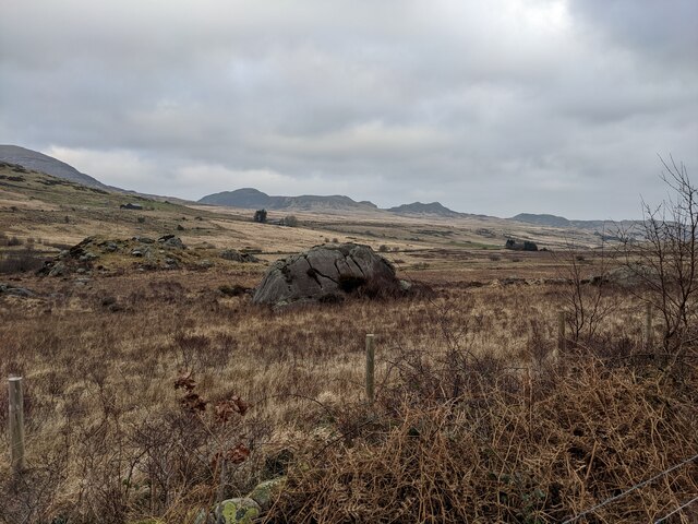
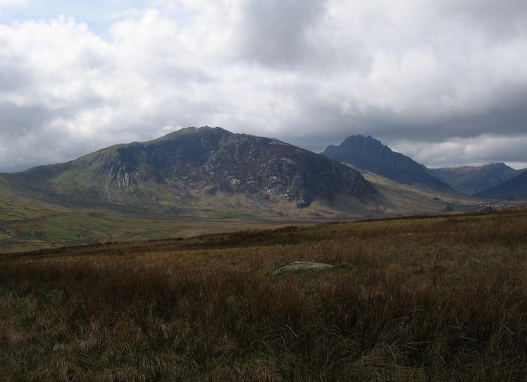
Nant y Benglog is a small valley located in Caernarfonshire, Wales. Situated in the Snowdonia National Park, the valley is known for its stunning natural beauty and picturesque landscapes. The valley is surrounded by rolling hills, lush greenery, and cascading streams, making it a popular destination for hikers, nature enthusiasts, and photographers.

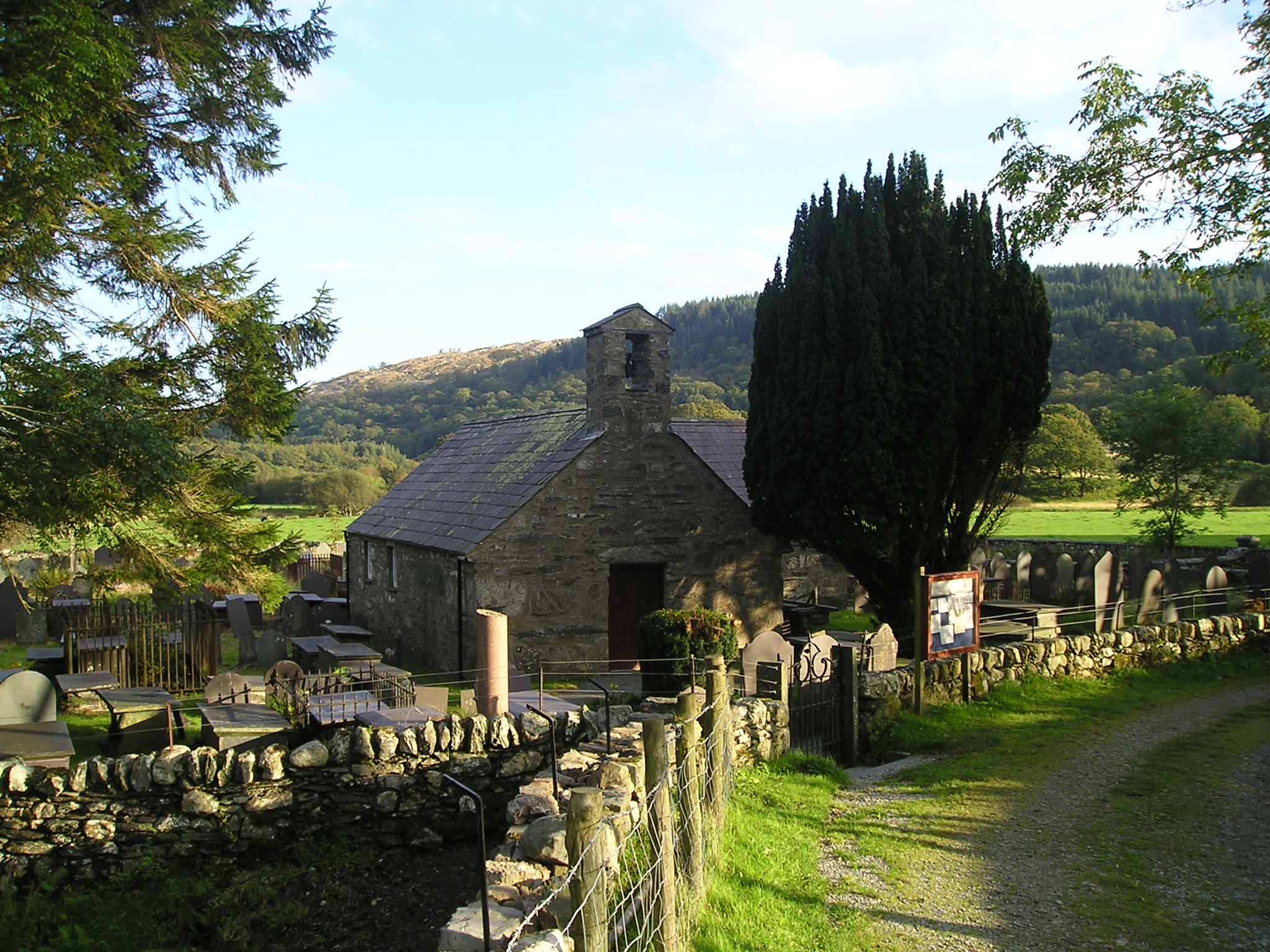
Nant y Benglog is home to a diverse range of flora and fauna, including rare plant species and a variety of birdlife. The valley is also known for its rich history, with ancient ruins and archaeological sites scattered throughout the area. Visitors can explore these historical landmarks and learn about the valley's past through guided tours and informational exhibits.

In addition to its natural and historical attractions, Nant y Benglog offers a range of outdoor activities for visitors to enjoy, such as hiking, mountain biking, and wildlife spotting. The valley is also a popular spot for picnicking and camping, providing a peaceful and tranquil setting for those looking to escape the hustle and bustle of city life. Overall, Nant y Benglog is a hidden gem in Caernarfonshire that offers a unique and unforgettable experience for all who visit.

If you have any feedback on the listing, please let us know in the comments section below.

Nant y Benglog Images

Images are sourced within 2km of 53.117444/-3.9399075 or Grid Reference SH7059. Thanks to Geograph Open Source API. All images are credited.

Damp bridleway crossing the moor Not quite the same place as <a href="https://www.geograph.org.uk/photo/6660852">SH7160 : The bridleway across the moor</a>, but not far away. Here we're looking uphill towards Pen Llithrig y Wrach 799m
Damp bridleway crossing the moor
Not quite the same place as SH7160 : The bridleway across the moor, but not far away. Here we're looking uphill towards Pen Llithrig y Wrach 799m
Pony at the gateway One of the semi-wild Carneddau ponies, here standing (legitimately!) on the bridleway leading to Llyn Cowlyd
Pony at the gateway
One of the semi-wild Carneddau ponies, here standing (legitimately!) on the bridleway leading to Llyn Cowlyd
New gates at the leat The path to Pen yr Helgi Du crosses the path along the leat at this place.
New gates at the leat
The path to Pen yr Helgi Du crosses the path along the leat at this place.
Nant yr Ogof between Gallt yr Ogof and Tryfan Bach Directly ahead, across the Llugwy Valley, is the Dwr Cymru (Welsh Water) road leading to the Llyn Llugwy Reservoir high in the Carneddau. Nant yr Ogof means 'valley of the cave'.
Nant yr Ogof between Gallt yr Ogof and Tryfan Bach
Directly ahead, across the Llugwy Valley, is the Dwr Cymru (Welsh Water) road leading to the Llyn Llugwy Reservoir high in the Carneddau. Nant yr Ogof means 'valley of the cave'.
An erratic boulder in Cwm Nant-y-Benglog The river is the Afon Llugwy, but the area is historically Cwm Nant-y-Benglog (the valley of the stream of the skull) and is still shown as that on the modern OS map.
An erratic boulder in Cwm Nant-y-Benglog
The river is the Afon Llugwy, but the area is historically Cwm Nant-y-Benglog (the valley of the stream of the skull) and is still shown as that on the modern OS map.
The Byway in Cwm Nant-y-Benglog
The crags of Gallt yr Ogof The OS map shows a cave somewhere amongst those crags.  Gallt yr Ogof means Hill of the Cave so it must be significant, if hard to spot.
The crags of Gallt yr Ogof
The OS map shows a cave somewhere amongst those crags. Gallt yr Ogof means Hill of the Cave so it must be significant, if hard to spot.
The track in Cwm Nant y Benglog Technically this is a Restricted Byway (no motorised vehicles). Just as well or it would be chewed up by 4 x 4s, as has happened in other places.
The track in Cwm Nant y Benglog
Technically this is a Restricted Byway (no motorised vehicles). Just as well or it would be chewed up by 4 x 4s, as has happened in other places.
Bwlch Goleuni A view of the track running across Bwlch Goleuni towards Cefn y Capel.
Bwlch Goleuni
A view of the track running across Bwlch Goleuni towards Cefn y Capel.
Outcrop of cleaved mudstones Rock outcrop is rare, but increases westwards towards Foel Goch. The rock exposed here is a slatey mudstone of the Cwm Eigiau Formation (Ordovician, Soudleyan to Longvillian).
Outcrop of cleaved mudstones
Rock outcrop is rare, but increases westwards towards Foel Goch. The rock exposed here is a slatey mudstone of the Cwm Eigiau Formation (Ordovician, Soudleyan to Longvillian).
Glacial erratic boulder A fine, tabular erratic boulder of rhyolite or tuff lying on the otherwise rather featureless moorland above Dyffryn Mymbyr. There is no heather here as the ground is boggy, and dominated by tussocky grass which is difficult to cross.
Glacial erratic boulder
A fine, tabular erratic boulder of rhyolite or tuff lying on the otherwise rather featureless moorland above Dyffryn Mymbyr. There is no heather here as the ground is boggy, and dominated by tussocky grass which is difficult to cross.
Pair of erratic boulders Two fine glacially-derived boulders on the featureless, boggy moorland. Both appear to be of rhyolitic tuff (see also <a href="https://www.geograph.org.uk/photo/7129952">SH6957 : Glacial erratic boulder</a>) which is of interest because rocks of this type are dominant at higher elevation on Foel Goch and Glyder Fach. This suggests an easterly flow of ice in Dyffryn Mymbyr, which fits with accepted models.
Pair of erratic boulders
Two fine glacially-derived boulders on the featureless, boggy moorland. Both appear to be of rhyolitic tuff (see also SH6957 : Glacial erratic boulder) which is of interest because rocks of this type are dominant at higher elevation on Foel Goch and Glyder Fach. This suggests an easterly flow of ice in Dyffryn Mymbyr, which fits with accepted models.
Glacial boulder with hawthorn The slope steepens while descending from Bwlch Goleuni and the hillside carries a good population of well-spaced hawthorn trees. Here one is paired with a fine, rounded glacial erratic boulder, which makes it look like a super-scale bonsai subject.
Glacial boulder with hawthorn
The slope steepens while descending from Bwlch Goleuni and the hillside carries a good population of well-spaced hawthorn trees. Here one is paired with a fine, rounded glacial erratic boulder, which makes it look like a super-scale bonsai subject.
Glacial erratic boulder Another fine erratic boulder on the hillside of Dyffryn Mymbyr. My assistant has decided that this one is good for a roll. Even at this distance, traffic on the road below is intrusive, especially motorcycles.
Glacial erratic boulder
Another fine erratic boulder on the hillside of Dyffryn Mymbyr. My assistant has decided that this one is good for a roll. Even at this distance, traffic on the road below is intrusive, especially motorcycles.
Gwern Gôf Isaf Panorama Dyffryn Ogwen shortly after sunrise.  This is a 360° panorama centred approximately north-west.  From the left, the mountains are the Glyderau, Tryfan and the Carneddau.  The bunkhouse at Gwern Gôf Isaf is in the foreground.
Gwern Gôf Isaf Panorama
Dyffryn Ogwen shortly after sunrise. This is a 360° panorama centred approximately north-west. From the left, the mountains are the Glyderau, Tryfan and the Carneddau. The bunkhouse at Gwern Gôf Isaf is in the foreground.
Artificial Water Channel East along the unnamed channel from the footbridge.
Artificial Water Channel
East along the unnamed channel from the footbridge.
Artificial Water Channel West along the unnamed channel from near the footbridge, towards Tryfan and the Carneddau, and Llyn Ogwen between them.
Artificial Water Channel
West along the unnamed channel from near the footbridge, towards Tryfan and the Carneddau, and Llyn Ogwen between them.
Tryfan, from near Gwern Gôf Isaf Taken from the same spot as <a href="https://www.geograph.org.uk/photo/1092405">SH6860 : View towards Tryfan from Gwern Gôf Isaf</a>, this time on a dull February day, mild but with the mountain still iced up.
Tryfan, from near Gwern Gôf Isaf
Taken from the same spot as SH6860 : View towards Tryfan from Gwern Gôf Isaf, this time on a dull February day, mild but with the mountain still iced up.
Show me another place!

Nant y Benglog is located at Grid Ref: SH7059 (Lat: 53.117444, Lng: -3.9399075)

Unitary Authority: Conwy

Police Authority: North Wales

What 3 Words

///talking.friend.contemplate. Near Betws-y-Coed, Conwy

Nearby Locations

Nant y Benglog

Related Wikis

Gallt yr Ogof

Gallt yr Ogof is a mountain in Snowdonia, North Wales. It is a subsidiary top of Glyder Fawr, and is the most easterly point in the Glyderau mountain range...
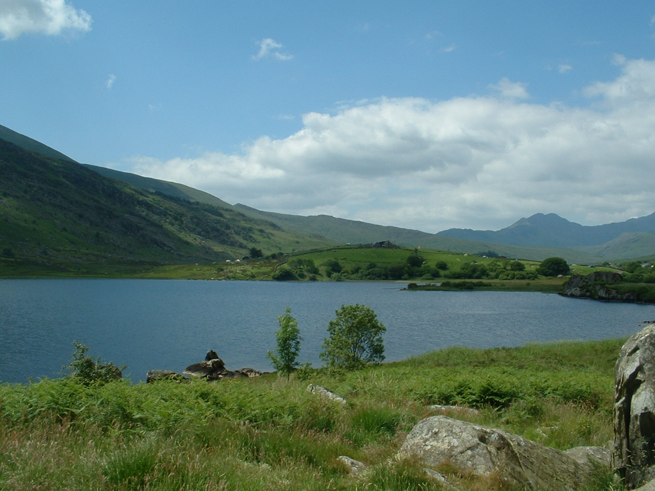
Llynnau Mymbyr

Llynnau Mymbyr are two lakes located in Dyffryn Mymbyr, a valley running from the village of Capel Curig to the Pen-y-Gwryd hotel in Snowdonia, north-west...

Capel Curig

Capel Curig (Welsh pronunciation: [ˈkɑːpɛl ˈkɨːrɪɡ]; meaning "Curig's Chapel") is a village and community in Conwy County Borough, Wales. Historically...

Plas y Brenin

Plas y Brenin, located in Conwy County Borough, Wales, is a National Outdoor Centre owned by Sport England. The centre is situated in Dyffryn Mymbyr, the...

Nearby Amenities

Located within 500m of 53.117444,-3.9399075
Barrier: cattle_grid
Lat/Long: 53.120293/-3.9446602
The data included in this document is from www.openstreetmap.org. The data is made available under ODbL.

Have you been to Nant y Benglog?

Leave your review of Nant y Benglog below (or comments, questions and feedback).