East Gully

Valley in Caernarfonshire

Wales

East Gully

On the hillside above Glan Dena On the first part of the climb up from the A5 at the eastern end of Llyn Ogwen, heading for a fine winter day out around the hills of the southern Carneddau. The route on this occasion took the Wrekin Mountaineering Club members directly up the steep headwall of Cwm Ffynnon Lloer, a line of ascent that wouldn't normally be at all wise due to masses of loose scree high up, but with a covering of frozen snow on the ground it was perfectly viable <a href="https://www.geograph.org.uk/photo/1671327">SH6562 : Down the headwall of Cwm Ffynnon Lloer, winter conditions</a>
On the hillside above Glan Dena Credit: Richard Law

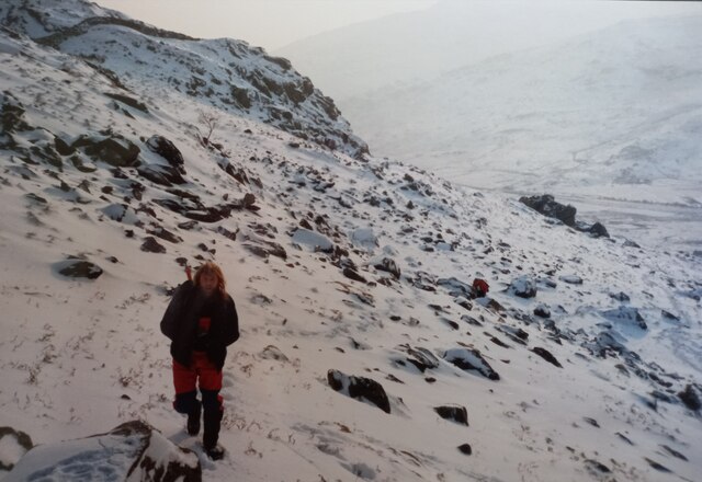
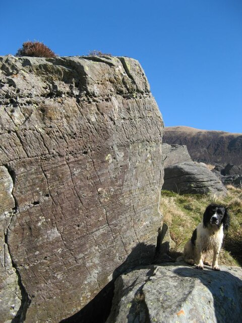
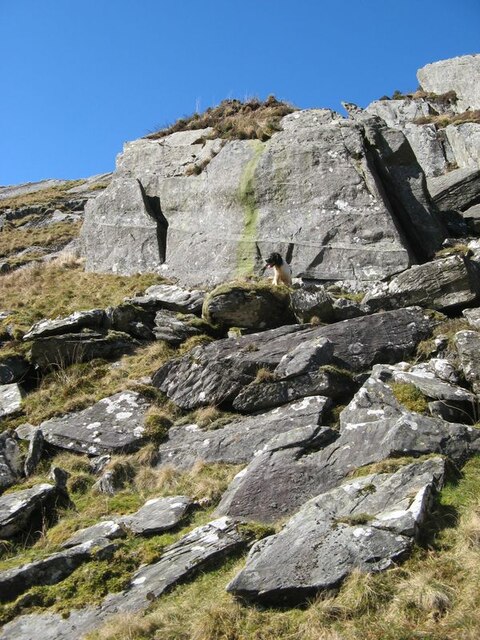
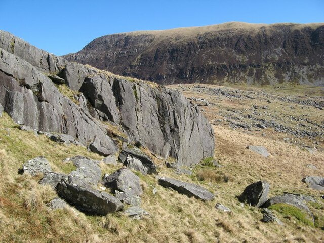
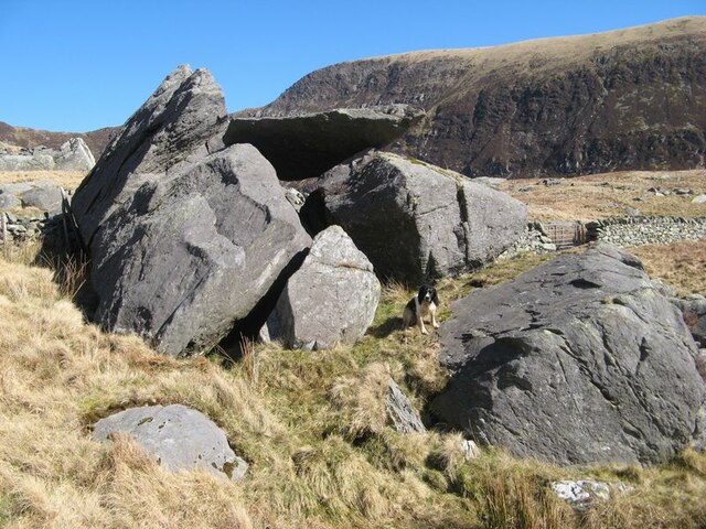
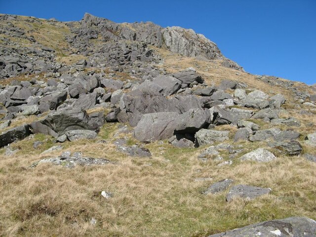
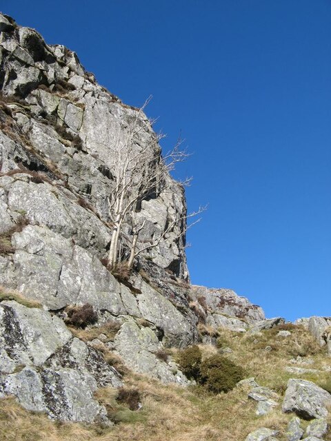
East Gully is a picturesque valley located in the county of Caernarfonshire, Wales. Nestled amidst the stunning Snowdonia National Park, this valley is renowned for its natural beauty and rich history.

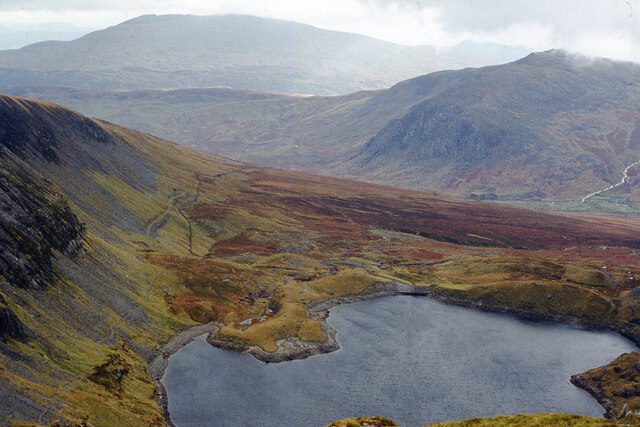
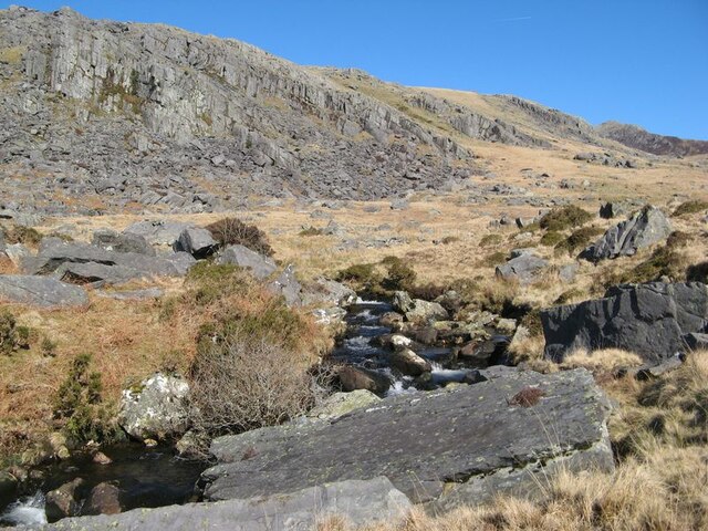
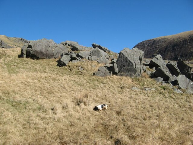
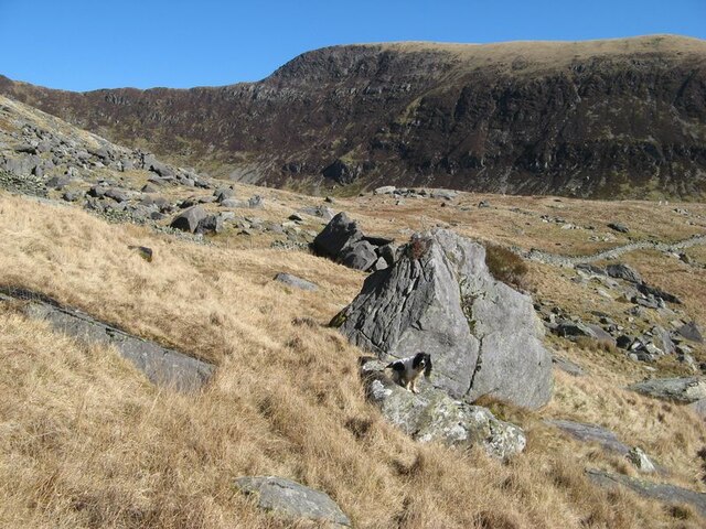
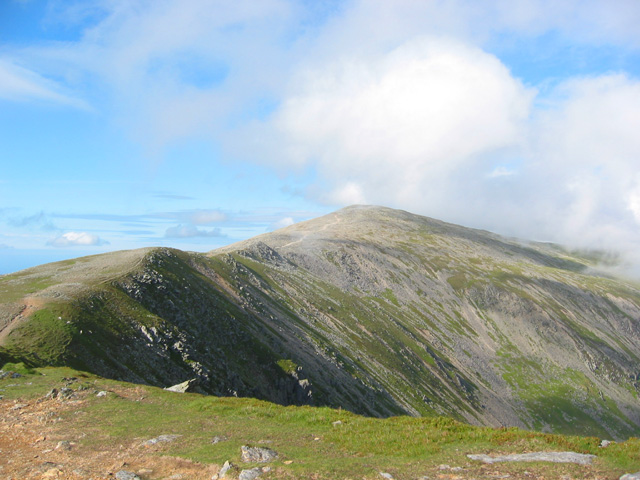
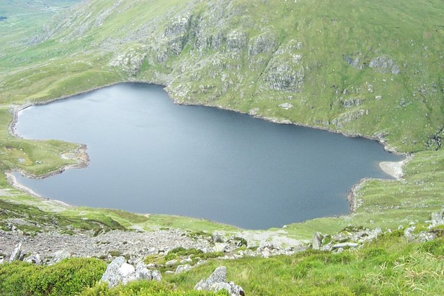
The valley is named after the East Gully Stream, which flows through its heart, providing a constant source of fresh water and adding to the charm of the surrounding landscape. The stream is flanked by lush green meadows, dotted with vibrant wildflowers during the summer months. The valley is surrounded by majestic mountains, including the iconic Mount Snowdon, which adds to the dramatic backdrop of the area.

East Gully boasts a diverse range of wildlife, making it a haven for nature lovers and avid birdwatchers. The valley is home to a variety of bird species, including red kites, buzzards, and peregrine falcons. Visitors may also spot mammals such as otters, badgers, and foxes, who thrive in the valley's woodland and rocky outcrops.

The area is steeped in history, with evidence of ancient settlements and fortifications dating back to the Iron Age. Ruins of old stone houses and remains of iron mines can still be seen today, serving as a reminder of the valley's industrial past. The East Gully Heritage Center provides visitors with a fascinating insight into the valley's history and local traditions.

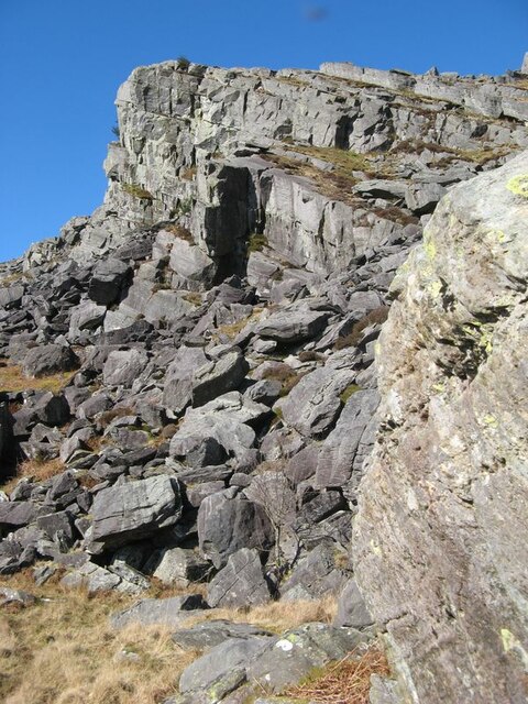
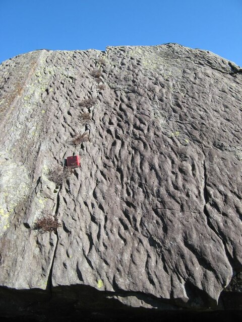
East Gully offers a range of outdoor activities, including hiking and mountain biking, with numerous trails catering to all levels of experience. The valley is also a popular destination for rock climbers, with its rugged cliffs and challenging ascents. For those seeking a more relaxed experience, the valley's tranquil atmosphere and breathtaking scenery provide the perfect setting for picnicking or simply taking a leisurely stroll.

In summary, East Gully, Caernarfonshire, is a captivating valley that combines natural beauty, wildlife, and a rich historical heritage, making it an ideal destination for nature enthusiasts and history buffs alike.

If you have any feedback on the listing, please let us know in the comments section below.

East Gully Images

Images are sourced within 2km of 53.149628/-3.9841883 or Grid Reference SH6763. Thanks to Geograph Open Source API. All images are credited.

On the hillside above Glan Dena On the first part of the climb up from the A5 at the eastern end of Llyn Ogwen, heading for a fine winter day out around the hills of the southern Carneddau. The route on this occasion took the Wrekin Mountaineering Club members directly up the steep headwall of Cwm Ffynnon Lloer, a line of ascent that wouldn't normally be at all wise due to masses of loose scree high up, but with a covering of frozen snow on the ground it was perfectly viable <a href="https://www.geograph.org.uk/photo/1671327">SH6562 : Down the headwall of Cwm Ffynnon Lloer, winter conditions</a>
On the hillside above Glan Dena
On the first part of the climb up from the A5 at the eastern end of Llyn Ogwen, heading for a fine winter day out around the hills of the southern Carneddau. The route on this occasion took the Wrekin Mountaineering Club members directly up the steep headwall of Cwm Ffynnon Lloer, a line of ascent that wouldn't normally be at all wise due to masses of loose scree high up, but with a covering of frozen snow on the ground it was perfectly viable SH6562 : Down the headwall of Cwm Ffynnon Lloer, winter conditions
Ffynnon Llugwy Reservoir Looking south from Bwlch Eryl Farchog. Gallt yr Ogof (right) and Moel Siabod (left) are in the distance.
Ffynnon Llugwy Reservoir
Looking south from Bwlch Eryl Farchog. Gallt yr Ogof (right) and Moel Siabod (left) are in the distance.
Afon Llugwy and Carreg Minianog The Afon Llugwy is less steep as it skirts the apron of debris which has fallen from Carreg Minianog. The angular nature of glacially-transported debris which is dumped about here suggests that it has not been transported far.
I am a particular enthusiast for the 'late-winter' colour palette of bleached grass and brown, dry bracken and it was an absolute joy to be out in the sun despite a degree of sogginess around the feet on this spectacularly wet moorland.
Afon Llugwy and Carreg Minianog
The Afon Llugwy is less steep as it skirts the apron of debris which has fallen from Carreg Minianog. The angular nature of glacially-transported debris which is dumped about here suggests that it has not been transported far. I am a particular enthusiast for the 'late-winter' colour palette of bleached grass and brown, dry bracken and it was an absolute joy to be out in the sun despite a degree of sogginess around the feet on this spectacularly wet moorland.
Rockfall, Carreg Minianog Extensive rockfalls here can be attributed to the presence of bedding surfaces inclined towards the low ground excavated by glacial action. The rockfalls are probably periglacial features that developed following the loss of significant buttressing by thick ice after de-glaciation, at which time frost acting on the bare rock would detach blocks to slide under the influence of gravity. A great deal of the huge volume of glacial boulders on the valley side appear to originate in this area.
The rock is a coarse sandstone with a significant content of rhyolite debris which has been eroded from rocks of the Llewelyn Volcanic Group of Ordovician, Caradoc age. Fallen blocks show good sections parallel and normal to the bedding surfaces.
Rockfall, Carreg Minianog
Extensive rockfalls here can be attributed to the presence of bedding surfaces inclined towards the low ground excavated by glacial action. The rockfalls are probably periglacial features that developed following the loss of significant buttressing by thick ice after de-glaciation, at which time frost acting on the bare rock would detach blocks to slide under the influence of gravity. A great deal of the huge volume of glacial boulders on the valley side appear to originate in this area. The rock is a coarse sandstone with a significant content of rhyolite debris which has been eroded from rocks of the Llewelyn Volcanic Group of Ordovician, Caradoc age. Fallen blocks show good sections parallel and normal to the bedding surfaces.
Bedding in sandstone Bedding and cross-stratification features are well-displayed in this fallen block of sandstone belonging to the Llewelyn Volcanic Group (Ordovician, Caradoc age).
Bedding in sandstone
Bedding and cross-stratification features are well-displayed in this fallen block of sandstone belonging to the Llewelyn Volcanic Group (Ordovician, Caradoc age).
Ripple-marking in sandstone A fabulous surface showing a slightly-oblique section through extensive ripple-marks in sandstone belonging to the Llewelyn Volcanic Group (Ordovician, Caradoc). Notebook included for scale (length 15cm).
Ripple-marking in sandstone
A fabulous surface showing a slightly-oblique section through extensive ripple-marks in sandstone belonging to the Llewelyn Volcanic Group (Ordovician, Caradoc). Notebook included for scale (length 15cm).
Glacial boulder group A collection of erratic boulders dropped in a group on the slope below Cwm Llugwy. Some, but not all, of them show significant rounding from transport within an ice stream.
Glacial boulder group
A collection of erratic boulders dropped in a group on the slope below Cwm Llugwy. Some, but not all, of them show significant rounding from transport within an ice stream.
Boulder-strewn hillside Giant boulders are tossed about at the foot of steep slopes leading onto Creigiau  Hirion. Ahead and to the right lie extensive deposits of moraine associated with the development of Cwm Llugwy.
Boulder-strewn hillside
Giant boulders are tossed about at the foot of steep slopes leading onto Creigiau Hirion. Ahead and to the right lie extensive deposits of moraine associated with the development of Cwm Llugwy.
Fallen blocks Large blocks of sandstone have fallen from the steep hillside. They preserve features such as bedding, cross-stratification and ripple-marking. In these sandstones are recorded the erosion of volcanic highlands to the north, and the deposition of the debris by braided rivers crossing wide plain to the contemporary ocean. All belong to the Llewelyn Volcanic Group (ordovician, Caradoc age).
Fallen blocks
Large blocks of sandstone have fallen from the steep hillside. They preserve features such as bedding, cross-stratification and ripple-marking. In these sandstones are recorded the erosion of volcanic highlands to the north, and the deposition of the debris by braided rivers crossing wide plain to the contemporary ocean. All belong to the Llewelyn Volcanic Group (ordovician, Caradoc age).
Competent crags Rock outcrop here is showing fewer signs of periglacial erosion and more evidence for flowing, solid ice which has carried away blocks quarried from the flanks of the valley. The cliffs of Y Braich form the backdrop to ground which is covered with moraine deposits.
Competent crags
Rock outcrop here is showing fewer signs of periglacial erosion and more evidence for flowing, solid ice which has carried away blocks quarried from the flanks of the valley. The cliffs of Y Braich form the backdrop to ground which is covered with moraine deposits.
Boulder group with lid A most satisfying group of glacial boulders atop outcrop which has been smoothed by ice flowing down the slope. A small watercourse chuckles its way underneath the boulders and around the rock outcrop, protected by a heavy iron bar.
Boulder group with lid
A most satisfying group of glacial boulders atop outcrop which has been smoothed by ice flowing down the slope. A small watercourse chuckles its way underneath the boulders and around the rock outcrop, protected by a heavy iron bar.
Change of rock-type Rockfalls from the southern margin of Craig y Llyn are mostly of a dark grey sandstone (Llewelyn Volcanic Group) but there are also pale blocks of rhyolite. Looking up the slope shows a contact between grey sandstone and pale grey rhyolite, actually welded ash-flows of the Capel Curig Volcanic Formation. The silica-rich volcanic rock weathers to a very pale grey colour and is distinctive in outcrops. Both rock types are of Ordovician, Caradoc age.
Change of rock-type
Rockfalls from the southern margin of Craig y Llyn are mostly of a dark grey sandstone (Llewelyn Volcanic Group) but there are also pale blocks of rhyolite. Looking up the slope shows a contact between grey sandstone and pale grey rhyolite, actually welded ash-flows of the Capel Curig Volcanic Formation. The silica-rich volcanic rock weathers to a very pale grey colour and is distinctive in outcrops. Both rock types are of Ordovician, Caradoc age.
Craig y Llyn A cliff face developed in hard, volcanic rocks belonging to the Capel Curig Volcanic Formation (Ordovician, Caradoc). A rowan tree is growing on a rather inhospitable cliff face, but probably only survived because sheep could not reach it. The Capel Curig Volcanic Formation represents the accumulation of rhyolitic tuffs which were erupted from volcanoes spread between Tryfan and the northern coast beyond Conwy. It is chilling to consider the violence of eruptions which would hurl red-hot clouds of ash as far as 25km before they coalesced and hardened, often under water.
Craig y Llyn
A cliff face developed in hard, volcanic rocks belonging to the Capel Curig Volcanic Formation (Ordovician, Caradoc). A rowan tree is growing on a rather inhospitable cliff face, but probably only survived because sheep could not reach it. The Capel Curig Volcanic Formation represents the accumulation of rhyolitic tuffs which were erupted from volcanoes spread between Tryfan and the northern coast beyond Conwy. It is chilling to consider the violence of eruptions which would hurl red-hot clouds of ash as far as 25km before they coalesced and hardened, often under water.
Quartz on fault surface Quartz spar coats an exposed fault surface in sandstone. I suspect that this plane of weakness has developed because of the contrast between the competence of the sandstone and the rhyolitic tuff which forms crags in the background.
Quartz on fault surface
Quartz spar coats an exposed fault surface in sandstone. I suspect that this plane of weakness has developed because of the contrast between the competence of the sandstone and the rhyolitic tuff which forms crags in the background.
Craig y Llyn The fabulous, rocky headwall of the lower cirque (or cwm). The development of these features relates to climate deterioration for a few centuries during the Loch Lomond cold stage (Younger Dryas) when the absence of glaciers at lower levels had halted systematic erosion and only isolated patches of ice were active.
Craig y Llyn
The fabulous, rocky headwall of the lower cirque (or cwm). The development of these features relates to climate deterioration for a few centuries during the Loch Lomond cold stage (Younger Dryas) when the absence of glaciers at lower levels had halted systematic erosion and only isolated patches of ice were active.
Craig y Llyn 2 The fabulous, rocky headwall of the lower cirque (or cwm). The development of these features relates to climate deterioration for a few centuries during the Loch Lomond cold stage (Younger Dryas) when the absence of glaciers at lower levels had halted systematic erosion and only isolated patches of ice were active.
I could not decide between portrait and landscape format here, so submitted both.
Craig y Llyn 2
The fabulous, rocky headwall of the lower cirque (or cwm). The development of these features relates to climate deterioration for a few centuries during the Loch Lomond cold stage (Younger Dryas) when the absence of glaciers at lower levels had halted systematic erosion and only isolated patches of ice were active. I could not decide between portrait and landscape format here, so submitted both.
Ffynnon Llugwy moraine The water of Ffynnon Llugwy is retained by a series of moraines which record the position of the ablation zone of the small, cirque glacier which excavated the basin. It is obvious that ice advanced and retreated episodically during the period known as the Younger Dryas (Loch Lomond cold stage) at around 11,500 years before present.
Ffynnon Llugwy moraine
The water of Ffynnon Llugwy is retained by a series of moraines which record the position of the ablation zone of the small, cirque glacier which excavated the basin. It is obvious that ice advanced and retreated episodically during the period known as the Younger Dryas (Loch Lomond cold stage) at around 11,500 years before present.
Moraines and glacial erosion Angular blocks of rock litter the downhill slope of the moraine which impounds the water of Ffynnon Llugwy. Slightly higher, on the shoulder of Craig y Llyn, rock outcrop is clearly smoothed by flowing ice.
Moraines and glacial erosion
Angular blocks of rock litter the downhill slope of the moraine which impounds the water of Ffynnon Llugwy. Slightly higher, on the shoulder of Craig y Llyn, rock outcrop is clearly smoothed by flowing ice.
Show me another place!

East Gully is located at Grid Ref: SH6763 (Lat: 53.149628, Lng: -3.9841883)

Unitary Authority: Conwy

Police Authority: North Wales

What 3 Words

///congested.internal.rattler. Near Bethesda, Gwynedd

Related Wikis

Welsh 1000 m Peaks Race

The Welsh 1000m Peaks Race takes place on the first Saturday in June each year. The 32 km route is also known as the Snowdonia Summits Marathon as competitors...

Foel Meirch

Foel Meirch is a top of Carnedd Dafydd in the Carneddau range in Snowdonia, North Wales. It offers commanding views of Carnedd Llewelyn and Yr Elen, and...

Carnedd Dafydd

Carnedd Dafydd is a mountain peak in the Carneddau range in Snowdonia, Wales, and is the third highest peak in Wales, or the fourth if Crib y Ddysgl on...

Carnedd Llewelyn

Carnedd Llewelyn, also spelled Carnedd Llywelyn, is a mountain massif in the Carneddau range in Snowdonia, north-west Wales. It is the highest point of...

Ffynnon Lloer

Ffynnon Lloer (Welsh : Source of [the] Moon) is a lake in the Carneddau range of mountains in Snowdonia, North Wales. It lies below the peaks of Pen yr...

Yr Elen

Yr Elen is a mountain in the Carneddau range in Snowdonia, Wales. It is the ninth highest mountain in Snowdonia. The average annual temperature of the...

Ffynnon Llugwy

Ffynnon Llugwy (English: Llugwy spring) is a lake in the Carneddau range of mountains in Snowdonia, North Wales. It lies at a height of about 1,786 feet...

Llyn Llyffant

Llyn Llyffant is the highest lake in Wales, located at grid reference SH 687 645. Its name translates into English as "frog lake". It lies at an elevation...

Nearby Amenities

Located within 500m of 53.149628,-3.9841883
Ysgolion Duon
Ele: 960
Natural: peak
Lat/Long: 53.1495064/-3.9834
Man Made: cairn
Lat/Long: 53.14946/-3.97923
The data included in this document is from www.openstreetmap.org. The data is made available under ODbL.

Have you been to East Gully?

Leave your review of East Gully below (or comments, questions and feedback).