Lowran Glen

Valley in Kirkcudbrightshire

Scotland

Lowran Glen

A frosty morning on Loch Ken An early morning shot of the shady side of Loch Ken, viewed in very cold December weather.
A frosty morning on Loch Ken Credit: Mary and Angus Hogg

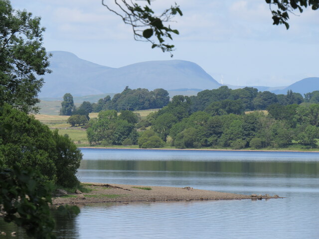
Lowran Glen is a picturesque valley located in the historical county of Kirkcudbrightshire, situated in the southwest of Scotland. The glen is nestled between rolling hills and breathtaking landscapes, providing visitors with a serene and tranquil environment.

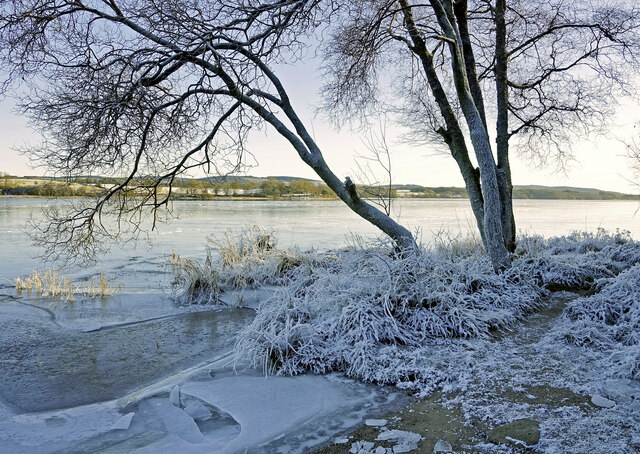
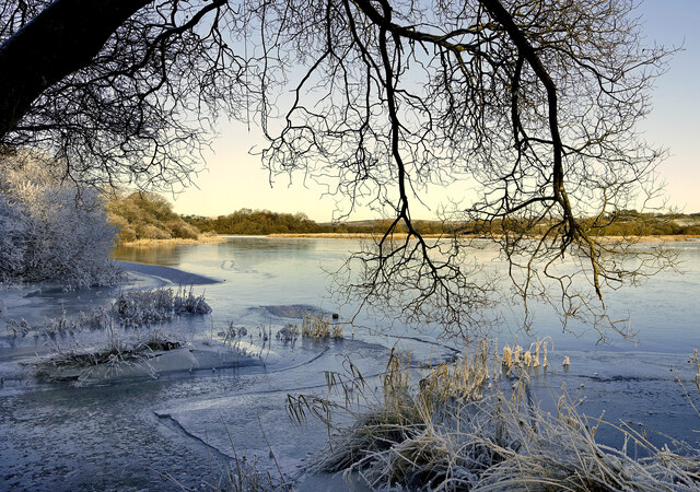
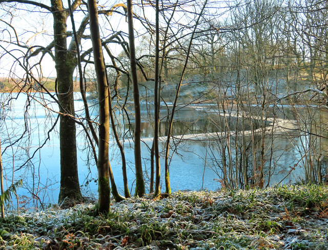
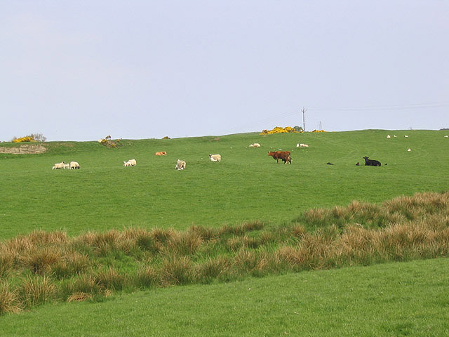
Covering an area of approximately 5 square kilometers, Lowran Glen is known for its stunning natural beauty and diverse wildlife. The valley boasts a rich variety of flora and fauna, making it a popular destination for nature enthusiasts and photographers alike. The glen is home to several species of birds, including buzzards, owls, and various waterfowls.

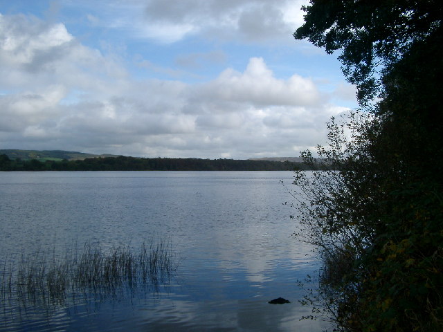
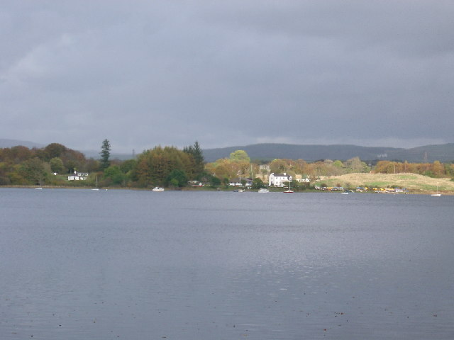
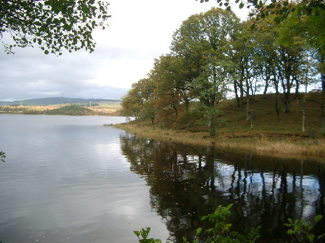
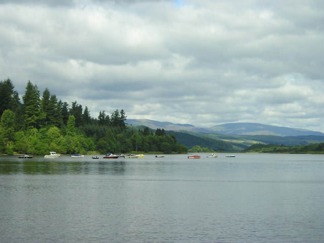
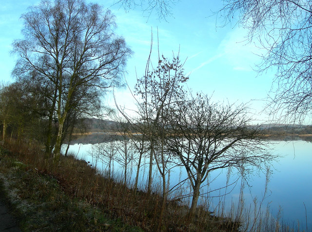
The focal point of Lowran Glen is a sparkling river that winds its way through the valley. The river is fed by numerous streams and cascades, creating a mesmerizing display of waterfalls and pools. These natural features provide a scenic backdrop for those looking to relax, hike, or indulge in some outdoor activities.

The glen is also renowned for its ancient history, with evidence of human settlement dating back thousands of years. Archaeological remains, including stone circles and burial sites, have been discovered in the area, adding to its historical significance.

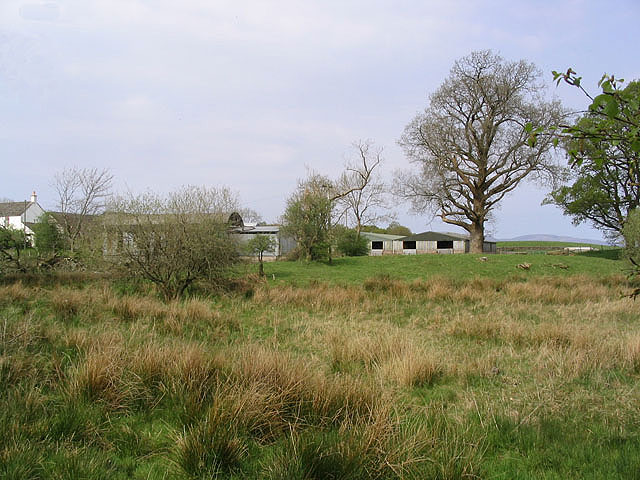
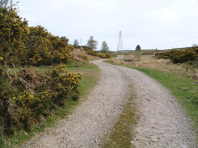
Lowran Glen offers a range of amenities for visitors, including walking trails, picnic areas, and a visitor center where tourists can learn more about the valley's history and natural heritage. The glen is easily accessible by road and is located within close proximity to the charming town of Kirkcudbright, known for its arts and crafts scene.

Overall, Lowran Glen is a hidden gem in Kirkcudbrightshire, offering a perfect blend of natural beauty, wildlife, and historical charm for those seeking a peaceful retreat in the Scottish countryside.

If you have any feedback on the listing, please let us know in the comments section below.
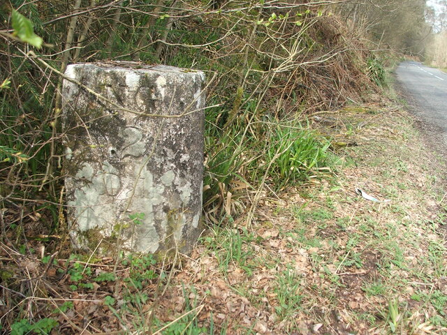
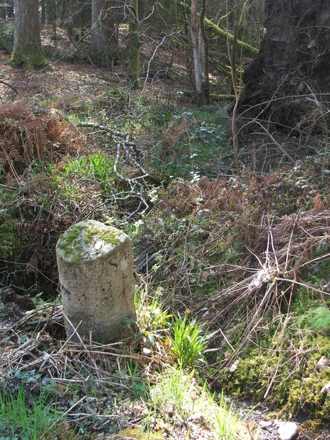
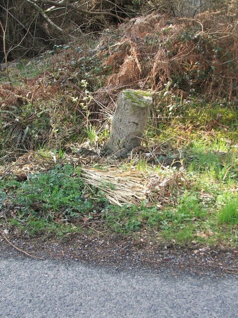
Lowran Glen Images

Images are sourced within 2km of 55.03799/-4.123514 or Grid Reference NX6473. Thanks to Geograph Open Source API. All images are credited.

A frosty morning on Loch Ken An early morning shot of the shady side of Loch Ken, viewed in very cold December weather.
A frosty morning on Loch Ken
An early morning shot of the shady side of Loch Ken, viewed in very cold December weather.
Little Kenmure Loch The northern end of Loch Ken viewed on a chilly December morning.
Little Kenmure Loch
The northern end of Loch Ken viewed on a chilly December morning.
Cadger's Loop The edge of Loch Ken viewed on a frosty December morning.
Cadger's Loop
The edge of Loch Ken viewed on a frosty December morning.
Old milestone 2 miles south from New Galloway and overlooking Loch Ken, this stone is at the northern end of a small rough lay-by on the west side of the road.
Old milestone
2 miles south from New Galloway and overlooking Loch Ken, this stone is at the northern end of a small rough lay-by on the west side of the road.
Old milestone Looking northwards the narrow A762 leads to New Galloway then onto the A713 to St John's Town of Dalry 4¼ miles away.
Old milestone
Looking northwards the narrow A762 leads to New Galloway then onto the A713 to St John's Town of Dalry 4¼ miles away.
Old milestone This milestone is in a rough lay-by with a grate, on the west side of the A762.   There is a view of Loch Ken across the road from the milestone.  2 miles to New Galloway Station.   It had not been spotted on earlier rides along this road.
Old milestone
This milestone is in a rough lay-by with a grate, on the west side of the A762. There is a view of Loch Ken across the road from the milestone. 2 miles to New Galloway Station. It had not been spotted on earlier rides along this road.
Old milestone This shows the edge of the lay-by and also how much the milestone is leaning.
Old milestone
This shows the edge of the lay-by and also how much the milestone is leaning.
Old milestone From the legends on each face this milestone must have originally stood on the opposite side of the road near to Bennan Cottage.   Now it is set with its right face to the road and the back at right angles to the road.
Old milestone
From the legends on each face this milestone must have originally stood on the opposite side of the road near to Bennan Cottage. Now it is set with its right face to the road and the back at right angles to the road.
Old milestone Of the 4 milestones south from New Galloway giving the distance to New Galloway Station, this one has the clearest inscriptions, although unfortunately it is set at the wrong angle on the wrong  side of the road.
Old milestone
Of the 4 milestones south from New Galloway giving the distance to New Galloway Station, this one has the clearest inscriptions, although unfortunately it is set at the wrong angle on the wrong side of the road.
Loch Ken Lochside Point and the Shirmers Wood take centre stage with some of the hills of Dumfries and Galloway in the distance.
Loch Ken
Lochside Point and the Shirmers Wood take centre stage with some of the hills of Dumfries and Galloway in the distance.
Loch Ken, looking southwards taken from the west bank
Loch Ken, looking southwards
taken from the west bank
Ringbane Sailing Centre across Loch Ken taken from the A762 (safely parked and out of the car, in case that debate starts again)
Ringbane Sailing Centre across Loch Ken
taken from the A762 (safely parked and out of the car, in case that debate starts again)
Cadger's Loop, Loch Ken Hillock on the other side of Loch Ken is the Upper Tors
Cadger's Loop, Loch Ken
Hillock on the other side of Loch Ken is the Upper Tors
Loch Ken
Loch Ken
Loch Ken Looking northwards on a flat calm January morning.
Loch Ken
Looking northwards on a flat calm January morning.
Livestock field Southeast of Fauld-o'-Wheat Farm.
Livestock field
Southeast of Fauld-o'-Wheat Farm.
Shirmers Farm Viewed from the A713.
Shirmers Farm
Viewed from the A713.
Farm road The road to Ken Ervie Farm, taken near Shirmers Bridge.
Farm road
The road to Ken Ervie Farm, taken near Shirmers Bridge.
Show me another place!

Lowran Glen is located at Grid Ref: NX6473 (Lat: 55.03799, Lng: -4.123514)

Unitary Authority: Dumfries and Galloway

Police Authority: Dumfries and Galloway

What 3 Words

///lyricism.firepower.midwinter. Near Castle Douglas, Dumfries & Galloway

Nearby Locations

Lochside Point Lowran Glen

Related Wikis

Galloway

Galloway (Scottish Gaelic: Gall-Ghàidhealaibh [ˈkal̪ˠaɣəl̪ˠu]; Scots: Gallowa; Latin: Gallovidia) is a region in southwestern Scotland comprising the historic...

Ironmacannie Mill

Ironmacannie Mill is a historic watermill near Balmaclellan in Dumfries and Galloway, Scotland. Built in the 18th and 19th centuries, on the site of an...

Kenmure Castle

Kenmure Castle is a fortified house or castle in The Glenkens, 1 mile (1.6 km) south of the town of New Galloway in Kirkcudbrightshire, Galloway, south...

New Galloway railway station

New Galloway railway station served the town of New Galloway in Dumfries and Galloway, Scotland, from 1861 to 1965 on the Portpatrick and Wigtownshire...

Water of Ken

The Water of Ken is a river in the historical county of Kirkcudbrightshire in Galloway, south-west Scotland. It rises on Blacklorg Hill, north-east of...

New Galloway

New Galloway (Scottish Gaelic: Gall-Ghàidhealaibh Nuadh) is a town in the historical county of Kirkcudbrightshire in Dumfries and Galloway. It lies on...

New Galloway Town Hall

The New Galloway Town Hall is a municipal building in Dumfries and Galloway, Scotland, situated on the town's high street. A tolbooth has existed on the...

Airds of Kells

Airds of Kells is a farm and small estate in the historical county of Kirkcudbrightshire in the parish of Kells, Dumfries and Galloway, Scotland. The...

Have you been to Lowran Glen?

Leave your review of Lowran Glen below (or comments, questions and feedback).