Cwm-llwyd

Valley in Merionethshire

Wales

Cwm-llwyd

The unclassified road near the sheepfolds The sheepfolds, just visible to the left, are one of the only landmarks in this wild area.
The unclassified road near the sheepfolds Credit: David Medcalf

The requested URL returned error: 429 Too Many Requests

If you have any feedback on the listing, please let us know in the comments section below.
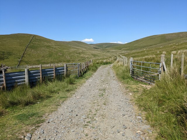
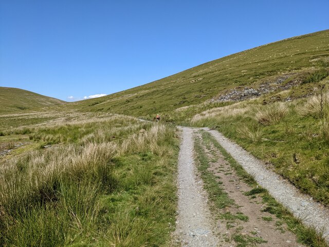
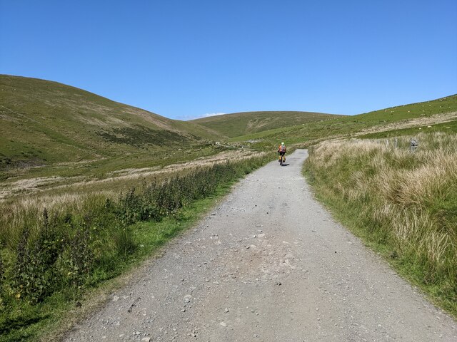
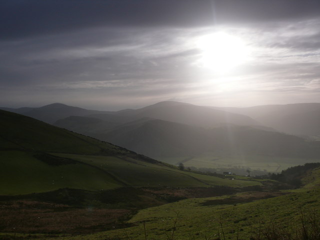
Cwm-llwyd Images

Images are sourced within 2km of 52.671131/-4.0250256 or Grid Reference SH6310. Thanks to Geograph Open Source API. All images are credited.

The unclassified road near the sheepfolds The sheepfolds, just visible to the left, are one of the only landmarks in this wild area.
The unclassified road near the sheepfolds
The sheepfolds, just visible to the left, are one of the only landmarks in this wild area.
Nothing here but an ancient tip It is amazing that there is an old mine tip in this vast and wild landscape. How did the miners know to dig here? And what did they find? (Or, probably, not find).
Nothing here but an ancient tip
It is amazing that there is an old mine tip in this vast and wild landscape. How did the miners know to dig here? And what did they find? (Or, probably, not find).
An ancient mine tip above the Afon Dyffryn Possibly a lead mine - see: <a title="https://www.geograph.org.uk/photo/2127998" href="https://www.geograph.org.uk/photo/2127998">Link</a>
An ancient mine tip above the Afon Dyffryn
Possibly a lead mine - see: Link
The track up the Afon Dyffryn valley
Llethrau Twllydarren / Slopes of Twllydarren Llethrau Twllydarren uwchben Dyffryn Dysynni / Slopes of Twllydarren above the Dysynni Valley.
Llethrau Twllydarren / Slopes of Twllydarren
Llethrau Twllydarren uwchben Dyffryn Dysynni / Slopes of Twllydarren above the Dysynni Valley.
Mynydd Pen-rhiw Dyffryn Dysynni islaw llethrau Mynydd Pen-rhiw / Dysynni Valley below the slopes of Mynydd Pen-rhiw.
Mynydd Pen-rhiw
Dyffryn Dysynni islaw llethrau Mynydd Pen-rhiw / Dysynni Valley below the slopes of Mynydd Pen-rhiw.
Llethrau Mynydd Pen-rhiw / Slopes of Mynydd Pen-rhiw Golygfa dros y llethrau i Dywyn yn y pellter / A view over the slopes to Tywyn in the distance.
Llethrau Mynydd Pen-rhiw / Slopes of Mynydd Pen-rhiw
Golygfa dros y llethrau i Dywyn yn y pellter / A view over the slopes to Tywyn in the distance.
Yr Allt Llwybr yn arwain at giat a chamfa / Footpath leading to a gate and stile.
Yr Allt
Llwybr yn arwain at giat a chamfa / Footpath leading to a gate and stile.
Tracks above Rhyd y Dyffryn The bike is on the joining track, but it's now very indistinct.
Tracks above Rhyd y Dyffryn
The bike is on the joining track, but it's now very indistinct.
The end of the tarmac The road beyond here is great for mountain bikes or trail bikes, but cars would find it rough!
The end of the tarmac
The road beyond here is great for mountain bikes or trail bikes, but cars would find it rough!
An exposed group of trees near the sheepfolds
Looking down to Rhyd y Dyffryn
"Call this a track??" My companion was not impressed. It is clearly a track - on the map!
"Call this a track??"
My companion was not impressed. It is clearly a track - on the map!
Cycle Route 82 above the Afon Dyffryn
Cycle Route 82, looking north
A feeder stream for Afon Dyffryn Flowing down from Esgair Berfa.
A feeder stream for Afon Dyffryn
Flowing down from Esgair Berfa.
Track climbing towards Rhydcriw and Trawsfynydd
Open cattle grid Not very effective at present but appears to be under construction and the side fencing will no doubt follow.
Open cattle grid
Not very effective at present but appears to be under construction and the side fencing will no doubt follow.
Show me another place!

Cwm-llwyd is located at Grid Ref: SH6310 (Lat: 52.671131, Lng: -4.0250256)

Unitary Authority: Gwynedd

Police Authority: North Wales

What 3 Words

///daredevil.fuse.zoomed. Near Barmouth, Gwynedd

Nearby Locations

Cwm-llwyd

Related Wikis

Friog

Friog (Welsh: Y Friog) is a small village in North Wales, near Fairbourne. Its lake and beach are a tourist attraction to over 1,000 visitors a year. Friog...

Fairbourne Railway

The Fairbourne Railway (Welsh: Rheilffordd y Friog) is a 12+1⁄4 in (311 mm) gauge miniature railway running for 2 miles (3.2 km) from the village of Fairbourne...

Fairbourne railway station

Fairbourne railway station serves the village of Fairbourne in Gwynedd, Wales. It is an unstaffed station on the Cambrian Coast Railway with passenger...

Fairbourne

Fairbourne is a seaside village in Gwynedd, Wales. Located on the coast of Barmouth Bay in Arthog community, to the south of the estuary of the River Mawddach...

Nearby Amenities

Located within 500m of 52.671131,-4.0250256
Barrier: cattle_grid
Lat/Long: 52.668657/-4.027495
Barrier: cattle_grid
Lat/Long: 52.671955/-4.019292
The data included in this document is from www.openstreetmap.org. The data is made available under ODbL.

Have you been to Cwm-llwyd?

Leave your review of Cwm-llwyd below (or comments, questions and feedback).