Bryant's Gully

Valley in Caernarfonshire

Wales

Bryant's Gully

Feral Goat close to the summit of Glyder Fawr
Feral Goat close to the summit of Glyder Fawr Credit: Eric Jones

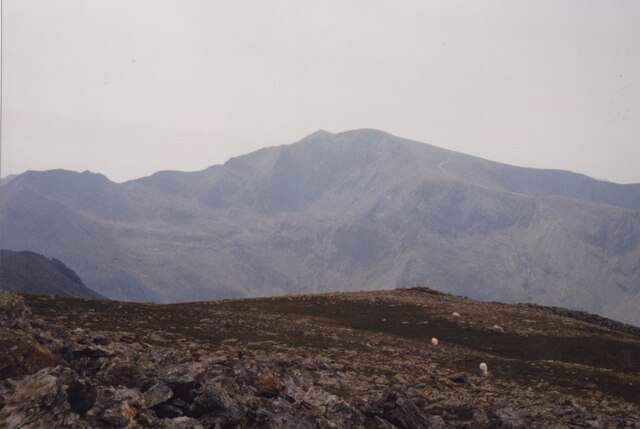
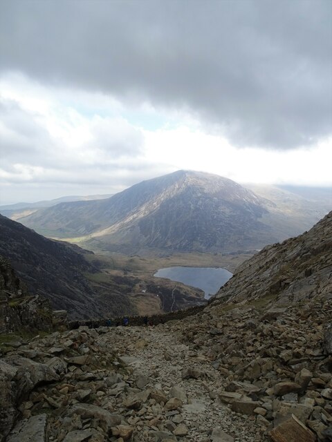
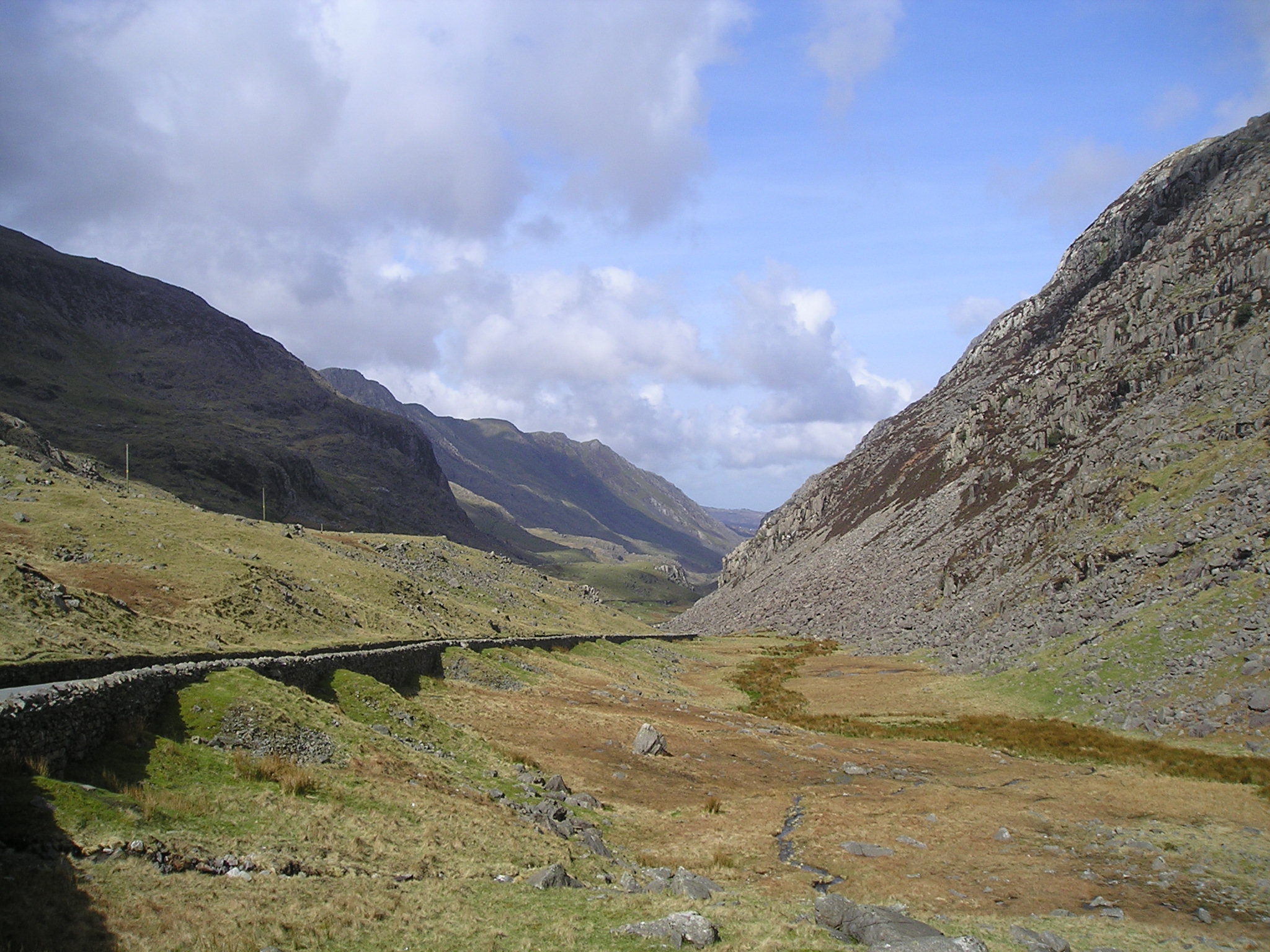
Bryant's Gully is a picturesque valley located in the county of Caernarfonshire, in the northwest part of Wales, United Kingdom. Nestled between the towering peaks of Snowdonia National Park, this enchanting valley offers breathtaking natural landscapes and a tranquil atmosphere.

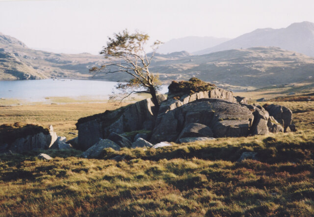
The valley is known for its lush greenery, with rolling hills covered in vibrant wildflowers, and dense forests that provide a haven for various wildlife species. The meandering river that runs through the valley adds to its charm, creating a serene ambiance.

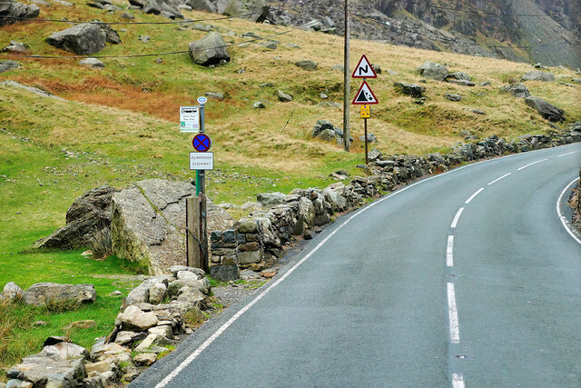
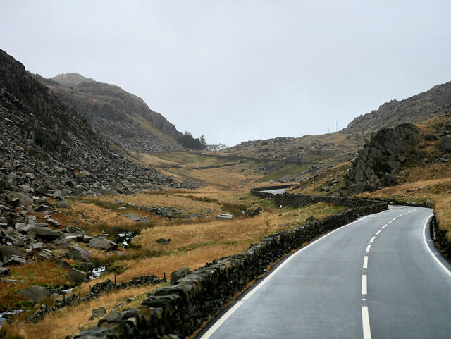
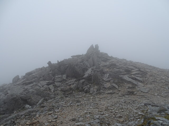
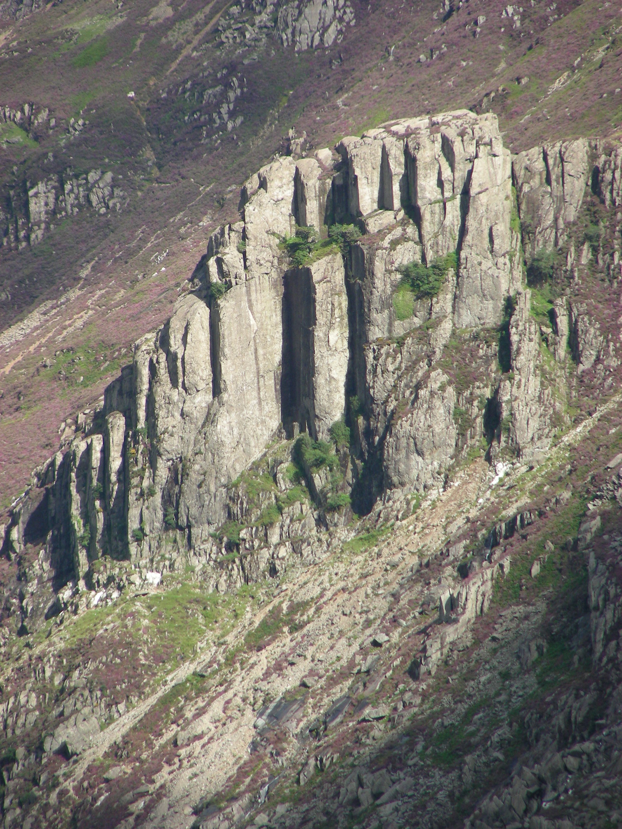
Bryant's Gully is a popular destination for outdoor enthusiasts, offering a wide range of activities for visitors to enjoy. Hiking and walking trails crisscross the valley, allowing nature lovers to explore its beauty firsthand. The challenging peaks surrounding the valley also attract climbers and mountaineers seeking an adrenaline rush.

The valley is also home to several quaint villages and hamlets, where visitors can experience the rich local culture and hospitality. The traditional stone houses and historic buildings add to the charm of the area, providing a glimpse into the region's past.

Caernarfonshire, the larger county encompassing Bryant's Gully, offers a range of amenities and attractions for visitors. The nearby town of Caernarfon boasts a stunning medieval castle and a bustling waterfront, while the coastal areas provide opportunities for water sports and beach activities.

Overall, Bryant's Gully in Caernarfonshire is a haven for nature enthusiasts, offering a perfect blend of natural beauty, outdoor activities, and Welsh charm.

If you have any feedback on the listing, please let us know in the comments section below.

Bryant's Gully Images

Images are sourced within 2km of 53.094768/-4.0519795 or Grid Reference SH6257. Thanks to Geograph Open Source API. All images are credited.

Feral Goat close to the summit of Glyder Fawr
View SSE across the Garn Plateau The Snowdon Massif occupies the background.
View SSE across the Garn Plateau
The Snowdon Massif occupies the background.
Glacial erratics above Llyn Cwm Ffynnon The tree - one a very few at this elevation - has benefitted from the shelter afforded by these large borders.
Glacial erratics above Llyn Cwm Ffynnon
The tree - one a very few at this elevation - has benefitted from the shelter afforded by these large borders.
Service Bus on the Llanberis Pass Gwynfor Coaches Alexander Dennis Enviro 200, YY17 GPZ on the route through the Llanberis Pass.
Service Bus on the Llanberis Pass
Gwynfor Coaches Alexander Dennis Enviro 200, YY17 GPZ on the route through the Llanberis Pass.
Llanberis Pass The Llanberis Pass (Welsh: Bwlch Llanberis) in Snowdonia carries the A4086 over Pen-y-Pass, between the mountain ranges of the Glyderau and the Snowdon massif.
Llanberis Pass
The Llanberis Pass (Welsh: Bwlch Llanberis) in Snowdonia carries the A4086 over Pen-y-Pass, between the mountain ranges of the Glyderau and the Snowdon massif.
Scree on the south-western flank of Glyder Fawr
Craggy south-western slope of Glyder Fawr
Cwm Glas Mawr Climbers' Hut
Cromlech Boulder, Pass of Llanberis One of the Cromlech Boulders close to the side of the road as it cuts through the Llanberis Pass. The boulders are volcanic rock from Dinas Cromlech; they have made the area popular for bouldering (<span class="nowrap"><a title="https://www.climber.co.uk/outdoor/bouldering/around-the-bloc-the-cromlech-boulders-llanberis/" rel="nofollow ugc noopener" href="https://www.climber.co.uk/outdoor/bouldering/around-the-bloc-the-cromlech-boulders-llanberis/">Link</a><img style="margin-left:2px;" alt="External link" title="External link - shift click to open in new window" src="https://s1.geograph.org.uk/img/external.png" width="10" height="10"/></span> Climber Magazine).
Cromlech Boulder, Pass of Llanberis
One of the Cromlech Boulders close to the side of the road as it cuts through the Llanberis Pass. The boulders are volcanic rock from Dinas Cromlech; they have made the area popular for bouldering (LinkExternal link Climber Magazine).
Bus Stop on the Llanberis Pass - near the Cromlech Boulders The A4086 runs for almost 18 miles between Caernarfon and Capel Curig. It is a popular tourist route as it passes through some of the most memorable and famous parts of Snowdonia including the Llanberis Pass.
Bus Stop on the Llanberis Pass - near the Cromlech Boulders
The A4086 runs for almost 18 miles between Caernarfon and Capel Curig. It is a popular tourist route as it passes through some of the most memorable and famous parts of Snowdonia including the Llanberis Pass.
Cyclist on the Llanberis Pass The A4086 runs for almost 18 miles between Caernarfon and Capel Curig. It is a popular tourist route as it passes through some of the most memorable and famous parts of Snowdonia including the Llanberis Pass.
Cyclist on the Llanberis Pass
The A4086 runs for almost 18 miles between Caernarfon and Capel Curig. It is a popular tourist route as it passes through some of the most memorable and famous parts of Snowdonia including the Llanberis Pass.
A4086 Llanberis Pass
Pass of Llanberis The A4086 runs for almost 18 miles between Caernarfon and Capel Curig. It is a popular tourist route as it passes through some of the most memorable and famous parts of Snowdonia including the Llanberis Pass.
Pass of Llanberis
The A4086 runs for almost 18 miles between Caernarfon and Capel Curig. It is a popular tourist route as it passes through some of the most memorable and famous parts of Snowdonia including the Llanberis Pass.
A4086, Pass of Llanberis approaching Pen-y-Pass The A4086 runs for almost 18 miles between Caernarfon and Capel Curig. It is a popular tourist route as it passes through some of the most memorable and famous parts of Snowdonia including the Llanberis Pass.
A4086, Pass of Llanberis approaching Pen-y-Pass
The A4086 runs for almost 18 miles between Caernarfon and Capel Curig. It is a popular tourist route as it passes through some of the most memorable and famous parts of Snowdonia including the Llanberis Pass.
Path down to Cwm Idwal
Cloudy summit of Glyder Fawr
Afon Nant Peris Boulders of many sizes
Scree slope on right
Afon Nant Peris
Boulders of many sizes Scree slope on right
Rocky slopes Some huge boulder beside road
Rocky slopes
Some huge boulder beside road
Show me another place!

Bryant's Gully is located at Grid Ref: SH6257 (Lat: 53.094768, Lng: -4.0519795)

Unitary Authority: Gwynedd

Police Authority: North Wales

What 3 Words

///farmed.broadens.mining. Near Llanberis, Gwynedd

Nearby Locations

Bryant's Gully

Related Wikis

Dinas Cromlech

Dinas Cromlech or Dinas y Gromlech is a distinctive rhyolite rock outcrop at the Llanberis Pass, in Snowdonia, northwest Wales, which has a distinctive...

Llanberis Pass

The Llanberis Pass (Welsh: Bwlch Llanberis; alternative English name, Pass of Llanberis) in Snowdonia carries the main road (A4086) from the south-east...

Arfon (Senedd constituency)

Arfon is a constituency of the Senedd. It was created for the former Assembly's 2007 election. It elects one Member of the Senedd by the first past the...

Glyderau

The Glyderau (a Welsh plural form, also known in English as the Glyders) are a mountain group in Snowdonia, North Wales. The name derives from the highest...

Nearby Amenities

Located within 500m of 53.094768,-4.0519795
Jerry's Roof
Natural: stone
Lat/Long: 53.0906176/-4.0524286
The data included in this document is from www.openstreetmap.org. The data is made available under ODbL.

Have you been to Bryant's Gully?

Leave your review of Bryant's Gully below (or comments, questions and feedback).