Glenwhapple

Valley in Stirlingshire

Scotland

Glenwhapple

Small hill behind Upper Carleston 110m spot height behind the farm.
Small hill behind Upper Carleston Credit: Stephen Sweeney

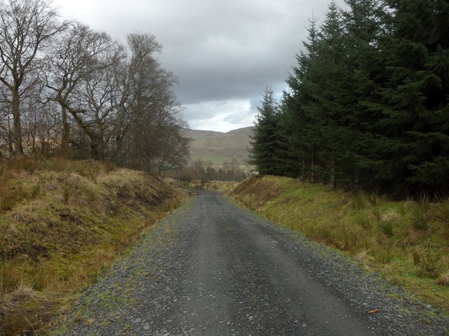
Glenwhapple is a picturesque valley situated in the county of Stirlingshire, Scotland. Nestled between the towering peaks of the Trossachs and the gentle slopes of the Lowlands, this idyllic location offers breathtaking views and a tranquil atmosphere.

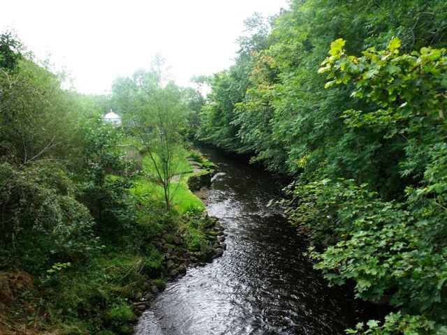
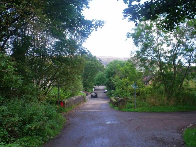
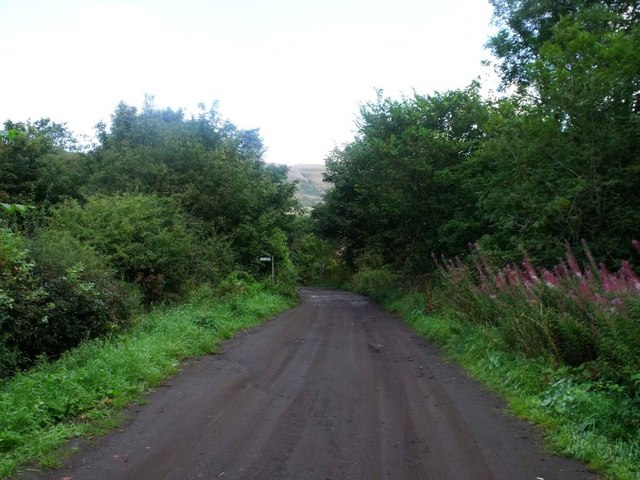
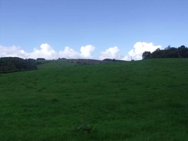
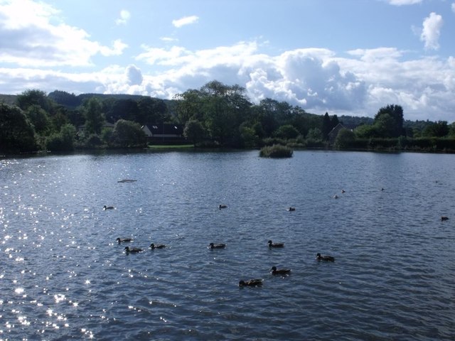
The valley is renowned for its stunning natural beauty, with lush green meadows and dense forests stretching as far as the eye can see. The River Whapple flows through the heart of the glen, adding to its charm and providing a haven for wildlife. Visitors can enjoy leisurely walks along the riverbanks, taking in the sights and sounds of nature.

Glenwhapple is also home to a number of historical landmarks. The ruins of Glenwhapple Castle, a medieval fortress that once stood proudly on a hilltop, offer a glimpse into the area's rich past. Nearby, the quaint village of Glenwhapple boasts charming cottages and traditional Scottish architecture, providing visitors with a glimpse into rural life in Stirlingshire.

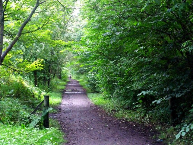
Outdoor enthusiasts will find plenty to do in Glenwhapple. The valley offers a range of activities, including hiking, cycling, and fishing. The surrounding hills and forests provide excellent opportunities for exploring, with numerous trails catering to all levels of ability.

For those seeking relaxation, Glenwhapple is home to a number of cozy bed and breakfasts and country inns, offering warm hospitality and traditional Scottish cuisine. The local community also hosts various events throughout the year, including music festivals and Highland games, providing visitors with a taste of Scottish culture.

In conclusion, Glenwhapple is a hidden gem in Stirlingshire, offering visitors a peaceful retreat amidst stunning natural scenery and a glimpse into Scotland's rich history and culture.

If you have any feedback on the listing, please let us know in the comments section below.
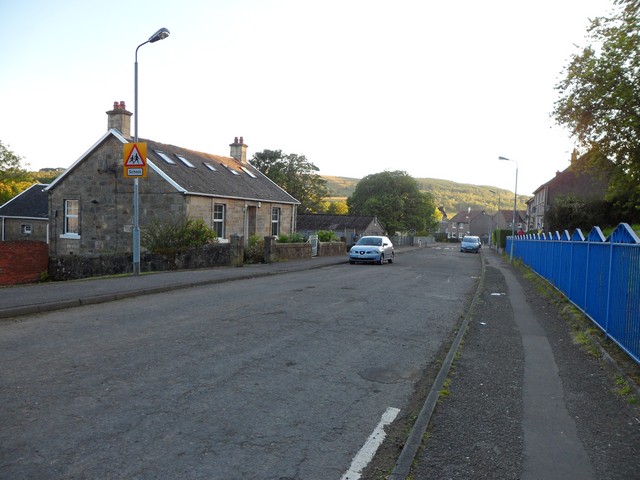
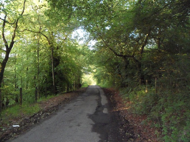
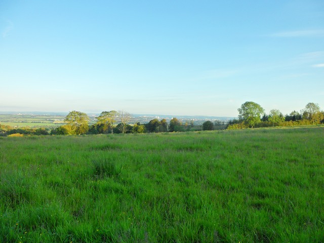
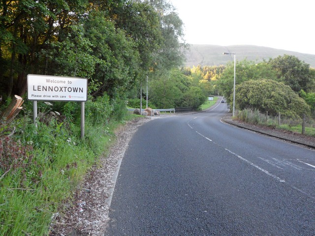
Glenwhapple Images

Images are sourced within 2km of 55.960374/-4.2157878 or Grid Reference NS6176. Thanks to Geograph Open Source API. All images are credited.

Small hill behind Upper Carleston 110m spot height behind the farm.
Small hill behind Upper Carleston
110m spot height behind the farm.
Rolling hills in East Dunbartonshire Opposite Redmoss Farm Road.
Rolling hills in East Dunbartonshire
Opposite Redmoss Farm Road.
North Birbiston Road, Lennoxtown
Road to Lennoxtown Just east of Muirhead Farm.
Road to Lennoxtown
Just east of Muirhead Farm.
Field west of Muirhead Farm Overlooking Glasgow.
Field west of Muirhead Farm
Overlooking Glasgow.
Approaching Lennoxtown on the B822 From the south.
Approaching Lennoxtown on the B822
From the south.
South Gate Lodge, Lennox Castle Hospital
Looking northeast from track to Lennox Castle A splendid view over Celtic F.C.'s training facility and beyond.
Looking northeast from track to Lennox Castle
A splendid view over Celtic F.C.'s training facility and beyond.
Lennoxtown, Glazert Water
Lennoxtown, path to Milton of Campsie Follows the old track of the LNER railway which connected Kirkintilloch with the near north.
Lennoxtown, path to Milton of Campsie
Follows the old track of the LNER railway which connected Kirkintilloch with the near north.
Lennoxtown, road, paths and bridge The path from Strathblane to Kirkintilloch crosses the scene and the bridge over the Glazert leads into the town via Chestnut Walk seen in the distance.
Lennoxtown, road, paths and bridge
The path from Strathblane to Kirkintilloch crosses the scene and the bridge over the Glazert leads into the town via Chestnut Walk seen in the distance.
Lennoxtown, road from Finniescroft Wood
Lennoxtown, South Brae View towards the South Brae area.
Lennoxtown, South Brae
View towards the South Brae area.
Lennoxtown, Whitefield Dam Dug out and formed in the early nineteenth century to store water for the Lennox Mill Printworks. 
The pond is fed from a series of drains coming off the Campsies which eventually are channelled into a small canal which enters the pond from the north. The overflow leaves by a weir situated at the north east corner.
Lennoxtown, Whitefield Dam
Dug out and formed in the early nineteenth century to store water for the Lennox Mill Printworks. The pond is fed from a series of drains coming off the Campsies which eventually are channelled into a small canal which enters the pond from the north. The overflow leaves by a weir situated at the north east corner.
Lennoxtown, Whitefield Park View to the escarpment of the Campsies that dominates Lennoxtown.
Lennoxtown, Whitefield Park
View to the escarpment of the Campsies that dominates Lennoxtown.
Disused parish church of Campsie, Lennoxtown In this churchyard are buried Norman MacLeod, known as Caraid nan Gaidheal (friend of the Highlanders), minister of this church, then of St Columba's the Gaelic speaking church in Glasgow, also his son Norman MacLeod, minister of the Barony church in Glasgow, noted for his concern for the poor.
Disused parish church of Campsie, Lennoxtown
In this churchyard are buried Norman MacLeod, known as Caraid nan Gaidheal (friend of the Highlanders), minister of this church, then of St Columba's the Gaelic speaking church in Glasgow, also his son Norman MacLeod, minister of the Barony church in Glasgow, noted for his concern for the poor.
Path down from Clochcore Wood From the reservoir heading towards the Celtic FC training facility.
Path down from Clochcore Wood
From the reservoir heading towards the Celtic FC training facility.
Small bridge in grounds of former Lennox Castle Hospital
Show me another place!

Glenwhapple is located at Grid Ref: NS6176 (Lat: 55.960374, Lng: -4.2157878)

Unitary Authority: East Dunbartonshire

Police Authority: Greater Glasgow

What 3 Words

///habits.clashes.ground. Near Lennoxtown, East Dunbartonshire

Nearby Locations

Glenwhapple

Related Wikis

Lennoxtown (New) railway station

Lennoxtown railway station served the town of Lennoxtown, Dunbartonshire, Scotland from 1867 to 1951 on the Blane Valley Railway. == History == The station...

Lennoxtown

Lennoxtown (Scottish Gaelic: Baile na Leamhnachd, pronounced [ˈpalə nə ˈʎãũnəxk]) is a town in the East Dunbartonshire council area and the historic county...

The Lennox

The Lennox (Scottish Gaelic: Leamhnachd, pronounced [ˈʎãũnəxk]) is a region of Scotland centred on The Vale of Leven, including its great loch: Loch Lomond...

Lennoxtown (Old) railway station

Lennoxtown railway station served the town of Lennoxtown, Dunbartonshire, Scotland from 1848 to 1881 on the Blane Valley Railway. == History == The station...

East Dunbartonshire (UK Parliament constituency)

East Dunbartonshire is a county constituency of the House of Commons of the Parliament of the United Kingdom (Westminster). It elects one Member of Parliament...

Glazert Water

The Glazert Water is a tributary of the River Kelvin in East Dunbartonshire, Scotland. It is formed 1 kilometre (5⁄8 mi) south of Clachan of Campsie (55...

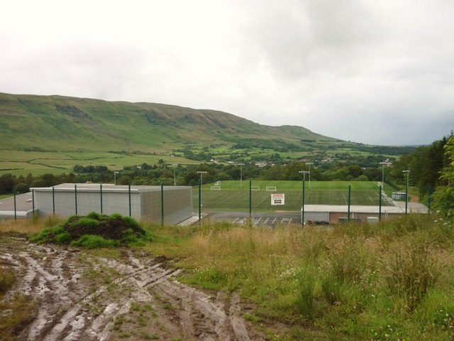
Lennoxtown training centre

Lennoxtown Training Centre is Celtic F.C.'s training centre, located at Lennoxtown, East Dunbartonshire in Scotland. The complex houses the club's training...

Torrance, East Dunbartonshire

Torrance is a relatively affluent village in East Dunbartonshire, formerly Stirlingshire, Scotland, located eight miles (thirteen kilometres) north of...

Nearby Amenities

Located within 500m of 55.960374,-4.2157878
Information: guidepost
Tourism: information
Lat/Long: 55.9635784/-4.2145173
Power: pole
Lat/Long: 55.9644052/-4.2175811
Power: pole
Lat/Long: 55.9637554/-4.2178263
Power: pole
Lat/Long: 55.9636264/-4.2178923
Power: pole
Lat/Long: 55.9627667/-4.2177037
Power: pole
Lat/Long: 55.9619305/-4.2175151
Power: pole
Lat/Long: 55.961493/-4.2170122
Power: pole
Lat/Long: 55.9610672/-4.2165261
Power: pole
Lat/Long: 55.9601335/-4.2164695
Power: pole
Lat/Long: 55.959357/-4.2169619
Power: pole
Lat/Long: 55.9586474/-4.2175339
Power: pole
Lat/Long: 55.9577911/-4.2179949
Power: pole
Lat/Long: 55.9571283/-4.2183532
Power: pole
Lat/Long: 55.9563705/-4.2187702
Power: pole
Lat/Long: 55.9644275/-4.2135851
Power: pole
Lat/Long: 55.9644181/-4.2146475
Power: pole
Lat/Long: 55.9644157/-4.2161227
Power: pole
Lat/Long: 55.9642949/-4.2189997
The data included in this document is from www.openstreetmap.org. The data is made available under ODbL.

Have you been to Glenwhapple?

Leave your review of Glenwhapple below (or comments, questions and feedback).