Campsie Glen

Valley in Stirlingshire

Scotland

Campsie Glen

End of the track past Knocknair Gateway onto the open fellside.
End of the track past Knocknair Credit: Chris Upson

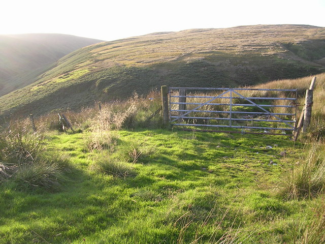
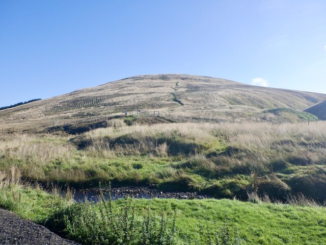
Campsie Glen is a picturesque valley located in Stirlingshire, Scotland. Nestled amidst the Campsie Fells, this natural wonder offers breathtaking views and an abundance of outdoor activities for visitors of all ages.

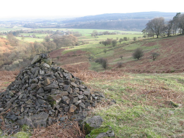
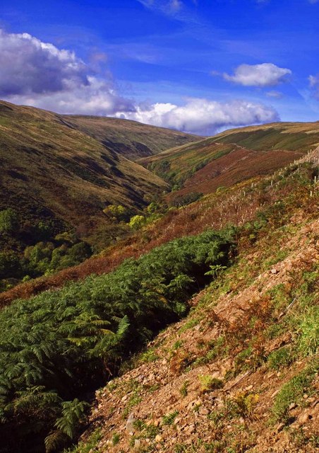
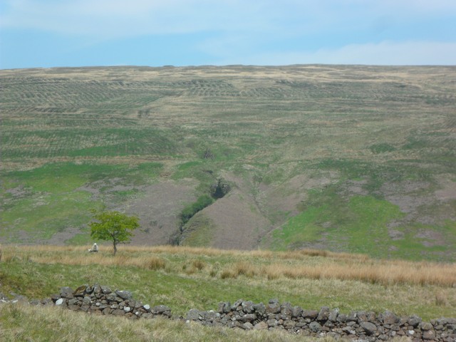
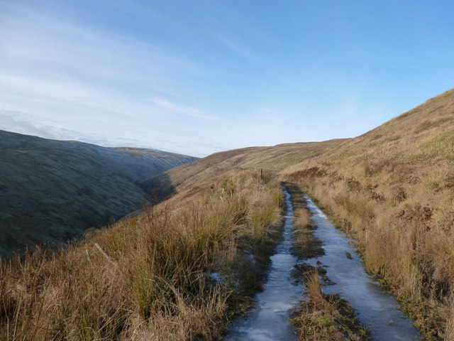
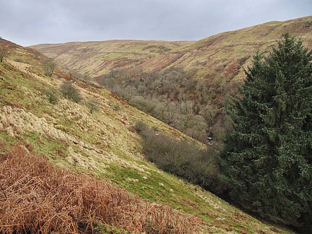
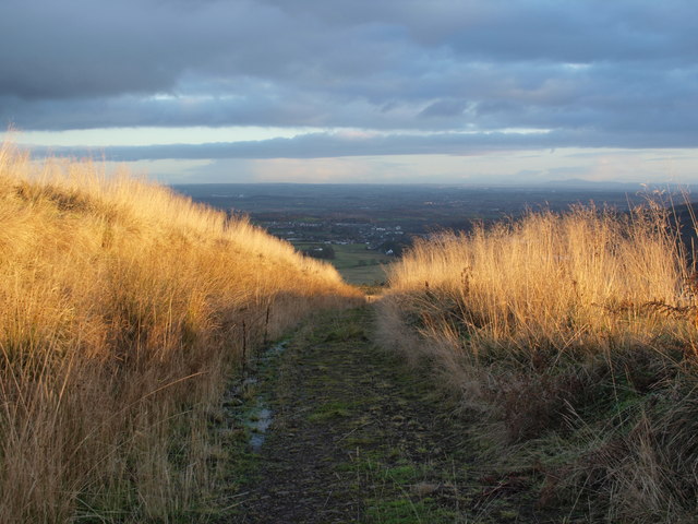
The glen is characterized by its rugged terrain, with steep hillsides and lush greenery. It is a haven for hikers and nature enthusiasts, who can explore the numerous trails that wind through the valley. These trails vary in difficulty, catering to both experienced trekkers and casual walkers.

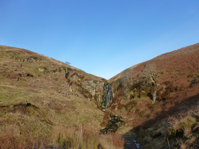
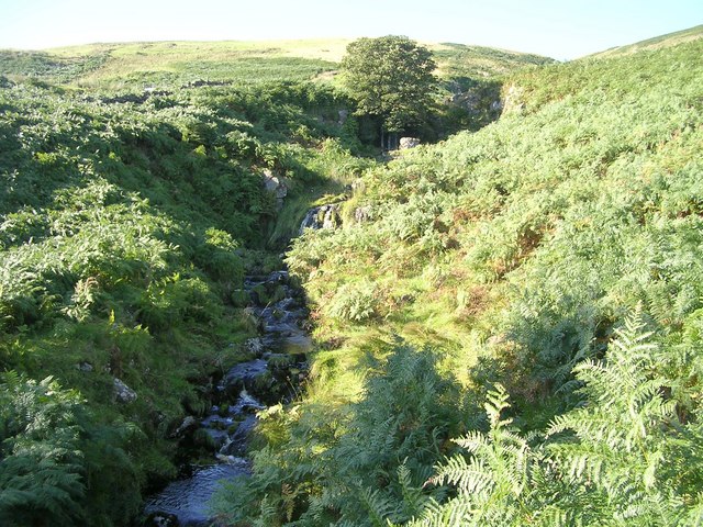
One of the highlights of Campsie Glen is the stunning waterfall known as the "The Meeting of the Waters." This majestic cascade is formed by the confluence of two rivers, creating a mesmerizing sight and a soothing soundtrack for those who visit. The waterfall is a popular spot for photography and provides a tranquil setting for picnics or simply enjoying the surrounding nature.

Campsie Glen also offers opportunities for outdoor pursuits such as mountain biking, fishing, and birdwatching. The glen is home to a diverse range of wildlife, including red deer, otters, and various species of birds. Birdwatchers can spot peregrine falcons, buzzards, and even the elusive golden eagle.

For those seeking a more leisurely experience, there are several charming villages in close proximity to Campsie Glen. These villages offer quaint accommodations, local pubs, and shops selling traditional Scottish crafts and produce.

Overall, Campsie Glen is a hidden gem in Stirlingshire, offering visitors a chance to immerse themselves in the natural beauty of Scotland. Whether it's hiking, wildlife spotting, or simply enjoying the tranquility of the surroundings, this valley has something to offer everyone.

If you have any feedback on the listing, please let us know in the comments section below.

Campsie Glen Images

Images are sourced within 2km of 55.993268/-4.2291514 or Grid Reference NS6180. Thanks to Geograph Open Source API. All images are credited.

End of the track past Knocknair Gateway onto the open fellside.
End of the track past Knocknair
Gateway onto the open fellside.
Cairn above Fin Glen
Fin Glen A view looking north up Fin Glen.
Fin Glen
A view looking north up Fin Glen.
Almeel Burn, Campsie Fells Cutting a steep-sided glen into the hillside before it meets up with Finglen Burn.
Almeel Burn, Campsie Fells
Cutting a steep-sided glen into the hillside before it meets up with Finglen Burn.
Icy track in Fin Glen This is a lower track than the one shown on the current 1:25,000 map.
Icy track in Fin Glen
This is a lower track than the one shown on the current 1:25,000 map.
Small waterfall on the Almeel Burn The track curves round here and crosses the burn at a ford.
Small waterfall on the Almeel Burn
The track curves round here and crosses the burn at a ford.
Fin Glen in the Campsies
Tree planting, Campsie Fells Young woodland above the Fin Glen.
Tree planting, Campsie Fells
Young woodland above the Fin Glen.
Finglen Burn From close to the waterfall (<a href="https://www.geograph.org.uk/photo/3245917">NS5980 : Small waterfall on the Almeel Burn</a>) we look up the glen across the Finglen Burn.
Finglen Burn
From close to the waterfall (NS5980 : Small waterfall on the Almeel Burn) we look up the glen across the Finglen Burn.
Path above the Fin Glen
Alnwick Burn and Crow Road Downstream view from a small car park.
Alnwick Burn and Crow Road
Downstream view from a small car park.
Path up Lecket Hill Replaces the path shown on the Ordnance Survey 1:25,000 map. The hillside has been forested but there are good gates on either side of the plantation so no problems with the deer fences.
Path up Lecket Hill
Replaces the path shown on the Ordnance Survey 1:25,000 map. The hillside has been forested but there are good gates on either side of the plantation so no problems with the deer fences.
Young trees, Campsie Fells The hillside west of the Crow Road has been planted with trees.
Young trees, Campsie Fells
The hillside west of the Crow Road has been planted with trees.
Path on Lecket Hill A different route to the one currently shown by the Ordnance Survey. It links two gates either side of a new woodland plantation with young trees lurking in the long grass.

A view down the Crow Road.
Path on Lecket Hill
A different route to the one currently shown by the Ordnance Survey. It links two gates either side of a new woodland plantation with young trees lurking in the long grass. A view down the Crow Road.
Young trees by Alnwick Bridge A newish, slow growing plantation in the Campsie Fells.
Young trees by Alnwick Bridge
A newish, slow growing plantation in the Campsie Fells.
Moorland above the Crow Road The slopes of Holehead have been planted with trees. Much moorland remains but is now ungrazed save for the deer and a small number of sheep which have breached the fences.
Moorland above the Crow Road
The slopes of Holehead have been planted with trees. Much moorland remains but is now ungrazed save for the deer and a small number of sheep which have breached the fences.
Basalt boulders On the lower slopes of Holehead in generally smooth rock free ground.
Basalt boulders
On the lower slopes of Holehead in generally smooth rock free ground.
Southern slopes of Holehead Outer Black Hill, mostly grassy ground.
Southern slopes of Holehead
Outer Black Hill, mostly grassy ground.
Show me another place!

Campsie Glen is located at Grid Ref: NS6180 (Lat: 55.993268, Lng: -4.2291514)

Unitary Authority: East Dunbartonshire

Police Authority: Greater Glasgow

What 3 Words

///buying.fires.clouds. Near Lennoxtown, East Dunbartonshire

Related Wikis

Aldessan Burn

Located in East Dunbartonshire, the Aldessan Burn (Scottish Gaelic: Allt Easain, meaning "burn of the falls"; also known as the Kirk Burn) is formed as...

Clachan of Campsie

Clachan of Campsie or Campsie Glen (Scottish Gaelic: Clachan Chamais) is a settlement in the East Dunbartonshire area of Scotland. It was formerly part...

Haughhead

Haughhead is a hamlet two miles from Lennoxtown in East Dunbartonshire, Scotland. It was historically part of Stirlingshire until 1975, when it became...

Campsie Glen railway station

Campsie Glen railway station served the village of Clachan of Campsie, East Dunbartonshire, Scotland from 1867 to 1951 on the Blane Valley Railway; the...

Nearby Amenities

Located within 500m of 55.993268,-4.2291514
Jame's Linn
Source Name: sign at bottom
Waterway: waterfall
Lat/Long: 55.9921502/-4.2301294
Lady's Linn
Source Name: sign at bottom
Waterway: waterfall
Lat/Long: 55.9917973/-4.2299683
Muckle Alicompen
Source Name: sign at bottom
Waterway: waterfall
Lat/Long: 55.9949726/-4.2244279
Campsie Glen
Place: locality
Source: local_knowledge
Lat/Long: 55.992677/-4.2295283
Wheelcraft
Addr City: Glasgow
Addr Housename: Aldessan House
Addr Housenumber: unit 4
Addr Postcode: G66 7AB
Opening Hours: Mo-Sa 10:00-18:00
Operator: Alister Gow
Shop: bicycle
Lat/Long: 55.9892565/-4.2284897
Post Box
Postal Code: G66 7
Ref: G66 1122
Lat/Long: 55.9888341/-4.228839
Parking
Lat/Long: 55.9890013/-4.2286808
Wee Alicompen
Source Name: sign at bottom
Waterway: waterfall
Lat/Long: 55.9950506/-4.223237
Cafe
Aldessan Gallery & Coffee Shop
Lat/Long: 55.9892389/-4.2288232
Campsie Glen
Hiking: yes
Information: map
Map Type: area
Tourism: information
Lat/Long: 55.9891652/-4.2285886
Toilets
Check Date: 2021-08-23
Fee: yes
Wheelchair: yes
Lat/Long: 55.9893426/-4.2281877
Tourism: viewpoint
Lat/Long: 55.9936301/-4.2259771
Ford: yes
Lat/Long: 55.9952508/-4.2322459
Bus Stop
Passenger Information Display: no
Shelter: no
Lat/Long: 55.9888222/-4.228363
Ford: yes
Lat/Long: 55.9964819/-4.226121
Ford: yes
Lat/Long: 55.9962766/-4.2275607
Waste Basket
Colour: black
Material: metal
Waste: trash
Lat/Long: 55.9938121/-4.2252532
Waste Basket
Colour: black
Material: metal
Waste: trash
Lat/Long: 55.9934067/-4.2256073
Board Type: geology
Direction: 300
Information: board
Tourism: information
Lat/Long: 55.993394/-4.2255733
Board Type: geology
Direction: 65
Information: board
Tourism: information
Lat/Long: 55.9935823/-4.2259455
Bench
Backrest: yes
Direction: 240
Material: wood
Lat/Long: 55.9928566/-4.2253971
The data included in this document is from www.openstreetmap.org. The data is made available under ODbL.

Have you been to Campsie Glen?

Leave your review of Campsie Glen below (or comments, questions and feedback).