Ceunant Bach

Valley in Caernarfonshire

Wales

Ceunant Bach

Llyn Padarn railway Headed by Elidir.
Built 1889, Hunslet 0-4-0ST Elidir worked at Dinorwic Quarries as Red Damsel until transferred to the Llanberis Lake Railway at the end of 1969.
Llyn Padarn railway Credit: Richard Hoare

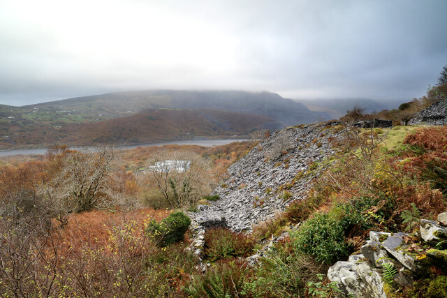
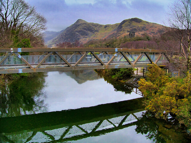
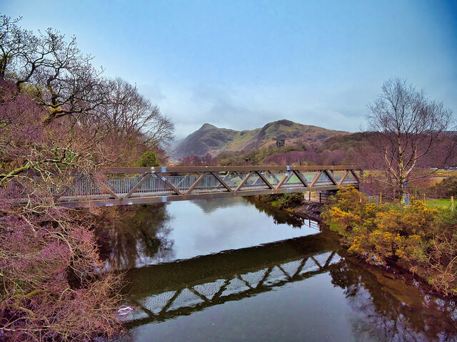
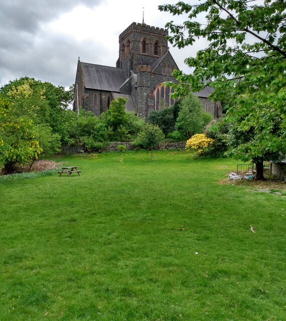
Ceunant Bach is a small valley located in Caernarfonshire, Wales. Nestled amidst the stunning Snowdonia National Park, this picturesque valley offers breathtaking views and a tranquil escape from the bustling city life. The name "Ceunant Bach" translates to "small ravine" in English, perfectly describing the geological formation that characterizes the area.

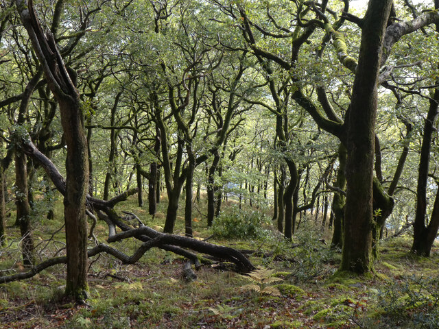
The valley is renowned for its natural beauty, with lush greenery, cascading waterfalls, and dramatic cliffs. It is a haven for nature lovers and hikers, providing numerous trails to explore and discover hidden gems along the way. The enchanting Afon Goch stream meanders through the valley, adding to its charm and creating a peaceful atmosphere.

Ceunant Bach is home to a diverse range of flora and fauna, including rare plants and wildlife species. The valley's unique ecosystem has made it a protected area, ensuring the preservation of its natural treasures.

For those seeking outdoor adventures, Ceunant Bach offers opportunities for rock climbing, abseiling, and canoeing. The challenging terrain and the presence of the waterfall make it an ideal destination for adrenaline junkies and thrill-seekers.

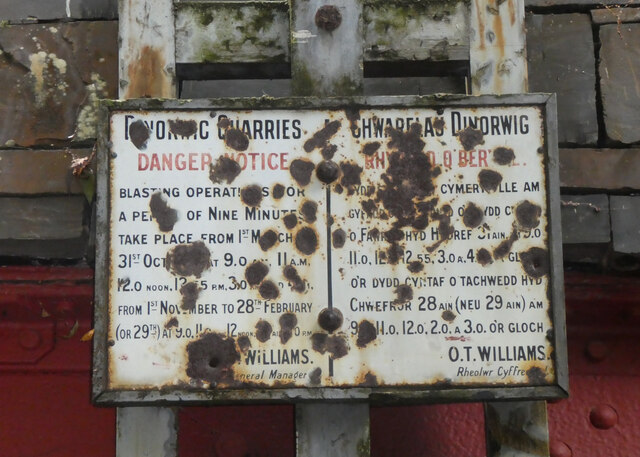
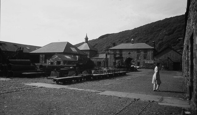
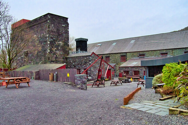
The valley is also steeped in history, with ancient ruins and remnants of a bygone era scattered throughout. Ruined farmhouses and old mining structures serve as reminders of the area's past, adding an intriguing element to the landscape.

Overall, Ceunant Bach is a hidden gem in Caernarfonshire, offering visitors a chance to immerse themselves in nature's splendor and experience the rich history of the region. Whether it's a leisurely walk, an adrenaline-pumping adventure, or a peaceful retreat, this valley has something to offer everyone.

If you have any feedback on the listing, please let us know in the comments section below.
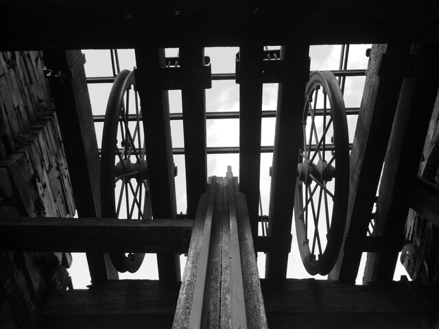
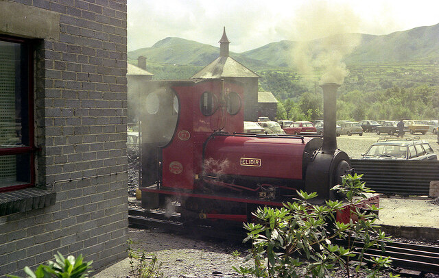
Ceunant Bach Images

Images are sourced within 2km of 53.107827/-4.1260184 or Grid Reference SH5758. Thanks to Geograph Open Source API. All images are credited.

Llyn Padarn railway Headed by Elidir.
Built 1889, Hunslet 0-4-0ST Elidir worked at Dinorwic Quarries as Red Damsel until transferred to the Llanberis Lake Railway at the end of 1969.
Llyn Padarn railway
Headed by Elidir. Built 1889, Hunslet 0-4-0ST Elidir worked at Dinorwic Quarries as Red Damsel until transferred to the Llanberis Lake Railway at the end of 1969.
Elidir at Gilfach Ddu Built 1889, Hunslet 0-4-0ST Elidir worked at Dinorwic Quarries as Red Damsel until transferred to the Llanberis Lake Railway at the end of 1969.
Elidir at Gilfach Ddu
Built 1889, Hunslet 0-4-0ST Elidir worked at Dinorwic Quarries as Red Damsel until transferred to the Llanberis Lake Railway at the end of 1969.
Llyn Padarn train at Gilfach Ddu
Rusty trucks and tracks At Gilfach Ddu station sidings.
Rusty trucks and tracks
At Gilfach Ddu station sidings.
Offer weindio Chwerel Dinorwig / Dinorwig Quarry winding gear
Coed Dinorwig
Coed Dinorwig
Chwarelau Dinorwig Rhybudd o Berygl / Dinorwig Quarries Danger Notice
Elidir at Gilfach Ddu Standing by the National Slate Museum, by the Llanberis Lake Railway.
Elidir at Gilfach Ddu
Standing by the National Slate Museum, by the Llanberis Lake Railway.
Slate tip above Afon Glyn Various public footpaths are marked above the minor road from Llanberis to Llanrug which lies among old slate quarries well above the main road. Their advantage lies in the slight possibility of finding somewhere to park without requiring a second mortgage, but their disadvantage is that signage indicates a strong desire by "the authorities" that you don't use them. This one seems to alternate between being easy to follow and being totally opaque and overgrown, but the correct route lies over a stile with a fierce "Keep out" sign which has to be ignored. Looking east from about that point, we are level with a horizon of waste slate above the Afon Glyn, with views just about discernible across Llyn Padarn to even bigger slate workings below Elidir Fach (whose summit is lost in the cloud).
Slate tip above Afon Glyn
Various public footpaths are marked above the minor road from Llanberis to Llanrug which lies among old slate quarries well above the main road. Their advantage lies in the slight possibility of finding somewhere to park without requiring a second mortgage, but their disadvantage is that signage indicates a strong desire by "the authorities" that you don't use them. This one seems to alternate between being easy to follow and being totally opaque and overgrown, but the correct route lies over a stile with a fierce "Keep out" sign which has to be ignored. Looking east from about that point, we are level with a horizon of waste slate above the Afon Glyn, with views just about discernible across Llyn Padarn to even bigger slate workings below Elidir Fach (whose summit is lost in the cloud).
National Slate Museum at Llanberis
Llanberis, Stryd Fawr (High Street)
High Street Llanberis
Llanberis Lake Railway, Bridge across Afon y Bala The Llanberis Lake Railway, in Snowdonia, uses this bridge to cross the shortest river in Wales, Afon y Bala, which flows between Llyn Peris and Llyn Padarn.
Llanberis Lake Railway, Bridge across Afon y Bala
The Llanberis Lake Railway, in Snowdonia, uses this bridge to cross the shortest river in Wales, Afon y Bala, which flows between Llyn Peris and Llyn Padarn.
Llanberis Lake Railway, Gilfach Ddu The original terminus of the railway, at Gilfach Ddu, is now a through station serving both the National Slate Museum and the nearby Dolbadarn Castle.
Llanberis Lake Railway, Gilfach Ddu
The original terminus of the railway, at Gilfach Ddu, is now a through station serving both the National Slate Museum and the nearby Dolbadarn Castle.
National Slate Museum. Llanberis The National Slate Museum (previously known as the Welsh Slate Museum and the North Wales Quarrying Museum) is located at Gilfach Ddu, the 19th-century workshops of the now disused Dinorwic quarry, within the Padarn Country Park, Llanberis. The museum is dedicated to the preservation and display of relics of the slate industry in Wales.

See <span class="nowrap"><a title="https://museum.wales/slate/" rel="nofollow ugc noopener" href="https://museum.wales/slate/">Link</a><img style="margin-left:2px;" alt="External link" title="External link - shift click to open in new window" src="https://s1.geograph.org.uk/img/external.png" width="10" height="10"/></span> (the museum’s official site) for more information.
National Slate Museum. Llanberis
The National Slate Museum (previously known as the Welsh Slate Museum and the North Wales Quarrying Museum) is located at Gilfach Ddu, the 19th-century workshops of the now disused Dinorwic quarry, within the Padarn Country Park, Llanberis. The museum is dedicated to the preservation and display of relics of the slate industry in Wales. See LinkExternal link (the museum’s official site) for more information.
Afon y Bala The Llanberis Lake Railway, in Snowdonia, uses this bridge to cross the shortest river in Wales, Afon y Bala, which flows between Llyn Peris and Llyn Padarn.
Afon y Bala
The Llanberis Lake Railway, in Snowdonia, uses this bridge to cross the shortest river in Wales, Afon y Bala, which flows between Llyn Peris and Llyn Padarn.
Open space off High Street, Llanberis With a solitary picnic table. 
The church is in neighbouring square.
Open space off High Street, Llanberis
With a solitary picnic table. The church is in neighbouring square.
Llanberis High Street This is a most colourful part of the street.
Llanberis High Street
This is a most colourful part of the street.
Show me another place!

Ceunant Bach is located at Grid Ref: SH5758 (Lat: 53.107827, Lng: -4.1260184)

Unitary Authority: Gwynedd

Police Authority: North Wales

What 3 Words

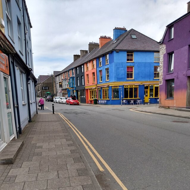
///manly.spite.fork. Near Llanberis, Gwynedd

Nearby Locations

Ceunant Bach

Related Wikis

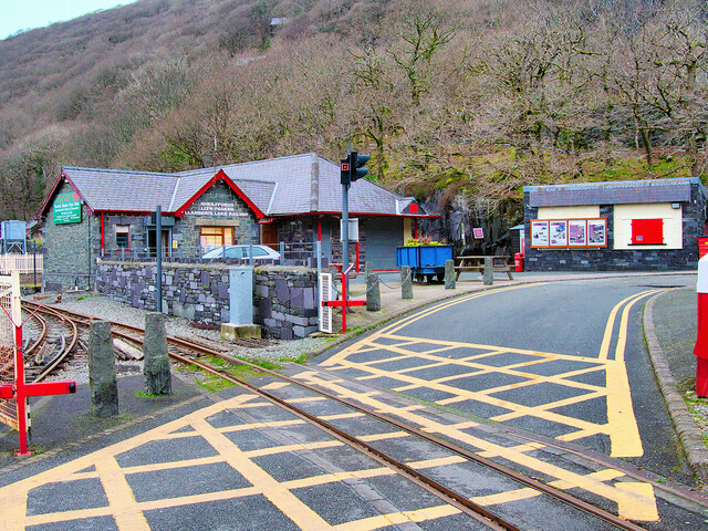
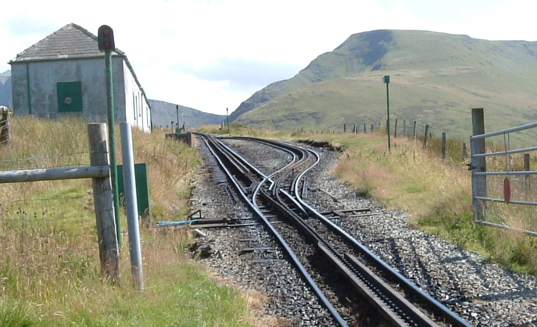
Waterfall railway station (Snowdon Mountain Railway)

Waterfall railway station was the first intermediate stop on the Snowdon Mountain Railway, located on the southern edge of Llanberis, Gwynedd, Wales....

Hebron railway station

/ Hebron railway station is an intermediate passing place and former halt on the Snowdon Mountain Railway, located near a long-standing chapel on the...

Llanberis railway station (Snowdon Mountain Railway)

Llanberis (SMR) railway station is the lower terminus of the Snowdon Mountain Railway, located in Llanberis, Gwynedd, Wales. The station houses the headquarters...

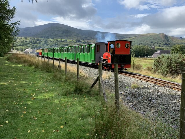
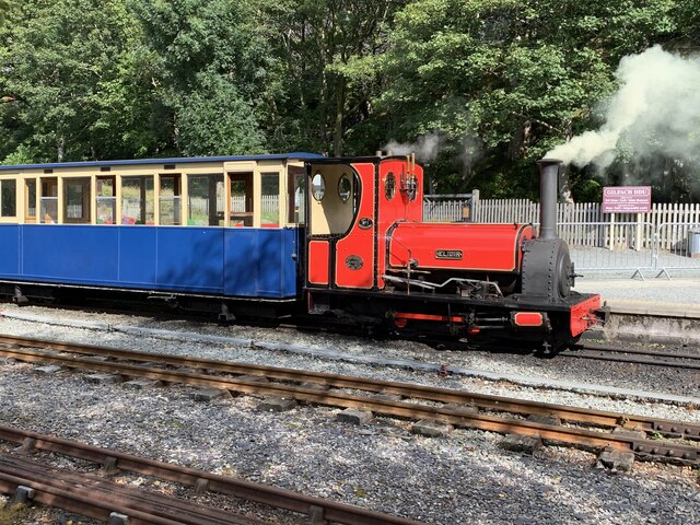
Llanberis railway station (Llanberis Lake Railway)

Llanberis (LLR) railway station is the southern terminus of the Llanberis Lake Railway (LLR), located in Llanberis, Gwynedd, Wales. The line and station...

Nearby Amenities

Located within 500m of 53.107827,-4.1260184
Source: npe
Lat/Long: 53.1061483/-4.1192218
Source: npe
Lat/Long: 53.106315/-4.1194422
Source: npe
Lat/Long: 53.110917/-4.1265447
Barrier: stile
Material: wood
Stile: ladder
Lat/Long: 53.1062234/-4.1294364
Barrier: stile
Material: wood
Note: ladder_stile
Source: gps
Stile: ladder
Lat/Long: 53.1087061/-4.1242175
Barrier: stile
Material: wood
Source: gps
Stile: stepover
Lat/Long: 53.1087545/-4.1242241
Cafe
Penceunant Isaf
Lat/Long: 53.1114821/-4.1243152
Rhaeadr Llanberis
Alt Name: Ceunant Mawr Waterfall
Waterway: waterfall
Lat/Long: 53.1117755/-4.1257747
Power: pole
Source: Bing
Lat/Long: 53.1090506/-4.1202138
Power: pole
Source: Bing
Lat/Long: 53.1087769/-4.1213885
Railway: crossing
Source: survey
Lat/Long: 53.1087218/-4.1242195
Power: pole
Source: Bing;survey
Lat/Long: 53.1100525/-4.1234715
Power: pole
Source: Bing
Lat/Long: 53.1091166/-4.1203345
Power: pole
Source: Bing
Lat/Long: 53.1077438/-4.1256858
Power: pole
Source: Bing;survey
Lat/Long: 53.1093066/-4.1237703
Power: pole
Source: Bing;survey
Lat/Long: 53.1081371/-4.1240645
Power: pole
Source: Bing
Lat/Long: 53.1085036/-4.1225774
Power: pole
Source: Bing
Lat/Long: 53.1098315/-4.1226947
Power: pole
Source: Bing
Lat/Long: 53.1096415/-4.1244435
Power: pole
Source: Bing
Lat/Long: 53.108822/-4.121595
Power: pole
Source: Bing;survey
Lat/Long: 53.1090152/-4.1231721
Power: pole
Source: Bing
Lat/Long: 53.108578/-4.1267989
Power: pole
Source: Bing
Lat/Long: 53.1089267/-4.1224238
Power: pole
Source: Bing;survey
Lat/Long: 53.1092213/-4.119436
Power: pole
Source: Bing;survey
Lat/Long: 53.1092873/-4.119672
Power: pole
Source: Bing;survey
Lat/Long: 53.1094065/-4.119106
Power: pole
Source: Bing
Lat/Long: 53.1081764/-4.1280806
Power: pole
Source: Bing
Lat/Long: 53.1084871/-4.1297328
Power: pole
Source: Bing
Lat/Long: 53.1087431/-4.1311571
Rhaeadr Llanberis
Tourism: viewpoint
Lat/Long: 53.1120536/-4.1256784
Railway: crossing
Lat/Long: 53.1122309/-4.1258785
Rhaeadr Llanberis
Alt Name: Ceunant Mawr Waterfall
Waterway: waterfall
Lat/Long: 53.1118758/-4.1258122
Grit Bin
Lat/Long: 53.1121694/-4.1265225
Grit Bin
Source: survey
Lat/Long: 53.1101206/-4.1214345
Grit Bin
Source: survey
Lat/Long: 53.1114676/-4.1245728
Grit Bin
Source: survey
Lat/Long: 53.1064569/-4.1198413
Power: pole
Lat/Long: 53.1099424/-4.125342
Material: wood
Power: pole
Lat/Long: 53.1102306/-4.1257551
Material: wood
Power: pole
Lat/Long: 53.110266/-4.1262003
Power: pole
Lat/Long: 53.1106833/-4.1240636
Power: pole
Lat/Long: 53.1109554/-4.1241602
Power: pole
Lat/Long: 53.1112983/-4.1242004
Power: pole
Lat/Long: 53.1115881/-4.1240985
Power: pole
Lat/Long: 53.1104052/-4.1238932
Power: pole
Lat/Long: 53.1103302/-4.1277975
Barrier: stile
Lat/Long: 53.1108082/-4.1301026
Ford: yes
Lat/Long: 53.1119867/-4.1265962
Barrier: kissing_gate
Lat/Long: 53.1122462/-4.1259081
Ford: yes
Lat/Long: 53.1111272/-4.1290427
Ford: yes
Lat/Long: 53.1092295/-4.1295711
Barrier: cattle_grid
Lat/Long: 53.1112586/-4.1271201
Defibrillator
Access: yes
Defibrillator Location: Penceunant Isaf Cafe Llanberis
Emergency: defibrillator
Opening Hours: 24/7
Lat/Long: 53.1114436/-4.1243656
The data included in this document is from www.openstreetmap.org. The data is made available under ODbL.

Have you been to Ceunant Bach?

Leave your review of Ceunant Bach below (or comments, questions and feedback).