Nant y Betws

Valley in Caernarfonshire

Wales

Nant y Betws

Snowdon Ranger Path/Welsh Highland Railway Line Near to the end of the Snowdon Ranger path, which takes you to the summit of Snowdon, the highest mountain in Wales. Here the path crosses the restored Welsh Highland Railway line, with Llyn Cwellyn in the distance.
Snowdon Ranger Path/Welsh Highland Railway Line Credit: Andrew Woodvine

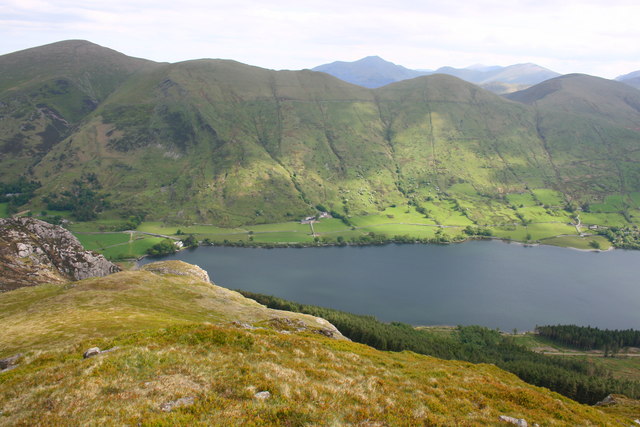
Nant y Betws is a picturesque valley located in the county of Caernarfonshire, Wales. Nestled in the heart of Snowdonia National Park, this valley offers breathtaking natural beauty and a tranquil setting for visitors to enjoy.

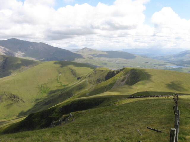
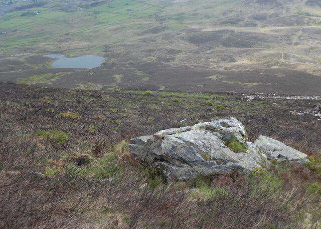
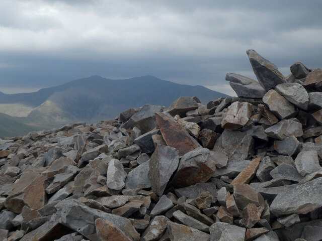
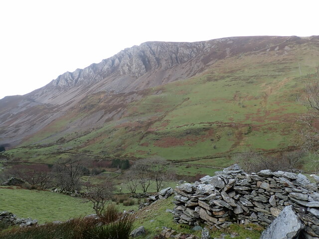
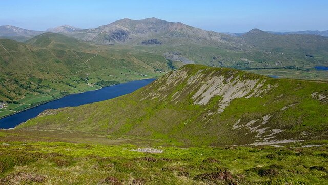
The valley is surrounded by majestic mountains, including the iconic Mount Snowdon, which provides a stunning backdrop to the area. The landscape is characterized by rolling hills, dense forests, and crystal-clear streams that flow through the valley. It is a haven for nature enthusiasts, with an abundance of wildlife and flora to explore.

Nant y Betws is also home to a number of walking trails and hiking routes, offering visitors the opportunity to immerse themselves in the stunning scenery. The valley is particularly popular with birdwatchers, as it attracts a wide variety of bird species, including buzzards, peregrine falcons, and red kites.

In addition to its natural beauty, Nant y Betws is also known for its rich history. The valley is dotted with historical sites, such as ancient burial chambers and standing stones, which provide insight into the area's past.

Visitors to Nant y Betws can enjoy a range of outdoor activities, including camping, fishing, and cycling. The valley is also a popular destination for photography and painting enthusiasts, who are drawn to its breathtaking vistas and ever-changing light.

Overall, Nant y Betws is a hidden gem in Caernarfonshire, offering visitors a chance to escape the hustle and bustle of everyday life and immerse themselves in the beauty of nature.

If you have any feedback on the listing, please let us know in the comments section below.

Nant y Betws Images

Images are sourced within 2km of 53.079283/-4.1633263 or Grid Reference SH5555. Thanks to Geograph Open Source API. All images are credited.

Snowdon Ranger Path/Welsh Highland Railway Line Near to the end of the Snowdon Ranger path, which takes you to the summit of Snowdon, the highest mountain in Wales. Here the path crosses the restored Welsh Highland Railway line, with Llyn Cwellyn in the distance.
Snowdon Ranger Path/Welsh Highland Railway Line
Near to the end of the Snowdon Ranger path, which takes you to the summit of Snowdon, the highest mountain in Wales. Here the path crosses the restored Welsh Highland Railway line, with Llyn Cwellyn in the distance.
Looking S from near the summit of Moel Eilio The summits of Snowdon and Y Garn on the skyline.
Looking S from near the summit of Moel Eilio
The summits of Snowdon and Y Garn on the skyline.
Welsh Highland Railway train near Betws Garmon Welsh Highland Railway Garratt locomotive No.K1 about to pass under the A4085 in Nant-y-Betws with a train from Caernarfon to Rhyd-Ddu, which was the terminus of the line at the time.
Welsh Highland Railway train near Betws Garmon
Welsh Highland Railway Garratt locomotive No.K1 about to pass under the A4085 in Nant-y-Betws with a train from Caernarfon to Rhyd-Ddu, which was the terminus of the line at the time.
Dog stopper on Foel Gron Thirty kilograms is a good weight for a flat-coated retriever (courtesy of my daughter, who had gone mountain biking elsewhere) if you don't want it to blow off the mountain in a gale, but is less convenient when there are umpteen stiles along the way and you are trying to stay one fence away from a big drop off into a deep cwm in poor visibility. The collie (our own) is less than half that weight and more likely to become airborne. The lack of view ahead and the path becoming increasingly vague once we were south of Moel Eilio also contributed to crossing more stiles like this one than were strictly necessary. I'd recommend this walk on a day when the reputed stunning views across to Snowdon are actually realisable and standing upright more readily achievable.
Dog stopper on Foel Gron
Thirty kilograms is a good weight for a flat-coated retriever (courtesy of my daughter, who had gone mountain biking elsewhere) if you don't want it to blow off the mountain in a gale, but is less convenient when there are umpteen stiles along the way and you are trying to stay one fence away from a big drop off into a deep cwm in poor visibility. The collie (our own) is less than half that weight and more likely to become airborne. The lack of view ahead and the path becoming increasingly vague once we were south of Moel Eilio also contributed to crossing more stiles like this one than were strictly necessary. I'd recommend this walk on a day when the reputed stunning views across to Snowdon are actually realisable and standing upright more readily achievable.
Track across the southern flank of Foel Rudd Looking north from Clogwyn on the Rhyd Ddu - Nantlle road.
Track across the southern flank of Foel Rudd
Looking north from Clogwyn on the Rhyd Ddu - Nantlle road.
Maen ar Fynydd Mawr / A boulder on The Elephant
Carnedd ar gopa Mynydd Mawr / Cairn on the summit of The Elephant Snowdon is in the background.
Carnedd ar gopa Mynydd Mawr / Cairn on the summit of The Elephant
Snowdon is in the background.
Walking by the track The path from the car park to the start of the Snowdon Ranger path runs beside the Welsh Highland Railway track.
Walking by the track
The path from the car park to the start of the Snowdon Ranger path runs beside the Welsh Highland Railway track.
Looking towards Llyn Cwellyn... ...with Mynydd Mawr (elev. 698 m) (left) and Craig Cwmbychan (elev. 592 m) (right) in the background.  The BGS interactive map tells us that they are part of the same unnamed igneous intrusion of microgranite (igneous bedrock formed between 485.4 and 443.8 million years ago during the Ordovician period).
Looking towards Llyn Cwellyn...
...with Mynydd Mawr (elev. 698 m) (left) and Craig Cwmbychan (elev. 592 m) (right) in the background. The BGS interactive map tells us that they are part of the same unnamed igneous intrusion of microgranite (igneous bedrock formed between 485.4 and 443.8 million years ago during the Ordovician period).
Ultramarathon! As I was plodding upwards at the start of the Snowdon Ranger path, hundreds of runners competing in an ultramarathon (<span class="nowrap"><a title="https://en.wikipedia.org/wiki/Ultramarathon" rel="nofollow ugc noopener" href="https://en.wikipedia.org/wiki/Ultramarathon">Link</a><img style="margin-left:2px;" alt="External link" title="External link - shift click to open in new window" src="https://s1.geograph.org.uk/img/external.png" width="10" height="10"/></span> ) were rapidly heading downwards...
Ultramarathon!
As I was plodding upwards at the start of the Snowdon Ranger path, hundreds of runners competing in an ultramarathon (LinkExternal link ) were rapidly heading downwards...
Majestic view of Llyn Cwellyn from the Snowdon Ranger path Note the ultramarathon runners to the left.
Majestic view of Llyn Cwellyn from the Snowdon Ranger path
Note the ultramarathon runners to the left.
Ultramarathon runners starting the zigzag section... ...on the Snowdown Ranger path descending to Llyn Cwellyn.
Ultramarathon runners starting the zigzag section...
...on the Snowdown Ranger path descending to Llyn Cwellyn.
Craig y Bera cliffs, Eryri The Craig y Bera cliffs above the Dyffryn Nantlle valley. Ref:PC200077.
Craig y Bera cliffs, Eryri
The Craig y Bera cliffs above the Dyffryn Nantlle valley. Ref:PC200077.
Foel Rudd and Llyn Cwellyn Descending Mynydd Mawr above the excellent Craig y Bera cliffs, Foel Rudd is a small rise on the eastern spur of the mountain. Llyn Cwellyn and the Snowdon group beyond.
Foel Rudd and Llyn Cwellyn
Descending Mynydd Mawr above the excellent Craig y Bera cliffs, Foel Rudd is a small rise on the eastern spur of the mountain. Llyn Cwellyn and the Snowdon group beyond.
View over Clogwynygarreg from Craig y Bera The lowland between Mynydd Mawr and the Nantlle ridge, extensively quarried on the western side in the past. Clogwynygarreg is a striking rocky hill and part of Llyn y Dywarchen is visible beyond.
View over Clogwynygarreg from Craig y Bera
The lowland between Mynydd Mawr and the Nantlle ridge, extensively quarried on the western side in the past. Clogwynygarreg is a striking rocky hill and part of Llyn y Dywarchen is visible beyond.
Snowdon Ranger Station Snowdon Ranger Station on the recently rebuilt Welsh Mountain Railway.  A simple station with just a small shelter to protect passengers from the Welsh climate.
Snowdon Ranger Station
Snowdon Ranger Station on the recently rebuilt Welsh Mountain Railway. A simple station with just a small shelter to protect passengers from the Welsh climate.
The Welsh Highland Railway The Welsh Highland Railway heading northwards towards Caernarvon, viewed here from Snowdon Ranger Station.
The Welsh Highland Railway
The Welsh Highland Railway heading northwards towards Caernarvon, viewed here from Snowdon Ranger Station.
The Welsh Mountain Railway, Snowdon Ranger The Welsh Mountain Railway approaching Snowdon Ranger Station from the north.
The Welsh Mountain Railway, Snowdon Ranger
The Welsh Mountain Railway approaching Snowdon Ranger Station from the north.
Show me another place!

Nant y Betws is located at Grid Ref: SH5555 (Lat: 53.079283, Lng: -4.1633263)

Unitary Authority: Gwynedd

Police Authority: North Wales

What 3 Words

///jousting.quail.soccer. Near Llanberis, Gwynedd

Nearby Locations

Nant y Betws

Related Wikis

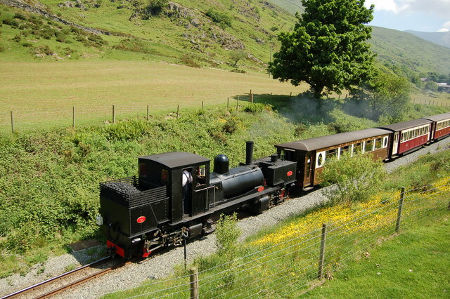
Plas-y-Nant railway station

Plas-y-Nant is an unstaffed halt on the narrow gauge Welsh Highland Railway. == History == A halt at Plas-y-Nant was first used in the 1920s but closed...
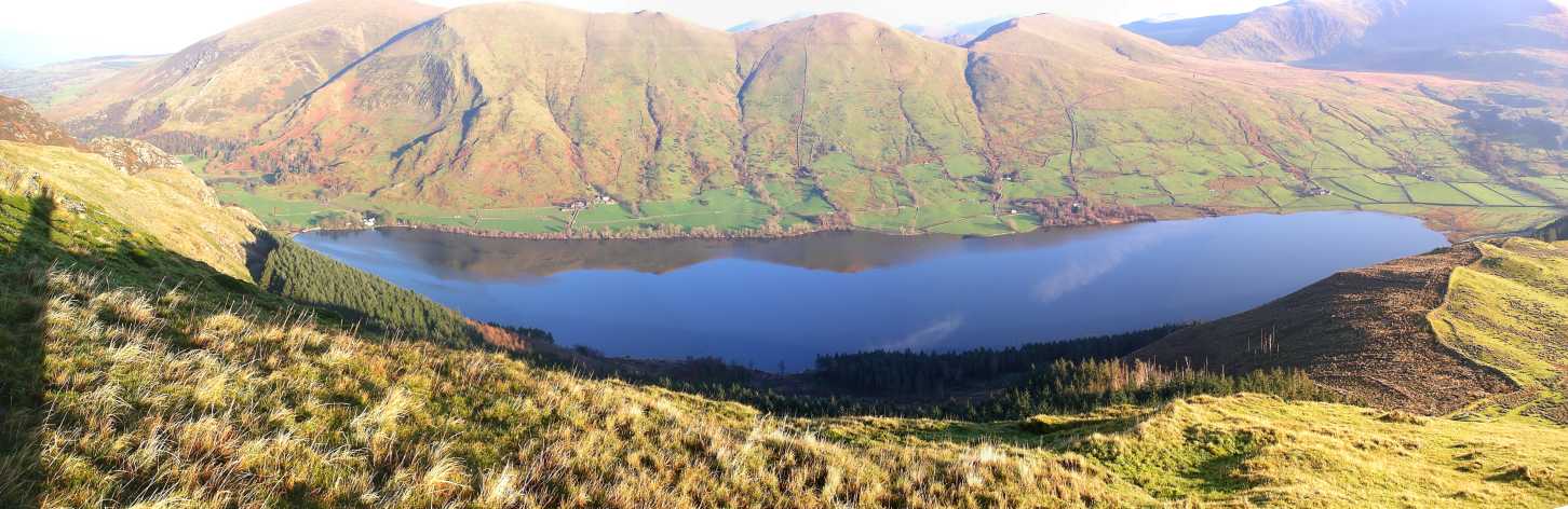
Llyn Cwellyn

Llyn Cwellyn (Llyn Quellyn in some antiquated texts) is a reservoir in North Wales which supplies drinking water to parts of Gwynedd and Anglesey. It lies...
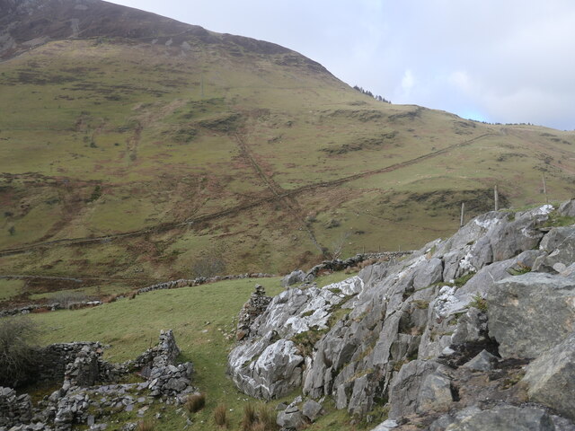
Foel Gron

Foel Gron is a peak on the Moel Eilio ridge of hills/mountains in Snowdonia, North Wales. This ridge is used as a hiker's route from Llanberis to the summit...

Snowdon Ranger railway station

Snowdon Ranger is a station on the narrow gauge Welsh Highland Railway, which was built in 1878 as the North Wales Narrow Gauge Railways Moel Tryfan Undertaking...

Mynydd Mawr

Mynydd Mawr (Welsh for big mountain) is a mountain in Snowdonia, North Wales, approximately 7 km (4.3 mi) west of Snowdon itself, overlooking Llyn Cwellyn...

Moel Eilio

Moel Eilio is a mountain in Snowdonia, North Wales, that is situated approximately 3 miles north-west of Snowdon itself. It has two subsidiary tops, Foel...

Betws Garmon

Betws Garmon is a community and small hamlet outside Waunfawr and near Beddgelert in Gwynedd, Wales. It has a population of 249.The summit of Snowdon...

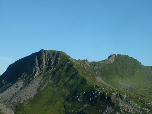
Y Garn (Nantlle Ridge)

Y Garn is a top of Mynydd Drws-y-Coed in Snowdonia, north Wales and is the easterly end of the Nantlle Ridge.It has steep north-facing cliffs, the summit...

Nearby Amenities

Located within 500m of 53.079283,-4.1633263
Railway: crossing
Ref: LC34.95
Lat/Long: 53.0779727/-4.1562261
Railway: crossing
Ref: LC34.95
Lat/Long: 53.0791224/-4.162403
Railway: crossing
Ref: LC34.79
Lat/Long: 53.0785679/-4.1584705
Railway: crossing
Ref: LC33.95
Lat/Long: 53.0811781/-4.1685937
Power: pole
Lat/Long: 53.0783551/-4.156359
Power: pole
Lat/Long: 53.0786794/-4.1577977
Power: pole
Lat/Long: 53.0792922/-4.1596116
Power: pole
Lat/Long: 53.0796618/-4.1607461
Power: pole
Lat/Long: 53.0791012/-4.1631224
Power: pole
Lat/Long: 53.0793924/-4.1618339
Power: pole
Lat/Long: 53.0786981/-4.162631
Power: pole
Lat/Long: 53.0782445/-4.1620863
Power: pole
Lat/Long: 53.0788004/-4.1643949
Power: pole
Lat/Long: 53.0830575/-4.1663617
Power: pole
Lat/Long: 53.0825728/-4.1669035
Power: pole
Lat/Long: 53.0821989/-4.1681716
Power: pole
Lat/Long: 53.0791844/-4.1658779
Power: pole
Lat/Long: 53.0803372/-4.1671839
Power: pole
Lat/Long: 53.0797837/-4.1665569
Power: pole
Lat/Long: 53.08223/-4.1673358
Power: pole
Lat/Long: 53.0814993/-4.166194
Power: pole
Lat/Long: 53.0818798/-4.1667901
Castell Cidwm
Historic: archaeological_site
Place: locality
Lat/Long: 53.0757102/-4.1657664
Ford: yes
Lat/Long: 53.0751975/-4.1646456
Ford: yes
Lat/Long: 53.0754252/-4.1623879
The data included in this document is from www.openstreetmap.org. The data is made available under ODbL.

Have you been to Nant y Betws?

Leave your review of Nant y Betws below (or comments, questions and feedback).