Black Gutter

Valley in Kirkcudbrightshire

Scotland

Black Gutter

Rig of the Gloon The Galloway hills are full of curiously named locations; Rig of the Gloon is one of them. It's effectively the south ridge of The Merrick but rather than descending directly from that summit, it branches away from the broad ridge connecting the main hill with Benyellary. It's seen from the path to The Merrick which begins in Glen Trool.
Rig of the Gloon Credit: Trevor Littlewood

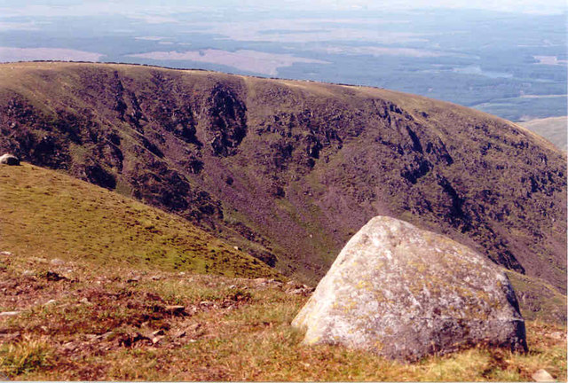
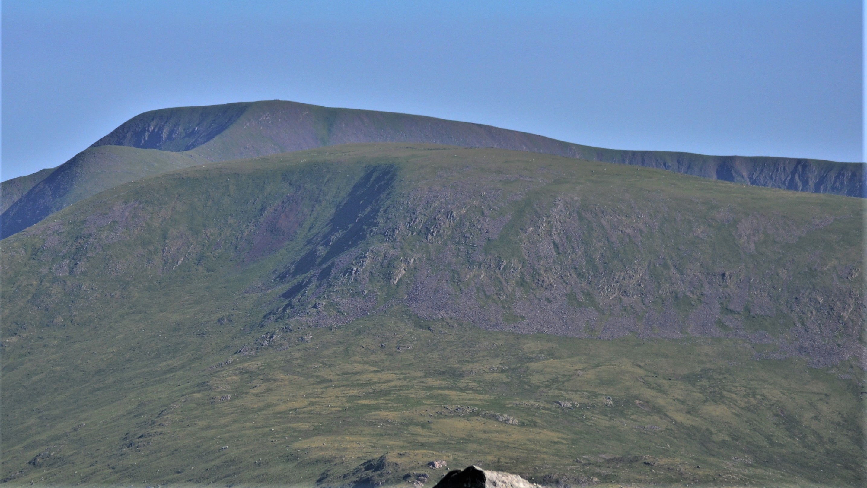
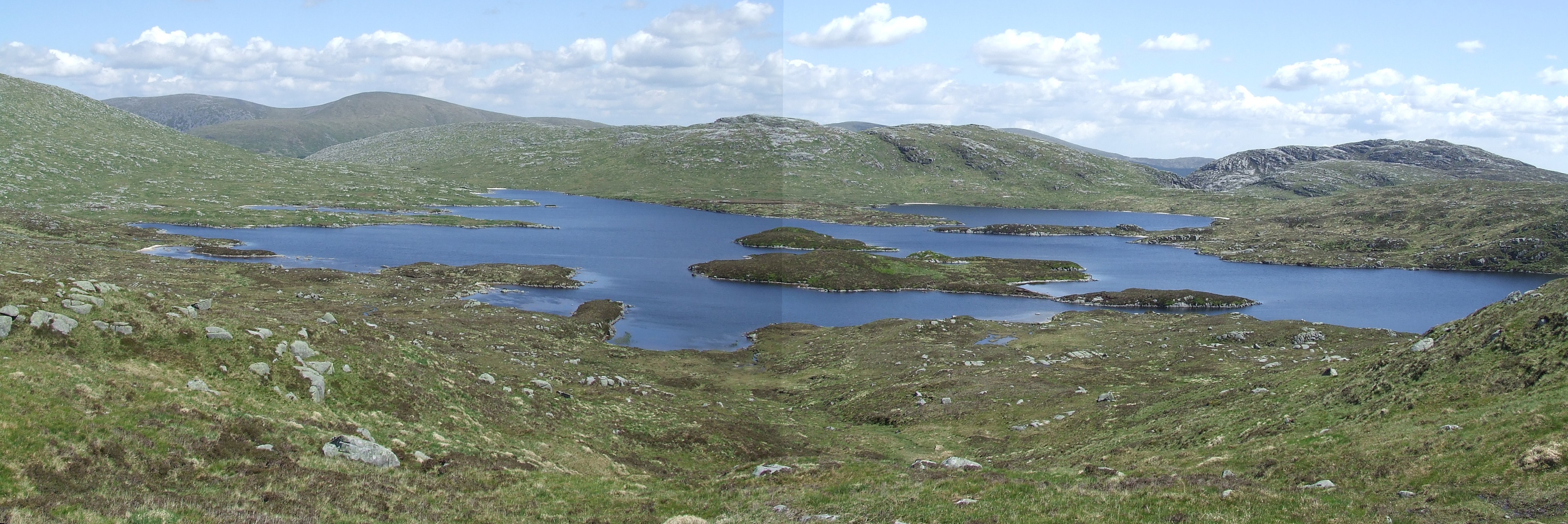
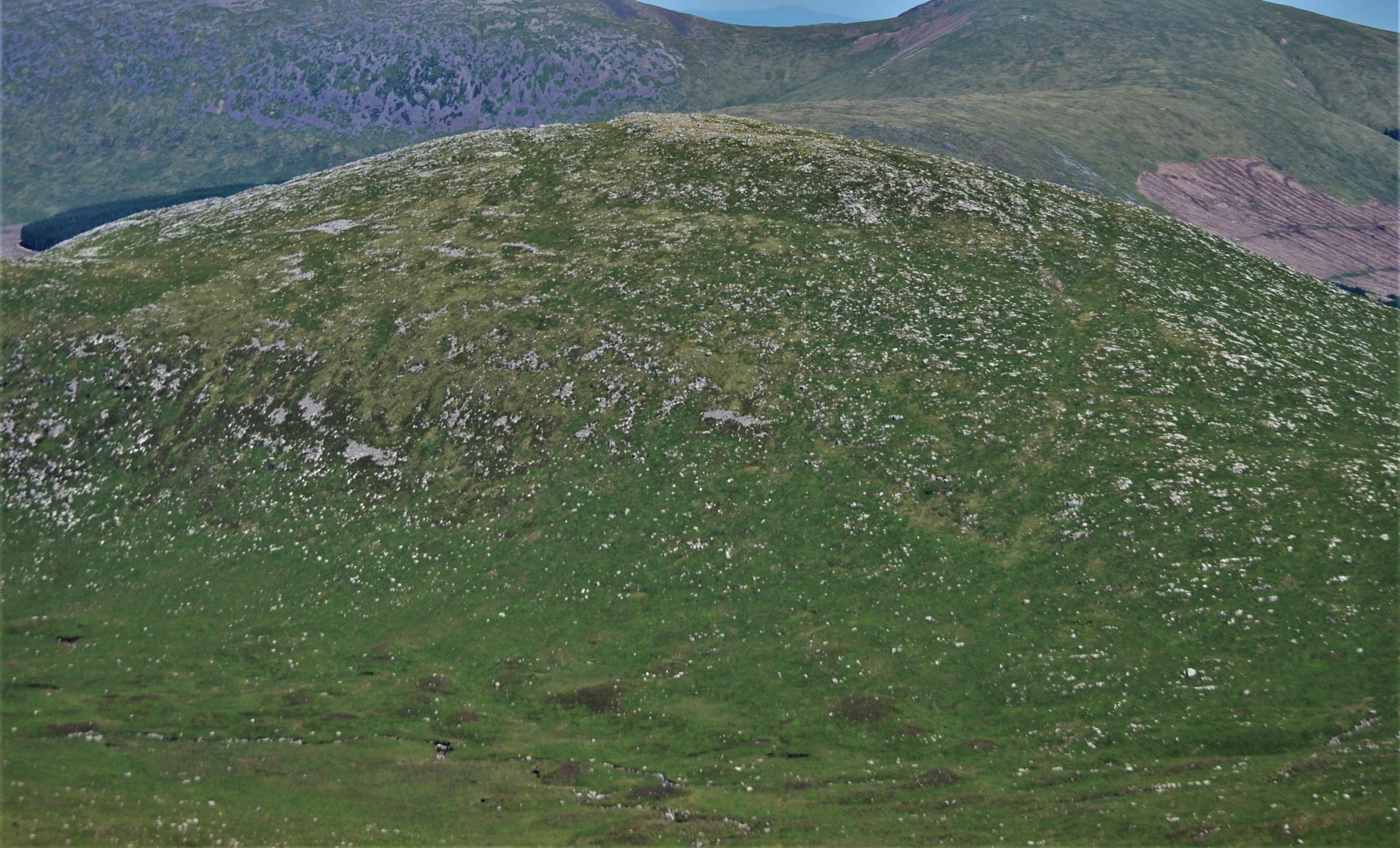
Black Gutter is a small valley located in Kirkcudbrightshire, Scotland. It is known for its picturesque views and tranquil atmosphere. The valley is surrounded by rolling hills and lush greenery, making it an ideal destination for nature lovers and outdoor enthusiasts.

Black Gutter is home to a variety of wildlife, including deer, birds, and other native species. The valley is a popular spot for birdwatching, with many rare and migratory birds making their home in the area. Visitors can also enjoy hiking and walking trails that wind through the valley, offering stunning views of the surrounding countryside.

The valley is named for the dark, peaty soil that lines its banks, giving it a unique and striking appearance. The Black Gutter stream runs through the valley, providing a peaceful soundtrack to the natural beauty of the area.

Overall, Black Gutter is a hidden gem in Kirkcudbrightshire, offering visitors a chance to escape the hustle and bustle of everyday life and immerse themselves in the beauty of the Scottish countryside.

If you have any feedback on the listing, please let us know in the comments section below.

Black Gutter Images

Images are sourced within 2km of 55.140107/-4.4871844 or Grid Reference NX4185. Thanks to Geograph Open Source API. All images are credited.

Rig of the Gloon The Galloway hills are full of curiously named locations; Rig of the Gloon is one of them. It's effectively the south ridge of The Merrick but rather than descending directly from that summit, it branches away from the broad ridge connecting the main hill with Benyellary. It's seen from the path to The Merrick which begins in Glen Trool.
Rig of the Gloon
The Galloway hills are full of curiously named locations; Rig of the Gloon is one of them. It's effectively the south ridge of The Merrick but rather than descending directly from that summit, it branches away from the broad ridge connecting the main hill with Benyellary. It's seen from the path to The Merrick which begins in Glen Trool.
Ruined dry stone wall along Neive of the Spit The Neive of the Spit is the name given to part of the ridge connecting Benyellary with The Merrick.
Craignaw is in the middle distance at the left side of the image and Loch Neldricken is at the centre of it.
Ruined dry stone wall along Neive of the Spit
The Neive of the Spit is the name given to part of the ridge connecting Benyellary with The Merrick. Craignaw is in the middle distance at the left side of the image and Loch Neldricken is at the centre of it.
Icy patches on Benyellary
Redstone Rig on Merrick Loch Enoch way below and the Rhinns of Kells on the skyline.
Redstone Rig on Merrick
Loch Enoch way below and the Rhinns of Kells on the skyline.
Benyellary From the Glentrool~Straiton road
Benyellary
From the Glentrool~Straiton road
Summit area of The Merrick A large collection of smaller rocks has been made and formed into some form of shelter at the mountain summit. There's also the trig point of course.
Summit area of The Merrick
A large collection of smaller rocks has been made and formed into some form of shelter at the mountain summit. There's also the trig point of course.
Minor rocks near summit of Benyellary The view from Benyellary towards Merrick from close to the summit cairn. The connecting ridge is named Neive of the Spit and the roughness below it is known as The Scars of Benyellary.
Minor rocks near summit of Benyellary
The view from Benyellary towards Merrick from close to the summit cairn. The connecting ridge is named Neive of the Spit and the roughness below it is known as The Scars of Benyellary.
Benyellary With view over Neive of the Spit to the Merrick.
Benyellary
With view over Neive of the Spit to the Merrick.
The Merrick With view to Benyellary.
The Merrick
With view to Benyellary.
Black Gairy
Black Gairy
Kirriereoch Hill From the Merrick.
Kirriereoch Hill
From the Merrick.
The Merrick Trig Point
The Gloon Burn viewed from Benyellary The Gloon Burn has just appeared through the cloud as viewed from a lunch stop on Benyellary.  The summit of Merrick is somewhere through the clouds to the top left; fortunately, it soon revealed itself.
The Gloon Burn viewed from Benyellary
The Gloon Burn has just appeared through the cloud as viewed from a lunch stop on Benyellary. The summit of Merrick is somewhere through the clouds to the top left; fortunately, it soon revealed itself.
Neive of the Spit from Benyellary Neive of the Spit is the broad ridge linking Benyellary with Merrick; the scree slope beneath is Scars of Benyellary.  Cloud cloaking the summit of Merrick is just about to lift.
Neive of the Spit from Benyellary
Neive of the Spit is the broad ridge linking Benyellary with Merrick; the scree slope beneath is Scars of Benyellary. Cloud cloaking the summit of Merrick is just about to lift.
On Neive of The Spit Cloud has lifted from the summit of Merrick, but incoming clouds threaten rain.
On Neive of The Spit
Cloud has lifted from the summit of Merrick, but incoming clouds threaten rain.
Benyellary from Broads of the Merrick Looking back to the initial summit prior to Merrick when the path from Glen Trool is followed.
Benyellary from Broads of the Merrick
Looking back to the initial summit prior to Merrick when the path from Glen Trool is followed.
Fang of the Merrick Viewed from south-west of the summit of Merrick, clouds cast shadows over the Fang of the Merrick.  The distinctive outline of Ailsa Craig can be noted on the horizon.
Fang of the Merrick
Viewed from south-west of the summit of Merrick, clouds cast shadows over the Fang of the Merrick. The distinctive outline of Ailsa Craig can be noted on the horizon.
Little Spear and the summit of Merrick The triangulation pillar at the summit of Merrick can be noted at the extreme right of shot, with Little Spear down to the left.  Between the two, Loch Doon can be noted in the distance.
Little Spear and the summit of Merrick
The triangulation pillar at the summit of Merrick can be noted at the extreme right of shot, with Little Spear down to the left. Between the two, Loch Doon can be noted in the distance.
Show me another place!

Black Gutter is located at Grid Ref: NX4185 (Lat: 55.140107, Lng: -4.4871844)

Unitary Authority: Dumfries and Galloway

Police Authority: Dumfries and Galloway

What 3 Words

///bulky.snacks.cultivation. Near Bellsbank, East Ayrshire

Nearby Locations

Black Gutter

Related Wikis

Merrick (Galloway)

The Merrick, or simply Merrick (Scottish Gaelic: A' Mhearag), is a mountain in the Range of the Awful Hand, a sub-range of the Galloway Hills range, part...

Kirriereoch Hill

Kirriereoch Hill is a hill in the Range of the Awful Hand, a sub-range of the Galloway Hills range, part of the Southern Uplands of Scotland. It lies on...

Loch Enoch

Loch Enoch is a multi-basin freshwater loch in Galloway, to the east of Merrick and south of Mullwharchar. The loch is situated in a granite basin and...

Mullwharchar

Mullwharchar is a hill in the Dungeon Hills, a sub-range of the Galloway Hills range, part of the Southern Uplands of Scotland. Mullwarchar is situated...

Have you been to Black Gutter?

Leave your review of Black Gutter below (or comments, questions and feedback).