Glen Arklet

Valley in Stirlingshire

Scotland

Glen Arklet

Glen Arklet - Minor road near Corriearklet Looking south-westward.
Glen Arklet - Minor road near Corriearklet Credit: Peter Wood

Glen Arklet is a picturesque valley located in Stirlingshire, Scotland. Situated in the southern Highlands, the valley is nestled between the larger and more well-known Loch Lomond and the Trossachs National Park. It stretches for approximately 7 miles, carving its way through the stunning landscape.

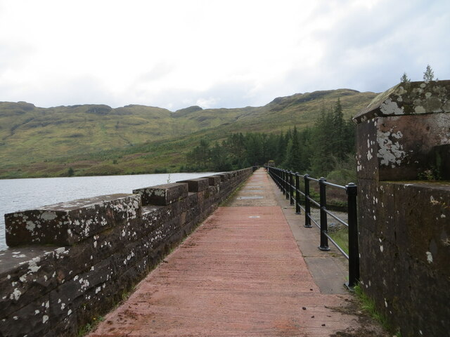
The valley is characterized by its rugged beauty, with rolling hills, steep slopes, and dense forests. The centerpiece of Glen Arklet is the Arklet Water, a charming river that flows through the valley, adding to its natural allure. The river is known for its crystal-clear waters, making it a popular spot for fishing and wildlife spotting.

The area is renowned for its rich biodiversity and serves as a habitat for various species of flora and fauna. Visitors to Glen Arklet may be lucky enough to spot red deer, otters, and a variety of birdlife, including golden eagles and ospreys.

For outdoor enthusiasts, Glen Arklet offers a plethora of activities. Hiking trails crisscross the valley, providing opportunities to explore the stunning scenery on foot. The valley is also a haven for mountain biking, with trails suitable for all skill levels. Additionally, the Arklet Water is a favorite spot for kayakers and canoeists, offering an exciting water adventure.

Glen Arklet is a hidden gem in Stirlingshire, offering visitors the chance to immerse themselves in the beauty of the Scottish Highlands. With its breathtaking landscapes and abundant outdoor activities, it is a must-visit destination for nature lovers and adventure seekers alike.

If you have any feedback on the listing, please let us know in the comments section below.

Glen Arklet Images

Images are sourced within 2km of 56.248203/-4.6531831 or Grid Reference NN3509. Thanks to Geograph Open Source API. All images are credited.

Glen Arklet - Minor road near Corriearklet Looking south-westward.
Glen Arklet - Minor road near Corriearklet
Looking south-westward.
Glen Arklet - The reservoir (Loch Arklet) dam Looking southward.
Glen Arklet - The reservoir (Loch Arklet) dam
Looking southward.
Glen Arklet - Minor road descending towards Inversnaid and Loch Lomond Looking south-westward.
Glen Arklet - Minor road descending towards Inversnaid and Loch Lomond
Looking south-westward.
Glen Arklet - Minor road climbing away from Inversnaid and Loch Lomond Looking north-eastward.
Glen Arklet - Minor road climbing away from Inversnaid and Loch Lomond
Looking north-eastward.
Minor road climbing out of Inversnaid Looking north-eastward. At this point the West Highland Way has been re-routed along the road and the orange barrier ahead is an access point to re-join the main route.
Minor road climbing out of Inversnaid
Looking north-eastward. At this point the West Highland Way has been re-routed along the road and the orange barrier ahead is an access point to re-join the main route.
Glen Arklet - Minor road beside Loch heading towards Inversnaid Looking westward.
Glen Arklet - Minor road beside Loch heading towards Inversnaid
Looking westward.
Ordnance Survey Flush Bracket 11785 This bracket can be found at the roadside entrance to Loch Arklet dam wall.
The recorded details give a height of 147.275 metres above sea level.
For more detail see : <span class="nowrap"><a title="https://www.bench-marks.org.uk/bm20970" rel="nofollow ugc noopener" href="https://www.bench-marks.org.uk/bm20970">Link</a><img style="margin-left:2px;" alt="External link" title="External link - shift click to open in new window" src="https://s1.geograph.org.uk/img/external.png" width="10" height="10"/></span>
Ordnance Survey Flush Bracket 11785
This bracket can be found at the roadside entrance to Loch Arklet dam wall. The recorded details give a height of 147.275 metres above sea level. For more detail see : LinkExternal link
Ordnance Survey Cut Mark with Rivet This mark and rived can be found on top of the parapet of the road bridge spanning Snaid Burn at Inversnaid.
The recorded details give a height of 115.889 metres above seal level.
For more detail see : <span class="nowrap"><a title="https://www.bench-marks.org.uk/bm179874" rel="nofollow ugc noopener" href="https://www.bench-marks.org.uk/bm179874">Link</a><img style="margin-left:2px;" alt="External link" title="External link - shift click to open in new window" src="https://s1.geograph.org.uk/img/external.png" width="10" height="10"/></span>
Ordnance Survey Cut Mark with Rivet
This mark and rived can be found on top of the parapet of the road bridge spanning Snaid Burn at Inversnaid. The recorded details give a height of 115.889 metres above seal level. For more detail see : LinkExternal link
Loch Arklet Dam
Loch Arklet Dam
Inversnaid upper falls Viewed from the footbridge that carries the West Highland Way.
Inversnaid upper falls
Viewed from the footbridge that carries the West Highland Way.
Loch Arklet Dam Built 1909-1914 as part of the Glasgow Corporation Waterworks System, Loch Arklet Dam is 350 yards in length and is a Category A listed building.
Loch Arklet Dam
Built 1909-1914 as part of the Glasgow Corporation Waterworks System, Loch Arklet Dam is 350 yards in length and is a Category A listed building.
The old military road The military road was built so that soldiers could move quickly during the time of troubles in the 1700's. It is only about a metre wide but was so well laid that it is still a good walkers' path and the modern road runs very close to it between Inversnaid and Trossachs Pier.
The old military road
The military road was built so that soldiers could move quickly during the time of troubles in the 1700's. It is only about a metre wide but was so well laid that it is still a good walkers' path and the modern road runs very close to it between Inversnaid and Trossachs Pier.
Garrison Farm Inversnaid This is an RSPB reserve with a good range of wild life if you are very lucky.
Garrison Farm Inversnaid
This is an RSPB reserve with a good range of wild life if you are very lucky.
Road out of Inversnaid Passing Inversnaid Lodge where the gradient eases a little.
Road out of Inversnaid
Passing Inversnaid Lodge where the gradient eases a little.
Former church, Inversnaid The building is now used as a bunkhouse, connected to the Inversnaid Hotel.
Former church, Inversnaid
The building is now used as a bunkhouse, connected to the Inversnaid Hotel.
Young woodland, Inversnaid Young trees on the north side of Cruachan.  The Arklet water is about to plunge out of its hanging valley down to Loch Lomond.
Young woodland, Inversnaid
Young trees on the north side of Cruachan. The Arklet water is about to plunge out of its hanging valley down to Loch Lomond.
Rough ground, Inversnaid Beneath Stob an Fhàinne.
Rough ground, Inversnaid
Beneath Stob an Fhàinne.
Loch Arklet A dark afternoon beside the reservoir. The loch was much enlarged by a dam to provide drinking water for Glasgow.
Loch Arklet
A dark afternoon beside the reservoir. The loch was much enlarged by a dam to provide drinking water for Glasgow.
Show me another place!

Glen Arklet is located at Grid Ref: NN3509 (Lat: 56.248203, Lng: -4.6531831)

Unitary Authority: Stirling

Police Authority: Forth Valley

What 3 Words

///micro.angle.declines. Near Tyndrum, Stirling

Nearby Locations

Glen Arklet

Related Wikis

Inversnaid

Inversnaid (Scottish Gaelic: Inbhir Snàthaid) is a small rural community on the east bank of Loch Lomond in Scotland, near the north end of the loch....

Loch Arklet

Loch Arklet is a freshwater loch and reservoir in the Trossachs area of the Scottish Highlands. It is within the historic county and registration county...

Inversnaid Falls

Inversnaid Falls is a waterfall of Scotland. == See also == Waterfalls of Scotland == References == Media related to Inversnaid Falls at Wikimedia Commons

Loch Lomond and The Trossachs National Park

Loch Lomond and The Trossachs National Park (Scottish Gaelic: Pàirc Nàiseanta Loch Laomainn is nan Tròisichean) is a national park in Scotland centred...

Nearby Amenities

Located within 500m of 56.248203,-4.6531831
Power: pole
Lat/Long: 56.2502393/-4.65994
Power: pole
Lat/Long: 56.2502892/-4.6584967
Power: pole
Lat/Long: 56.2503264/-4.6571956
Power: pole
Lat/Long: 56.2503497/-4.6563213
Power: pole
Lat/Long: 56.250388/-4.6550871
Power: pole
Lat/Long: 56.2504275/-4.6537359
Power: pole
Lat/Long: 56.2504659/-4.6525499
Power: pole
Lat/Long: 56.2503915/-4.6514119
Power: pole
Lat/Long: 56.2502916/-4.6498892
Power: pole
Lat/Long: 56.2502207/-4.6487575
Power: pole
Lat/Long: 56.250144/-4.6476217
Power: pole
Lat/Long: 56.2500615/-4.646237
Power: pole
Lat/Long: 56.2498395/-4.6554051
Power: pole
Lat/Long: 56.2494235/-4.6551248
The data included in this document is from www.openstreetmap.org. The data is made available under ODbL.

Have you been to Glen Arklet?

Leave your review of Glen Arklet below (or comments, questions and feedback).