Laleham

Settlement in Middlesex Spelthorne

England

Laleham

Houses on Laleham Road, Staines
Houses on Laleham Road, Staines Credit: JThomas

Laleham is a small village located in the county of Middlesex, England. Situated on the banks of the River Thames, it is part of the Spelthorne borough and lies approximately 16 miles southwest of central London. With its picturesque surroundings and historical charm, Laleham is often regarded as a hidden gem in the region.

The village dates back to the Roman era and has a rich history that can be traced through its architecture and landmarks. One notable attraction is the medieval St. Mary's Church, which stands as a testament to the village's past. Laleham is also home to several beautiful Georgian and Victorian houses, adding to its character and appeal.

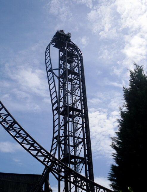
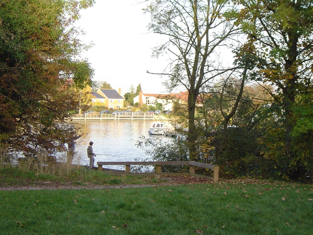
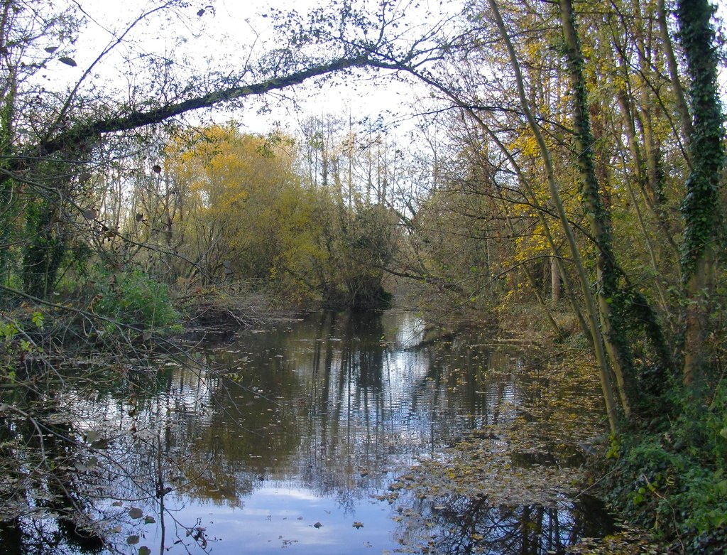
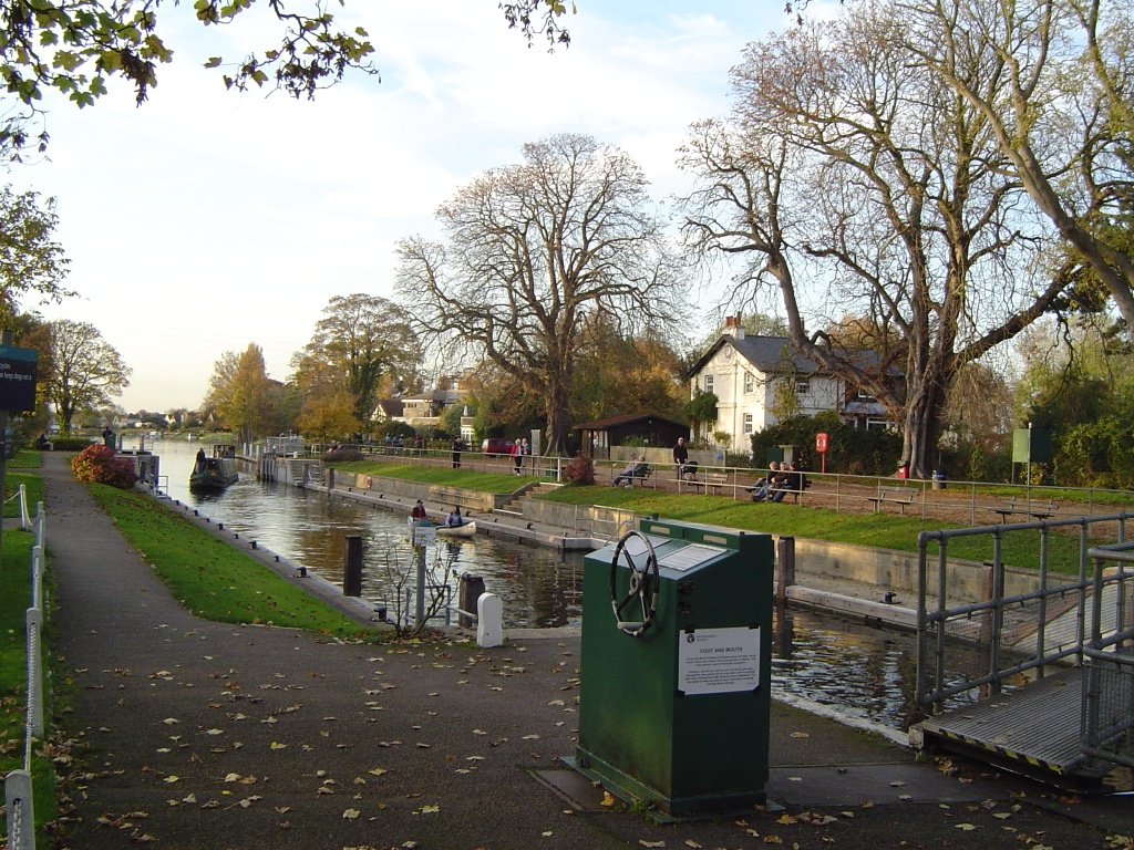
The village offers a peaceful and idyllic setting, with its well-maintained green spaces, including Laleham Park and Laleham Recreation Ground, providing recreational opportunities for residents and visitors alike. The River Thames plays a significant role in the village's charm, offering stunning views and opportunities for boating and fishing enthusiasts.

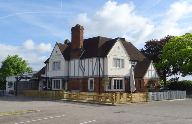
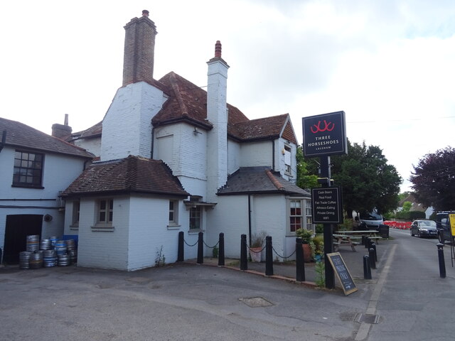
Laleham has a close-knit community, with a range of local amenities to cater to its residents' needs. These include a primary school, a village hall, a pub, and a few local shops. The village also benefits from excellent transport links, with easy access to the M3 and M25 motorways, as well as nearby railway stations.

Overall, Laleham is a quintessential English village that offers a peaceful and scenic retreat from the bustling city life. Its historical significance, natural beauty, and strong sense of community make it a desirable place to live or visit in Middlesex.

If you have any feedback on the listing, please let us know in the comments section below.

Laleham Images

Images are sourced within 2km of 51.408654/-0.485955 or Grid Reference TQ0568. Thanks to Geograph Open Source API. All images are credited.

Houses on Laleham Road, Staines
Laleham Road (B376), Staines
SAW - The Ride, Thorpe Park The Thorpe Park Resort is operated and owned by Merlin Entertainments. It first opened as an outdoor activity park in 1979, but is now one of the major theme parks in the UK.
SAW - The Ride, Thorpe Park
The Thorpe Park Resort is operated and owned by Merlin Entertainments. It first opened as an outdoor activity park in 1979, but is now one of the major theme parks in the UK.
Littleton Lane Looking north.
Littleton Lane
Looking north.
The Retreat, Staines On Staines Road.
The Retreat, Staines
On Staines Road.
Houses on Staines Road, Staines
Staines Road (B376)
Staines Road (B376)
Grazing off Staines Road, Laleham
Staines Road (B376), Laleham
The Three Horseshoes, Laleham On Shepperton Road.
See <a href="https://www.geograph.org.uk/photo/7298141">TQ0568 : Sign for the Three Horseshoes, Laleham</a> for sign.
The Three Horseshoes, Laleham
On Shepperton Road. See TQ0568 : Sign for the Three Horseshoes, Laleham for sign.
Sign for the Three Horseshoes, Laleham See <a href="https://www.geograph.org.uk/photo/7298140">TQ0568 : The Three Horseshoes, Laleham</a> for context.
Sign for the Three Horseshoes, Laleham
Shepperton Road (B376)
Park off Shepperton Road, Laleham
Houses on Laleham Road
B376 towards Shepperton
Houses on Fairview Drive, Shepperton
Fairview Drive, Shepperton
Houses on Rosewood Drive, Shepperton
Show me another place!

Laleham is located at Grid Ref: TQ0568 (Lat: 51.408654, Lng: -0.485955)

Administrative County: Surrey

District: Spelthorne

Police Authority: Surrey

What 3 Words

///pencil.tries.case. Near Chertsey, Surrey

Nearby Locations

Laleham

Related Wikis

Staines & Lammas (Middlesex) F.C.

Staines & Lammas (Middlesex) Football Club is a football club based in the town of Staines-upon-Thames. The club is affiliated to the Middlesex County...

Laleham

Laleham is a village on the River Thames, in the Borough of Spelthorne, about 17 mi (27 km) west of central London, England. Historically part of the...

Burway Rowing Club

Burway Rowing Club is a rowing club on the River Thames, based at Thameside, Laleham, Borough of Spelthorne, Surrey. == Club colours == The blade colours...

Sir William Perkins's School Boat Club

Sir William Perkins's School Boat Club (SWPSBC) is a rowing club based on the River Thames at Sir William Perkins's School Boathouse, Thameside, Laleham...

Penton Hook Island

Penton Hook Island is a mainly wooded former peninsula created into a series of three weir-divided islands in the River Thames in England, so created in...

River Ash, Surrey

The River Ash is a small, shallow river in Surrey, England. Its course of 10 kilometres (6.2 mi) is just outside Greater London. Work has been carried...

Penton Hook Lock

Penton Hook Lock is the sixth lowest lock of forty four on the non-tidal reaches of the River Thames in England. It faces an island which was until its...

Laleham Burway

Laleham Burway is a 1.6-square-kilometre (0.62 sq mi) tract of water-meadow and former water-meadow between the River Thames and Abbey River in the far...

Nearby Amenities

Located within 500m of 51.408654,-0.485955
Post Box
Operator: Royal Mail
Post Box Type: pillar
Ref: TW18 523
Royal Cypher: GR
Royal Cypher Wikidata: Q33102273
Lat/Long: 51.4084425/-0.489727
Pub
The Turks Head
Lat/Long: 51.4099453/-0.4888562
Bus Stop
Abbey Drive
Naptan AtcoCode: 40004402073A
Naptan Bearing: NW
Naptan CommonName: Abbey Drive
Naptan Indicator: Just Before
Naptan Landmark: Abbey Drive
Naptan NaptanCode: surdjwat
Naptan Street: Shepperton Road
Naptan Verified: no
Public Transport: platform
Source: naptan_import
Lat/Long: 51.4058159/-0.4845366
Bus Stop
Abbey Drive
Naptan AtcoCode: 40004402073B
Naptan Bearing: SE
Naptan CommonName: Abbey Drive
Naptan Indicator: Opp
Naptan Landmark: Abbey Drive
Naptan NaptanCode: surdjwaw
Naptan Street: Shepperton Road
Naptan Verified: no
Public Transport: platform
Source: naptan_import
Lat/Long: 51.4060437/-0.4848118
Bus Stop
All Saints Church
Naptan AtcoCode: 40004402074A
Naptan Bearing: NW
Naptan CommonName: All Saints Church
Naptan Indicator: Opp
Naptan Landmark: Church
Naptan NaptanCode: surdjwda
Naptan Street: Shepperton Road
Naptan Verified: no
Public Transport: platform
Source: naptan_import
Lat/Long: 51.4090126/-0.4901753
Bus Stop
All Saints Church
Naptan AtcoCode: 40004402074B
Naptan Bearing: SW
Naptan CommonName: All Saints Church
Naptan Indicator: O/s
Naptan Landmark: Church
Naptan NaptanCode: surdjwga
Naptan Street: The Broadway
Naptan Verified: no
Public Transport: platform
Source: naptan_import
Lat/Long: 51.4093852/-0.4898437
Crossing
Crossing Island: yes
Kerb: lowered
Sloped Curb: yes
Source: Surrey Air Survey; seen on journey
Lat/Long: 51.4097088/-0.4894461
Mini Roundabout
Direction: clockwise
Lat/Long: 51.4096351/-0.4893827
Crossing
Crossing Island: yes
Kerb: lowered
Sloped Curb: yes
Source: Surrey Air Survey
Lat/Long: 51.4086485/-0.4897543
Laleham
Place: village
Source: local_knowledge
Wikidata: Q984973
Lat/Long: 51.4089005/-0.4902658
Give Way
Lat/Long: 51.4081362/-0.4895457
Barrier: bollard
Lat/Long: 51.4091469/-0.4922317
Barrier: bollard
Lat/Long: 51.408417/-0.4924191
Crossing
Crossing: unmarked
Kerb: lowered
Sloped Curb: yes
Source: Surrey Air Survey
Lat/Long: 51.4099383/-0.4896157
Crossing
Crossing: unmarked
Kerb: lowered
Sloped Curb: yes
Source: Surrey Air Survey; seen on journey
Lat/Long: 51.4095139/-0.4896252
Crossing
Crossing Island: yes
Kerb: lowered
Sloped Curb: yes
Source: Surrey Air Survey
Lat/Long: 51.4081137/-0.4896025
Pub
Three Horseshoes, Laleham
Brand: Fuller's
Brand Wikidata: Q5253950
Website: https://www.3horseshoeslaleham.com/
Lat/Long: 51.4080468/-0.4892735
Shop: supermarket
Lat/Long: 51.4084737/-0.4897668
Room 14 Barber Shop
Addr Housename: 14B Shepperton Rd, Laleham, Staines TW18 1SD
Shop: hairdresser
Lat/Long: 51.4084233/-0.4897575
Barrier: height_restrictor
Maxheight: 2.1
Lat/Long: 51.4101728/-0.4872968
Waste Basket
Lat/Long: 51.4102835/-0.4872528
Bench
Backrest: yes
Material: wood
Seats: 4
Lat/Long: 51.4102424/-0.4871941
The data included in this document is from www.openstreetmap.org. The data is made available under ODbL.

Have you been to Laleham?

Leave your review of Laleham below (or comments, questions and feedback).