Brownhill Glen

Valley in Ayrshire

Scotland

Brownhill Glen

B707 Swindridge Muir The field on the left has just been planted with trees.
B707 Swindridge Muir Credit: Richard Webb

Brownhill Glen is a picturesque valley situated in Ayrshire, a county located in the southwestern part of Scotland. The glen is nestled amidst the rolling hills and lush green countryside, offering visitors a serene and tranquil escape from the hustle and bustle of daily life.

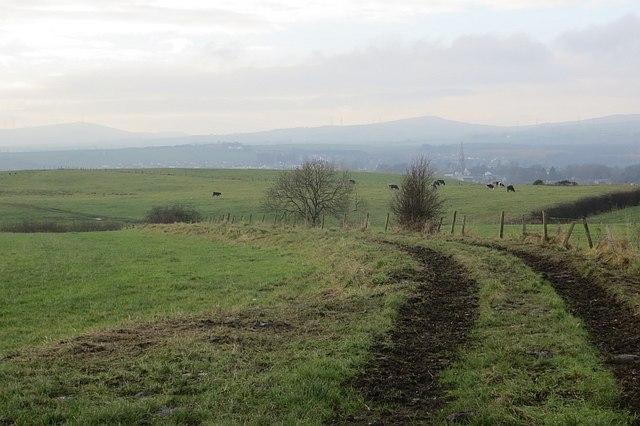
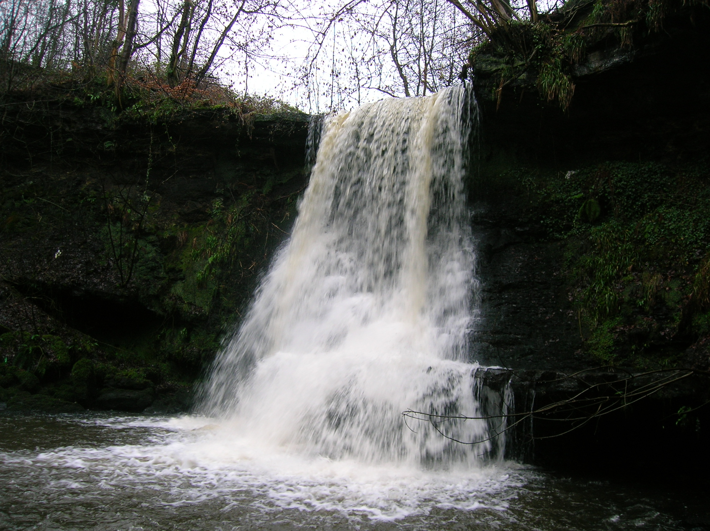
Stretching over a mile long, Brownhill Glen is characterized by its enchanting woodland and meandering river, creating a stunning natural landscape that attracts both locals and tourists alike. The glen is home to a diverse range of flora and fauna, with ancient trees providing shade and a rich habitat for various species of birds and small animals.

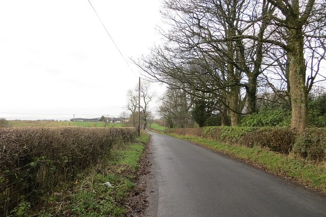
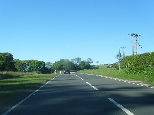
A popular attraction within the glen is the network of walking trails, which cater to all levels of fitness and provide opportunities for leisurely strolls or more challenging hikes. The trails wind their way through the glen, offering breathtaking views of the surrounding countryside and the meandering river below.

In addition to its natural beauty, Brownhill Glen also boasts historical significance. The glen was once home to a thriving mill industry during the 19th century, and remnants of this industrial heritage can still be seen today, adding a touch of nostalgia to the area.

Visitors to Brownhill Glen can enjoy a range of activities, from picnicking by the river to wildlife spotting and exploring the numerous trails. The glen provides a unique opportunity to immerse oneself in nature and experience the tranquility of the Scottish countryside.

If you have any feedback on the listing, please let us know in the comments section below.

Brownhill Glen Images

Images are sourced within 2km of 55.728017/-4.68529 or Grid Reference NS3151. Thanks to Geograph Open Source API. All images are credited.

B707 Swindridge Muir The field on the left has just been planted with trees.
B707 Swindridge Muir
The field on the left has just been planted with trees.
Green lane, Swindridgemuir A well surfaced farm road.
Green lane, Swindridgemuir
A well surfaced farm road.
November fields Seven years after <a href="https://www.geograph.org.uk/photo/616998">NS3049 : November Fields</a>. View towards Dalry.
November fields
Seven years after NS3049 : November Fields. View towards Dalry.
A737 northbound near Coalheugh Glen
Old Tree This old thorn bush in the middle of the pasture appears to be on its last legs.
Old Tree
This old thorn bush in the middle of the pasture appears to be on its last legs.
Grazing, near Highfield Unusual to find the watering trough well into the field.
Grazing, near Highfield
Unusual to find the watering trough well into the field.
Road leading to Highfield Farm
Grazing, near Highfield View towards the pharmaceutical works at Dalry.
Grazing, near Highfield
View towards the pharmaceutical works at Dalry.
In Kilbirnie Cemetery The access road runs alongside part of Zone E in this well-kept cemetery.
In Kilbirnie Cemetery
The access road runs alongside part of Zone E in this well-kept cemetery.
Kilbirnie Cemetery An elaborate mausoleum in the centre of the graveyard which is maintained by North Ayrshire Council.
Kilbirnie Cemetery
An elaborate mausoleum in the centre of the graveyard which is maintained by North Ayrshire Council.
Maulside from the air South of Glengarnock.
Maulside from the air
South of Glengarnock.
The A77 Dalry bypass from the air At The Den, between Dalry and Beith.
The A77 Dalry bypass from the air
At The Den, between Dalry and Beith.
The A737 Dalry bypass from the air Looking towards The Den, between Dalry and Beith.
The A737 Dalry bypass from the air
Looking towards The Den, between Dalry and Beith.
DM Beith from the air Looking east over Little Barkip.
DM Beith from the air
Looking east over Little Barkip.
Two bridges Railway footbridge at Glengarnock station in front of a second bridge carrying the B777 over the railway.
Two bridges
Railway footbridge at Glengarnock station in front of a second bridge carrying the B777 over the railway.
A737 passing Barcosh farm Power lines cross road ahead
A737 passing Barcosh farm
Power lines cross road ahead
The Graze restaurant just south of the Den A737 south
The Graze restaurant just south of the Den
A737 south
A737 passing Easter Highfield
Show me another place!

Brownhill Glen is located at Grid Ref: NS3151 (Lat: 55.728017, Lng: -4.68529)

Unitary Authority: North Ayrshire

Police Authority: Ayrshire

What 3 Words

///parties.ears.resonates. Near Kilbirnie, North Ayrshire

Nearby Locations

Brownhill Glen

Related Wikis

Garnock Valley

Garnock Valley is an area in the northern part of North Ayrshire, Scotland, adjoining Renfrewshire. The region includes the towns of Beith, Dalry, and...

Meikle Auchengree

Meikle Auchengree is a hamlet near Kilbirnie and Longbar in North Ayrshire, Scotland. == History == Meikle Auchengree is 500 metres (2+1⁄2 furlongs) east...

Barkip

Barkip, also known as The Den, is a hamlet in North Ayrshire, Scotland about three miles (five kilometres) southwest of Beith on the A737 road to Dalry...

Glengarnock

Glengarnock (Gaelic: Gleann Gairneig) is a small village in North Ayrshire that lies near the west coast of Scotland. It forms part of the Garnock Valley...

Nearby Amenities

Located within 500m of 55.728017,-4.68529
Power: tower
Lat/Long: 55.7288228/-4.6856086
Power: tower
Lat/Long: 55.7275158/-4.690726
Power: tower
Lat/Long: 55.7290781/-4.6814184
Brownhill Junction
Railway: junction
Source: NPE
Lat/Long: 55.7280368/-4.6927823
Description: Old Ironstone Pit
Historic: mine
Lat/Long: 55.7275888/-4.6922393
Power: pole
Lat/Long: 55.7255174/-4.6911797
Power: pole
Lat/Long: 55.7263245/-4.6904652
Power: pole
Lat/Long: 55.7270343/-4.6898194
Power: pole
Lat/Long: 55.7277569/-4.6891403
Power: pole
Lat/Long: 55.7281681/-4.6887819
Power: pole
Lat/Long: 55.7288039/-4.6882403
Power: pole
Lat/Long: 55.7294819/-4.6875674
Power: pole
Lat/Long: 55.7302479/-4.6868862
Power: pole
Lat/Long: 55.7310068/-4.6861925
Power: pole
Lat/Long: 55.7314526/-4.6857592
Power: pole
Lat/Long: 55.7317599/-4.6855238
Power: pole
Lat/Long: 55.7290514/-4.6866321
Power: pole
Lat/Long: 55.7286268/-4.6857217
Power: pole
Lat/Long: 55.7283511/-4.6850093
Power: pole
Lat/Long: 55.7280977/-4.6843468
Power: pole
Lat/Long: 55.7279206/-4.6838552
Power: pole
Lat/Long: 55.7277446/-4.6833844
Power: pole
Lat/Long: 55.7277047/-4.6832927
Power: pole
Lat/Long: 55.7303676/-4.6784931
Power: pole
Lat/Long: 55.7242005/-4.6811116
The data included in this document is from www.openstreetmap.org. The data is made available under ODbL.

Have you been to Brownhill Glen?

Leave your review of Brownhill Glen below (or comments, questions and feedback).