Srath a' Chrom-Uillt

Valley in Sutherland

Scotland

Srath a' Chrom-Uillt

Moorland near Loch Borralan Blanket bog and lochans south of Loch Borralan.
Moorland near Loch Borralan Credit: david glass

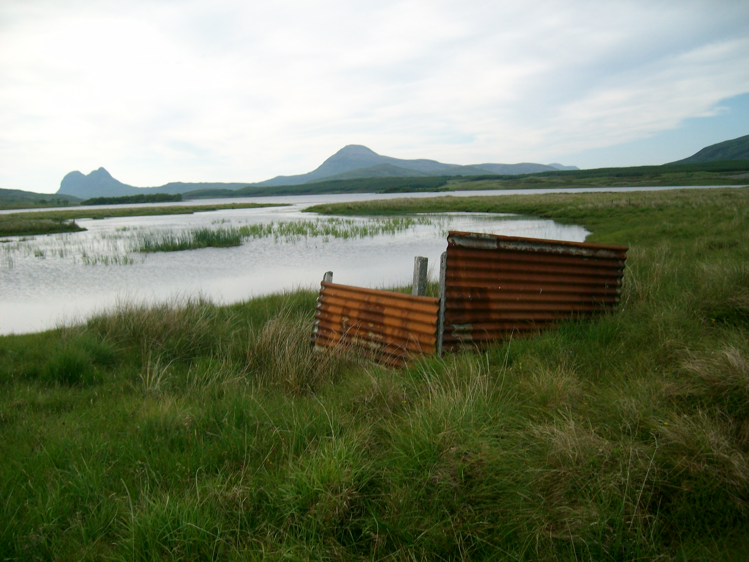
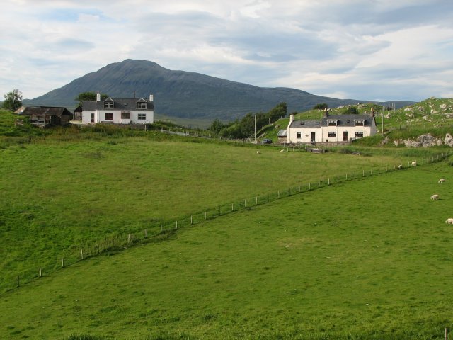
Srath a' Chrom-Uillt, also known as Sutherland Valley, is a picturesque region located in the northwestern part of Scotland. Nestled between the towering peaks of the Scottish Highlands, this valley is renowned for its breathtaking natural beauty and rich history.

The valley is characterized by its sweeping landscapes, with rolling hills, meandering rivers, and dense forests. It is a haven for outdoor enthusiasts, offering a wide range of activities such as hiking, fishing, and wildlife spotting. The area is home to various species of birds, mammals, and plant life, making it an ideal destination for nature lovers and photographers.

In addition to its natural wonders, Srath a' Chrom-Uillt boasts a fascinating history. The valley was once inhabited by the ancient Picts, and remnants of their stone circles and burial sites can still be found today. The area also played a significant role in the Highland Clearances, a period in Scottish history marked by the forced eviction of tenants from their ancestral lands.

Despite its tranquil and remote setting, the valley offers a few amenities for visitors. There are a handful of charming villages and towns nearby, providing accommodations, shops, and restaurants. The region is also known for its traditional Scottish hospitality, with locals welcoming tourists with warmth and friendliness.

Overall, Srath a' Chrom-Uillt, Sutherland Valley, is a captivating destination that showcases the raw beauty of the Scottish Highlands while offering a glimpse into its intriguing past. Whether seeking adventure or tranquility, visitors are sure to find solace in this enchanting valley.

If you have any feedback on the listing, please let us know in the comments section below.

Srath a' Chrom-Uillt Images

Images are sourced within 2km of 58.028619/-4.9619933 or Grid Reference NC2508. Thanks to Geograph Open Source API. All images are credited.

Moorland near Loch Borralan Blanket bog and lochans south of Loch Borralan.
Moorland near Loch Borralan
Blanket bog and lochans south of Loch Borralan.
Peatland Restoration Lodgepole Pines have been cut down and a drain has been dammed in an effort to restore blanket bog damaged by forestry.
Peatland Restoration
Lodgepole Pines have been cut down and a drain has been dammed in an effort to restore blanket bog damaged by forestry.
Cairn near Loch Urigill An ancient cairn.
Cairn near Loch Urigill
An ancient cairn.
Limestone Outcrop A limestone outcrop near Loch Urigill.
Limestone Outcrop
A limestone outcrop near Loch Urigill.
Cromalt Ruins The ruins of the farmstead of Cromalt.
Cromalt Ruins
The ruins of the farmstead of Cromalt.
Sheep Fank near Cromalt A large sheep fank with high walls.
Sheep Fank near Cromalt
A large sheep fank with high walls.
Drained Peatland Moorland near Cromalt, drained by closely spaced ditches.
Drained Peatland
Moorland near Cromalt, drained by closely spaced ditches.
Cromalt Hills Looking towards the ruins of Meoir on the slopes of Cnoc na Glas Choille.
Cromalt Hills
Looking towards the ruins of Meoir on the slopes of Cnoc na Glas Choille.
Burn in the Cromalt Hills A tributary of the Allt nam Meur.
Burn in the Cromalt Hills
A tributary of the Allt nam Meur.
The Banks of Loch Urigill You can see Cul Mor in the distance and the deer fence around the Ledmoore Estate
The Banks of Loch Urigill
You can see Cul Mor in the distance and the deer fence around the Ledmoore Estate
The point on Loch Urigill
Loch Urigill
Loch Urigill
Bothy Loch Urigill This shows one of two bothies on the south shore of Loch Urigill.  They are built on a stretch of firm ground between the marshy mouths of two burns which empty into the loch on either side of them.
Bothy Loch Urigill
This shows one of two bothies on the south shore of Loch Urigill. They are built on a stretch of firm ground between the marshy mouths of two burns which empty into the loch on either side of them.
Island in Loch Urigill The wooded island shows what the natural vegetation of the area might have looked like in the absence of deer and sheep.
Island in Loch Urigill
The wooded island shows what the natural vegetation of the area might have looked like in the absence of deer and sheep.
Burn mouth This is one of many small distributaries via which an unnamed burn drains into Loch Urigill through a marshy shore.
Burn mouth
This is one of many small distributaries via which an unnamed burn drains into Loch Urigill through a marshy shore.
Loch Urigill, Suilven behind The islands at the south east end of the loch are joined by a rocky reef when the water level is low.  Suilven is a scene stealer as always.
Loch Urigill, Suilven behind
The islands at the south east end of the loch are joined by a rocky reef when the water level is low. Suilven is a scene stealer as always.
Loch Urigill Loch Urigill seen from Meall Coire an Lochain. The conifer plantations between the loch and road are now very obvious.
Loch Urigill
Loch Urigill seen from Meall Coire an Lochain. The conifer plantations between the loch and road are now very obvious.
Native woodland  at Sithean na h-Ard-Lice
Native woodland at Sithean na h-Ard-Lice
Show me another place!

Srath a' Chrom-Uillt is located at Grid Ref: NC2508 (Lat: 58.028619, Lng: -4.9619933)

Unitary Authority: Highland

Police Authority: Highlands and Islands

What 3 Words

///palaces.yield.dating. Near Inchnadamph, Highland

Related Wikis

Loch Urigill

Loch Urigill is a freshwater loch near Elphin at the southern tip of the Assynt District in north-west Sutherland, Scotland.It's 2 miles from Elphin and...

Loch Borralan

Loch Borralan is a freshwater loch in the Assynt District of Sutherland in the Highland Council Area, northern Scotland.It is located adjacent to the A837...

Elphin, Highland

Elphin (Scottish Gaelic: Ailbhinn, which possibly derives from a combination of Norse and Gaelic fjell, "cliff" or "rock", and fionn, "bright") is a crofting...

Knockan Crag

Knockan Crag (Scottish Gaelic: Creag a' Chnocain, "crag of the small hill") lies within the North West Highlands Geopark in the Assynt region of Scotland...

Have you been to Srath a' Chrom-Uillt?

Leave your review of Srath a' Chrom-Uillt below (or comments, questions and feedback).