Coir' an Eich

Valley in Ross-shire

Scotland

Coir' an Eich

Road by Loch Fannich The access road to Fannich Lodge. This section is now smooth tarmac.
Road by Loch Fannich Credit: Craig Wallace

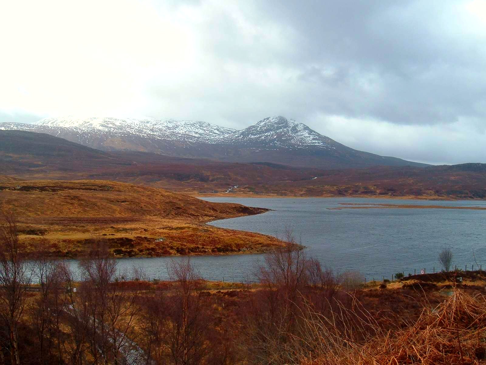
Coir' an Eich, located in Ross-shire, Scotland, is a picturesque valley renowned for its natural beauty and rich history. Nestled amidst the towering Highland mountains, this enchanting valley offers a tranquil escape from the hustle and bustle of modern life.

The name "Coir' an Eich" translates to "Valley of the Horse" in Gaelic, reflecting the area's long-standing association with horses. The valley is known for its lush greenery, meandering rivers, and cascading waterfalls that create a breathtaking landscape. It is a haven for outdoor enthusiasts, offering a multitude of activities such as hiking, horseback riding, and fishing.

The valley is also steeped in history, with several ancient sites and landmarks. The ruins of an old castle stand as a testament to the area's medieval past, while Neolithic standing stones provide a glimpse into its ancient origins. Visitors can explore these historical relics and immerse themselves in the rich cultural heritage of the region.

Coir' an Eich is home to a diverse range of wildlife, including deer, eagles, and otters, making it a paradise for nature lovers and wildlife enthusiasts. The valley's unique ecosystem supports a variety of flora and fauna, creating an idyllic habitat for many rare and endangered species.

In addition to its natural wonders, Coir' an Eich boasts charming villages and welcoming communities. Local pubs and restaurants offer traditional Scottish cuisine, allowing visitors to savor the flavors of the region.

Whether it's for outdoor adventures, historical exploration, or simply immersing oneself in nature's beauty, Coir' an Eich offers an unforgettable experience for all who venture into its stunning valley.

If you have any feedback on the listing, please let us know in the comments section below.

Coir' an Eich Images

Images are sourced within 2km of 57.652725/-4.9632964 or Grid Reference NH2366. Thanks to Geograph Open Source API. All images are credited.

Road by Loch Fannich The access road to Fannich Lodge. This section is now smooth tarmac.
Road by Loch Fannich
The access road to Fannich Lodge. This section is now smooth tarmac.
Bridge over the Alltan Caoruinn, by Loch Fannich The road to Fannich Lodge. Crossing a bridge over a small stream, then a cattle grid into a fenced area.
Bridge over the Alltan Caoruinn, by Loch Fannich
The road to Fannich Lodge. Crossing a bridge over a small stream, then a cattle grid into a fenced area.
Road to Fannich Lodge Smooth tarmac on this section of the road.
This is passing through a fenced area, some trees growing on both sides of the road.

A similar view a few months later. <a href="https://www.geograph.org.uk/photo/6898179">NH2265 : The Road to Fannich</a>
Road to Fannich Lodge
Smooth tarmac on this section of the road. This is passing through a fenced area, some trees growing on both sides of the road. A similar view a few months later. NH2265 : The Road to Fannich
Approach to Fannich Lodge The sign directs all walkers and cyclists up the track to the right, away from the buildings.
Approach to Fannich Lodge
The sign directs all walkers and cyclists up the track to the right, away from the buildings.
Road by Fannich Lodge The road crosses a cattle grid to enter a fenced area. A variety of trees growing within, including willow, birch and pine.
Road by Fannich Lodge
The road crosses a cattle grid to enter a fenced area. A variety of trees growing within, including willow, birch and pine.
Track by Fannich Lodge A wide gravel track, heading up the hill from the lodge. A view towards Coire Riabhach and Meall Gorm.
Track by Fannich Lodge
A wide gravel track, heading up the hill from the lodge. A view towards Coire Riabhach and Meall Gorm.
Track by Fannich Lodge A wide gravel track, heading up the hill from the lodge. A view towards Coire Riabhach and Meall Gorm.
Track by Fannich Lodge
A wide gravel track, heading up the hill from the lodge. A view towards Coire Riabhach and Meall Gorm.
Bridge over the Alltan Glas, by Loch Fannich The road to Fannich Lodge, crossing a bridge over a small stream.
Bridge over the Alltan Glas, by Loch Fannich
The road to Fannich Lodge, crossing a bridge over a small stream.
Alltan Glas, by Loch Fannich A small stream flowing down from An Coileachan towards Loch Fannich.
Alltan Glas, by Loch Fannich
A small stream flowing down from An Coileachan towards Loch Fannich.
Near the summit of An Coileachan
Summit cairn of An Coileachan
Fannich Lodge View from the summit of Meallan Odhar on the opposite side of Loch Fannich.
Fannich Lodge
View from the summit of Meallan Odhar on the opposite side of Loch Fannich.
Loch Fannich with Fannich mountains from north of Loch na Curra This view over Loch Fannich is from the north side of a moorland ridge to the north of Strath Bran. The mountains in view beyond the loch are of the Fannich group; a number of peaks are fully in view from Sgurr nan Each to Sgurr Mor.
Loch Fannich with Fannich mountains from north of Loch na Curra
This view over Loch Fannich is from the north side of a moorland ridge to the north of Strath Bran. The mountains in view beyond the loch are of the Fannich group; a number of peaks are fully in view from Sgurr nan Each to Sgurr Mor.
Access road to Fannich Lodge Along Loch Fannich, recently tarmacked.
Access road to Fannich Lodge
Along Loch Fannich, recently tarmacked.
Access road to Fannich Lodge Recently tarmacked, compare with <a href="https://www.geograph.org.uk/photo/274050">NH2465 : The track to Fannich Lodge</a>. The sign warns of deer on the road, it being fine to come here to kill deer with a gun but killing them with your 4x4 is just not the done thing.
Access road to Fannich Lodge
Recently tarmacked, compare with NH2465 : The track to Fannich Lodge. The sign warns of deer on the road, it being fine to come here to kill deer with a gun but killing them with your 4x4 is just not the done thing.
Approach to Fannich Lodge See <a href="https://www.geograph.org.uk/photo/274068">NH2265 : Approach to Fannich Lodge</a>, since when the track has been surfaced.
Approach to Fannich Lodge
See NH2265 : Approach to Fannich Lodge, since when the track has been surfaced.
Track above Fannich Lodge Good access to the hills from the lodge, which is easily reachable by bike.
Track above Fannich Lodge
Good access to the hills from the lodge, which is easily reachable by bike.
Plantation above Fannich Lodge With Loch Fannich behind.
Plantation above Fannich Lodge
With Loch Fannich behind.
Show me another place!

Coir' an Eich is located at Grid Ref: NH2366 (Lat: 57.652725, Lng: -4.9632964)

Unitary Authority: Highland

Police Authority: Highlands and Islands

What 3 Words

///blink.madness.defend. Near Achnasheen, Highland

Nearby Locations

Coir' an Eich

Related Wikis

Loch Fannich

Loch Fannich is a remote loch in Ross-shire, in Scotland. The loch is located 19 kilometres (12 mi) west of Strathpeffer. == Etymology == The name Fannich...

Ross and Cromarty

Ross and Cromarty (Scottish Gaelic: Ros agus Cromba), also referred to as Ross-shire and Cromartyshire, is a variously defined area in the Highlands and...

Achanalt

Achanalt (Gaelic: Achadh nan Allt) is a railway halt in Strath Bran, Ross and Cromarty, in the Scottish council area of Highland. It is served by a railway...

Achanalt railway station

Achanalt railway station is a geographically remote railway station on the Kyle of Lochalsh Line, serving the village of Achanalt in the north of Scotland...

Nearby Amenities

Located within 500m of 57.652725,-4.9632964
Barrier: cattle_grid
Lat/Long: 57.6484645/-4.9655229
The data included in this document is from www.openstreetmap.org. The data is made available under ODbL.

Have you been to Coir' an Eich?

Leave your review of Coir' an Eich below (or comments, questions and feedback).