Ballochhillie Glen

Valley in Ayrshire

Scotland

Ballochhillie Glen

Old sewage outfall pipe, Turnberry Old sewage outfall pipe, Turnberry.
Old sewage outfall pipe, Turnberry Credit: Colin Kinnear

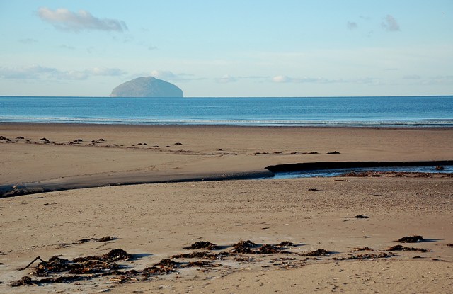
Ballochhillie Glen is a picturesque valley located in Ayrshire, Scotland. Situated near the village of Dalrymple, this glen is known for its stunning natural beauty and rich biodiversity. The glen spans over a considerable area, offering visitors a tranquil and serene environment to explore.

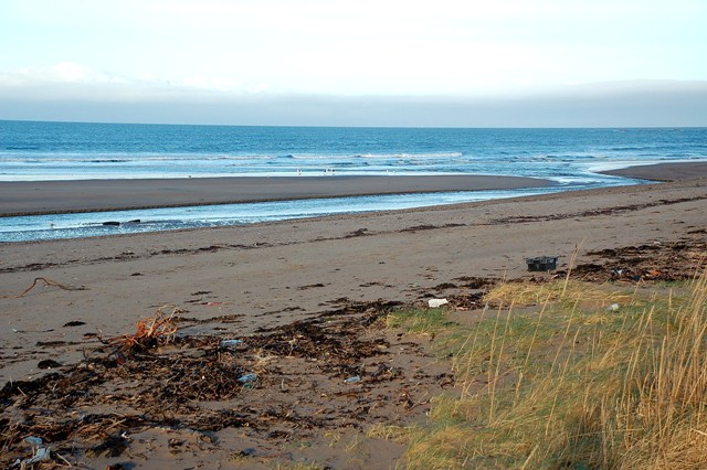
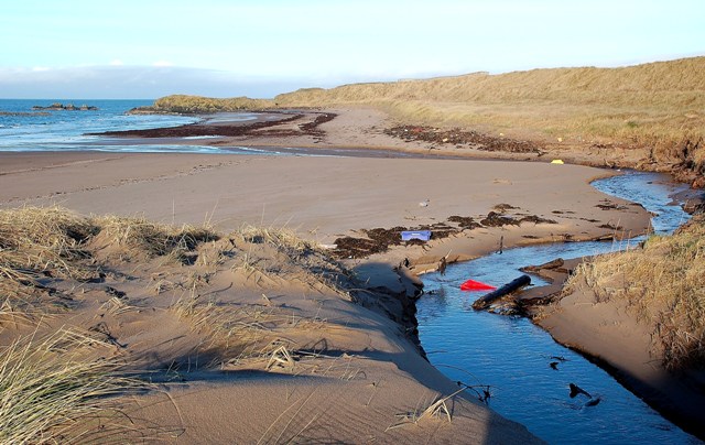
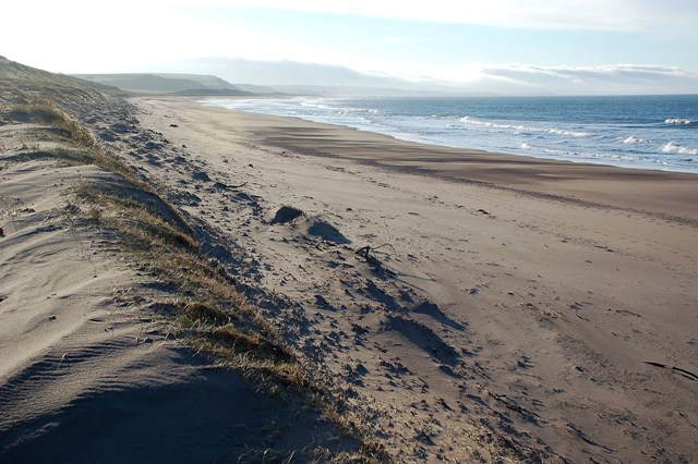
The glen is characterized by its rolling hills, dense woodland, and meandering streams. It is home to a diverse range of flora and fauna, making it a popular spot for nature enthusiasts and wildlife watchers. Visitors can expect to encounter a variety of bird species, including woodpeckers, owls, and various waterfowl near the streams.

The glen is also home to several walking trails, allowing visitors to fully immerse themselves in the beauty of the surroundings. The trails wind through the woodland, offering breathtaking views of the valley and its surrounding hills. These paths are well-maintained and suitable for both casual strolls and more adventurous hikes.

Ballochhillie Glen is also steeped in history. There are remnants of ancient settlements and burial sites, adding an element of mystery and intrigue to the area. This historical significance adds another layer of interest to the glen, attracting history buffs and archaeology enthusiasts.

Overall, Ballochhillie Glen is a hidden gem in Ayrshire, offering visitors a chance to escape the hustle and bustle of everyday life and reconnect with nature. Its stunning landscapes, diverse wildlife, and rich history make it a must-visit destination for anyone seeking tranquility and natural beauty.

If you have any feedback on the listing, please let us know in the comments section below.

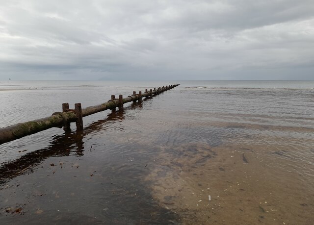
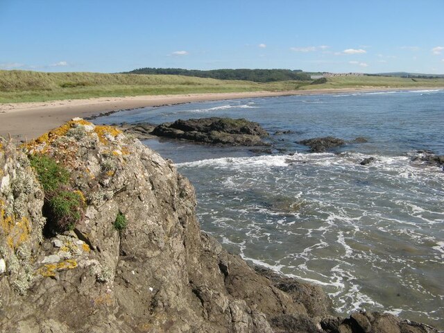
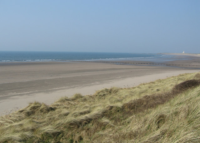
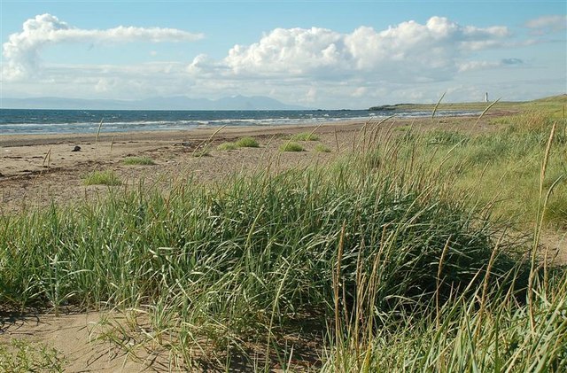
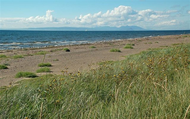
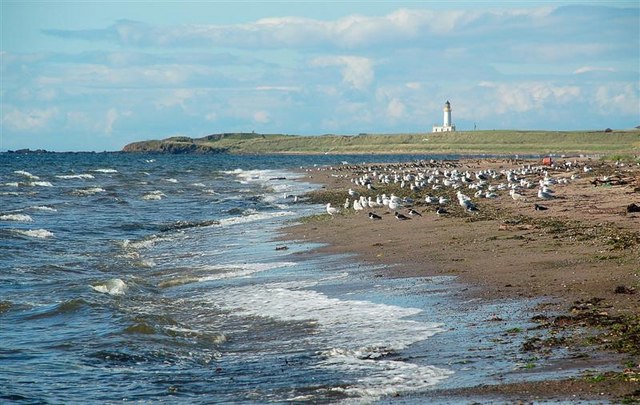
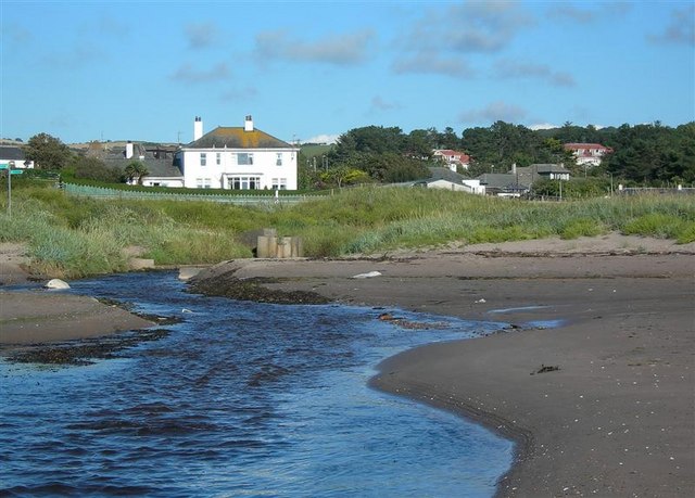
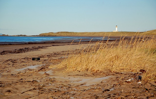
Ballochhillie Glen Images

Images are sourced within 2km of 55.313696/-4.8124052 or Grid Reference NS2105. Thanks to Geograph Open Source API. All images are credited.

Old sewage outfall pipe, Turnberry Old sewage outfall pipe, Turnberry.
Old sewage outfall pipe, Turnberry
Old sewage outfall pipe, Turnberry.
Turnberry Bay The wide sweep of the fine bay with its dunes which drop down to admit a small burn to drain through to the sea.
Turnberry Bay
The wide sweep of the fine bay with its dunes which drop down to admit a small burn to drain through to the sea.
Turnberry Dunes Turnberry lighthouse in the distance. Milton Burn outflow in middle distance.
Turnberry Dunes
Turnberry lighthouse in the distance. Milton Burn outflow in middle distance.
A First Look At Turnberry Bay The Explorer map puts the camera position for this view just inside the square.  It's the first view that you see of the northern end of Turnberry Bay, coming down the Milton Burn track.
A First Look At Turnberry Bay
The Explorer map puts the camera position for this view just inside the square. It's the first view that you see of the northern end of Turnberry Bay, coming down the Milton Burn track.
Turnberry Bay View Turnberry Bay viewed from the start of the dunes, looking out towards the island of Arran on a fine August afternoon.
Turnberry Bay View
Turnberry Bay viewed from the start of the dunes, looking out towards the island of Arran on a fine August afternoon.
High Tide A mixed group of gulls and waders on Turnberry beach, shortly after high tide. I didn't go any closer, to avoid disturbance.  Turnberry lighthouse, in <a href="https://www.geograph.org.uk/gridref/NS1907">NS1907</a>, is visible in the background.
High Tide
A mixed group of gulls and waders on Turnberry beach, shortly after high tide. I didn't go any closer, to avoid disturbance. Turnberry lighthouse, in NS1907, is visible in the background.
Milton Burn Mouth Milton Burn enters the Firth of Clyde here in a fast-flowing channel.  Walkers on the Ayrshire Coastal Path can cross over safely on a concrete footbridge, on the left in the middle distance of this shot. It's shown in <a href="https://www.geograph.org.uk/photo/907804">NS2005 : On The Ayrshire Coastal Path</a> along with a warning about the bridge being washed away. There's a better crossing a little further upstream.
Milton Burn Mouth
Milton Burn enters the Firth of Clyde here in a fast-flowing channel. Walkers on the Ayrshire Coastal Path can cross over safely on a concrete footbridge, on the left in the middle distance of this shot. It's shown in NS2005 : On The Ayrshire Coastal Path along with a warning about the bridge being washed away. There's a better crossing a little further upstream.
A Winter View Turnberry Bay, viewed on a frosty December morning.  For a summer view, see <a href="https://www.geograph.org.uk/photo/912498">NS1905 : A First Look At Turnberry Bay</a>.
A Winter View
Turnberry Bay, viewed on a frosty December morning. For a summer view, see NS1905 : A First Look At Turnberry Bay.
Turnberry Beach Viewed where Milton Burn crosses the beach, with Ailsa Craig in the background, on a frosty December morning.
Turnberry Beach
Viewed where Milton Burn crosses the beach, with Ailsa Craig in the background, on a frosty December morning.
Milton Burn At Turnberry - Relocated The course of Milton Burn across Turnberry Beach has moved in response to sea and weather conditions.  It used to flow almost straight out from the land but now flows along the beach to the north before reaching the sea.
Milton Burn At Turnberry - Relocated
The course of Milton Burn across Turnberry Beach has moved in response to sea and weather conditions. It used to flow almost straight out from the land but now flows along the beach to the north before reaching the sea.
Wilson's Burn at Turnberry Bay This small burn flows from the golf course into Turnberry Bay.
Wilson's Burn at Turnberry Bay
This small burn flows from the golf course into Turnberry Bay.
Turnberry Bay View Looking southwards from the edge of the dune system at Turnberry Bay.  The bank of cloud in the far distance is hiding the hills inland from Girvan.
Turnberry Bay View
Looking southwards from the edge of the dune system at Turnberry Bay. The bank of cloud in the far distance is hiding the hills inland from Girvan.
Old sewage outfall pipe, Turnberry On the extreme left, the warning beacon on Brest Rocks (marked on the OS 50,000 mapping but, strangely, not on the 25,000 version).
Old sewage outfall pipe, Turnberry
On the extreme left, the warning beacon on Brest Rocks (marked on the OS 50,000 mapping but, strangely, not on the 25,000 version).
The beach at Turnberry The lighthouse just visible in the (hazy) distance.
The beach at Turnberry
The lighthouse just visible in the (hazy) distance.
Building down from Balkenna Bridge This building seems to be associated with what looks like a pumping station.
Building down from Balkenna Bridge
This building seems to be associated with what looks like a pumping station.
Turnberry Bay The start of Turnberry Bay, with the famous hotel in the background. Viewed from Turnberry Point on a bright but chilly February afternoon.
Turnberry Bay
The start of Turnberry Bay, with the famous hotel in the background. Viewed from Turnberry Point on a bright but chilly February afternoon.
A Winter Walk On Turnberry Shore Glorious winter sunshine in Turnberry Bay with the snow-covered island of Arran in the background.
A Winter Walk On Turnberry Shore
Glorious winter sunshine in Turnberry Bay with the snow-covered island of Arran in the background.
Turnberry Shore A beautiful sandy shore runs northwards towards Turnberry Point with its lighthouse.
Turnberry Shore
A beautiful sandy shore runs northwards towards Turnberry Point with its lighthouse.
Show me another place!

Ballochhillie Glen is located at Grid Ref: NS2105 (Lat: 55.313696, Lng: -4.8124052)

Unitary Authority: South Ayrshire

Police Authority: Ayrshire

What 3 Words

///yummy.vocal.flukes. Near Girvan, South Ayrshire

Related Wikis

Turnberry railway station

Turnberry railway station was a railway station serving the Turnberry Golf Course and its associated hotel, South Ayrshire, Scotland. The station was part...

1986 Open Championship

The 1986 Open Championship was a men's major golf championship and the 115th Open Championship, held from 17 to 20 July at Turnberry Golf Resort, Scotland...

2002 Women's British Open

The 2002 Women's British Open was held 8–11 August at the Ailsa Course at Turnberry Golf Club in South Ayrshire, Scotland. It was the 26th edition of the...

1977 Open Championship

The 1977 Open Championship was the 106th Open Championship, held 6–9 July on the Ailsa Course at Turnberry, Scotland. Tom Watson won the second of his...

Nearby Amenities

Located within 500m of 55.313696,-4.8124052
Parking
Lat/Long: 55.3144188/-4.8132676
Place: farm
Lat/Long: 55.3100908/-4.8098935
Power: pole
Lat/Long: 55.315451/-4.8191544
Power: pole
Lat/Long: 55.3156204/-4.8181272
Power: pole
Lat/Long: 55.3161012/-4.8171106
Power: pole
Lat/Long: 55.3165469/-4.8160994
Power: pole
Lat/Long: 55.3169834/-4.8151445
Power: pole
Lat/Long: 55.3174688/-4.8140663
Power: pole
Lat/Long: 55.3179175/-4.8130336
Power: pole
Lat/Long: 55.3103237/-4.815681
Power: pole
Lat/Long: 55.3109465/-4.8166171
Power: pole
Lat/Long: 55.3113969/-4.8172393
Power: pole
Lat/Long: 55.311925/-4.8180413
Power: pole
Lat/Long: 55.3124455/-4.8188165
Power: pole
Lat/Long: 55.3130347/-4.8196936
Power: pole
Lat/Long: 55.3103381/-4.8123933
Power: pole
Lat/Long: 55.3103959/-4.8114844
Power: pole
Lat/Long: 55.3105007/-4.8105306
Power: pole
Lat/Long: 55.3107049/-4.8093313
Power: pole
Lat/Long: 55.3108594/-4.8081202
Power: pole
Lat/Long: 55.3108675/-4.8071924
Power: pole
Lat/Long: 55.3108944/-4.8062245
Power: pole
Lat/Long: 55.3177421/-4.8091188
Power: pole
Lat/Long: 55.3152823/-4.8055894
Power: pole
Lat/Long: 55.3147597/-4.8062386
Power: pole
Lat/Long: 55.3142693/-4.8068407
Power: pole
Lat/Long: 55.3135546/-4.8066966
Power: pole
Lat/Long: 55.3128667/-4.806614
Power: pole
Lat/Long: 55.3122339/-4.8064842
Power: pole
Lat/Long: 55.3115809/-4.8063661
The data included in this document is from www.openstreetmap.org. The data is made available under ODbL.

Have you been to Ballochhillie Glen?

Leave your review of Ballochhillie Glen below (or comments, questions and feedback).